
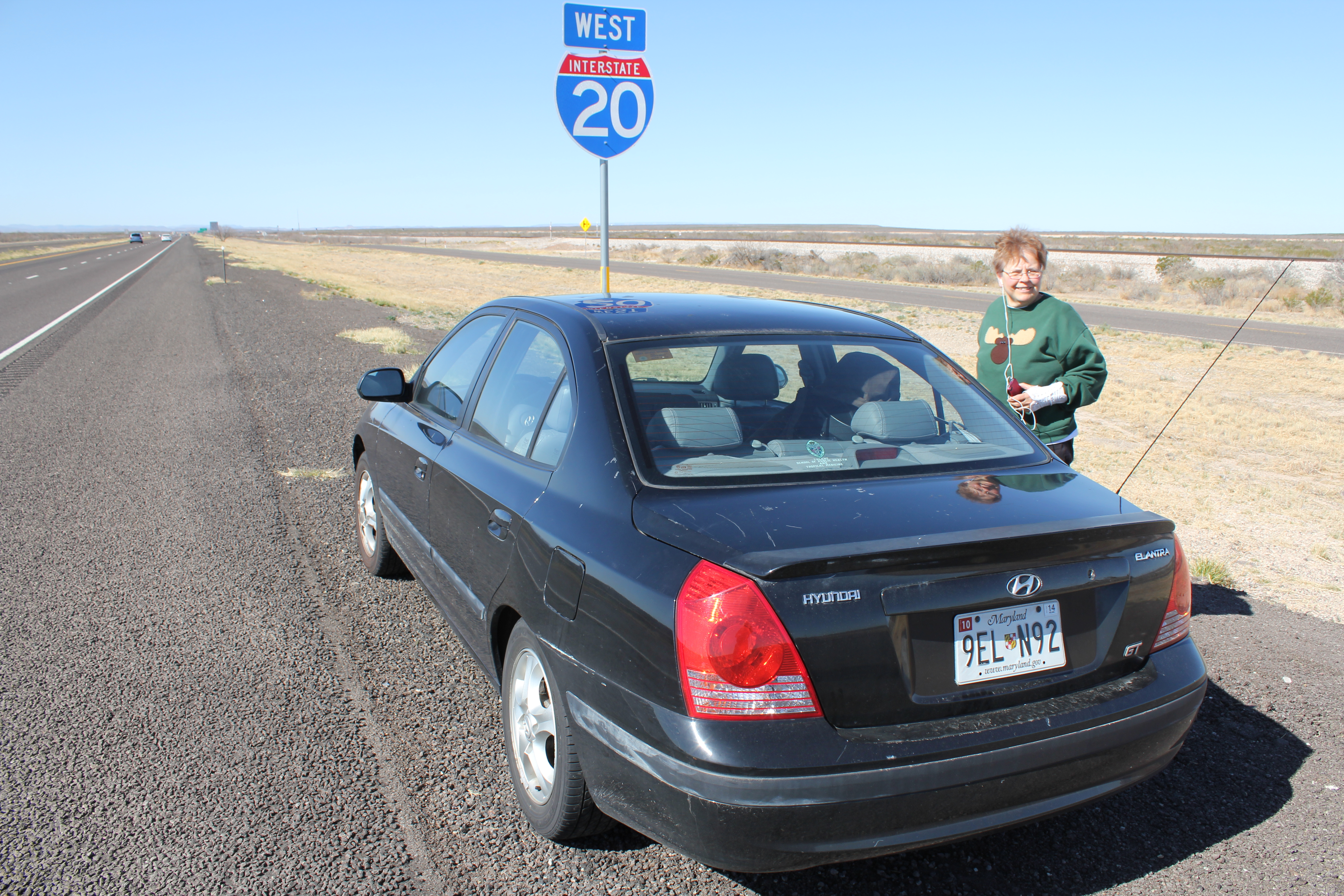
The first memorable thing that happened was that Kathie's car turned 100K miles.
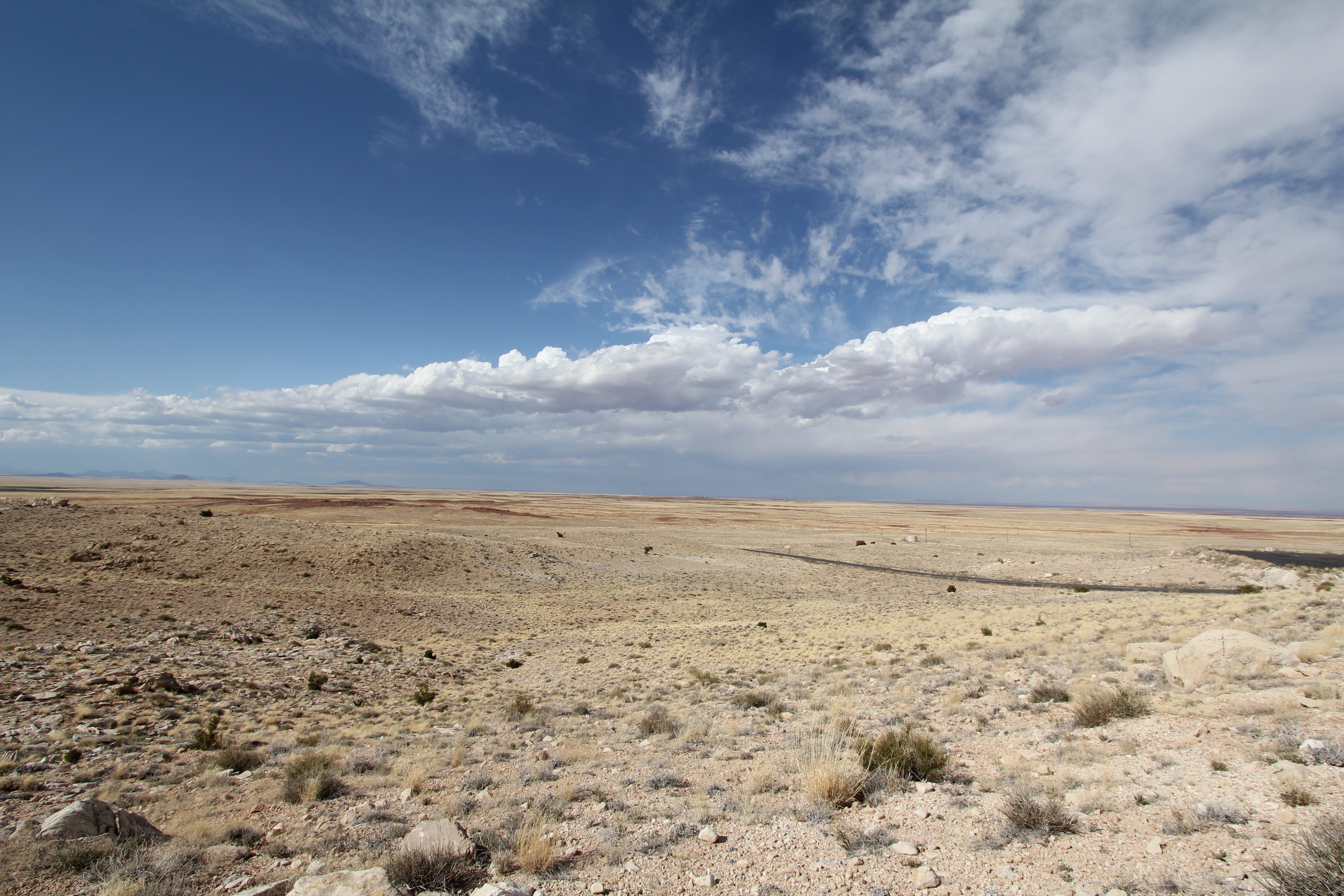
In the Middle of Nowhere, Texas. Note the featureless landscape. I-20, BTW, is an 80 MPH road.
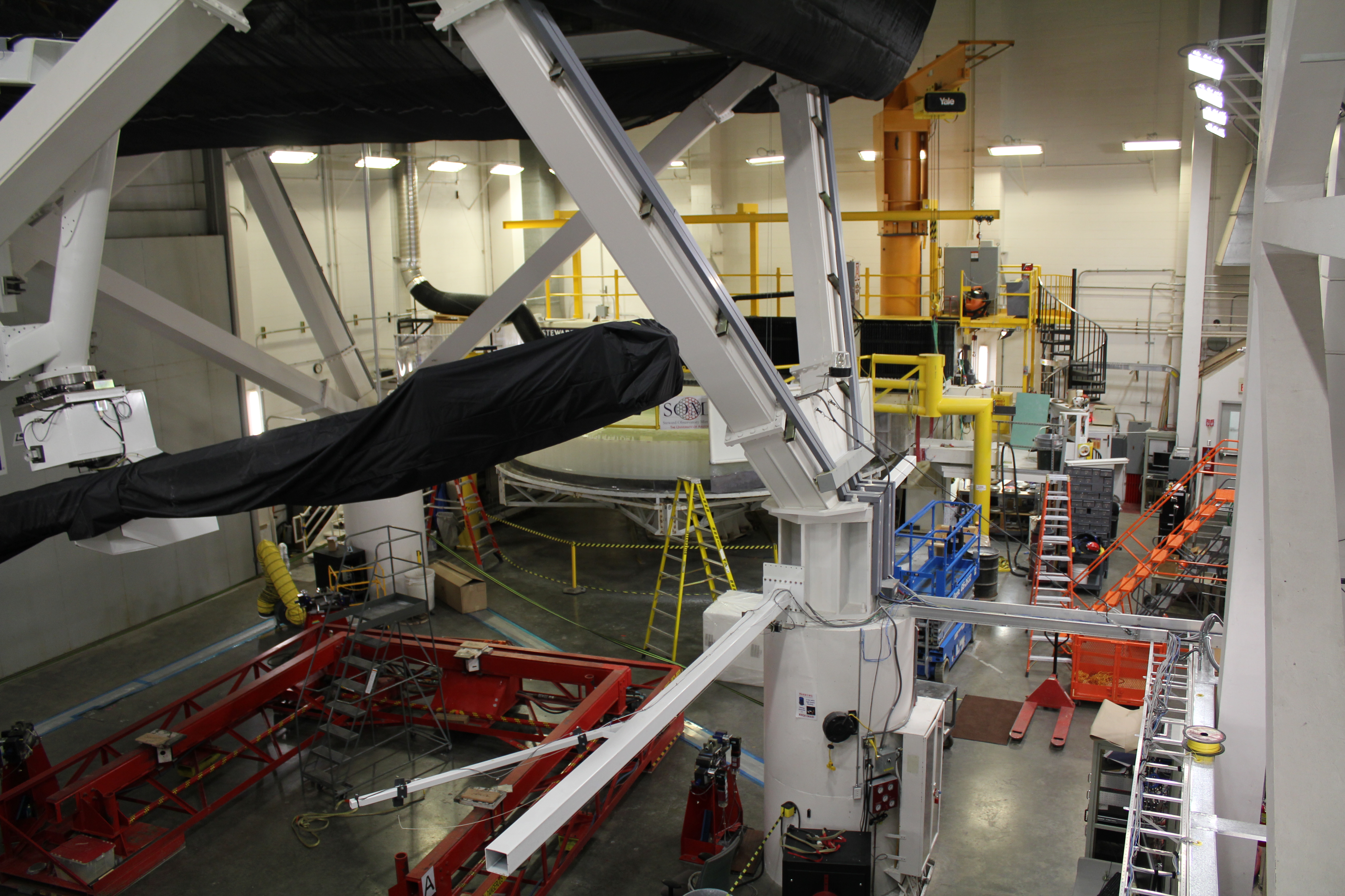
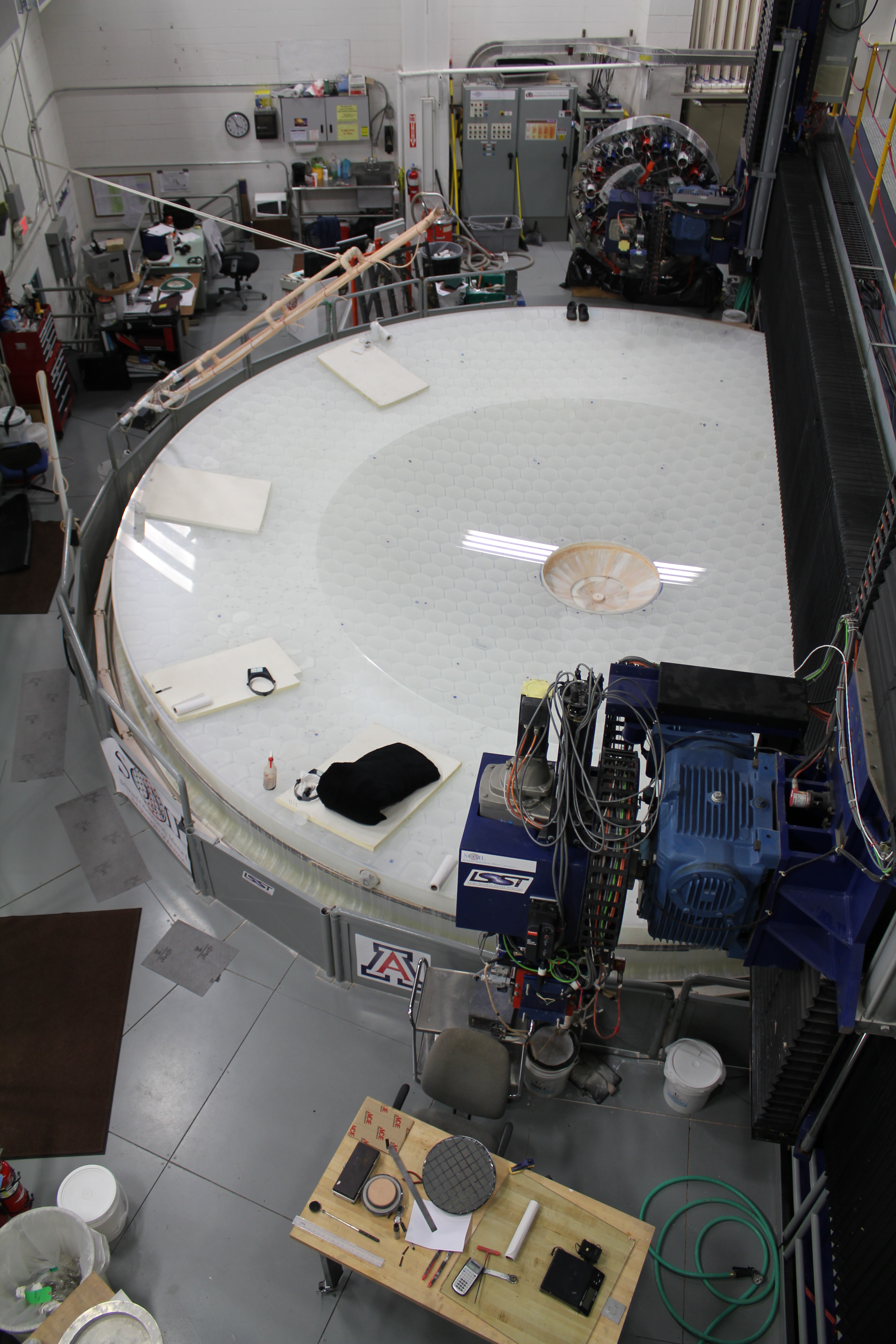
We arrived in Green Valley, Az the next day and toured the U of A's mirror lab, where Huge mirrors are made for the astronomical observatories of the world. Here you see the interferometric tester. Behind it is a mirror getting ready for test.
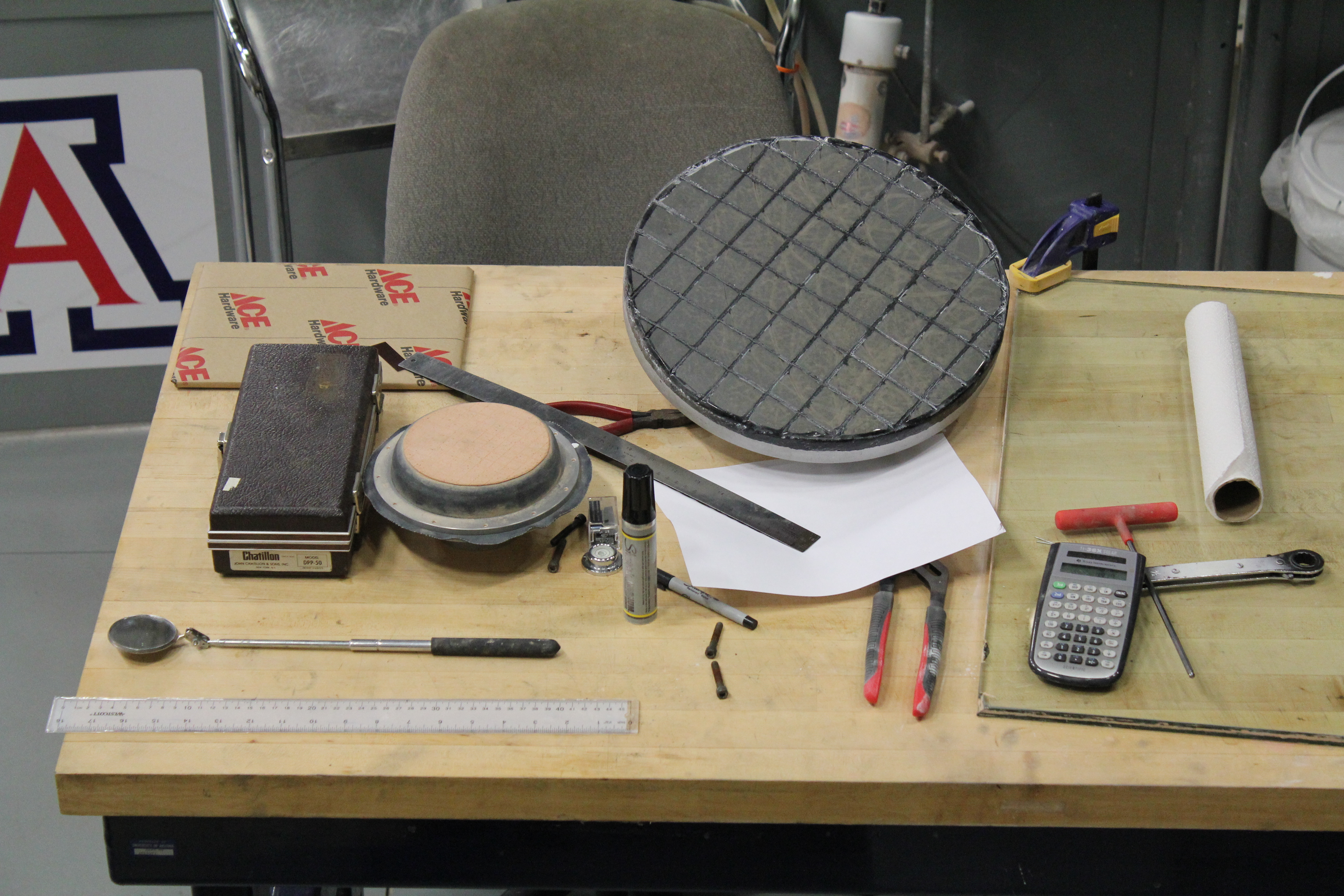
It's not all high-tech. The tools on this table would be familiar to the master opticians of the early 20th century, although their calculators would have been the size of a small desk.
This is a special, two zone mirror, that will be at the center of the latest multiple mirror telescope, The light travels from the outer part to a secondary, and then to the inner part. It then bounces to a tertiary mirror, and finally through the hole in the center of the mirror.
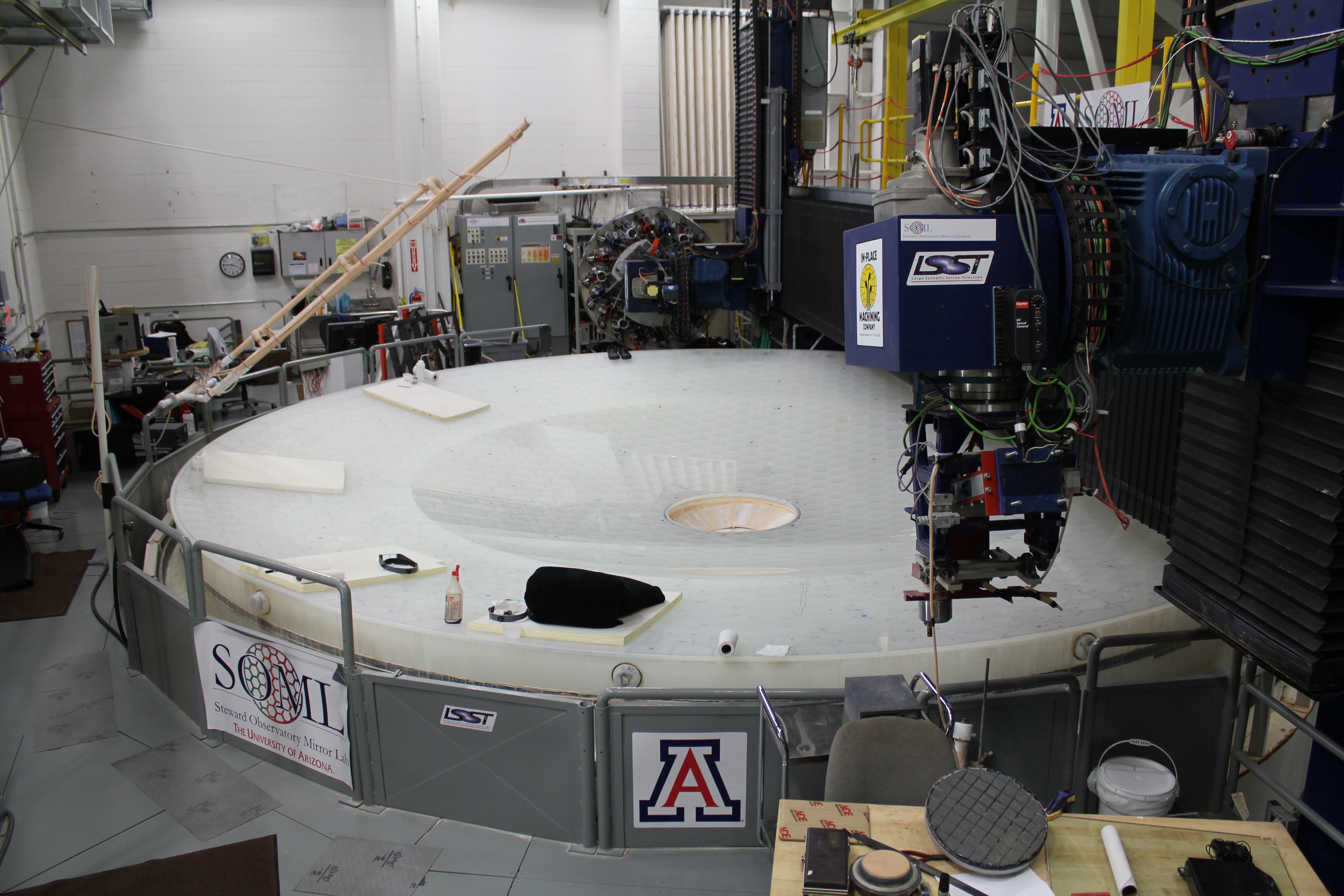
Another view of the two zone mirror. The LSST apparatus is a computer controlled polisher.
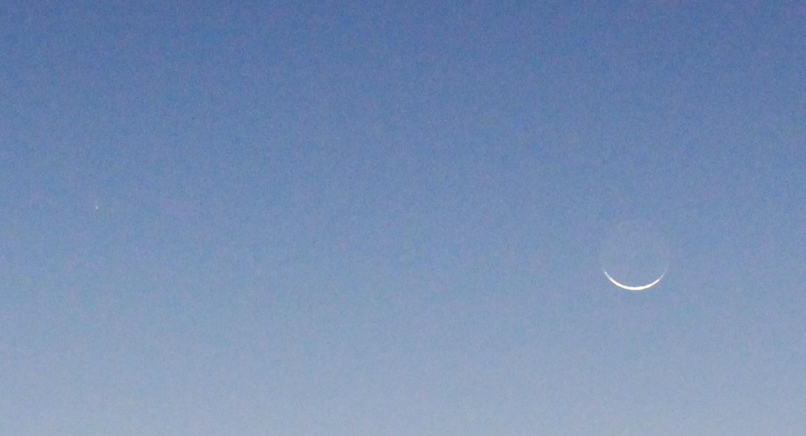
That night, we went up the mountian road to the Whipple Observatory, and completely missed the unmarked concrete pads set aside for amateurs to observe from. The road became a one lane white knuckle affair, as if we had met someone coming down, the only way we could get out of the way was to drive off the road and straight down the mountain!
Instead we met a couple parked on an old side road who were taking pictures of comet PanStarrs. Kathie managed to get an image of the comet, although she did not know it at the time. She was taking a picture of the very young moon. You can see the comet to the left, in the center of the photo.
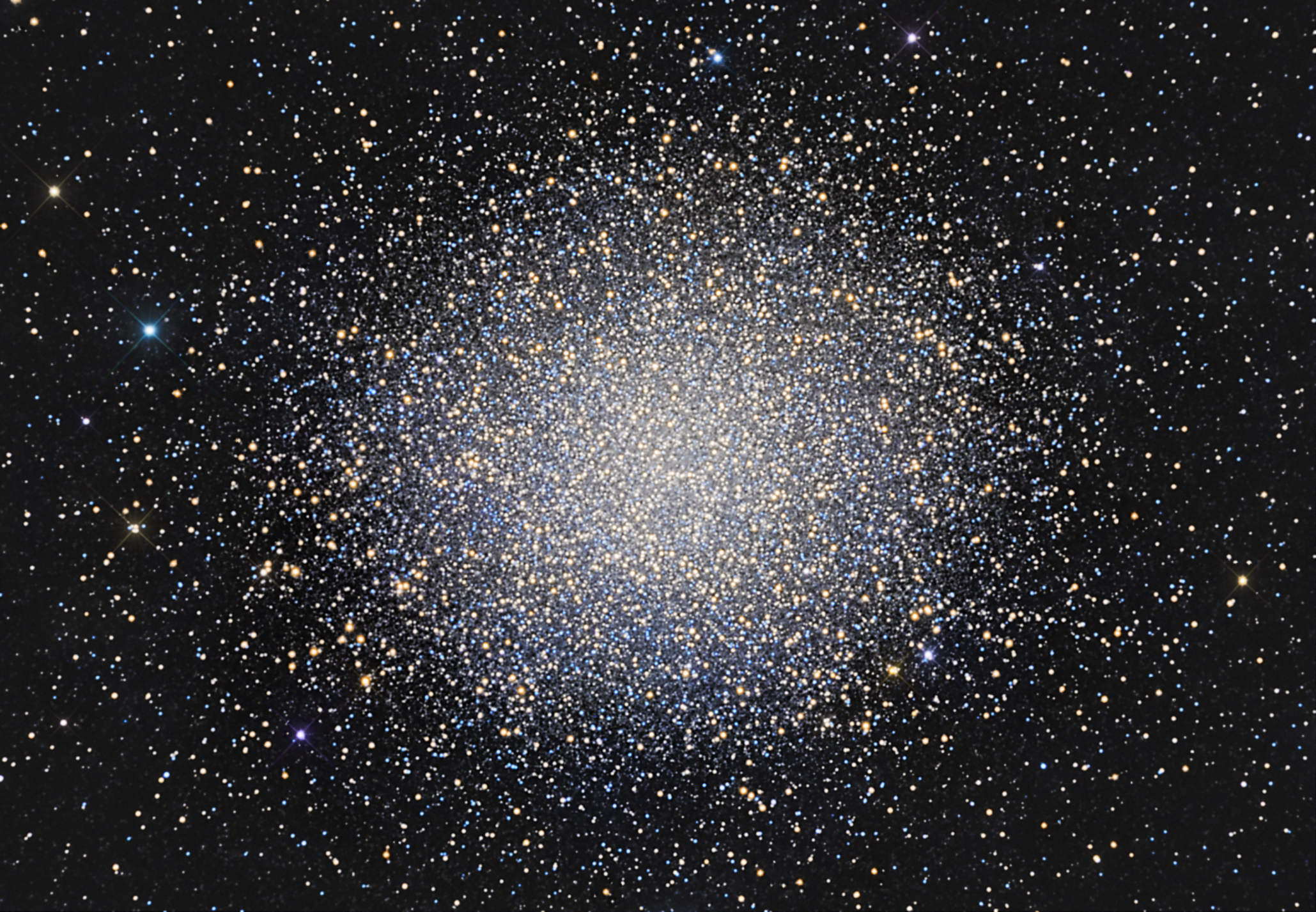
That night I got a good view of southern stars quite invisible from Maryland, including that most magnificent of globular clusters, Omega Centauri. Here's a view from NASA's Astronomy Picture of the Day (APOD) of the cluster.
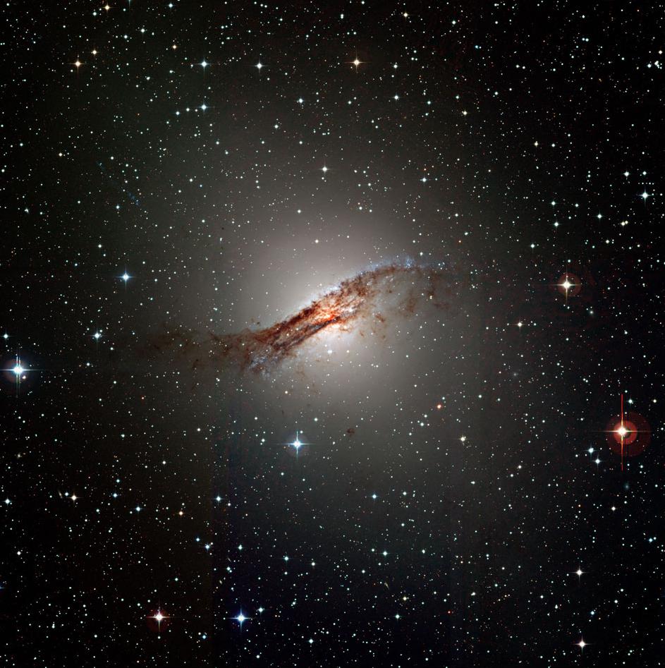
NGC 5128, the nearest "active" galaxy is just north of Omega Cen, and it
looks like a dim view of this APOD photo, one of the few galaxies that look
like their pictures in a small telescope. This turbulent galaxy is thought
to have collided with another, smaller galaxy a short time ago (perhaps just
a few hundred million years or so, when the
Wednesday, March 13, we just rested. We again went to Whipple, and this time observed from the Visitor Center parking lot. I again saw stars and galaxies invisibe in the light polluted Maryland skies, and had a lovely conversation with the head of the Physics department at the University of Utah.
Resting was a rather plesant experience!
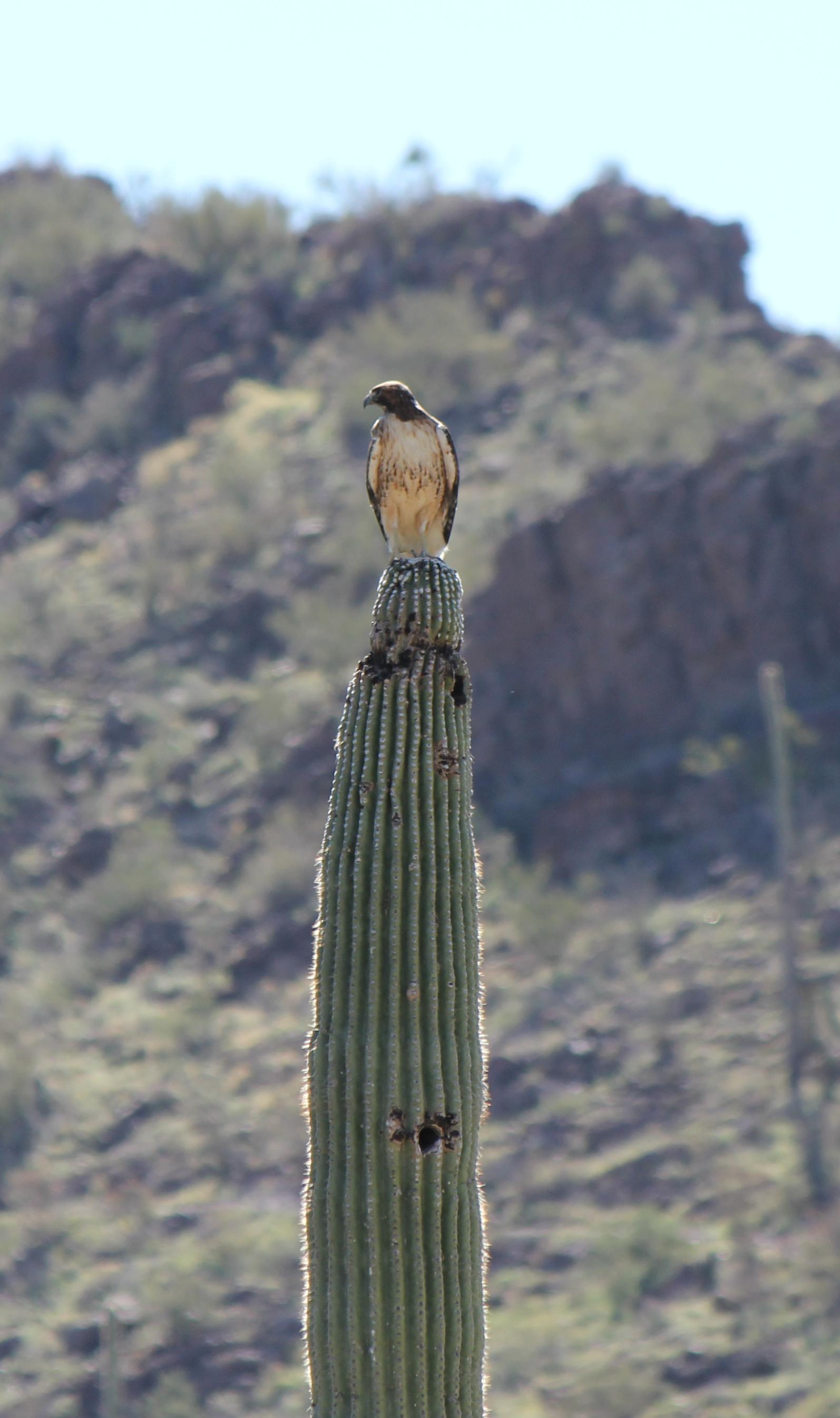
The next day found us at the desert museum, west of Tucson. A superb museum, well worth the $15 admission. Here's a tame red tailed hawk on a saguaro cactus, hamming it up for our cameras.
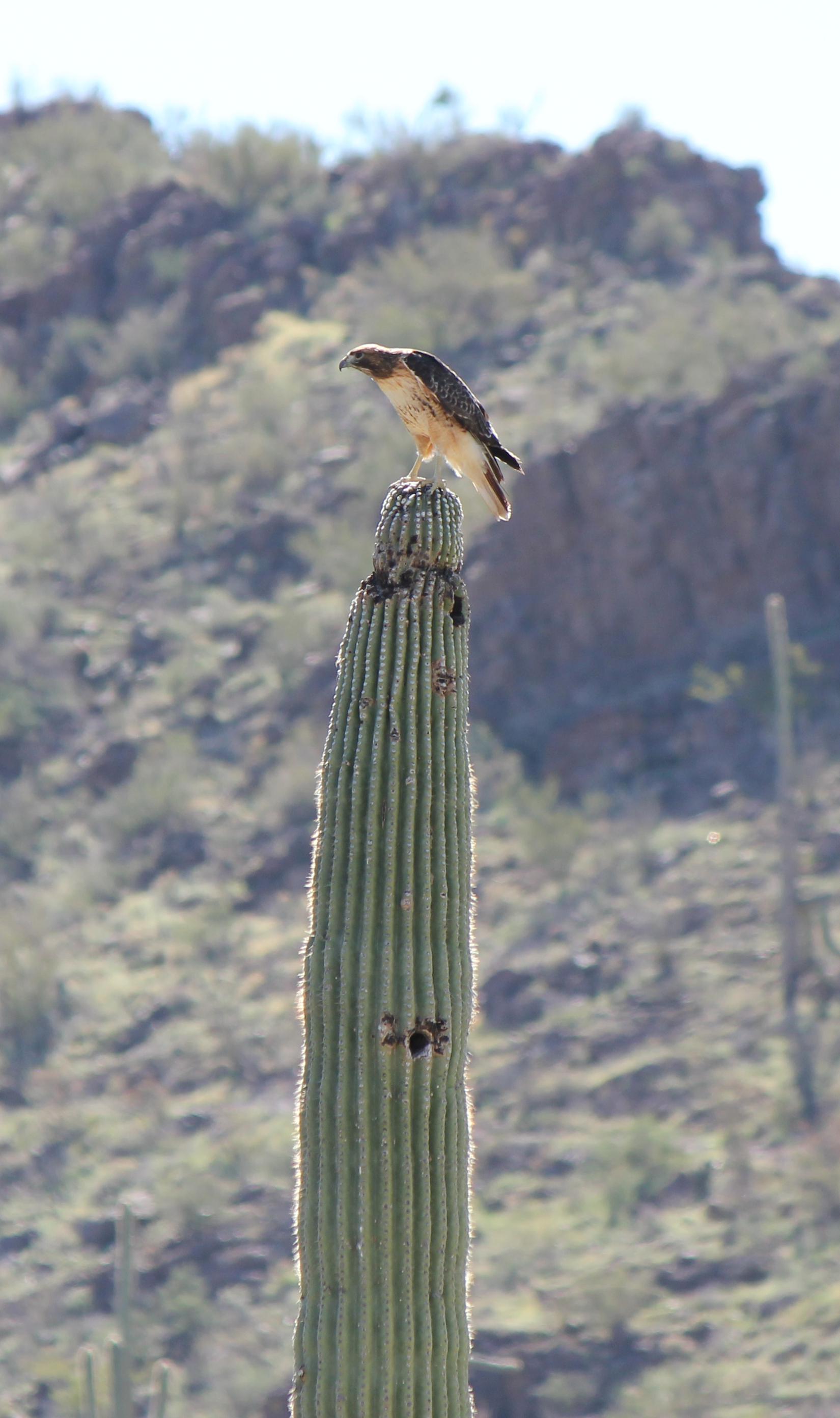
Another view of that hawk and cactus.
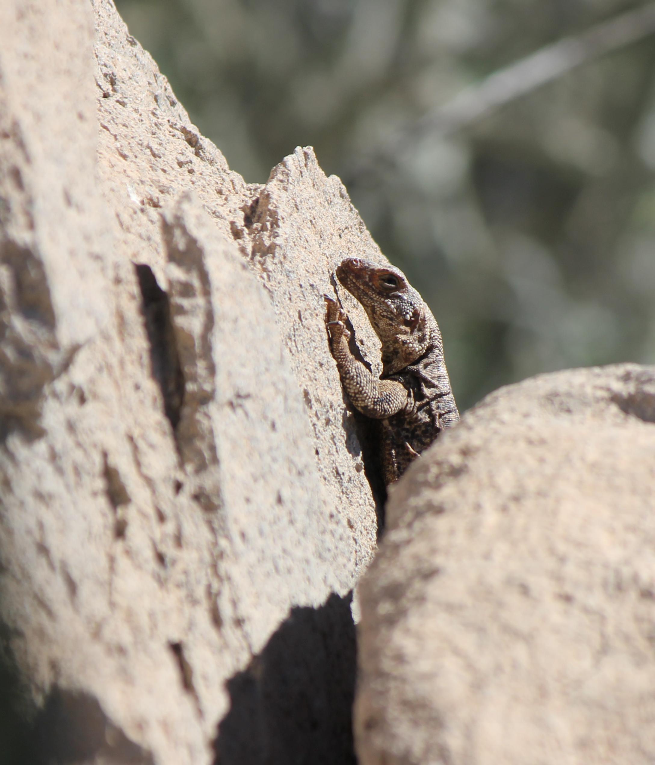
A lizard peeks out from a crevice in the rocks.
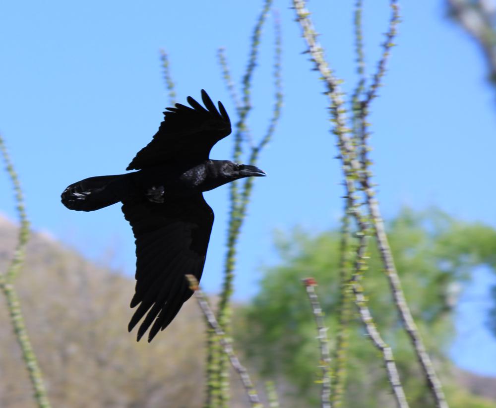
A desert raven files by.
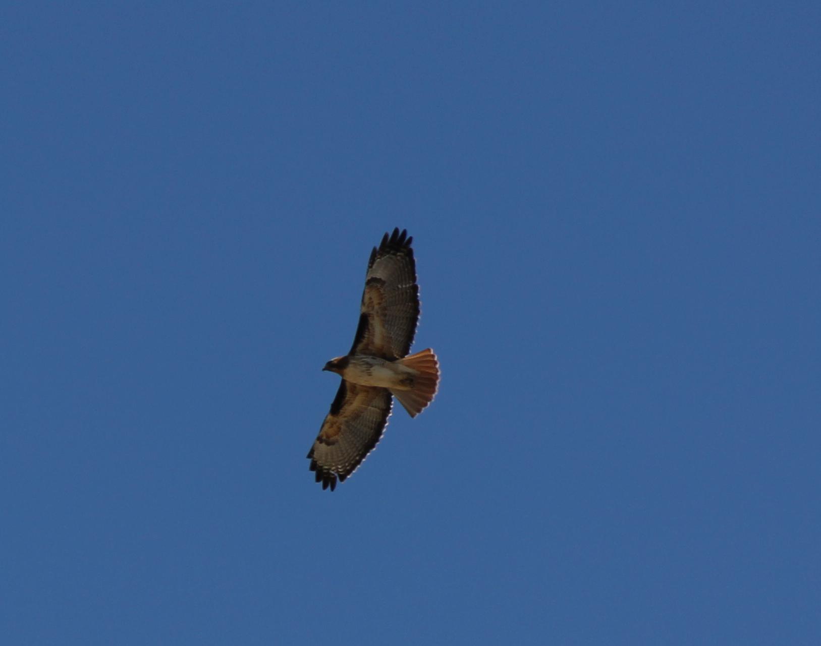
A wild red tailed hawk flew over to check us out.
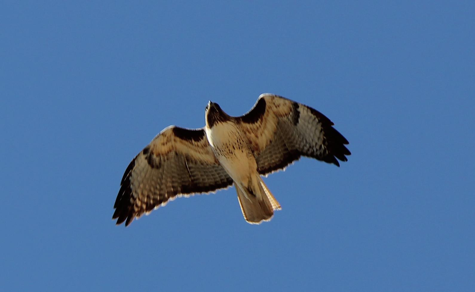
Our wild hawk, again.
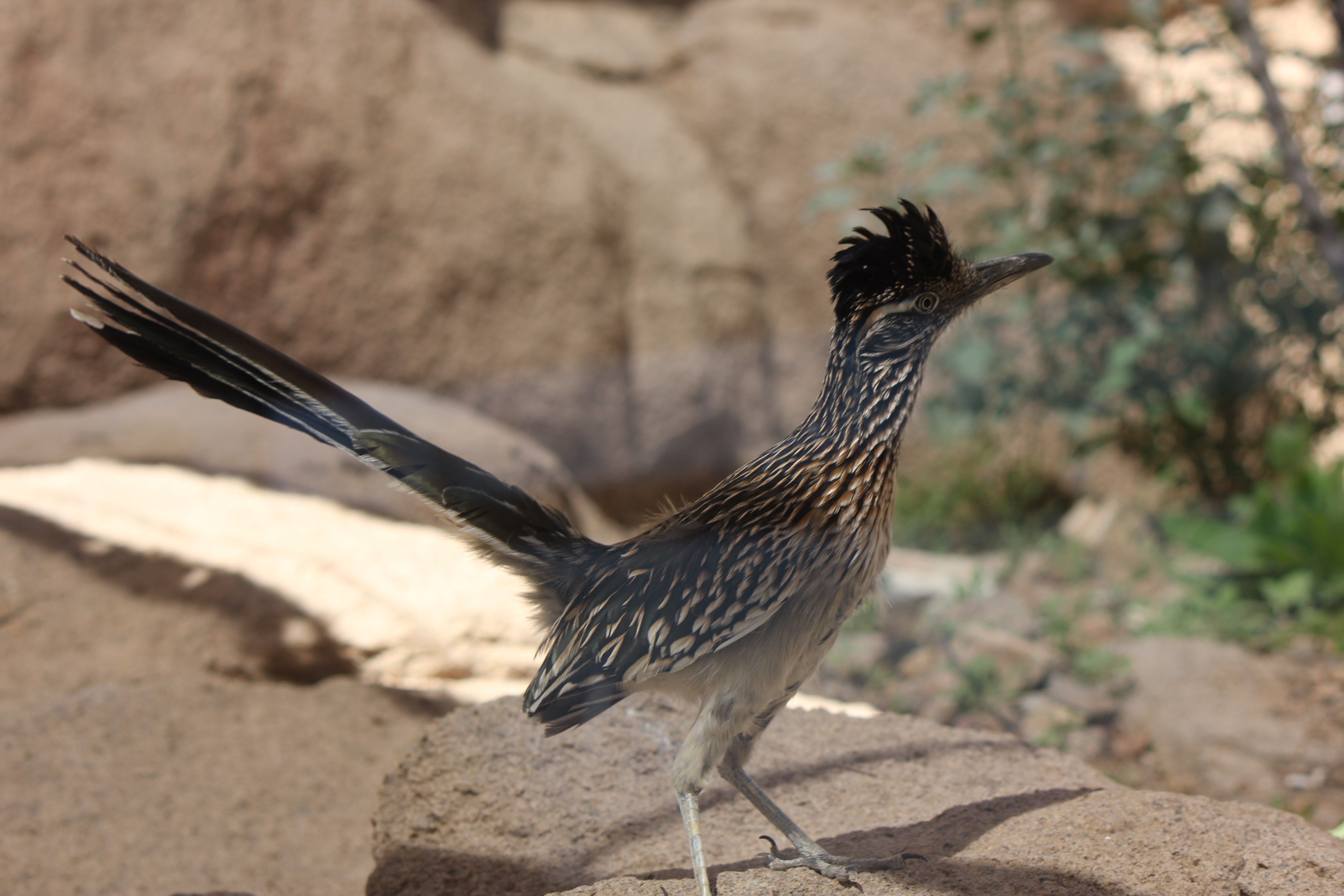
A road runner who did not like the cage it was in, and spent most of its time looking to escape.
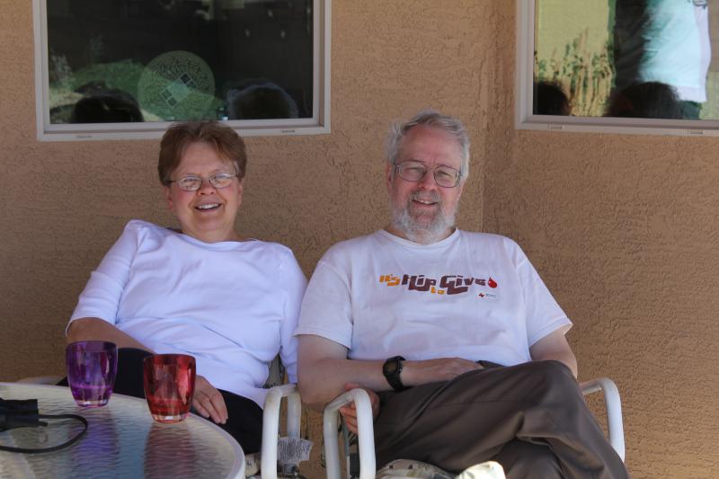
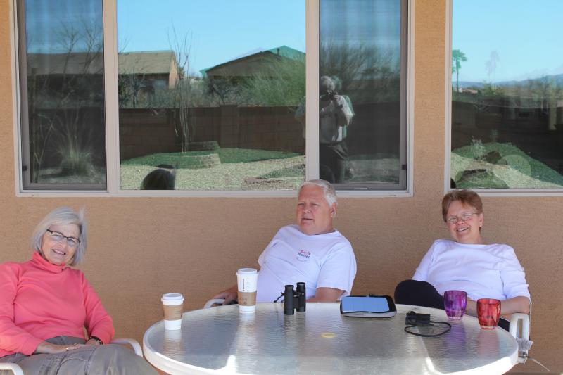
The Petersons are marvelous hosts.
On the 15th, Kathie visited her college roommate, whom she had not seen in 43 years.

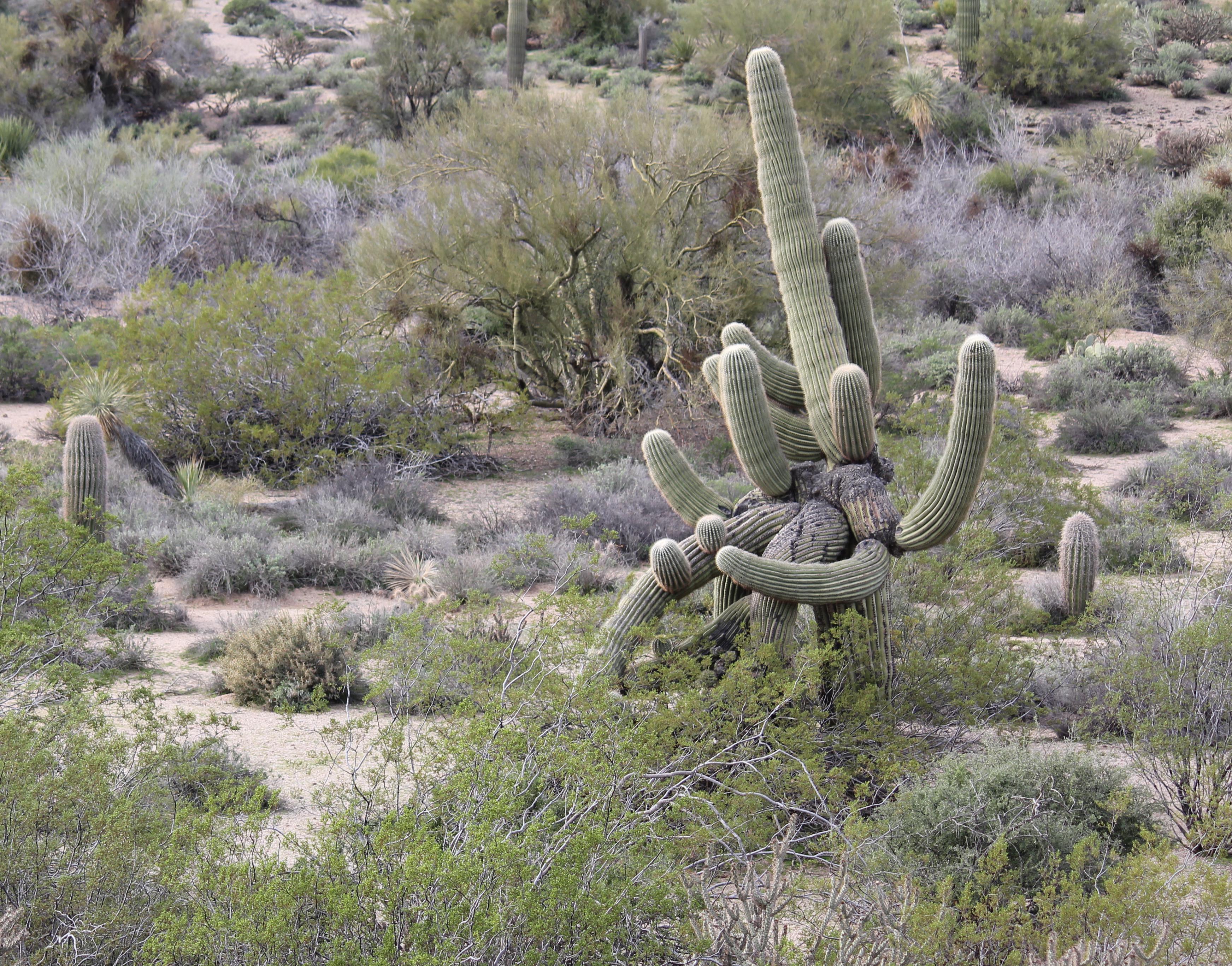
In the arroyo behind her house there was a very interesting saguaro cactus.
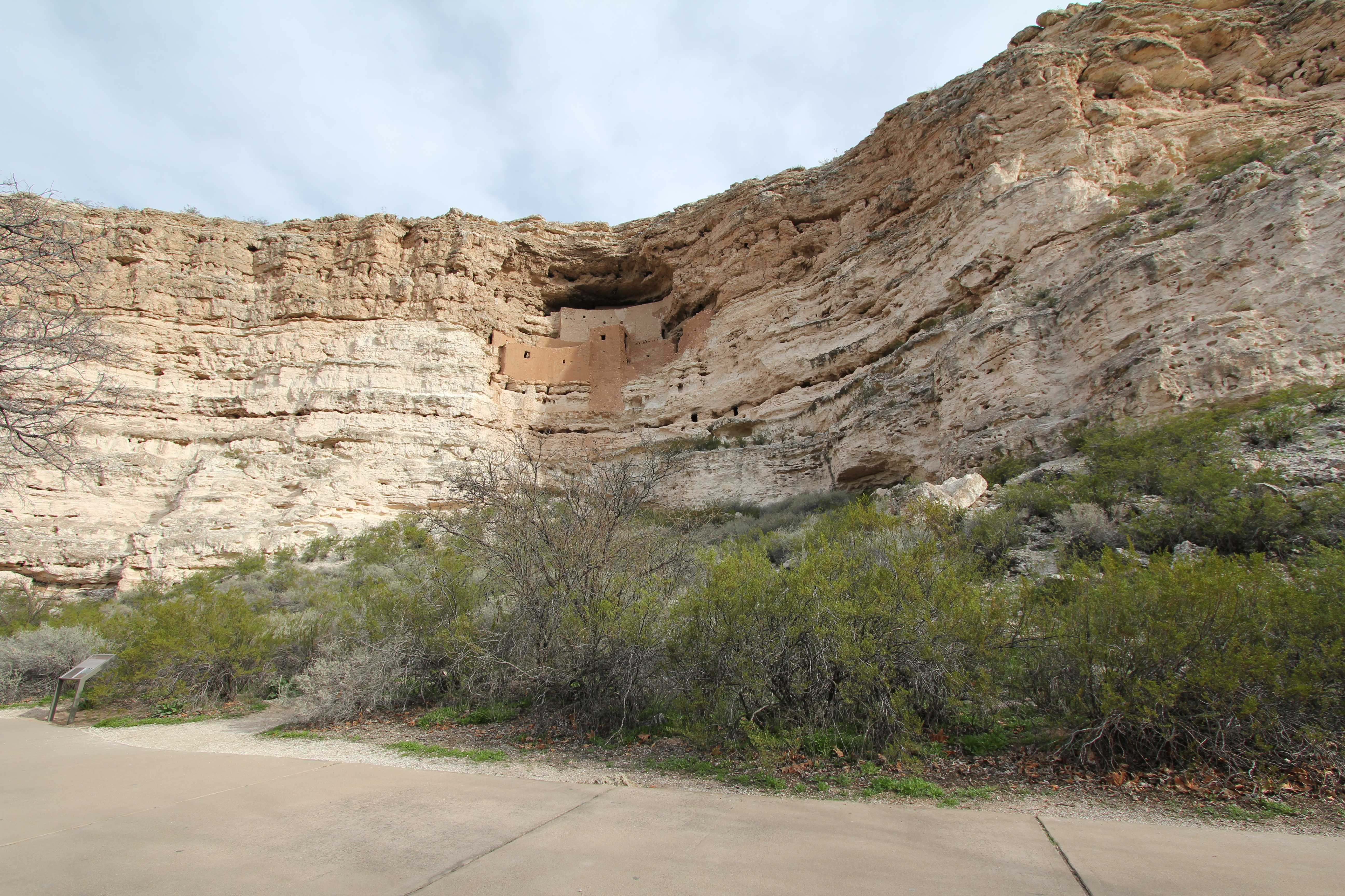
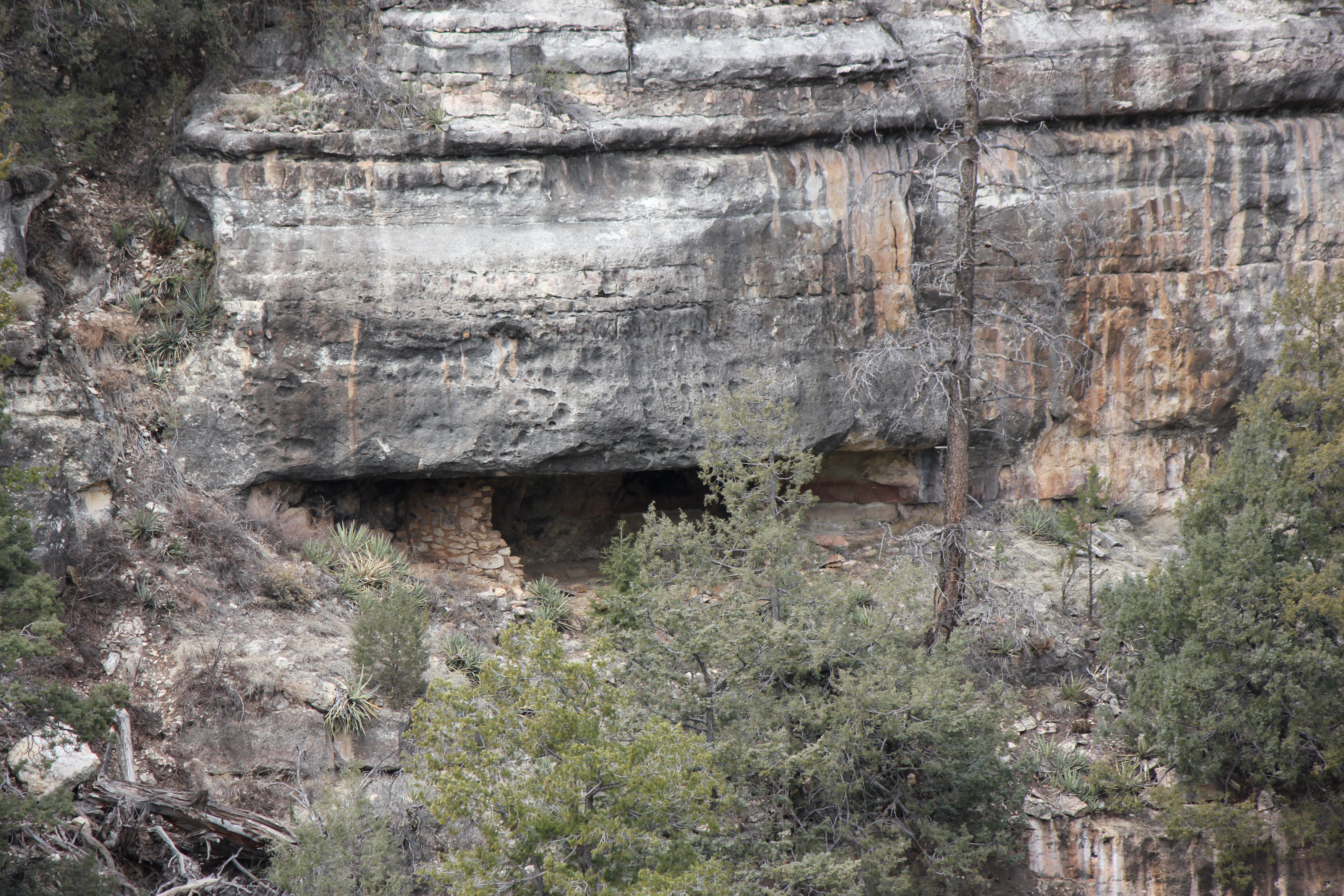
The next day, Saturday, March 16, we then went to "Montezuma Castle", an Anasazi cliff dwelling. I took several shots of it, using a wide angle, normal and telephoto lens.
Here's the wide angle view,
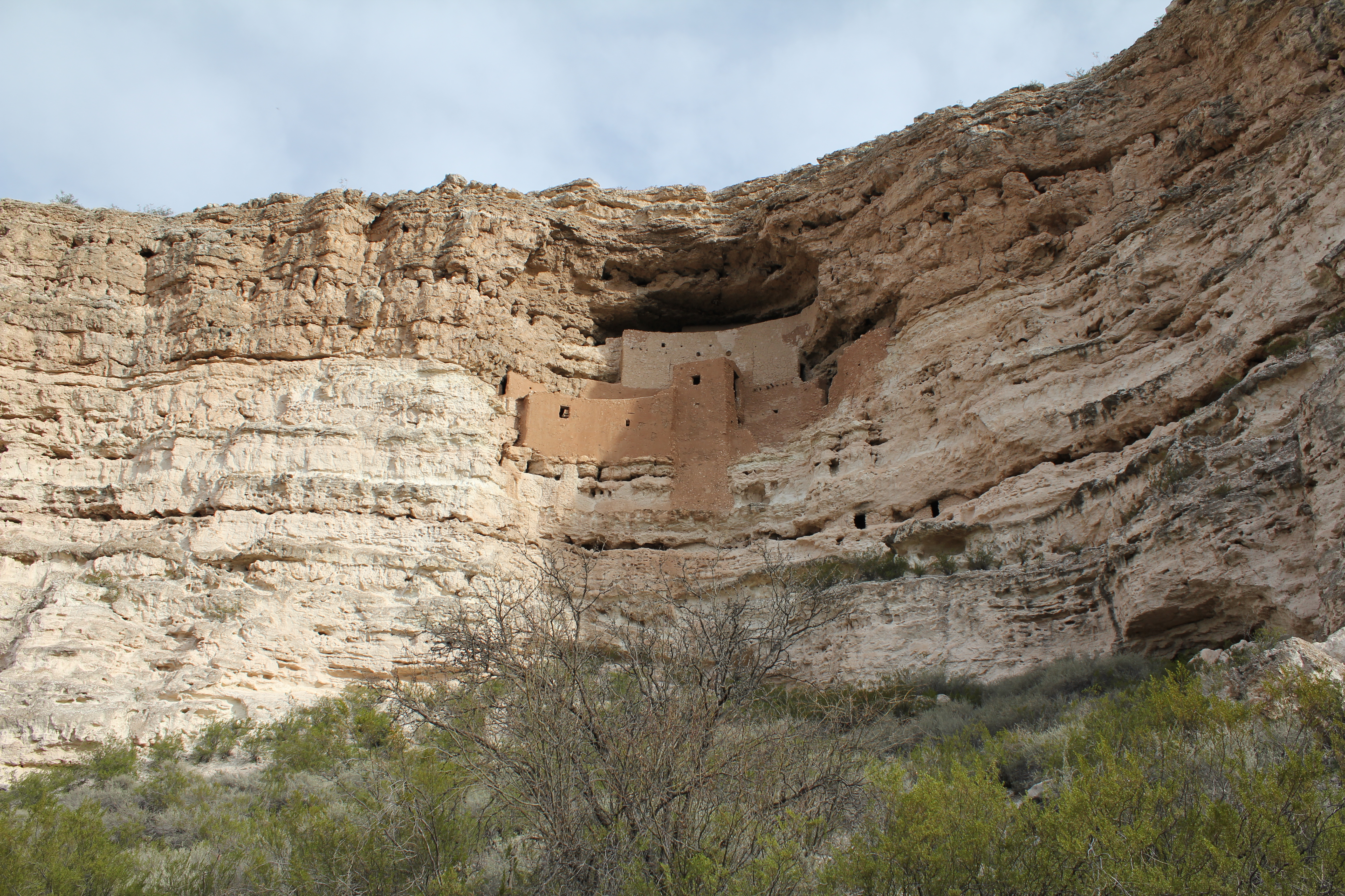
and the normal view.
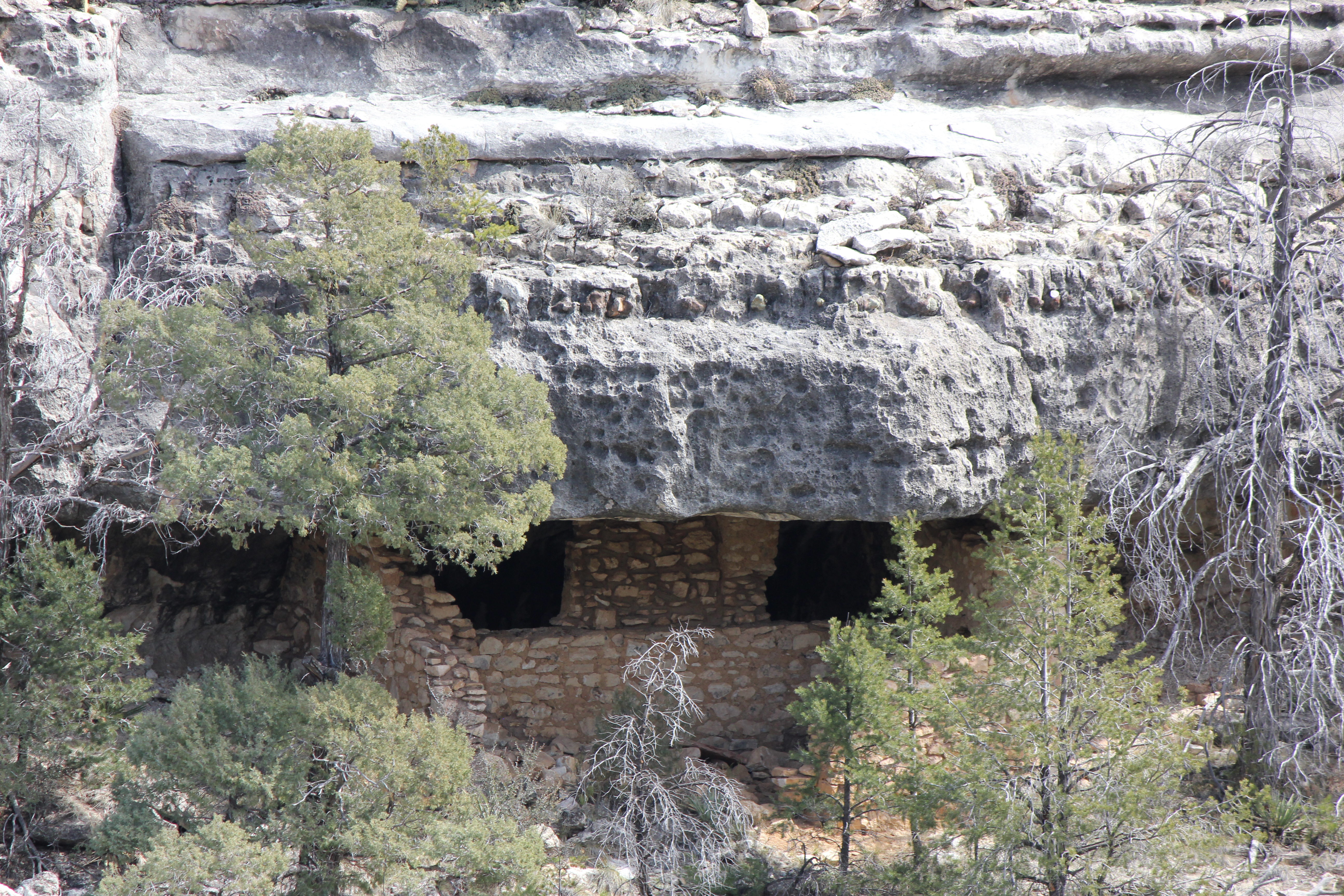
A medium telephoto view.
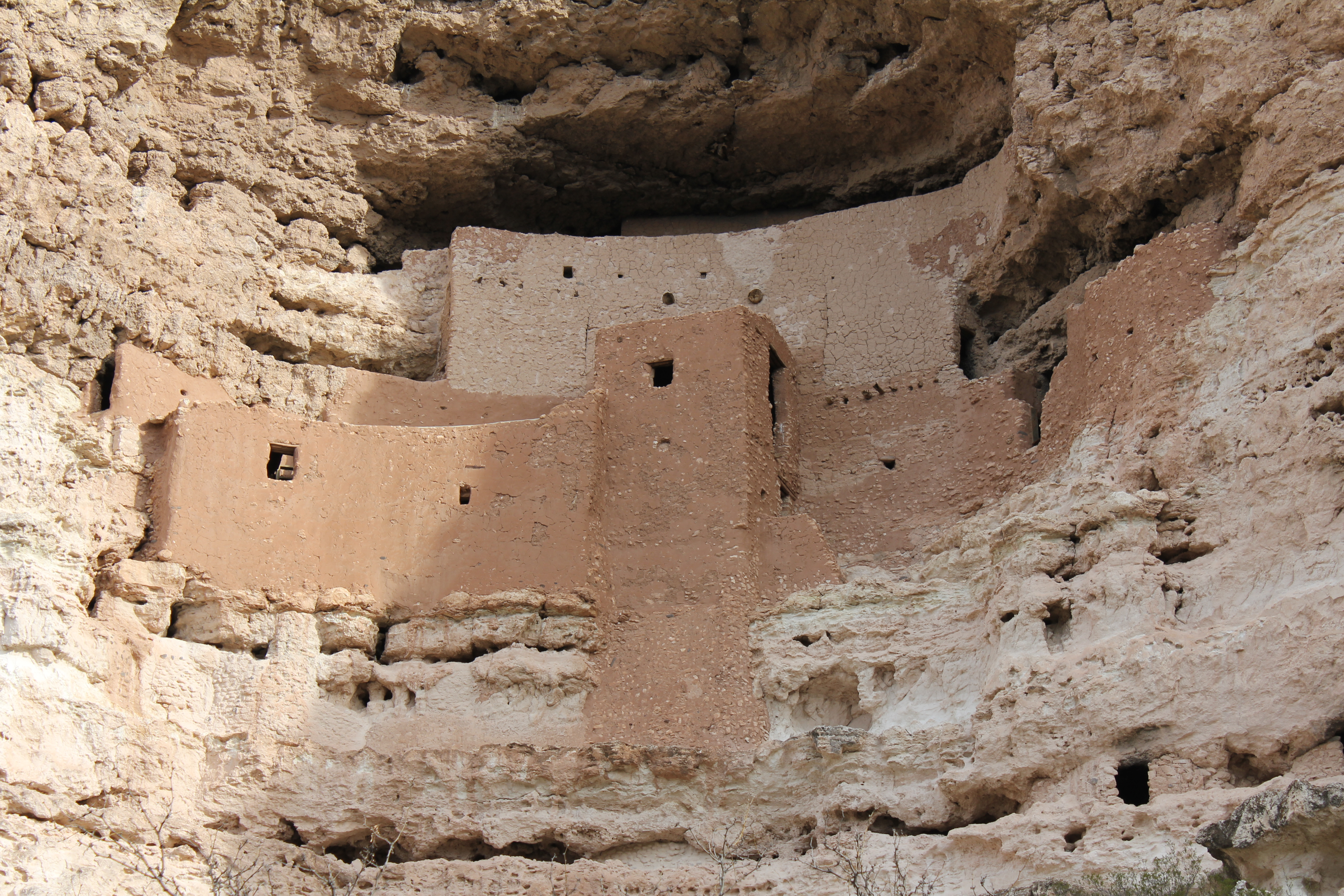
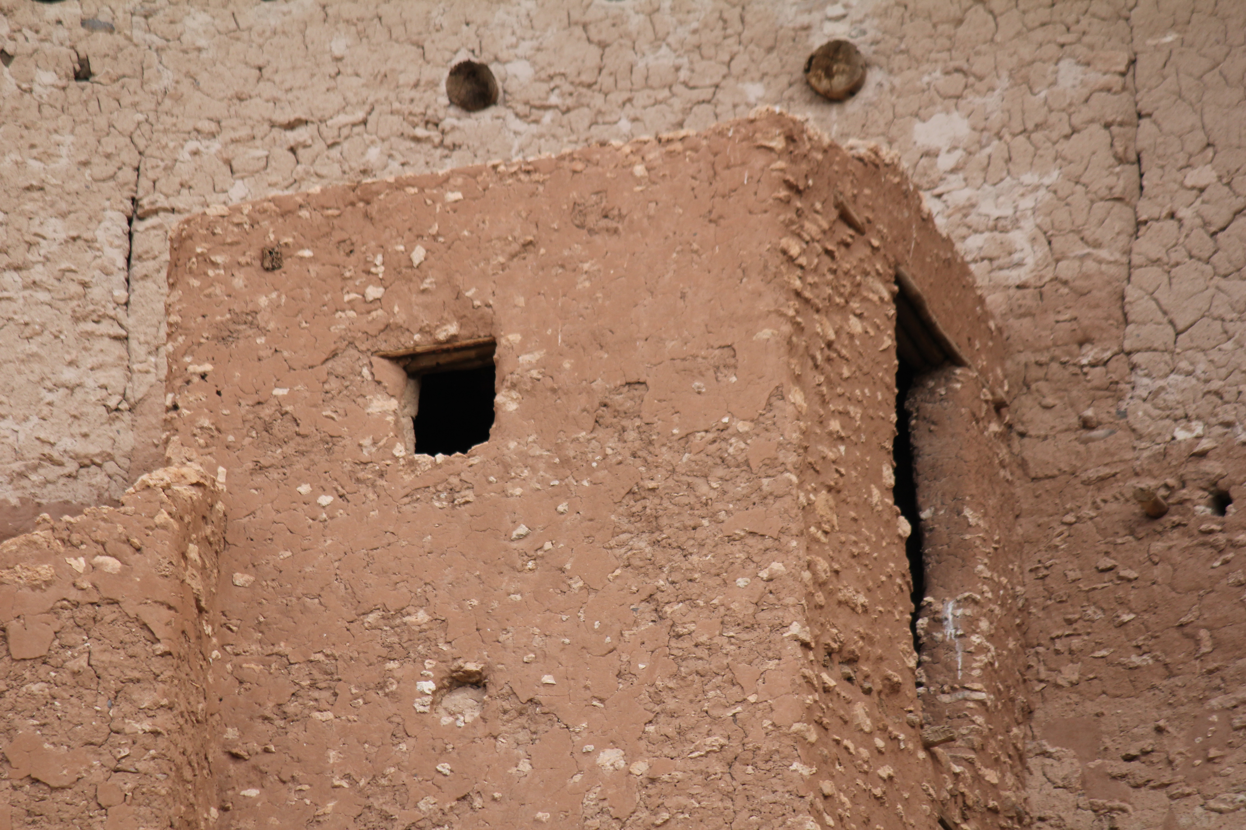
Finally the extreme telephoto shot. The cement like stuff that holds the rocks together is actually mud.
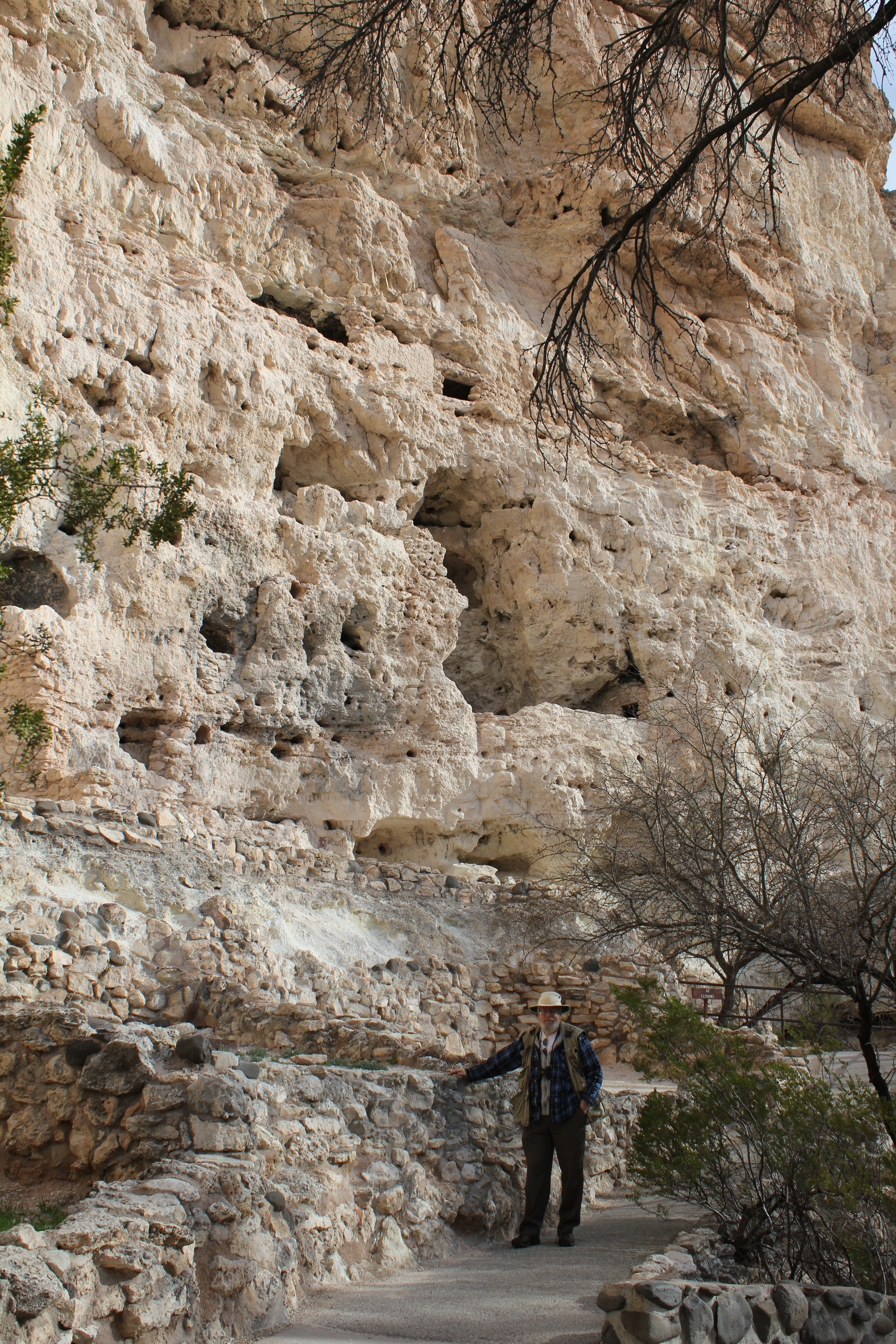
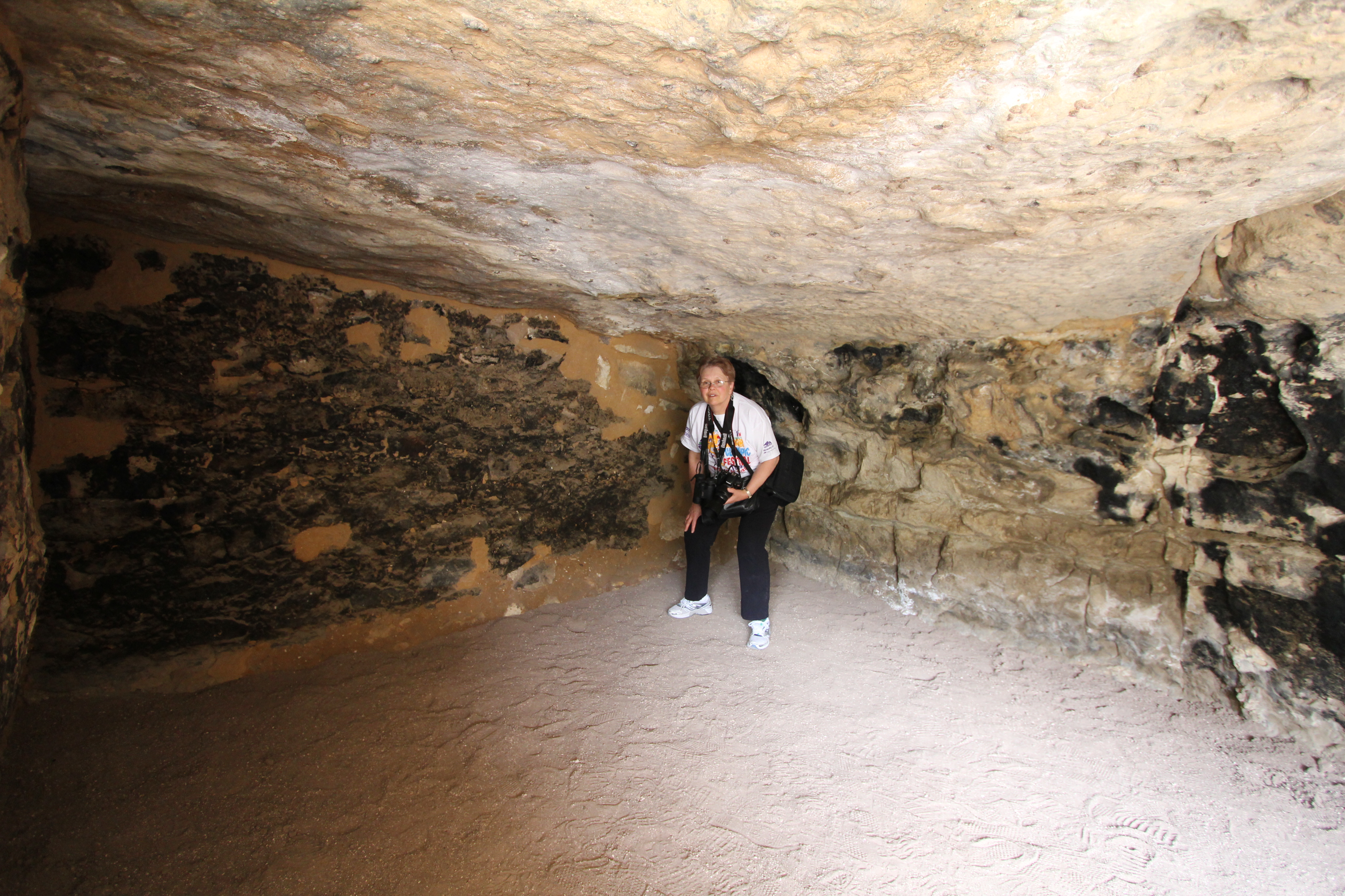
A little to the west of the main structure are other gaps in the rock that the Anasazi dug into the sandstone. That's me at the base, so you can get an idea of the size of the excavations.
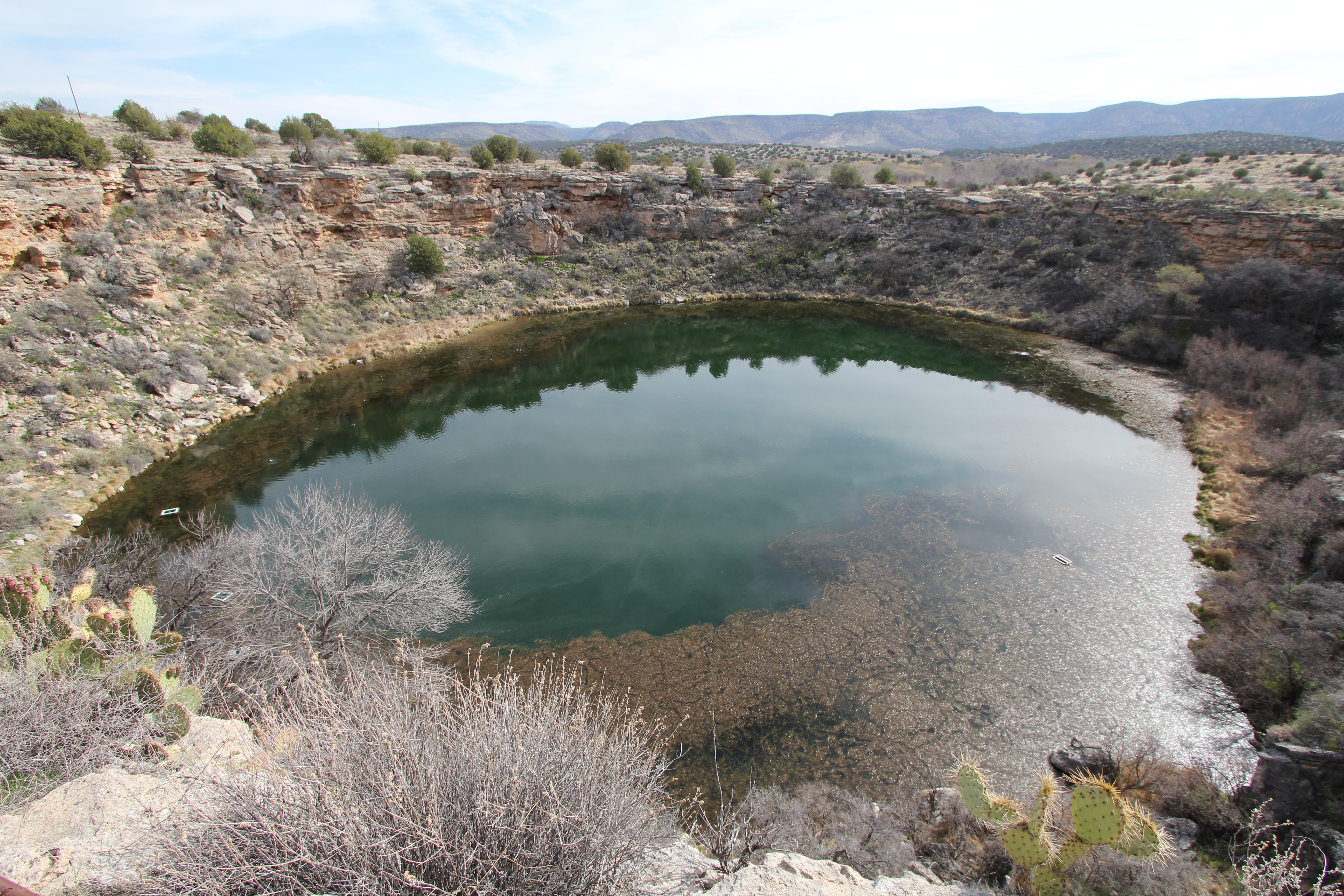
A bit further on is Montezuma Well, a natural crater that has an artesian well in it's center, creating a lake in the middle of the desert. Here's a wide angle shot. The angle of view is 97° .
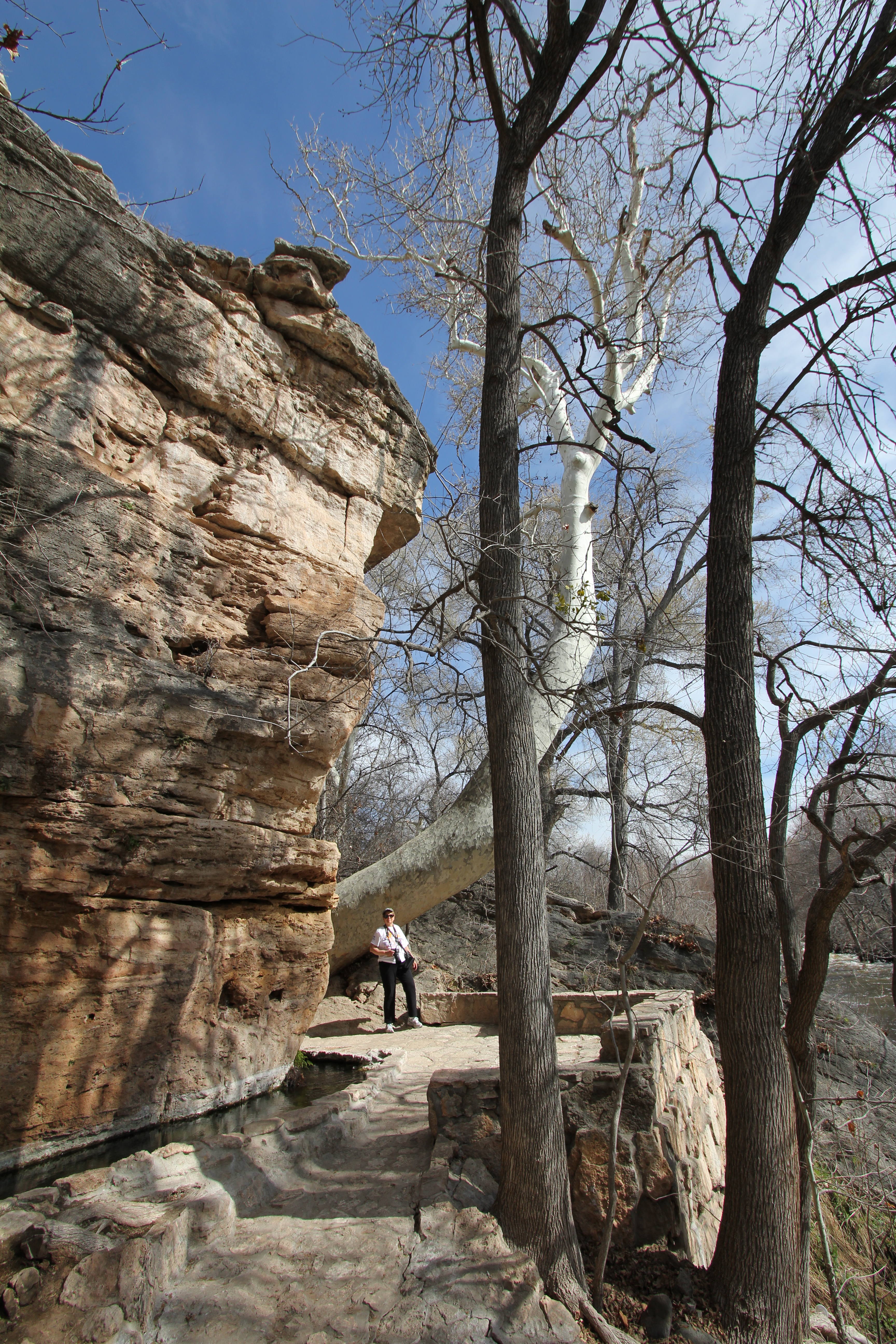
Just outside the crater, there's an outlet where the well water escapes into the nearby Beaver creek. The irrigation ditch to the left has been there for millennia. Kathie is standing by a large Arizona Sycamore tree.
From Montezuma Well, we drove to Flagstaff to see Lowell Observatory. A real bust. The only thing you can see there for free is the gift shop! I wasn't about to waste $24 for a view of the old Clark telescope; there's a similar one in downtown DC one can look through on public nights for free. The mercenary attitude of the management was dissappointing.
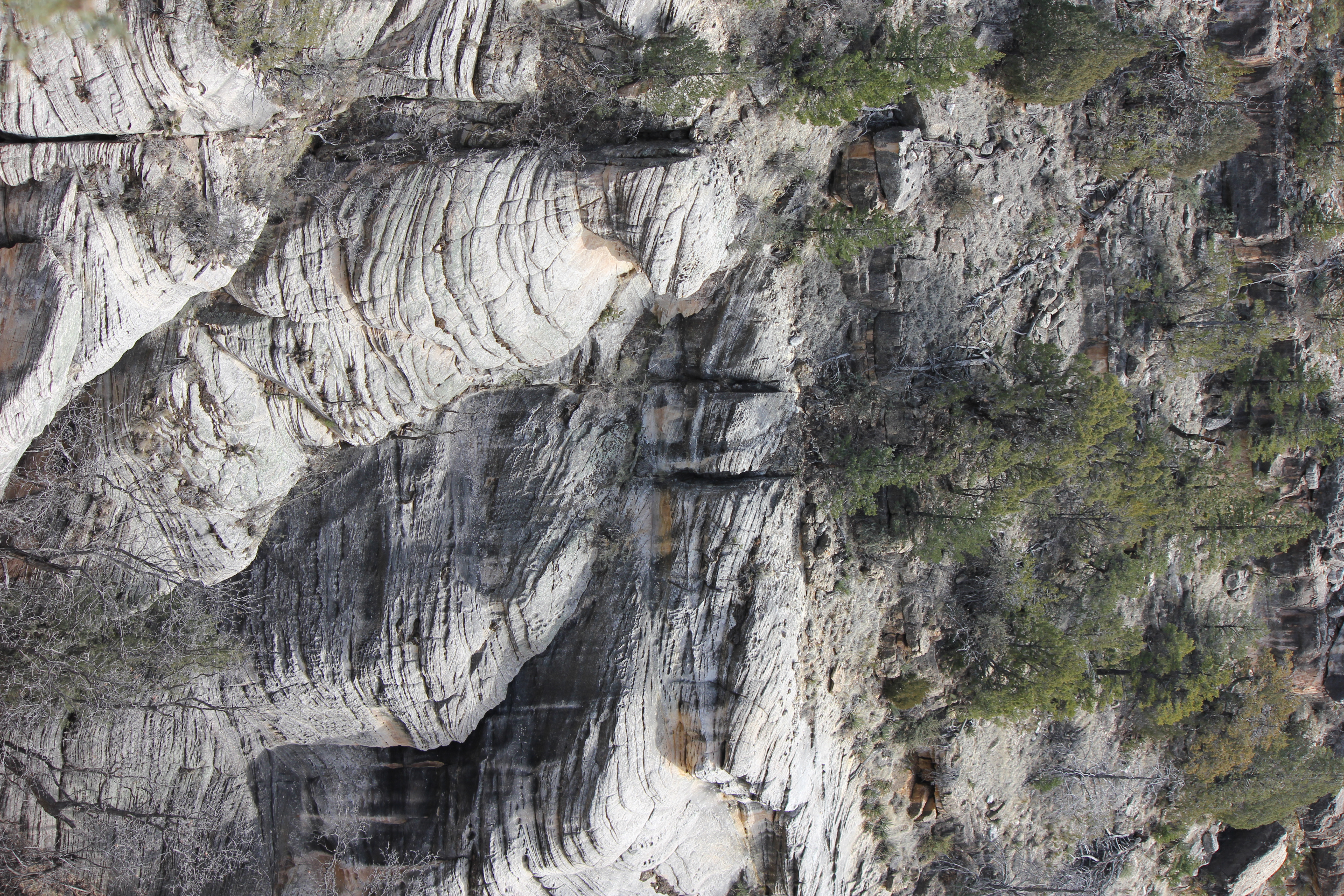
We drove east on I-40, with a bit of time on our hands, and lo and behold, came across signs guiding us to Walnut Canyon National Monument. Away we went!
A brief description, but no high res photo attached.
After you pass through the Visitor's center, this is your first view of the canyon.
Or this...
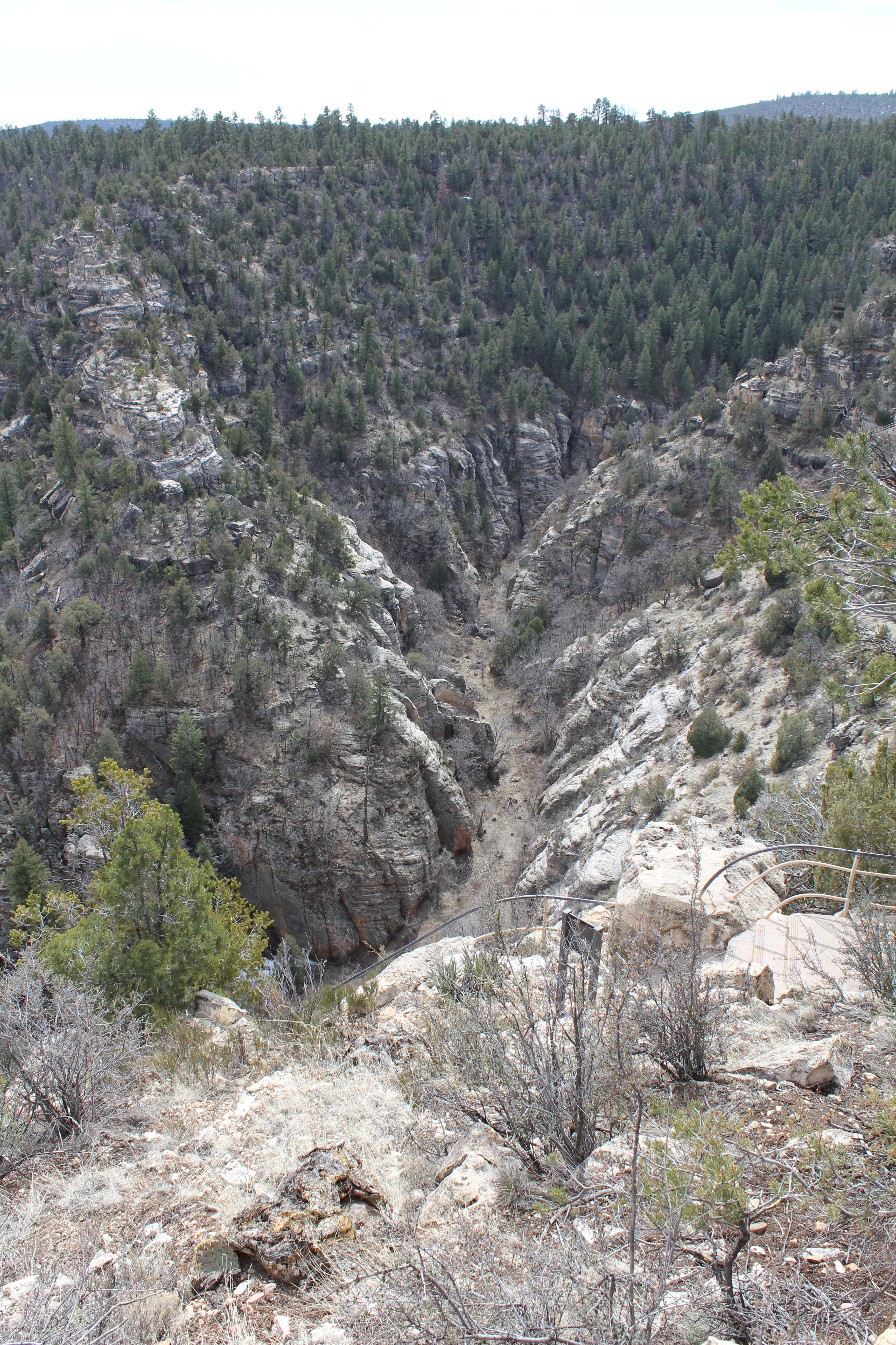
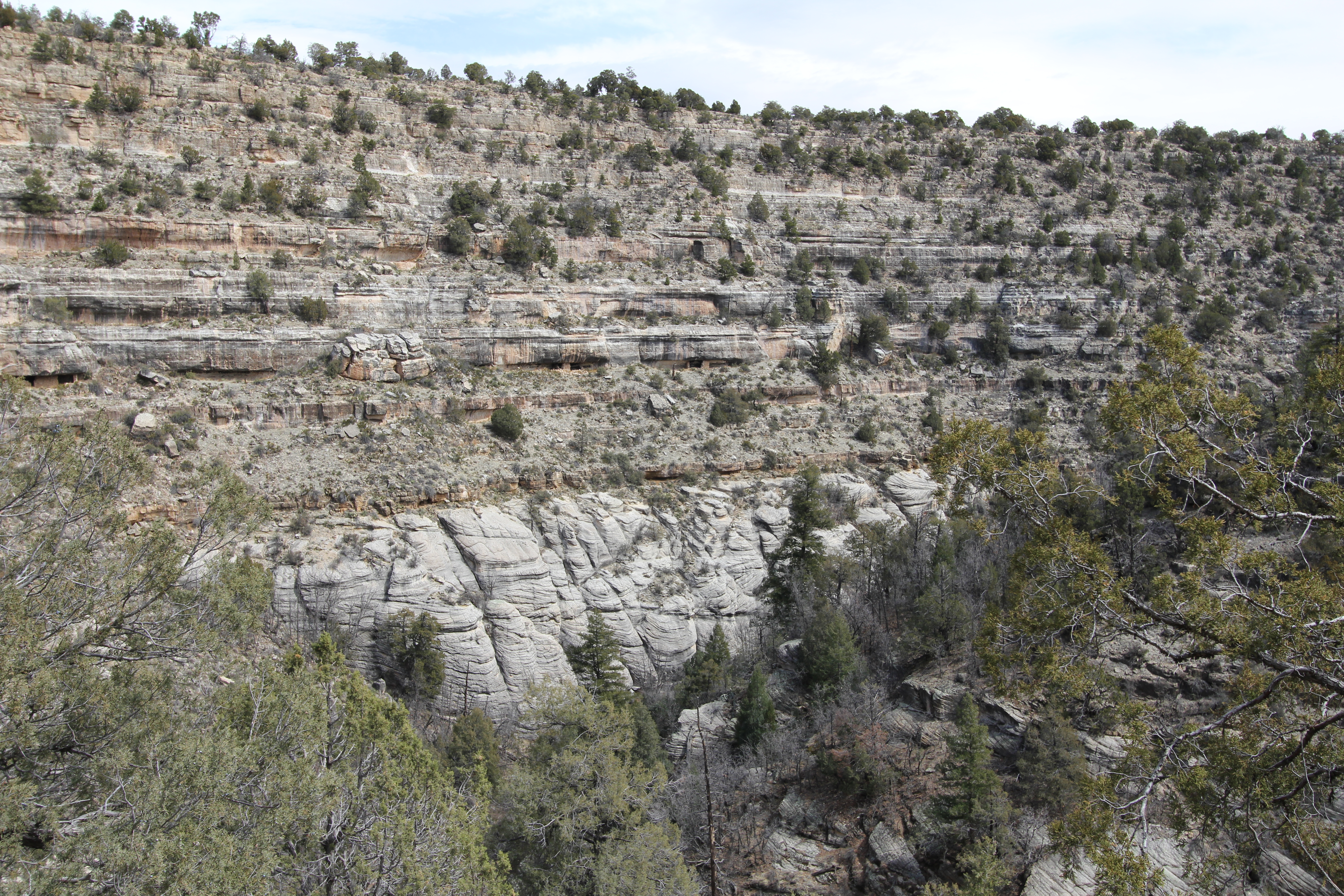
The trail decends down the canyon for about a mile and drops about 100 meters, which makes for a good workout coming back up. Here's a view from a bit down the trail.
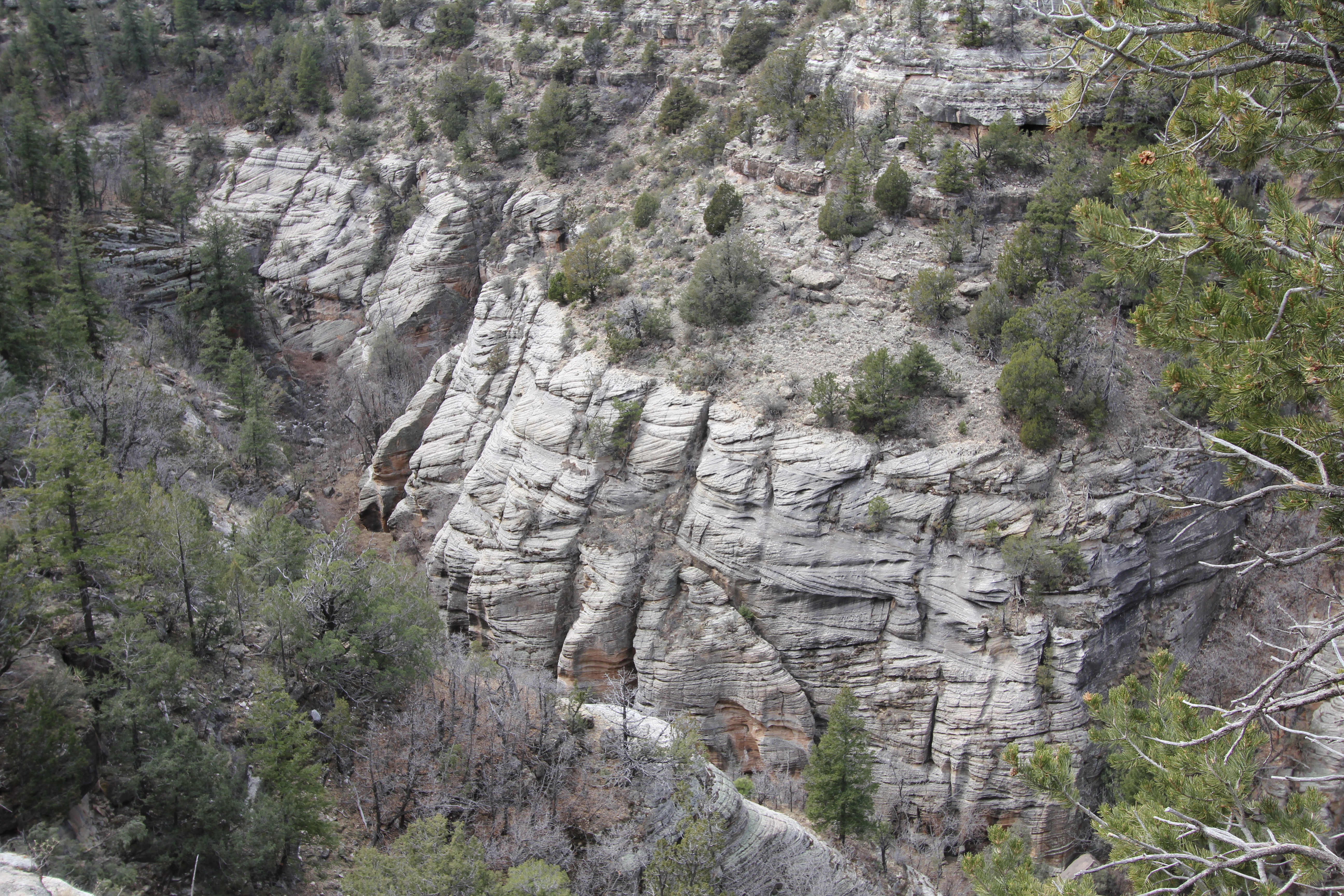
Still farther down.
Almost at the bottom. Here Kathie checks out the remains of a room. Any movable artifacts, and probably some of the walls themselves, were plundered over a century ago.
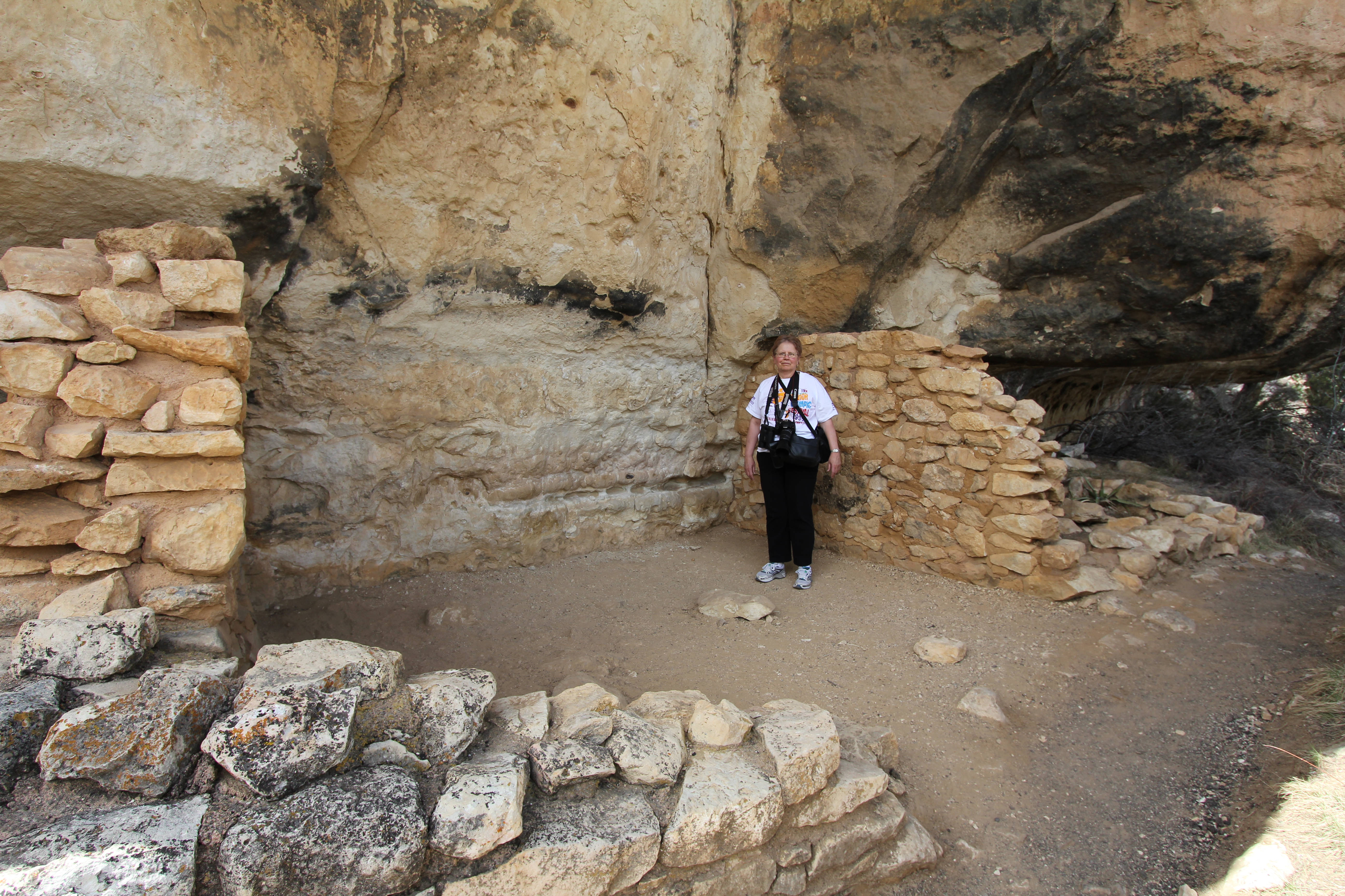
This would be a difficult place to plunder. These Sinagua farmers were into some serious security. We would later learn that all of the cliff dwelling people had similar ideas.
Another dwelling, carved into the rock.
Yet another.
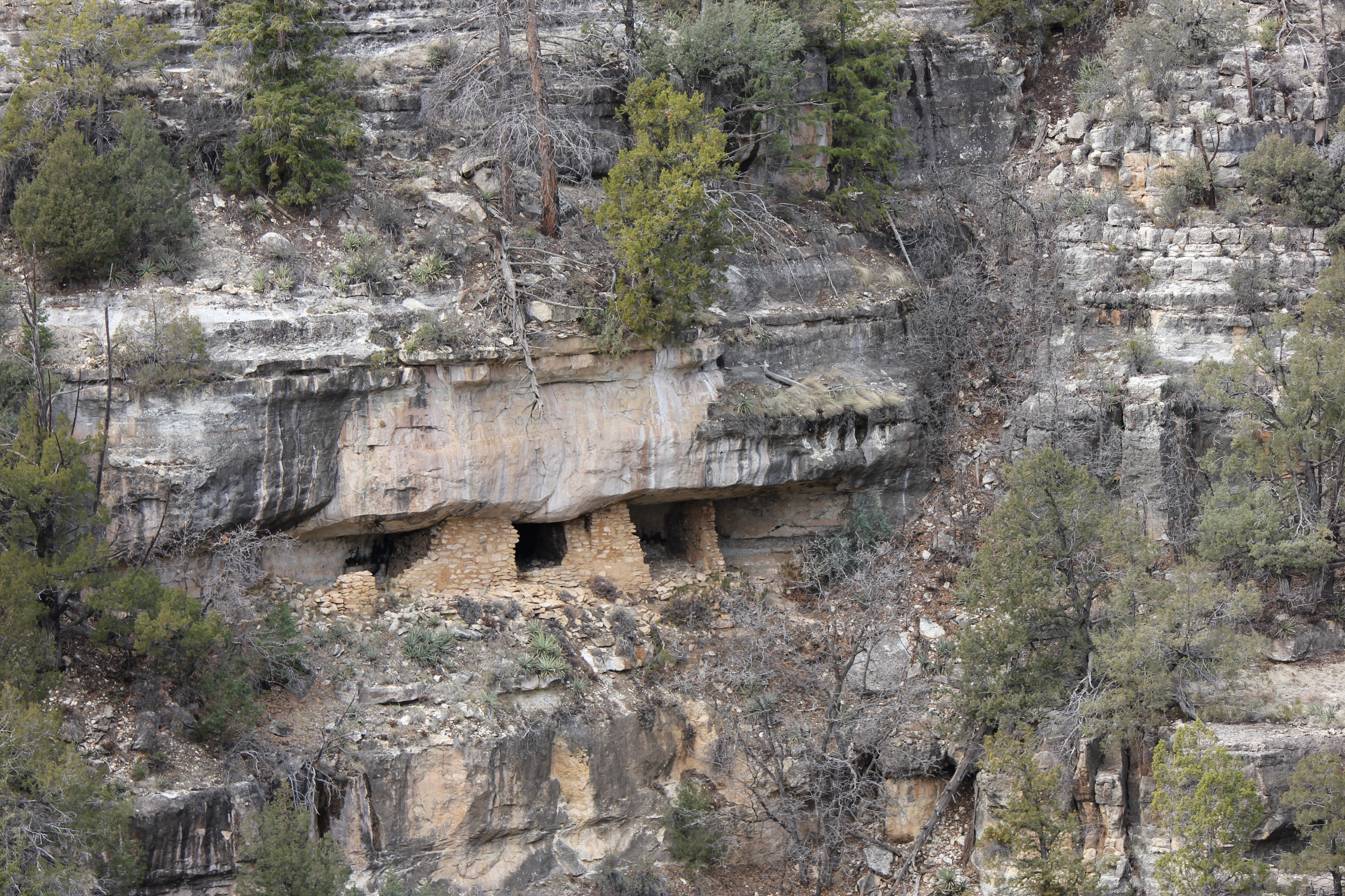
At the end of the trail, there were the most extensive, well preserved dwellings. Here's a 97° view, with Kathie providing a bit of scale.
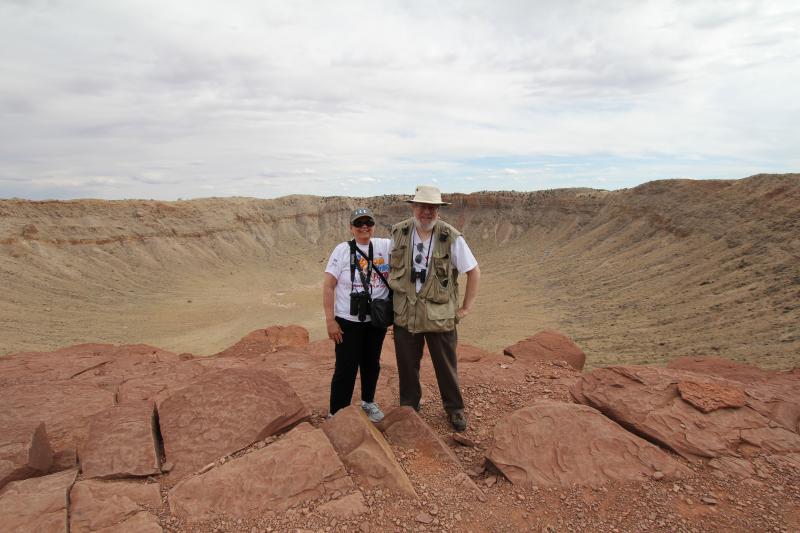
From Walnut canyon, we drove to the Meteor crater, which I had heard about since I was 6 but never seen. Well, it's a Big hole in the ground. For $15/person, there was a geologist who gave an interesting talk about the meteor (there's not much left, it pretty much scattered itself over a few tens of square miles upon impact, 50,000 years ago.)
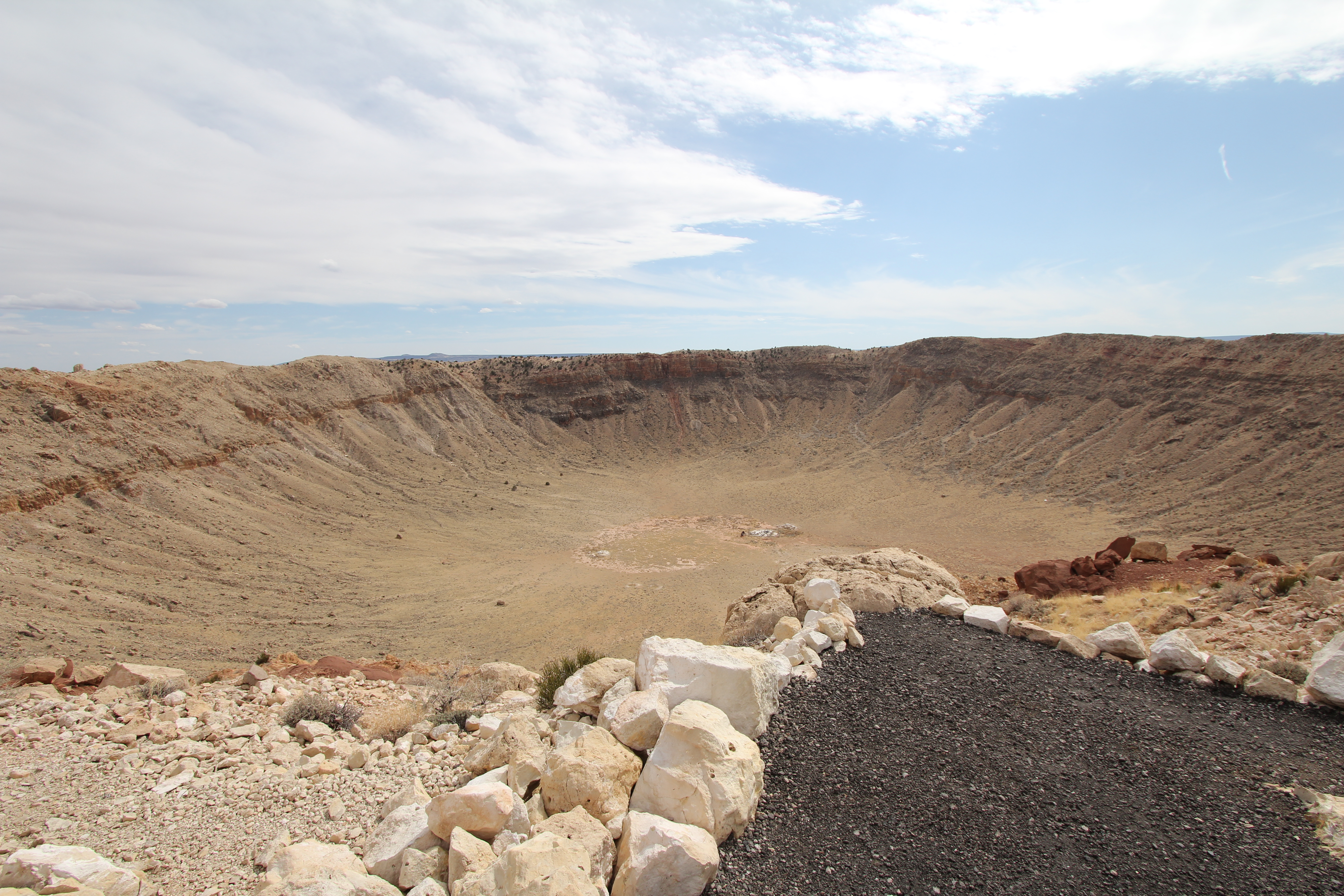
The plateau the meteor hit was very flat.
The geologist guide was kind enough to take our picture with my camera. I didn't include a high res of this, sorry!
From the meteor crater, we drove to Winslow, AZ, found a nice cheap hotel, and had an excellent mexican meal in the Brown Jug, a restaurant recommended by our Meteor Crater geologist/guide.
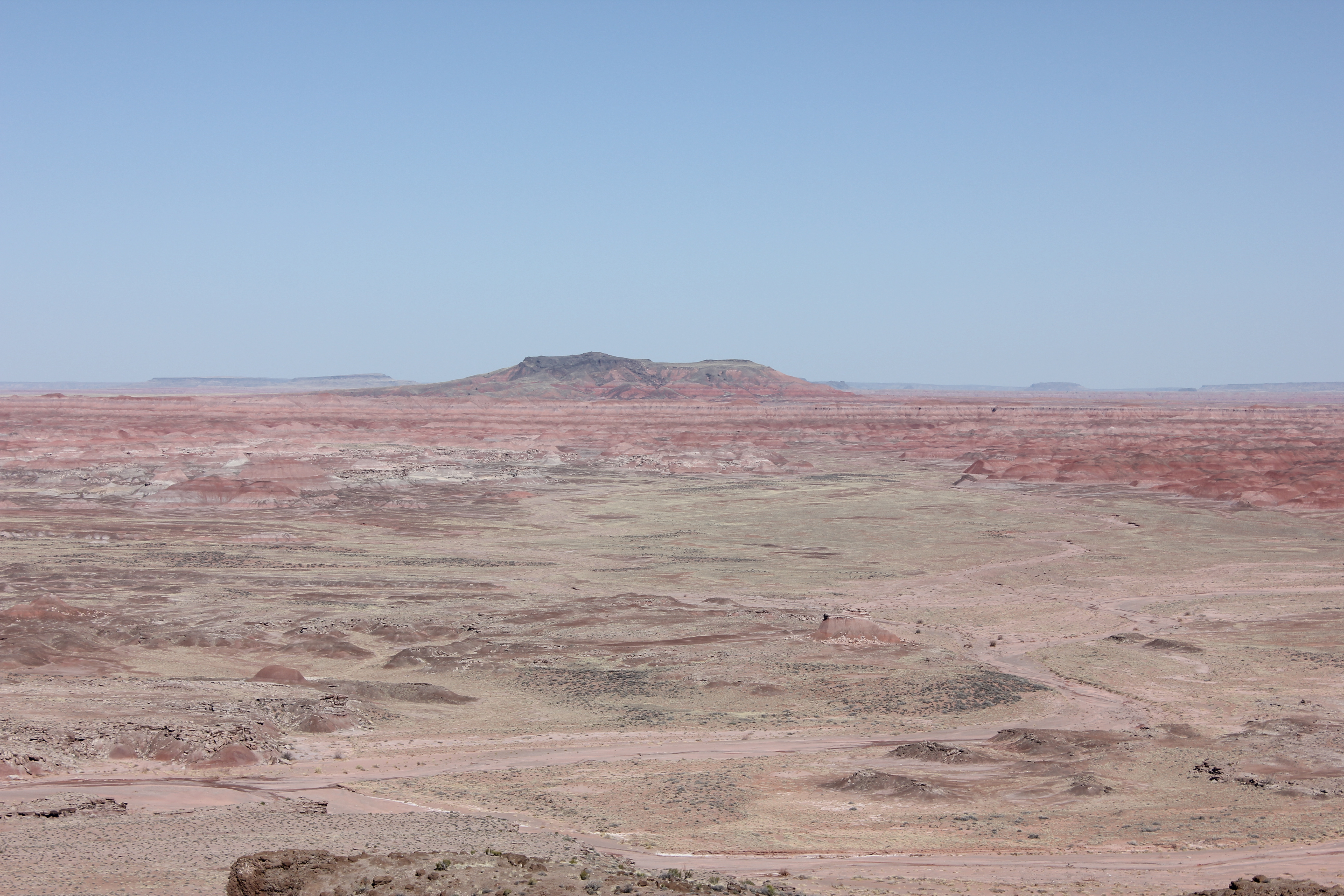
On Monday, March 18, we headed east to the Painted Desert / Petrified Forest.
The Painted Desert is superb. Here's part of the reason why.
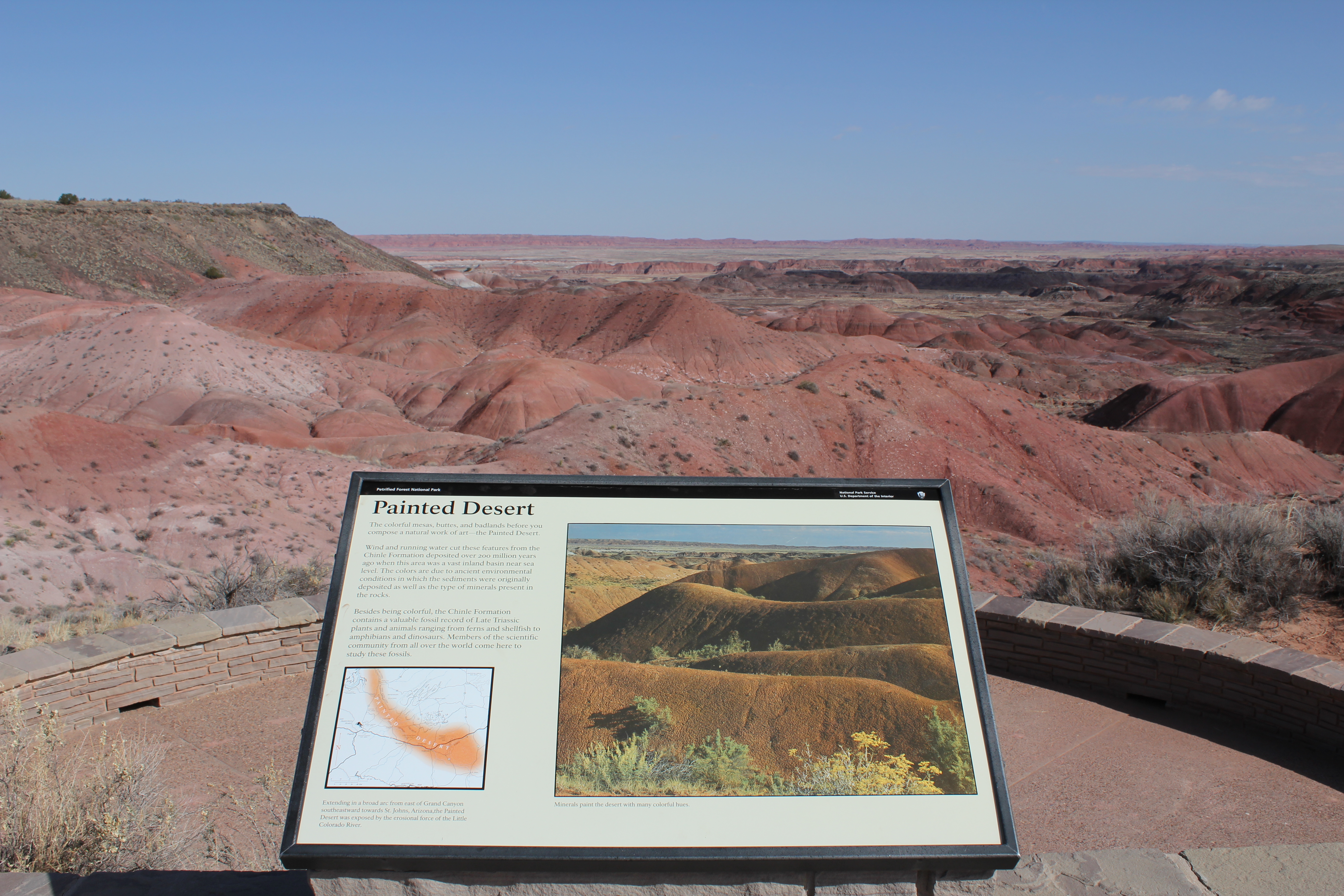
The colors are unexpectedly vivid. The camera tries to capture some of this, but nothing quite compares to being there and seeing it with your own eyes.
The multi colored sediments are like a permanent sunset.
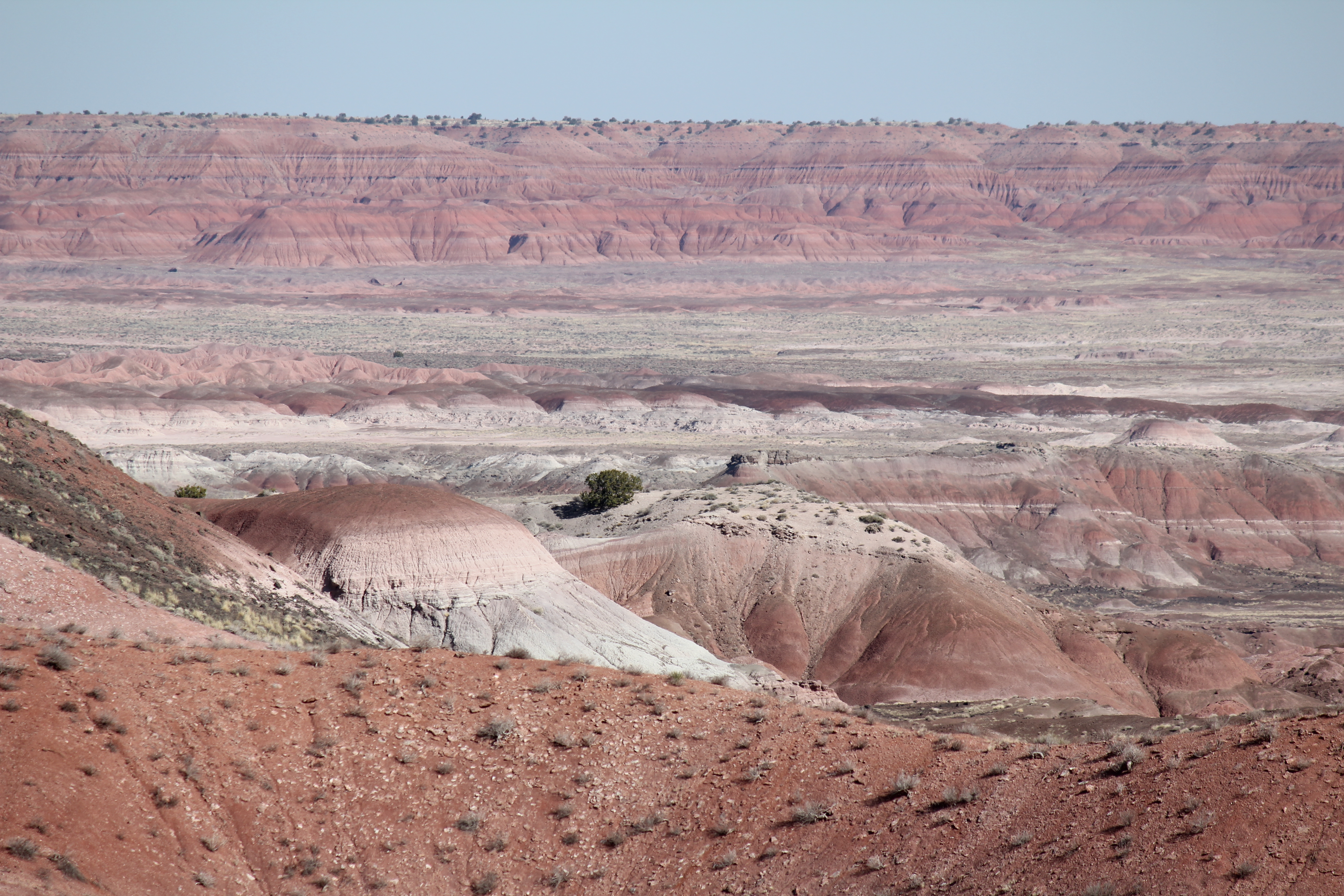
The 97° wide angle tries to capture the grand sweep of the land.
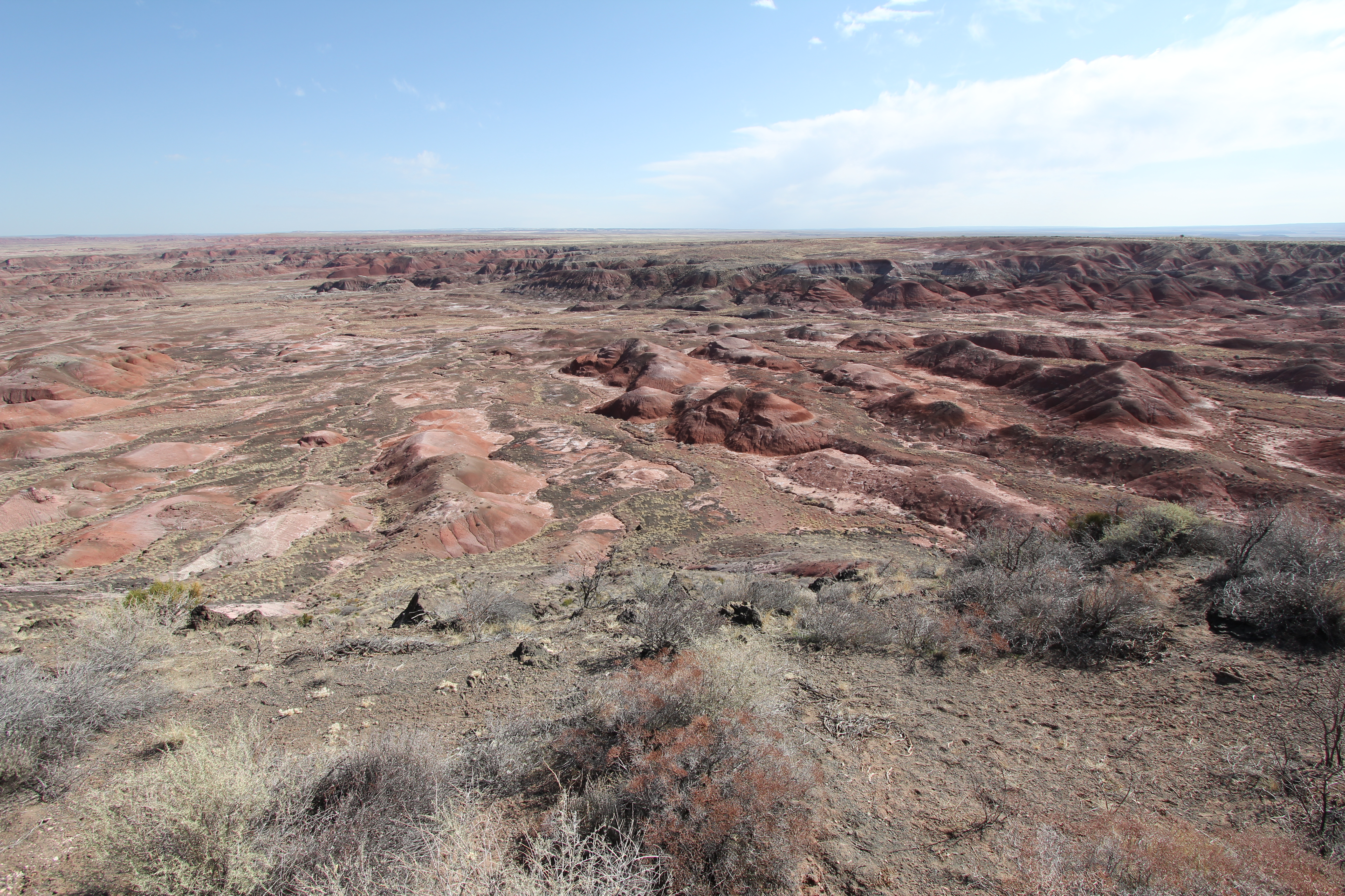
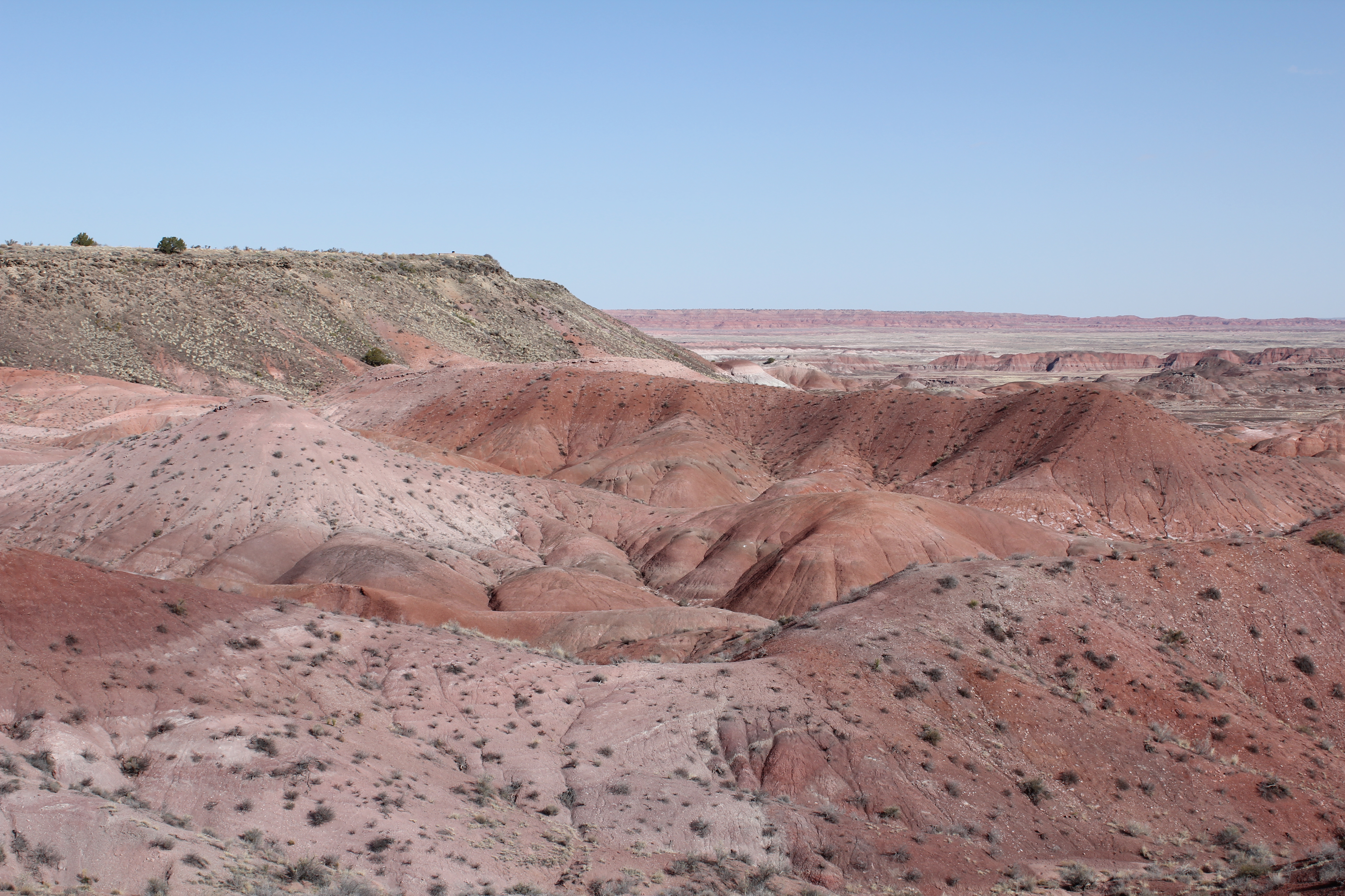
Each pull off offered a superb vista. This was one of the few parks that one can see almost as well by car as by walking.
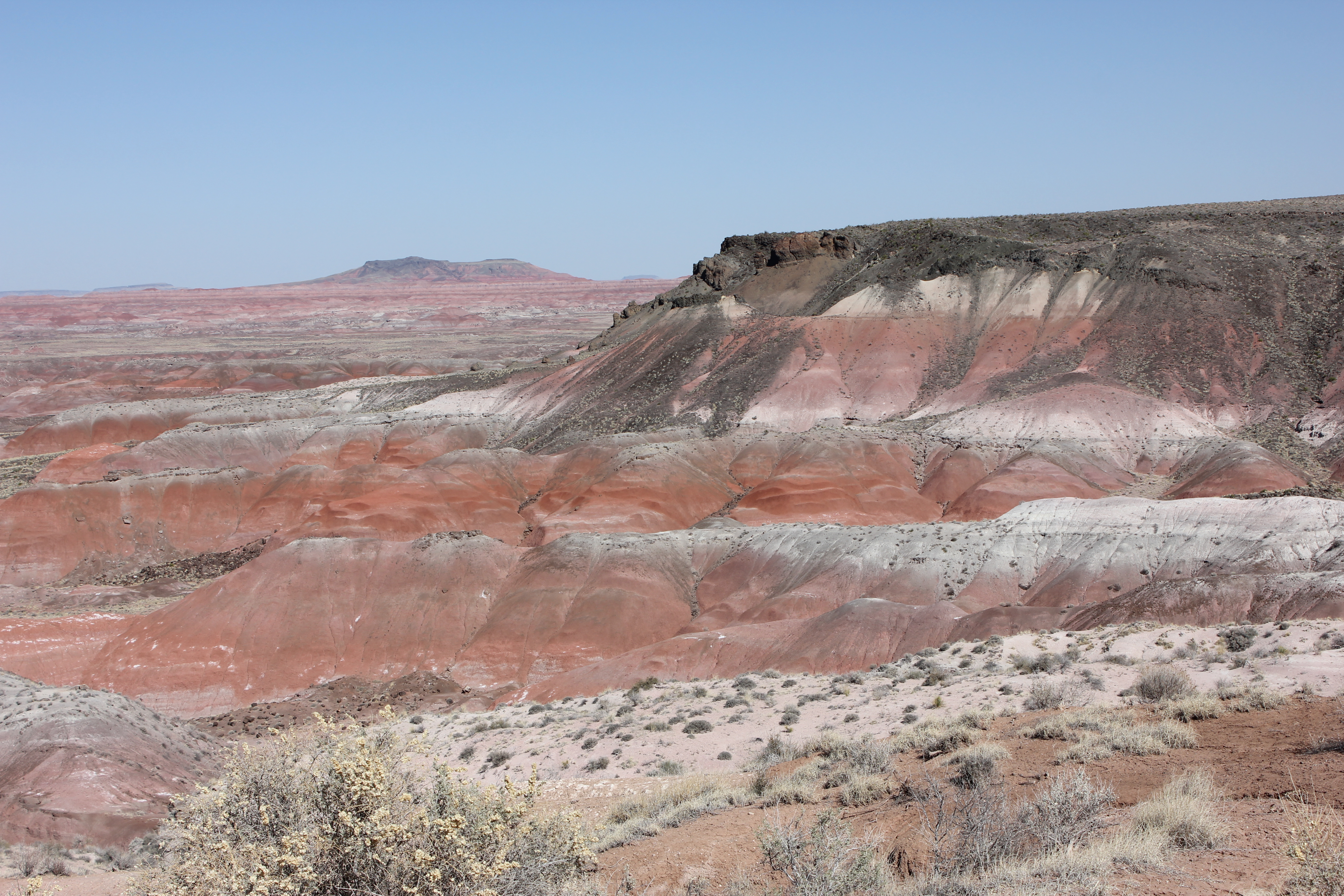
I was reminded of the red of the planet Mars, but there is more variety in this scene than any panaroma I've seen from Mars.
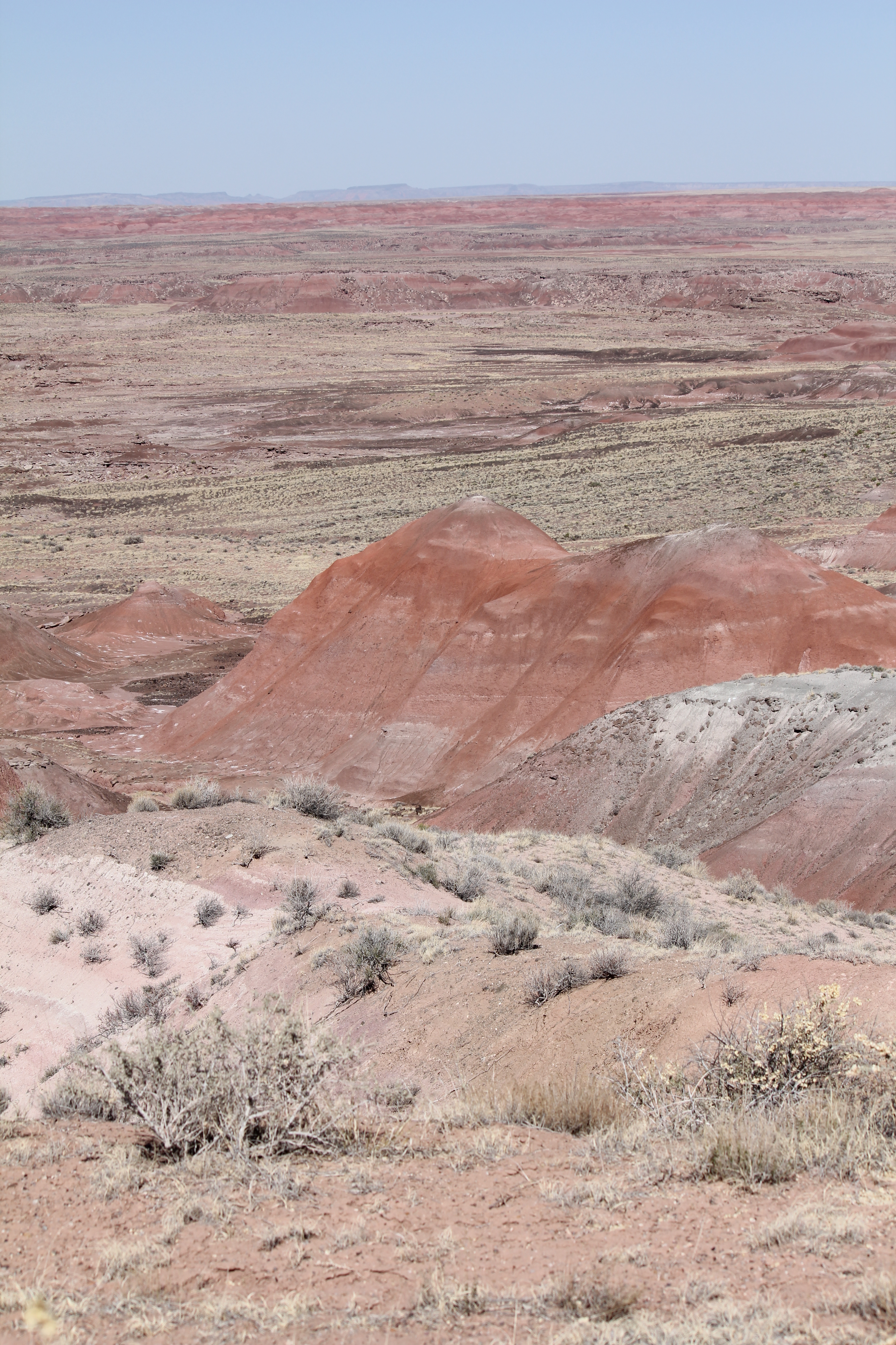
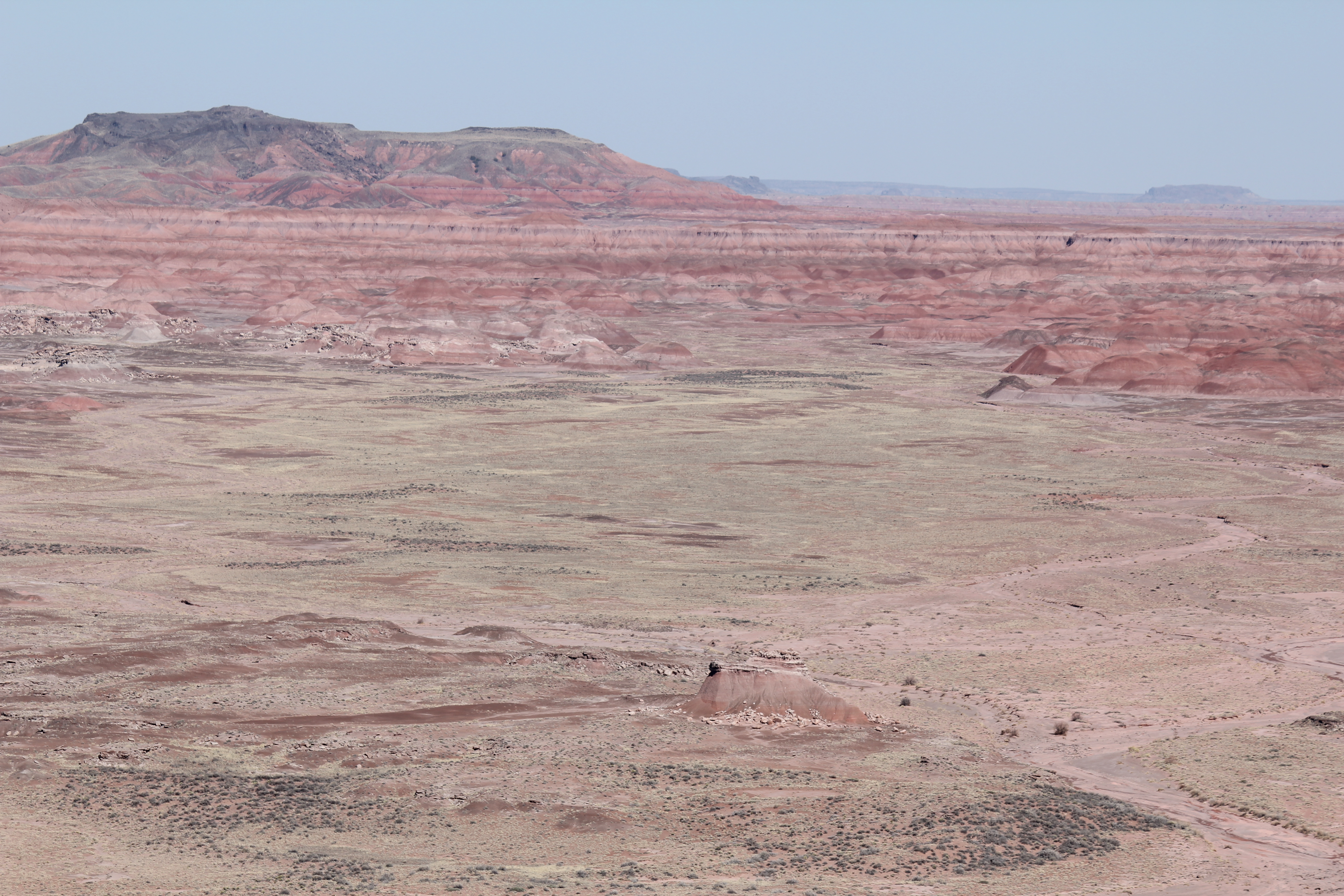
A multicolored mountian seven miles in the distance.
A similar cliff. The rock outcropings at its top are intriguing in the high res version.
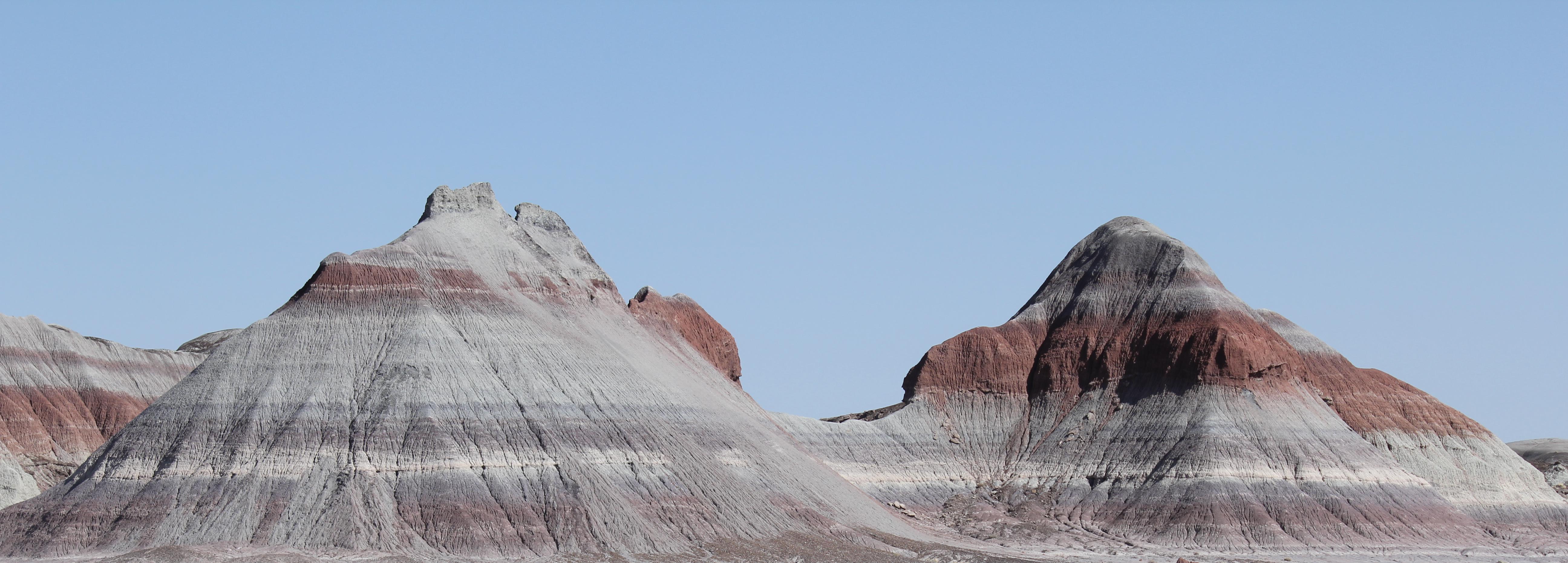
These hills are known as the teepes.
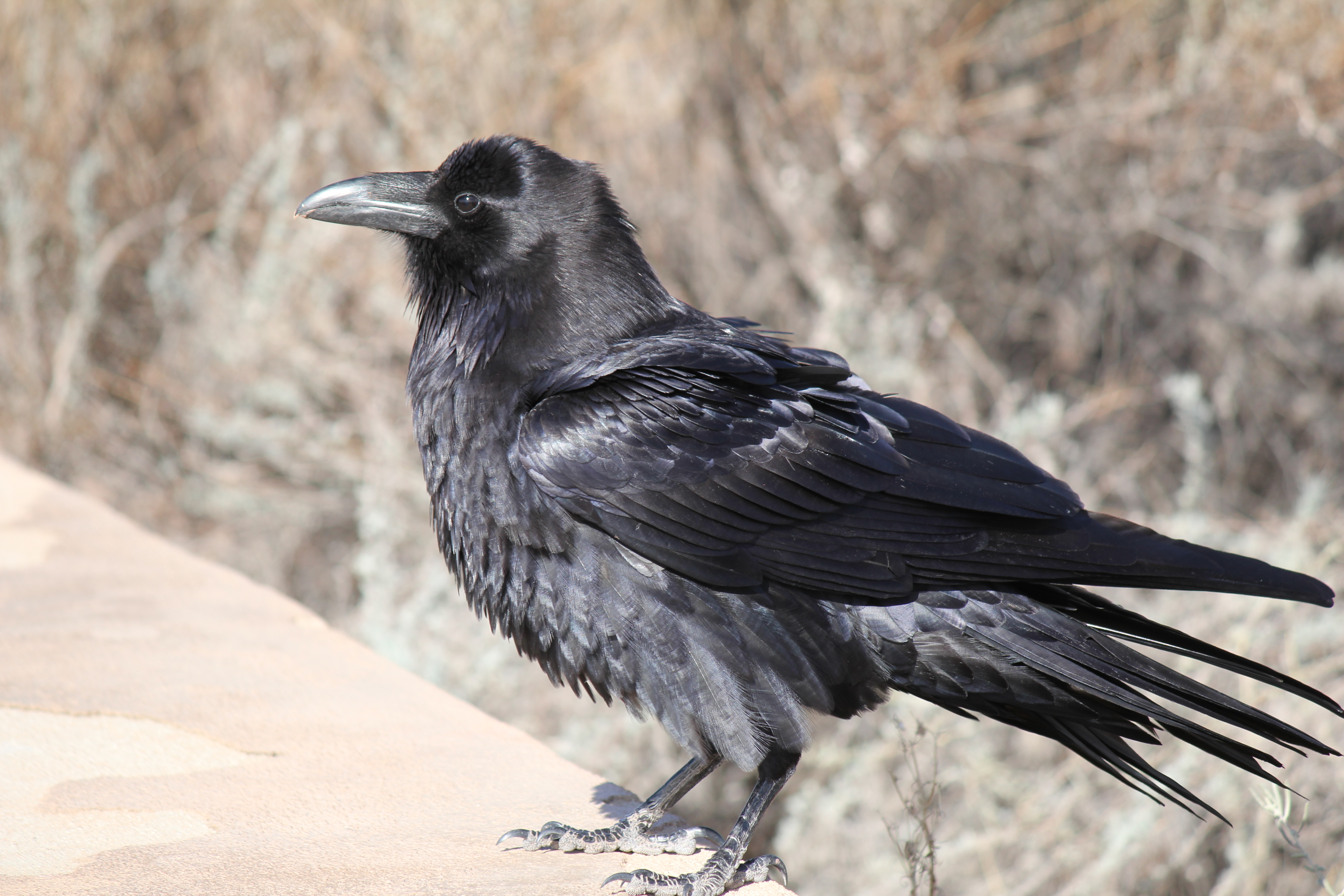
A fairly tame and well fed raven came looking for food. Despite his skilled begging, we didn't feed him. Others, I'm sure, do.
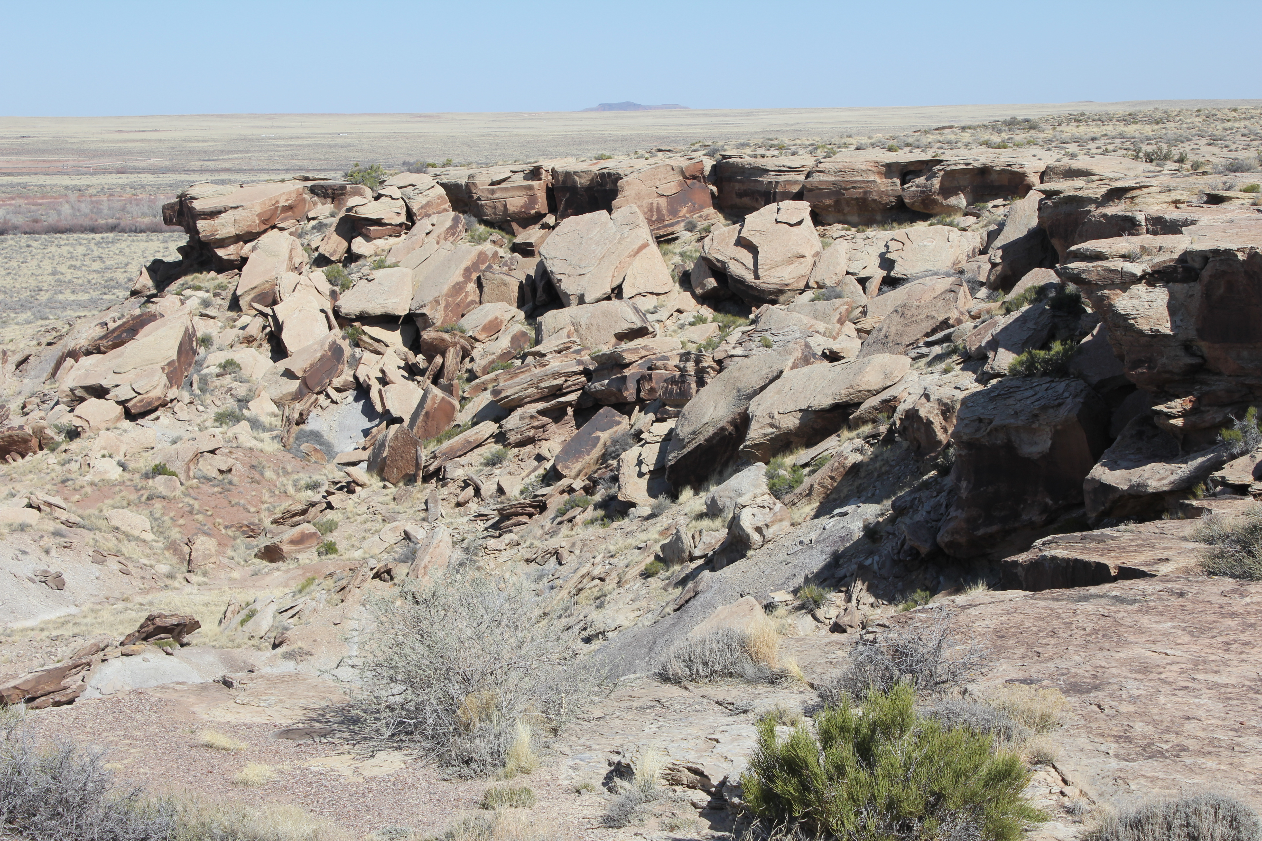
From the painted desert, the petrified forest, in the same park is but 20 miles to the south. First, however, we stopped by Newspaper rock.
Broken, cubist sandstone. Picasso never did better! It's very near the celebrated Newspaper rock.
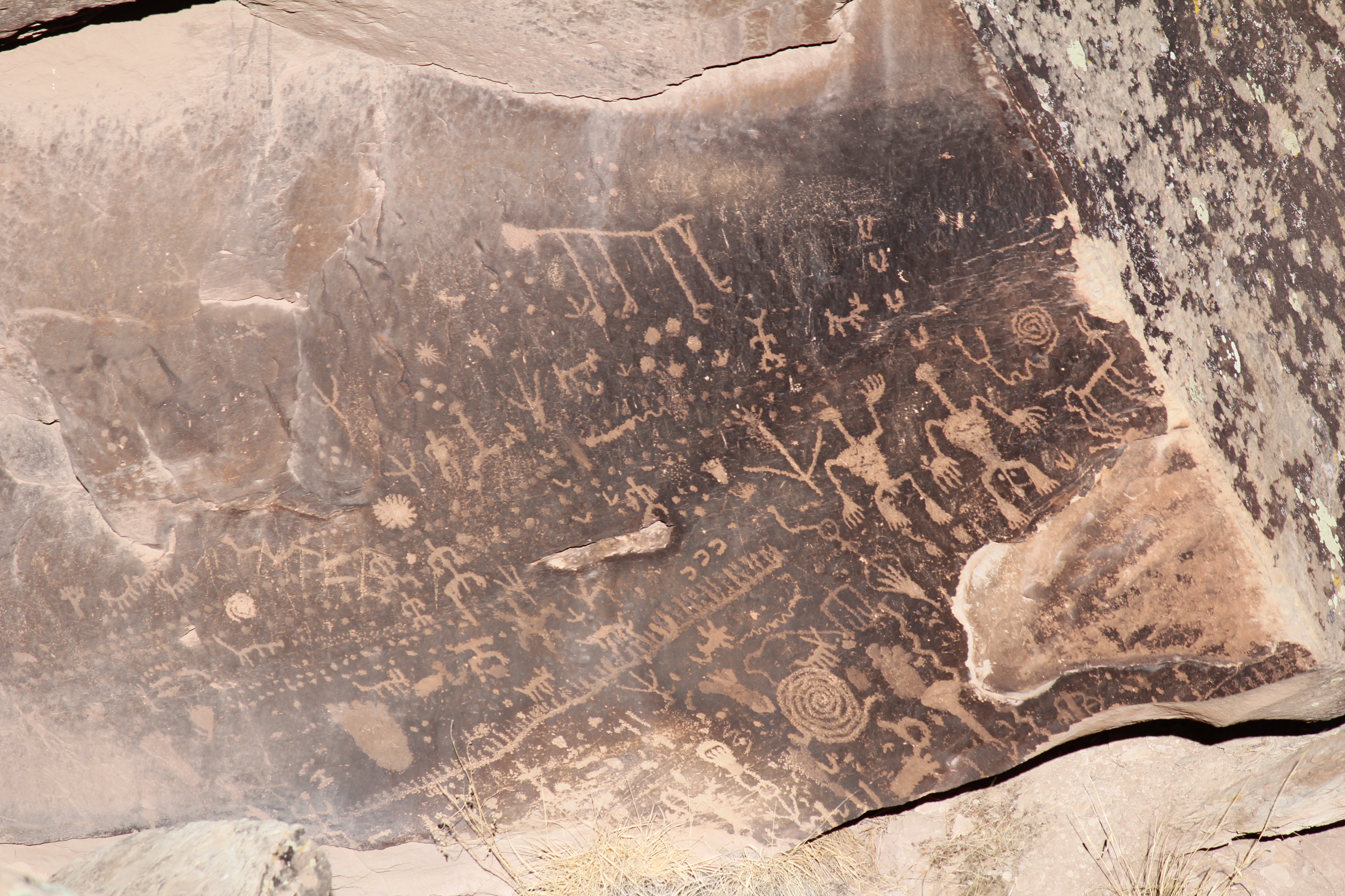
Newspaper rock. Go ahead and look at the high res version. Perhaps you can read the headlines. No one else has been able to do so!
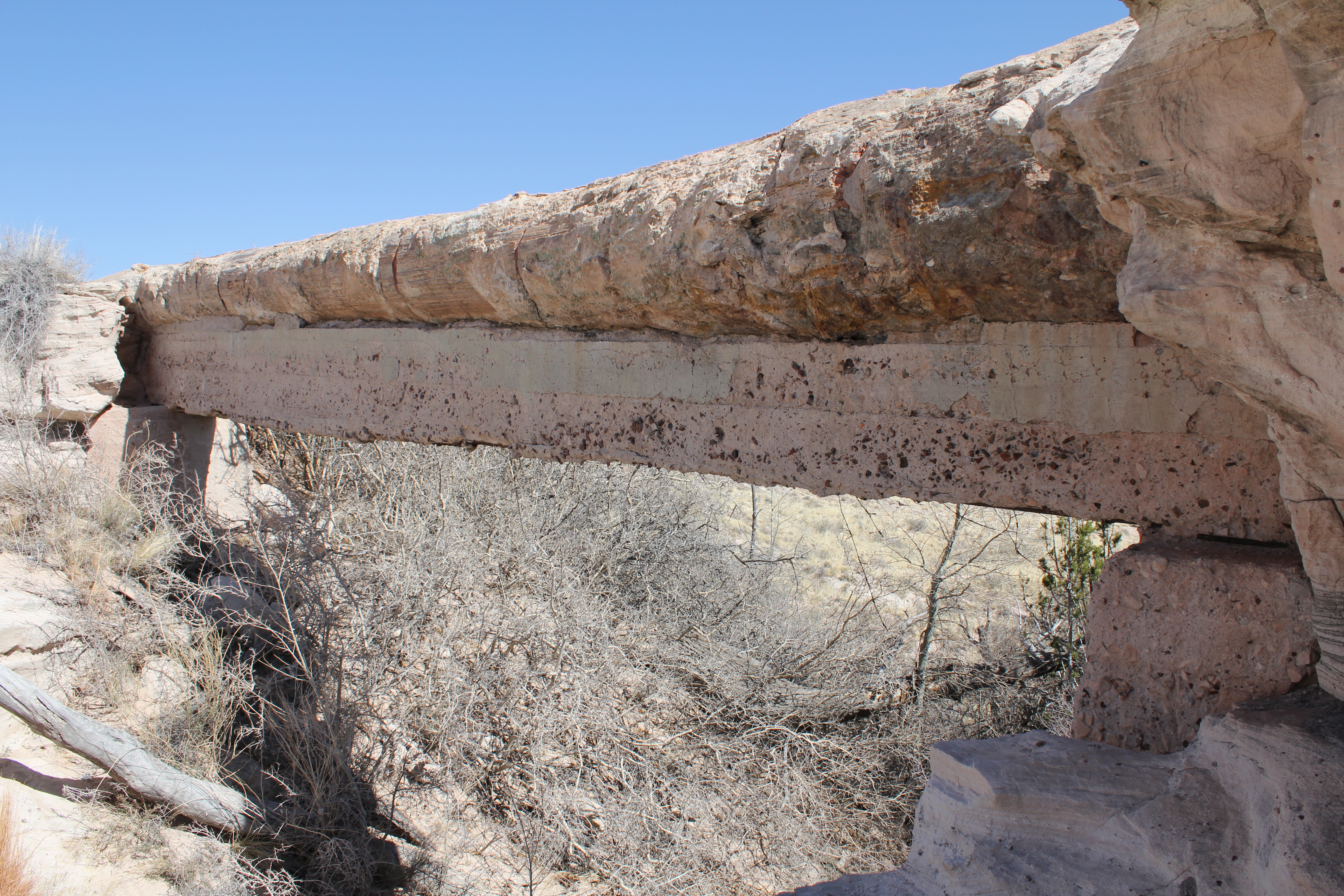
On to the petrified forest. As we drew near, the "Agate bridge" turn off caught our eye, and we stopped to look. For uncounted years, the log formed a natural bridge above this small arroyo. Then a century ago, the locals felt it would need a bit of help, and obligingly erected the concrete support you see under it. The concrete is slowly eroding, but the log itself seems none the worse for its century of support.
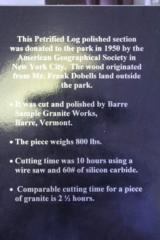
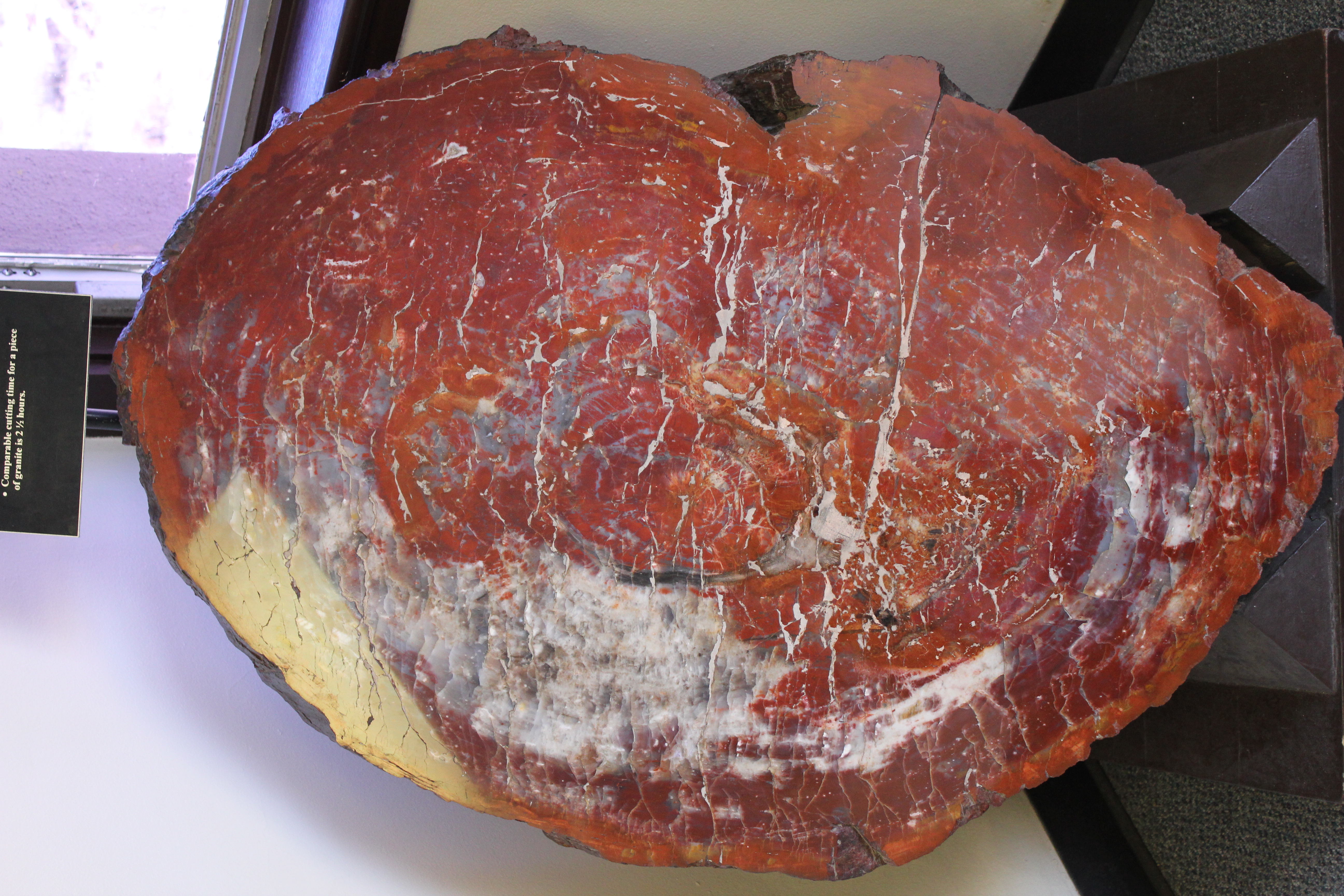
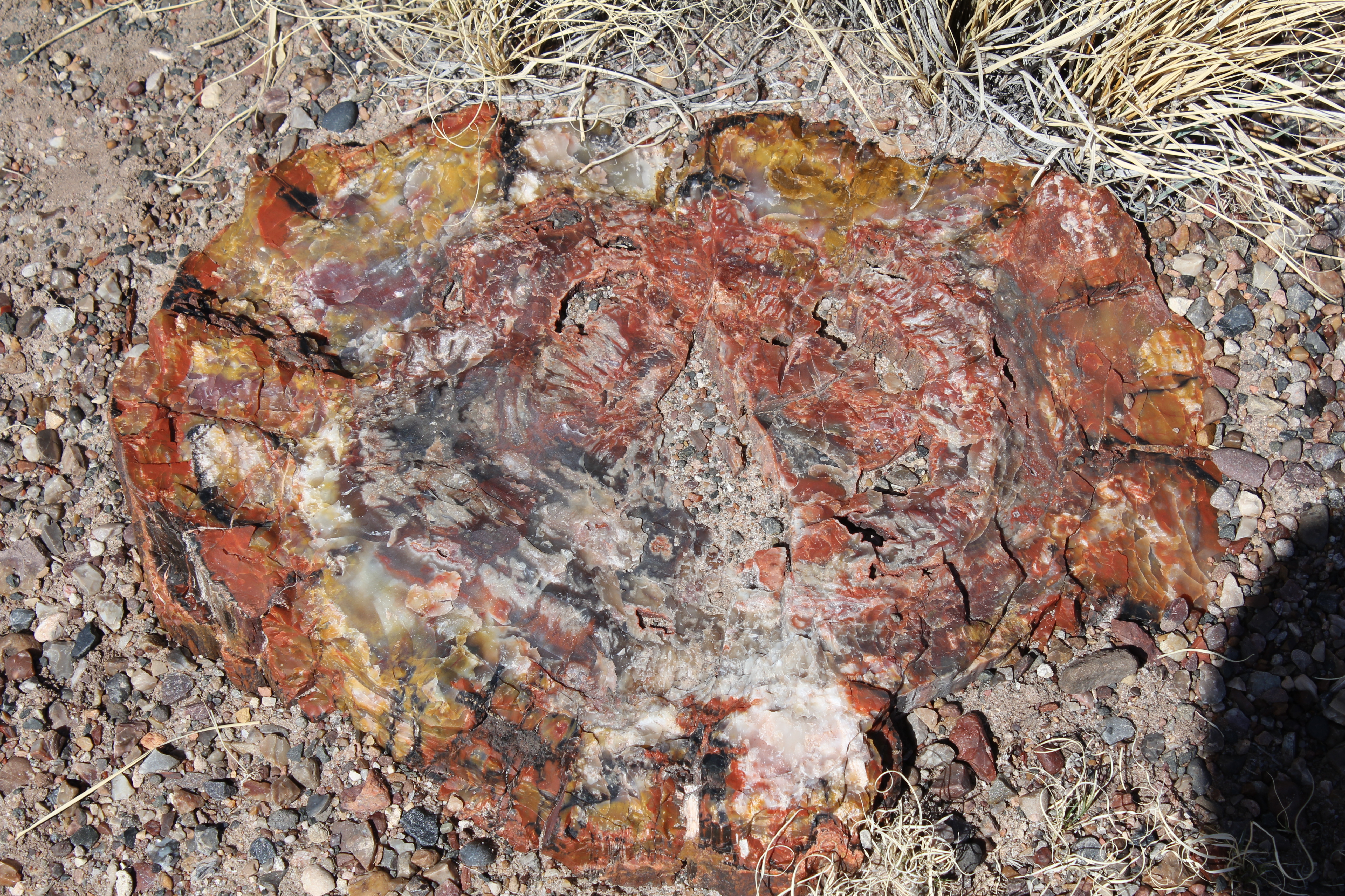
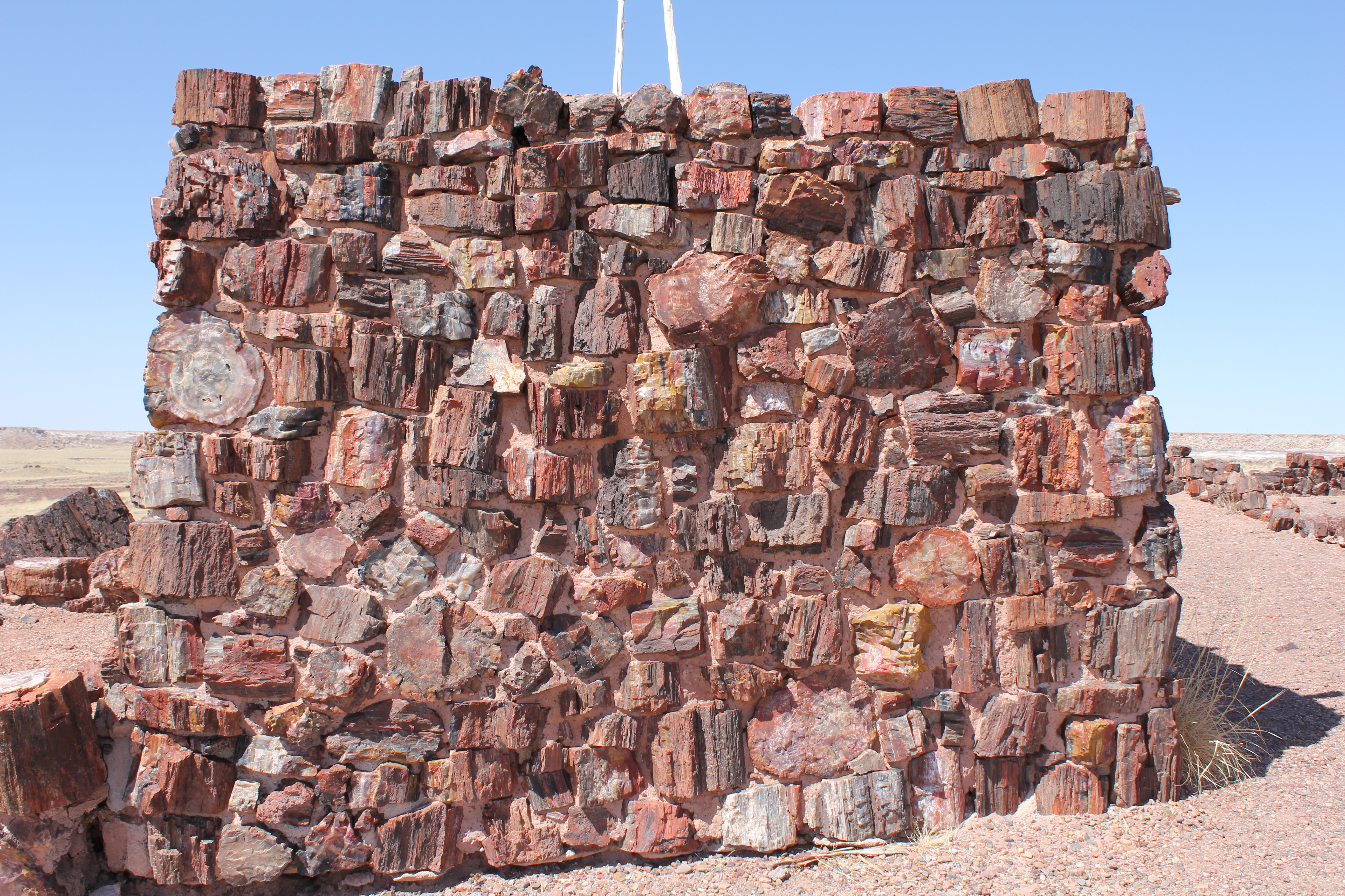
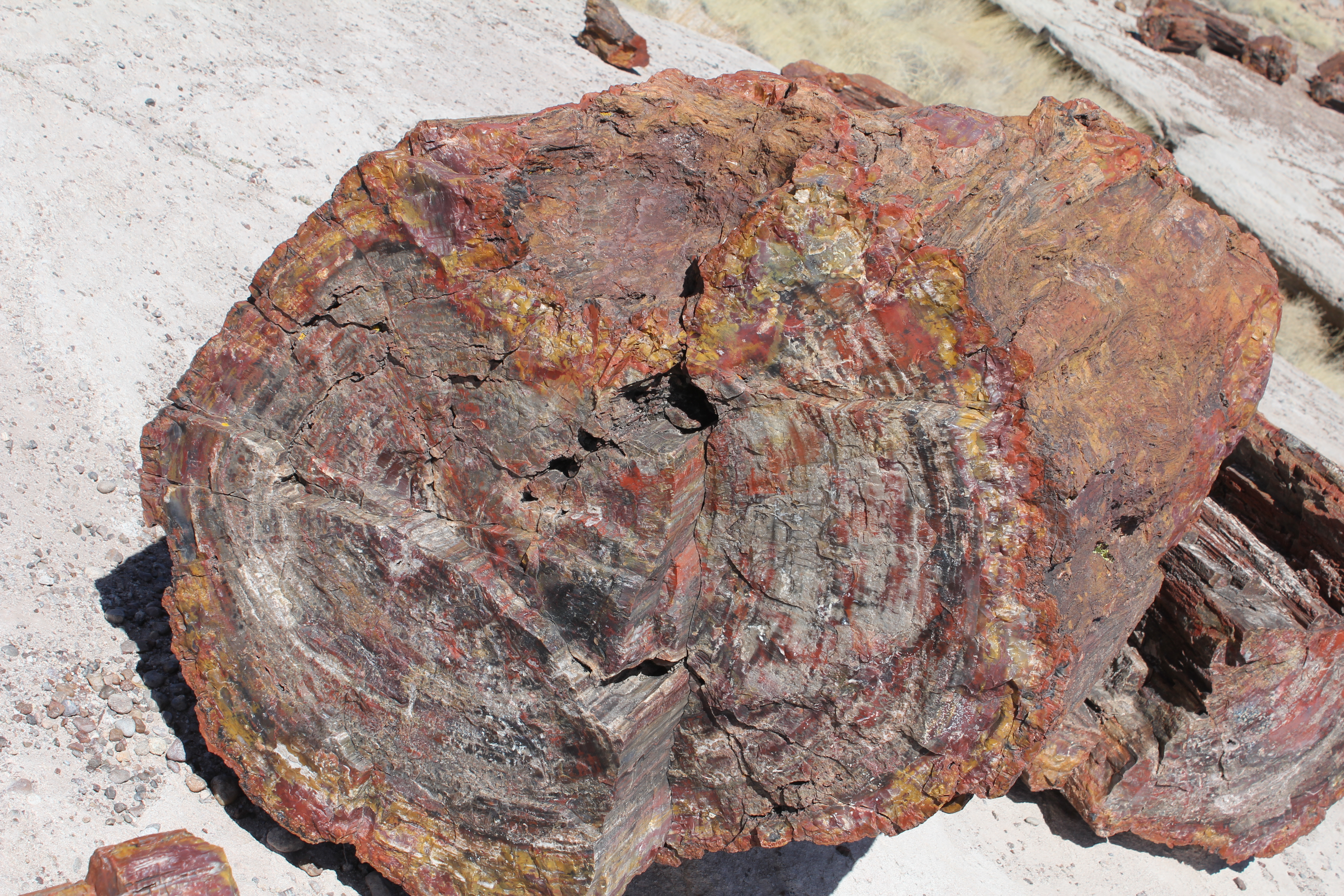
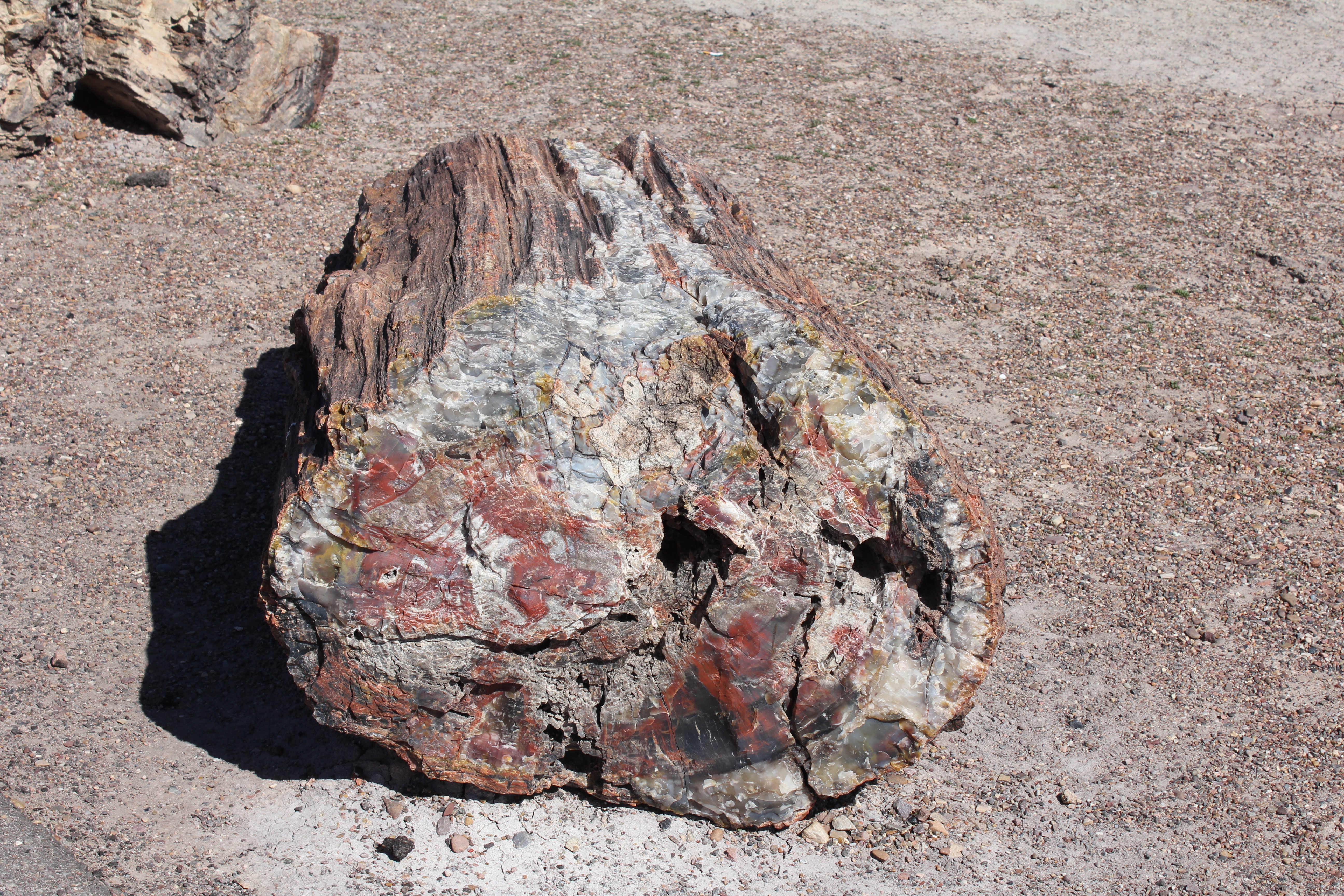
We stopped in the museum/visitors center and saw some cool dinosaur exibits of nicely mounted Triassic bones. A large slab of petrified tree was in a prominent corner.
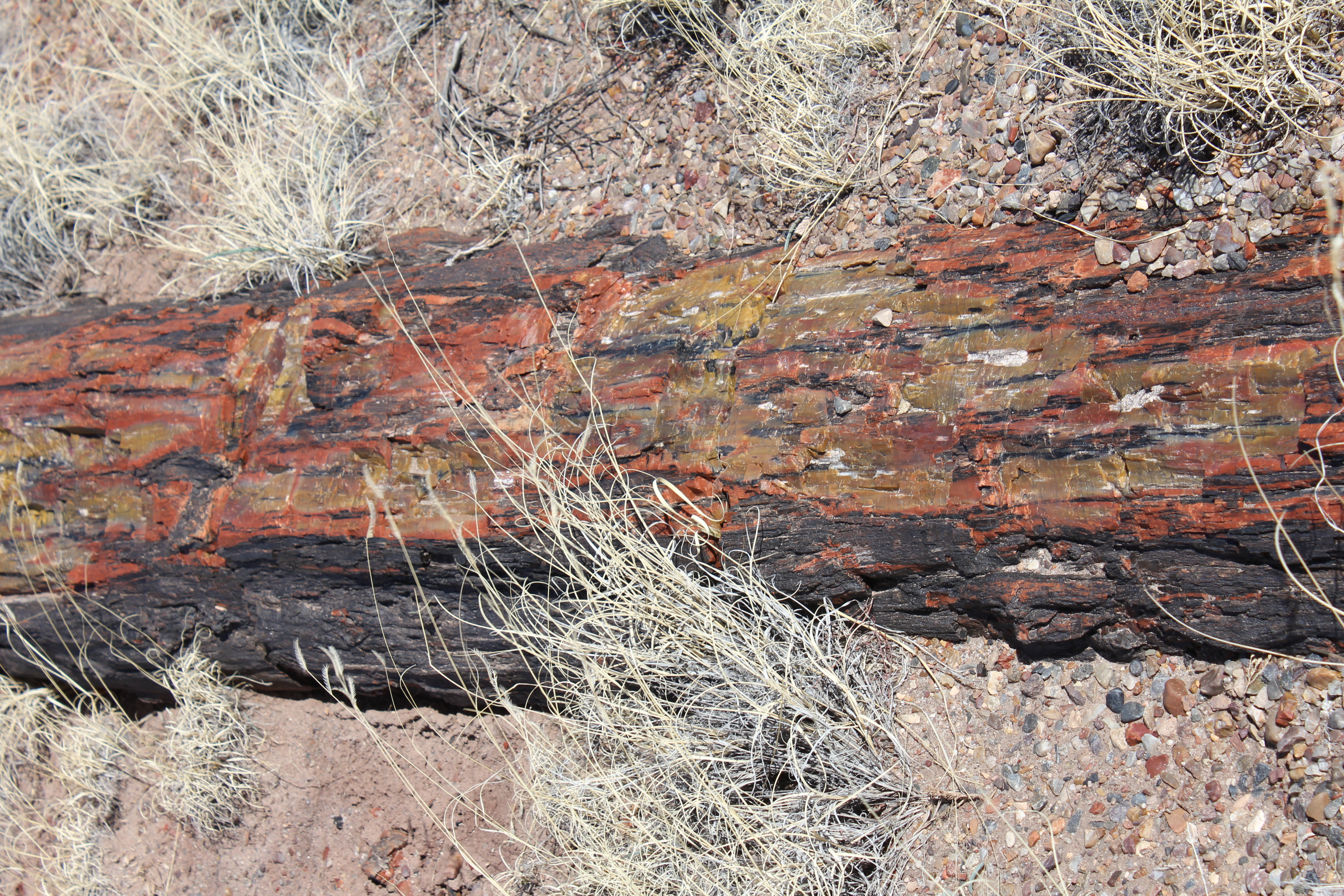
The story of the polished log. Note how much harder the petrified wood is than granite!
The log itself.
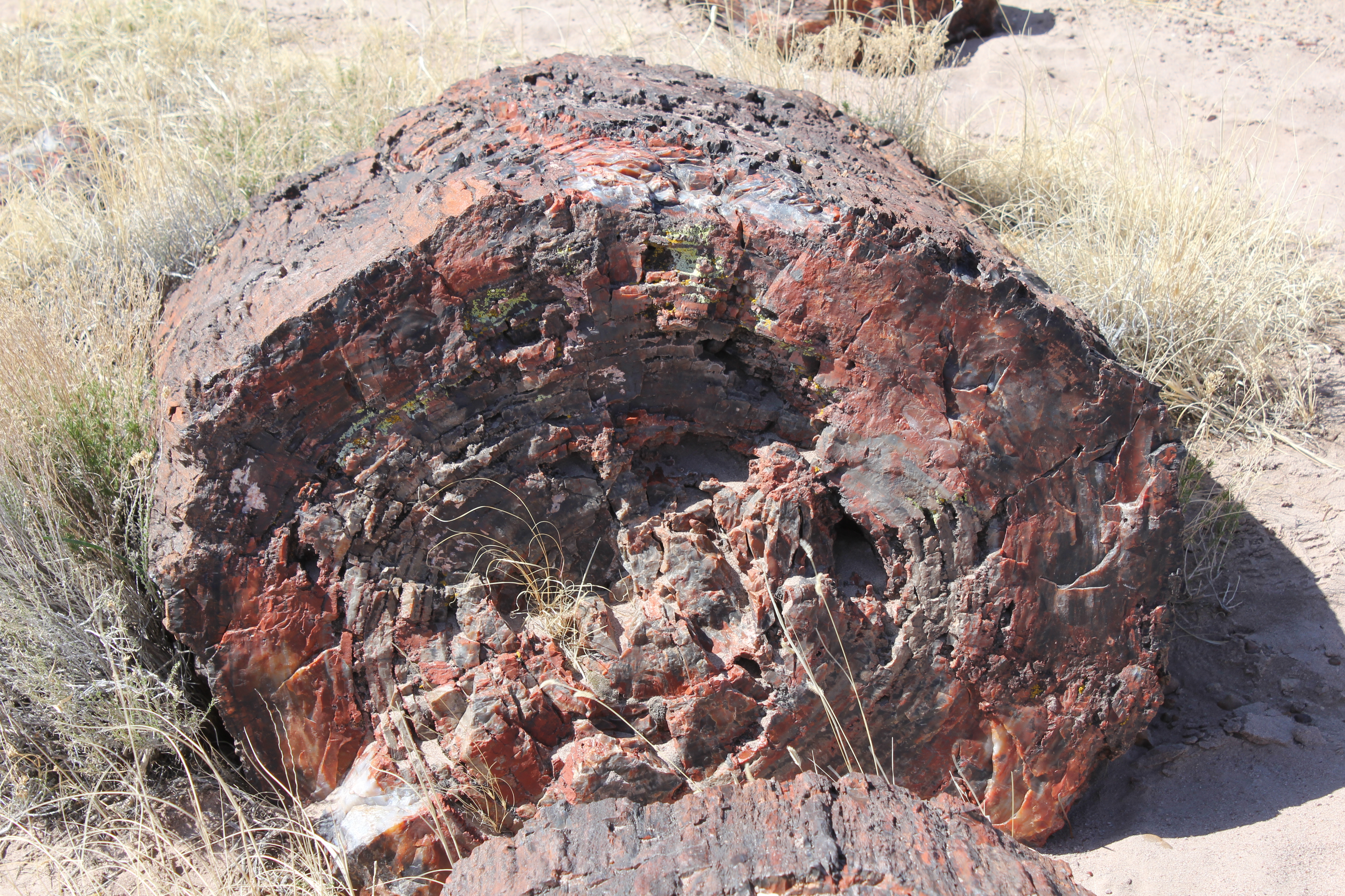
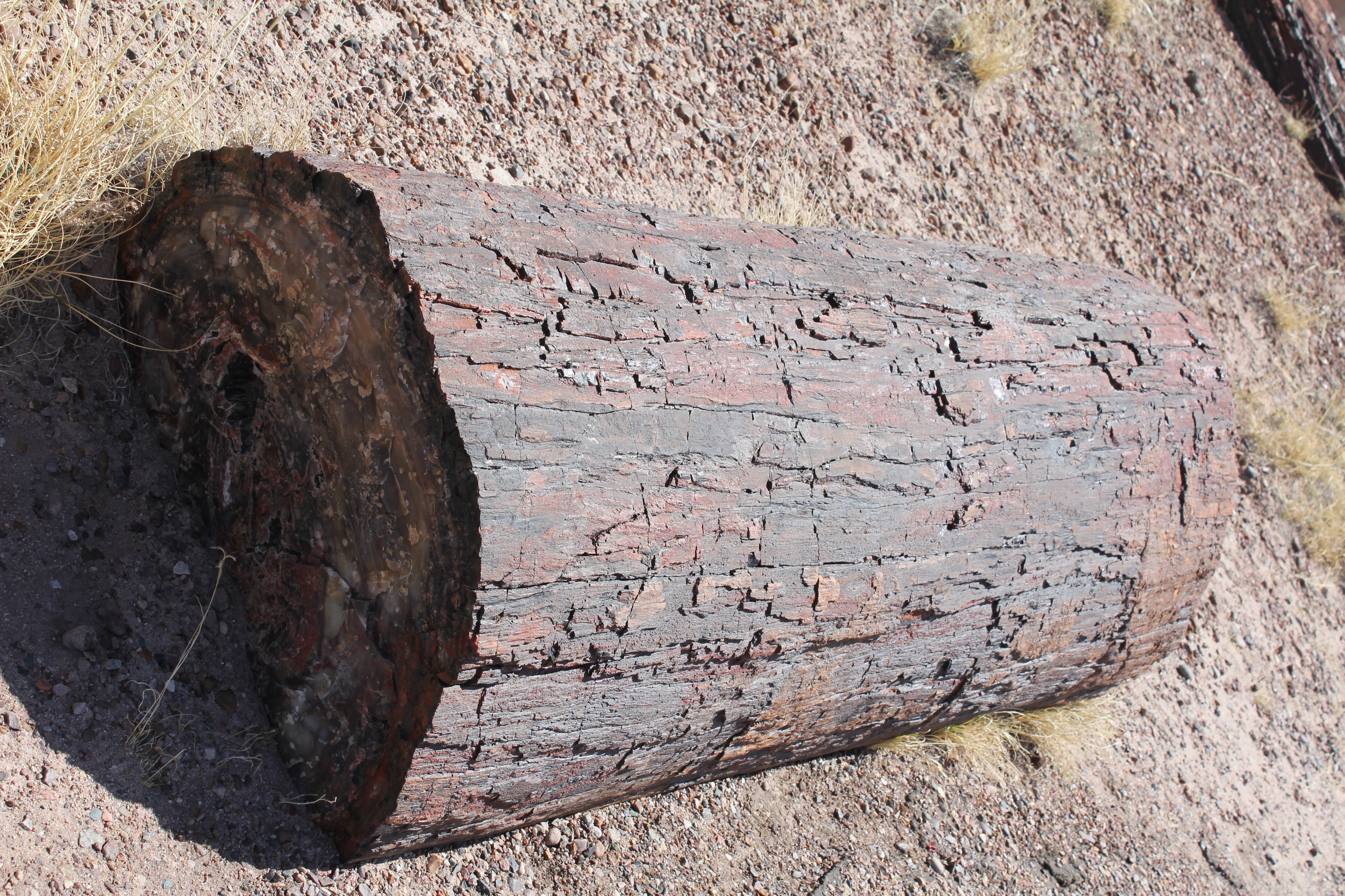
Just behind (west of) the museum, a huge log. Note how much like a tree trunk it is. There has been no human effort to make this look more log like, it's how it weathered out, from sandstone much softer than it is. It's probably been lying around like this for many millenia.
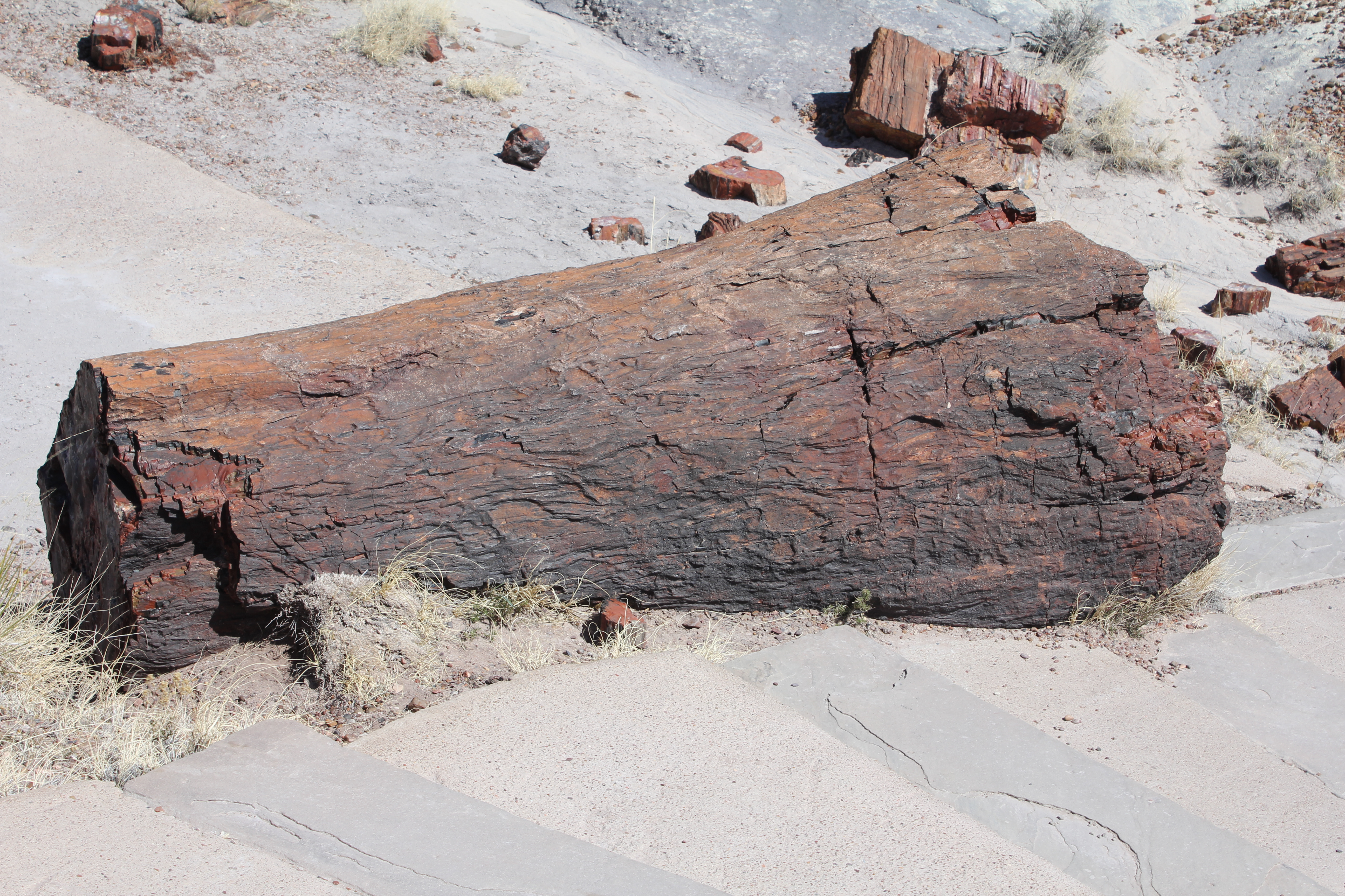
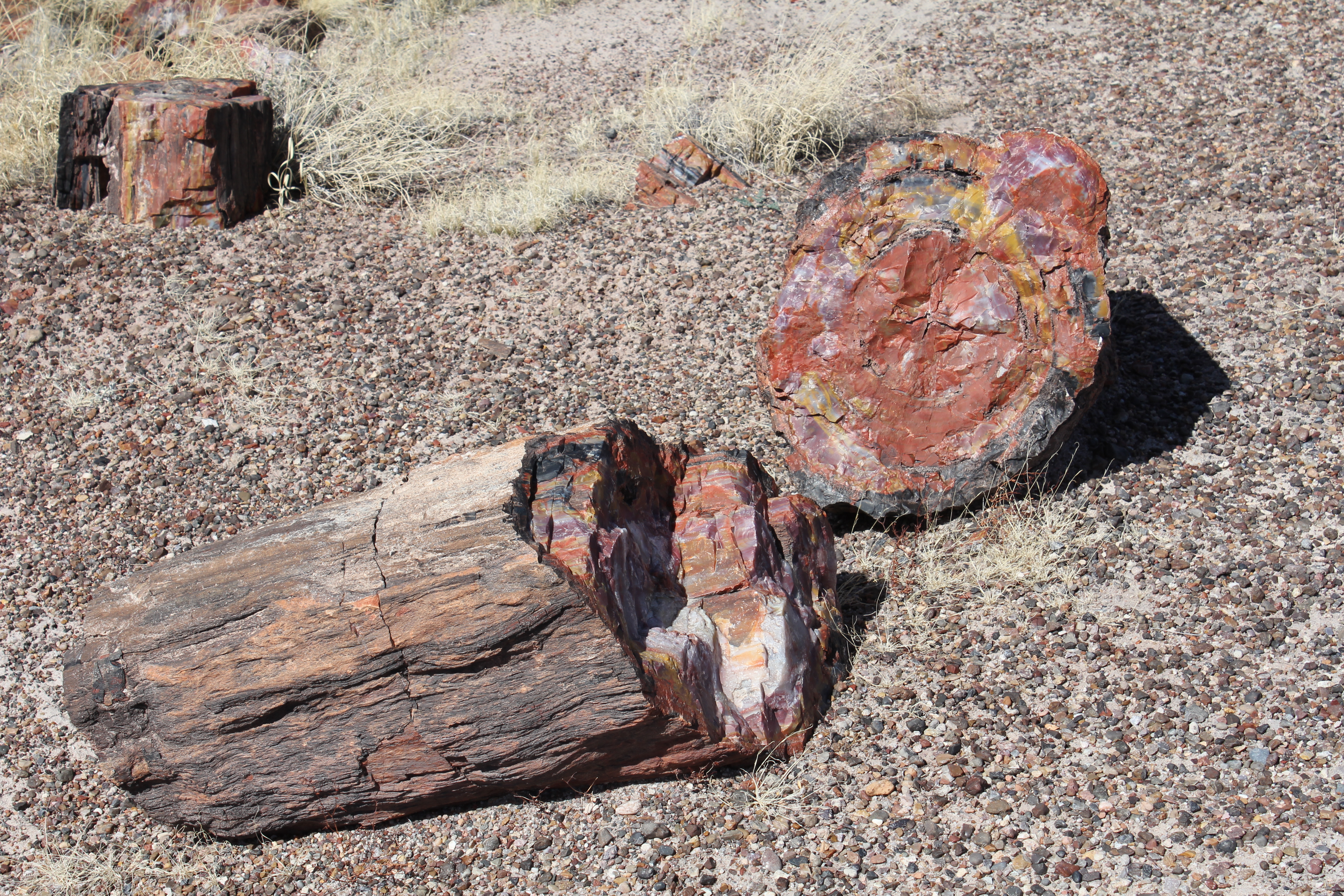
Another huge log, in sections. It looks like it's just been cut down, but these logs are 225 million years old!
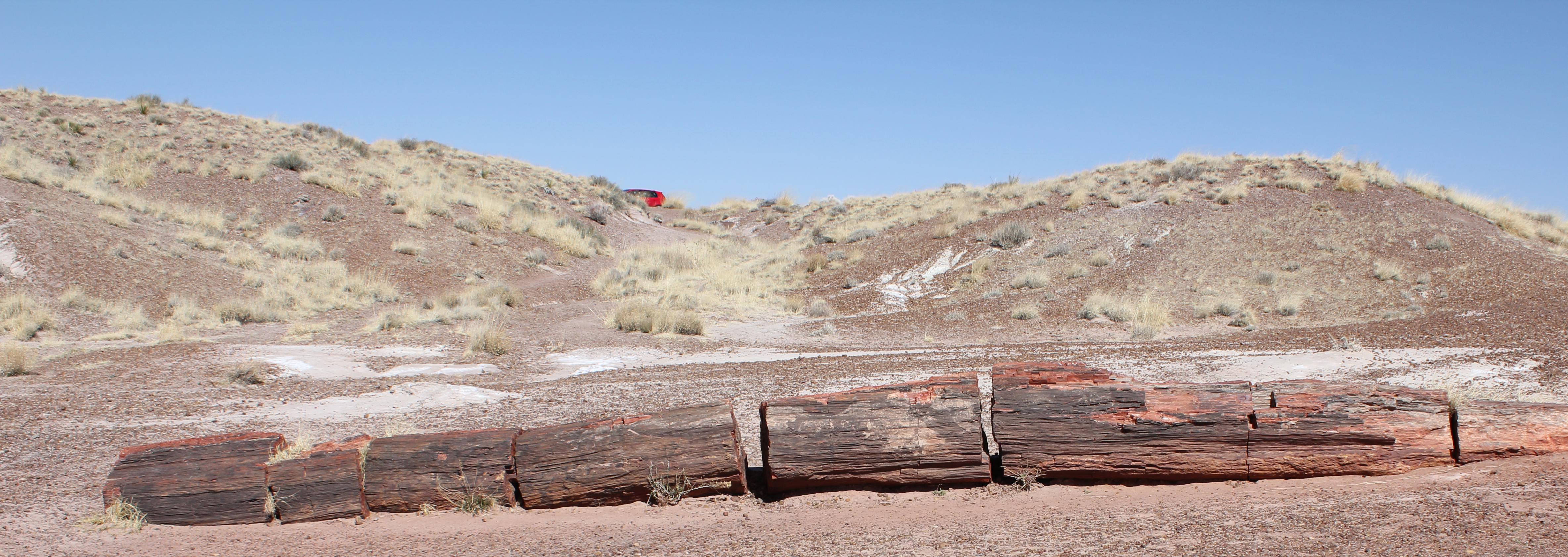
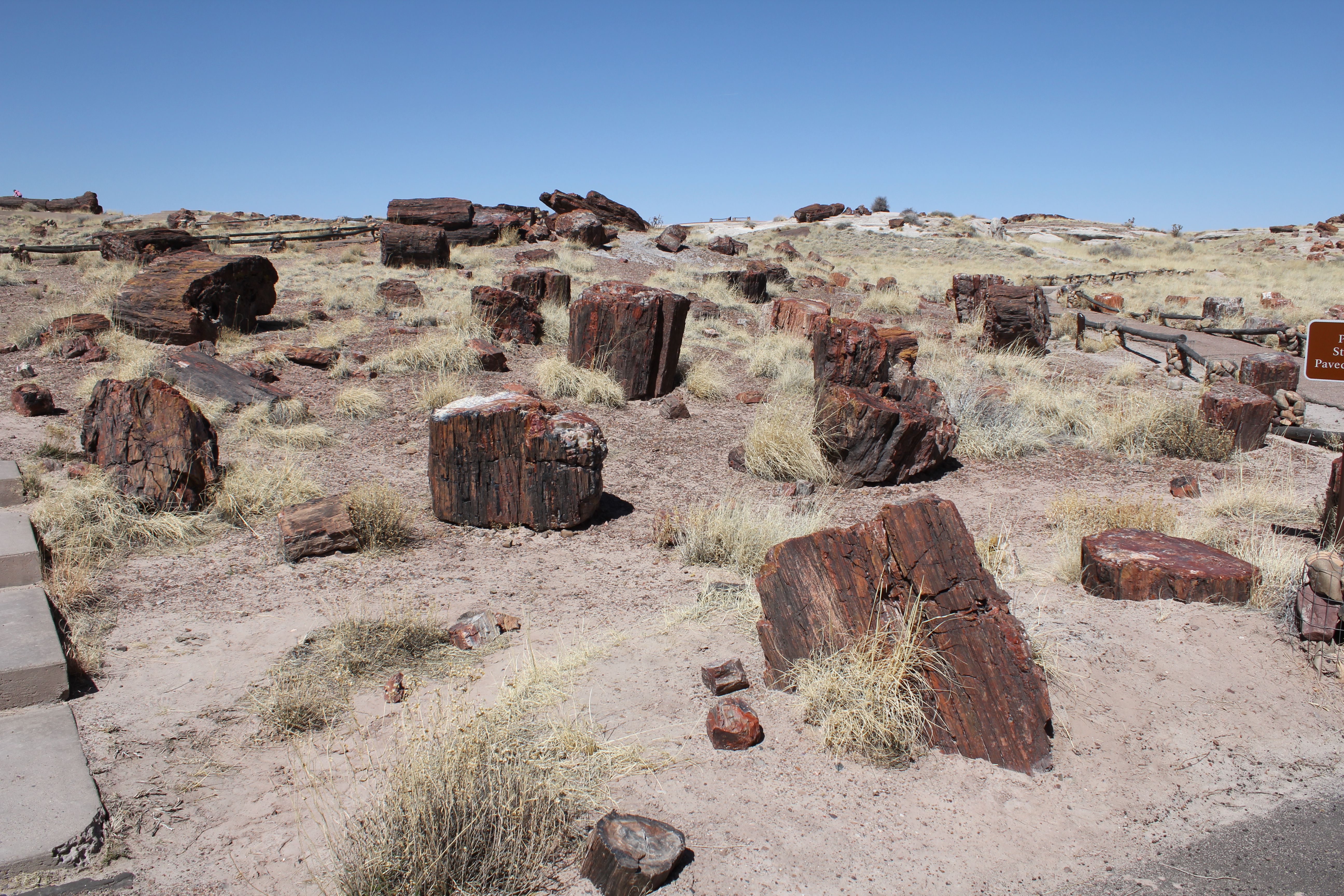
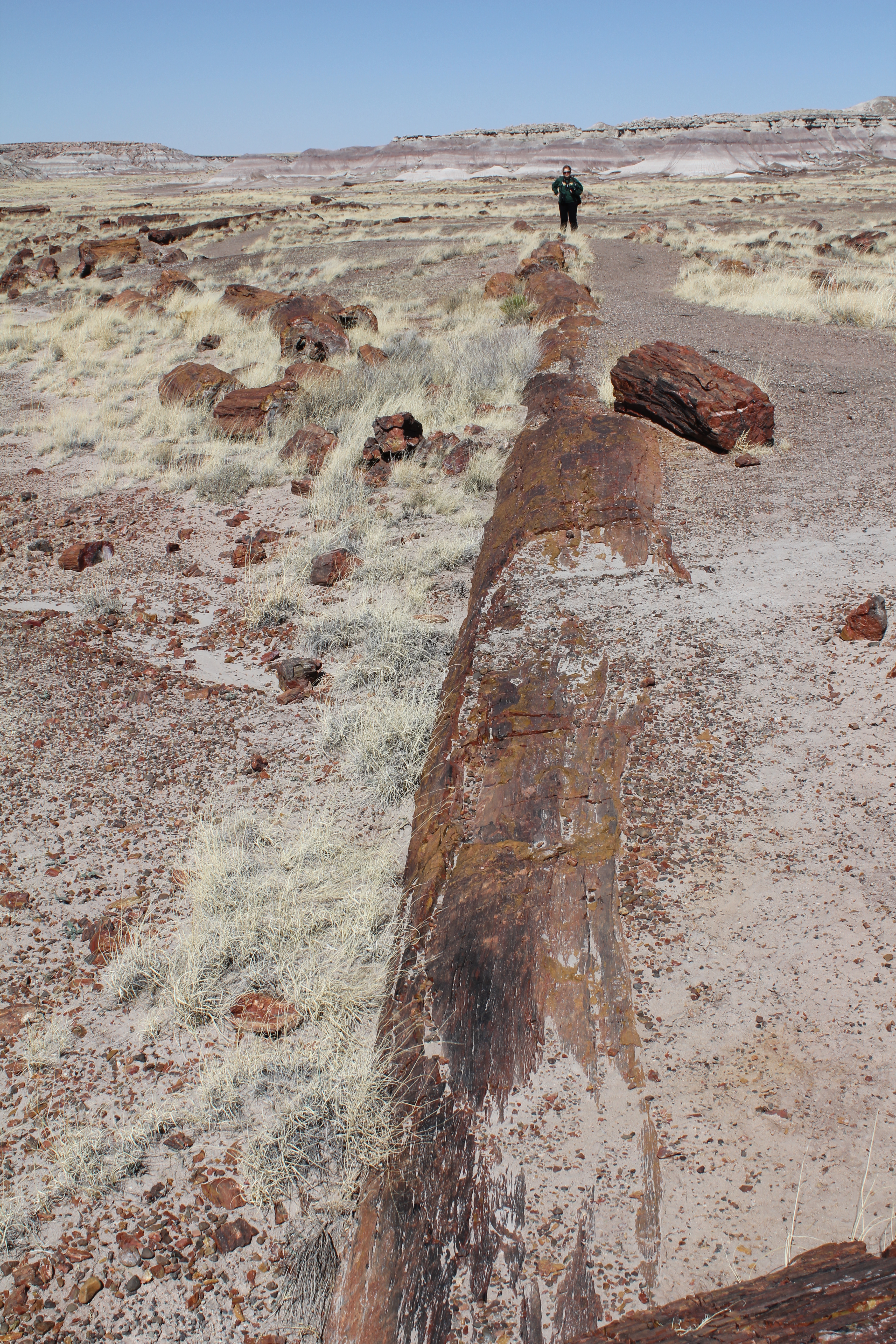
A short walk along the path behind the museum brings us to this impressive field of fossilized logs.
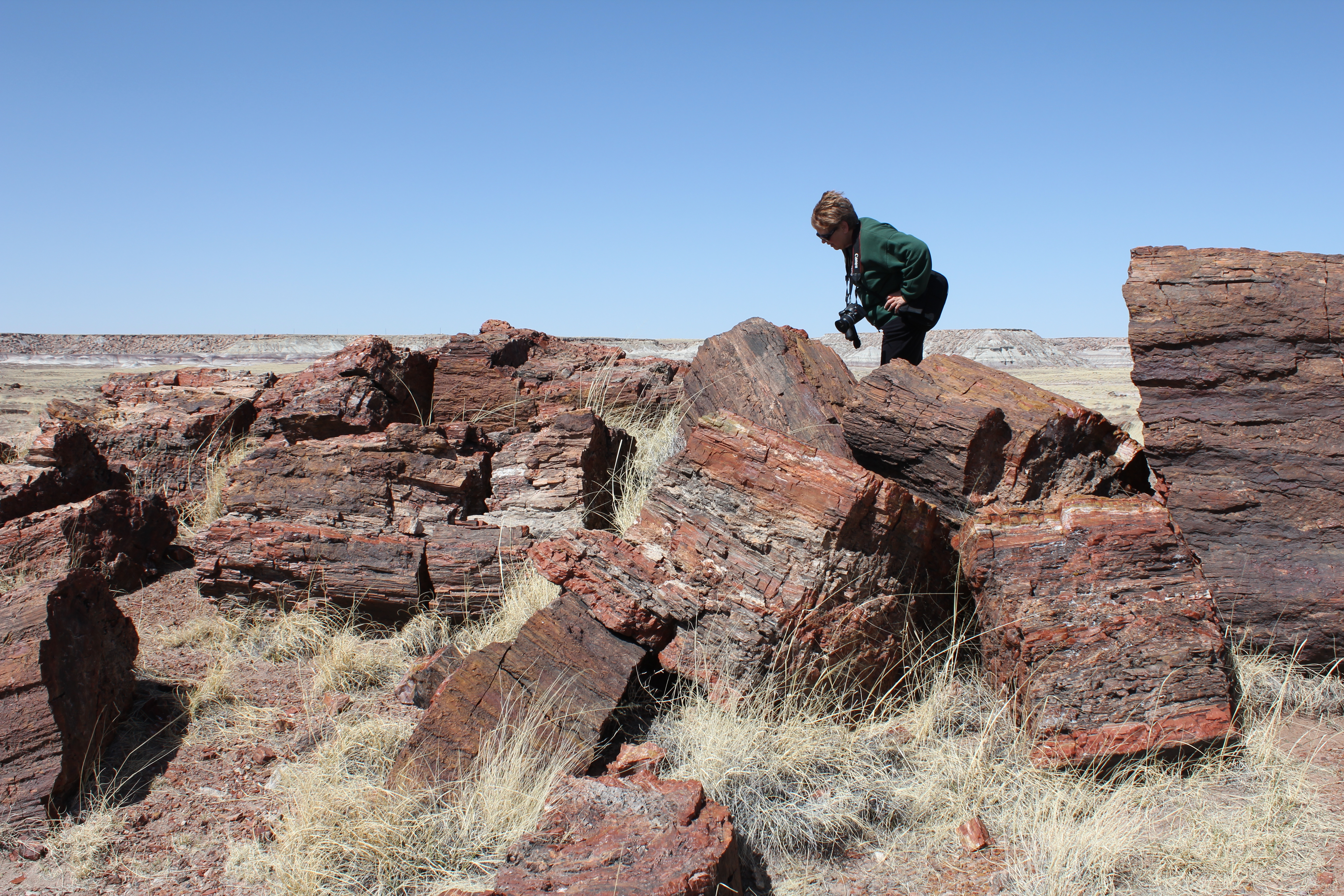
We left the museum, and headed to the long logs trail. As with most things in the National Parks, you need to walk to see the best stuff. A walk of about a kilometer gets you to the field, and then another mile loop lets you see the best logs in the park. In no particular order, here are some photos of what is to be seen on this walk.
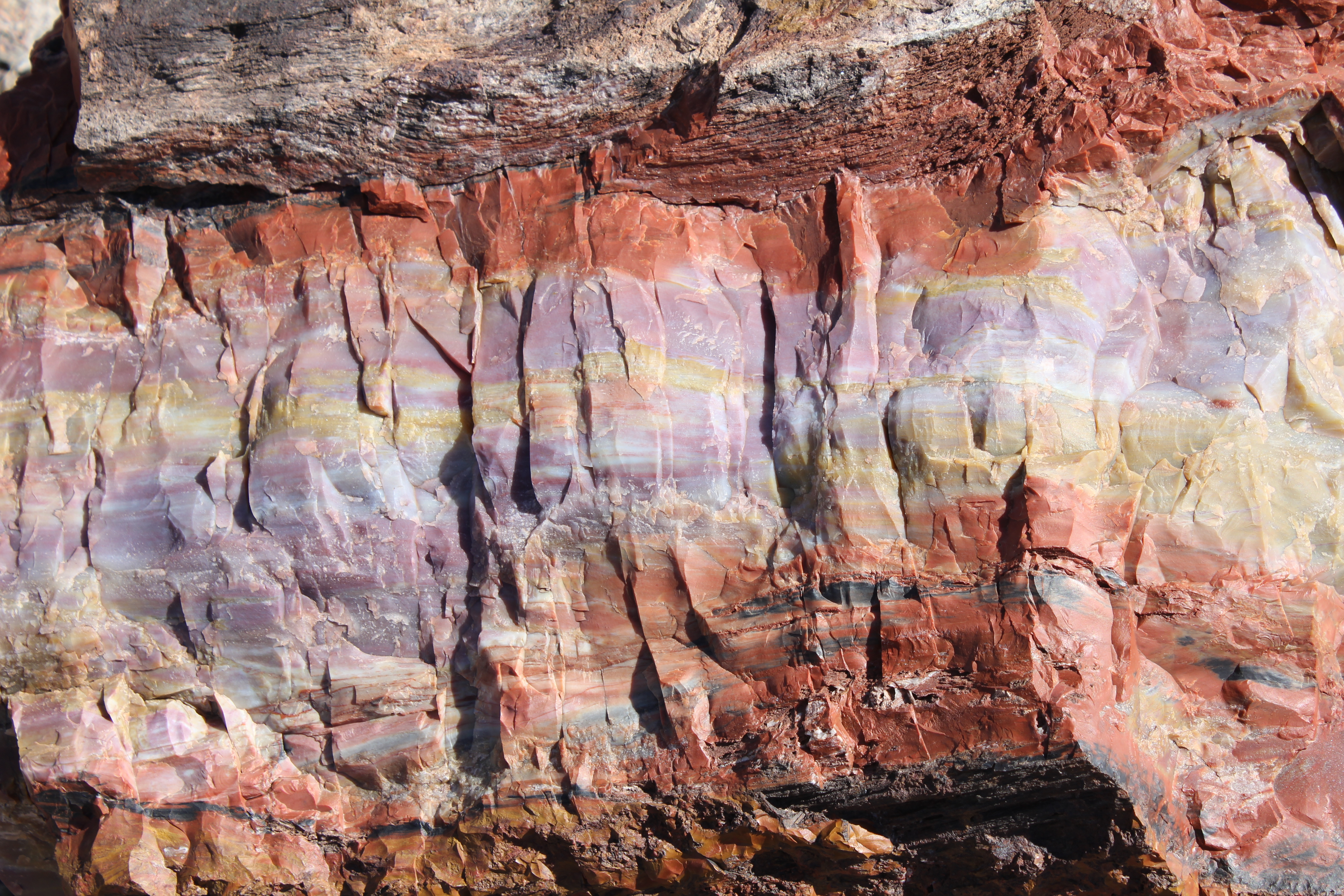
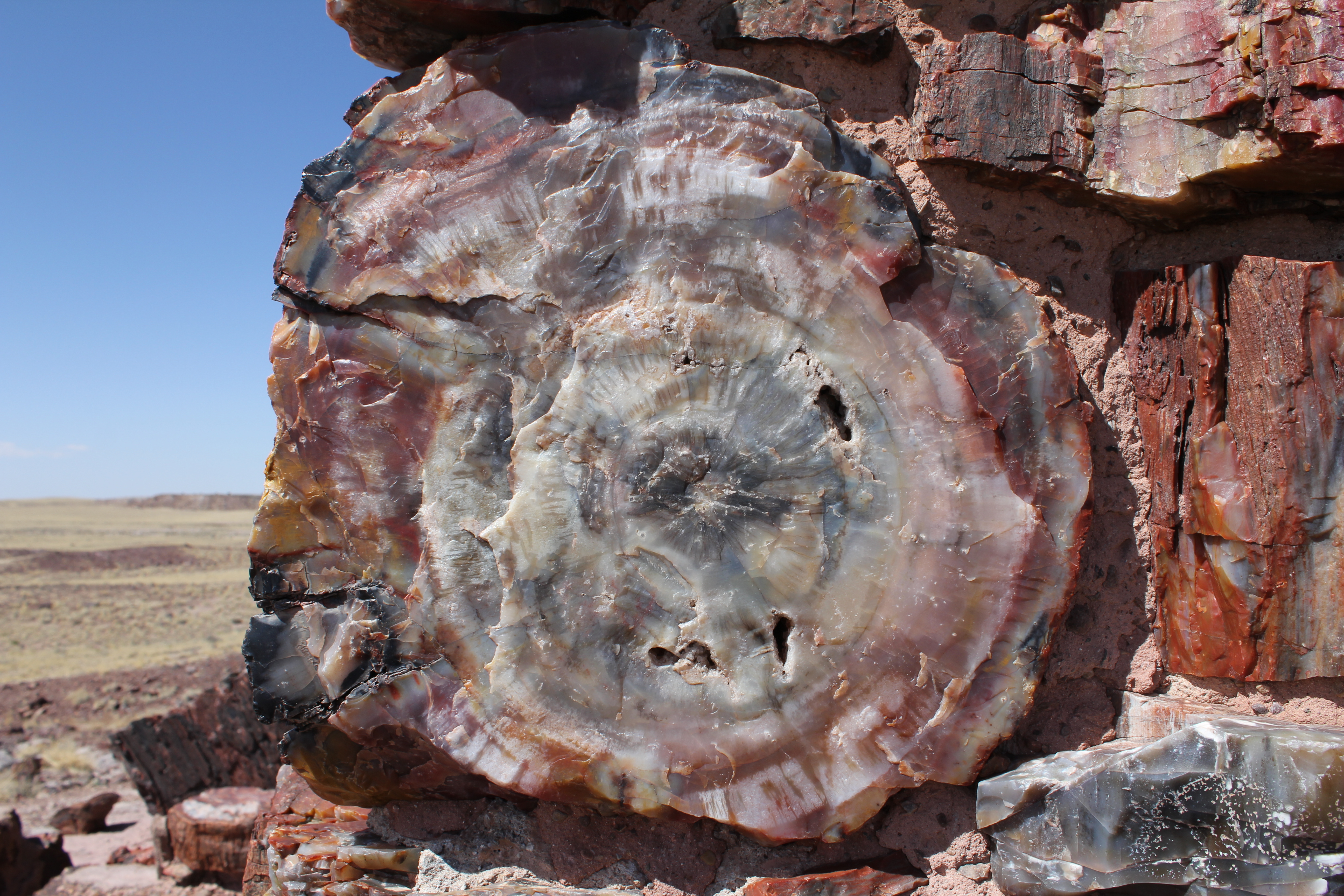
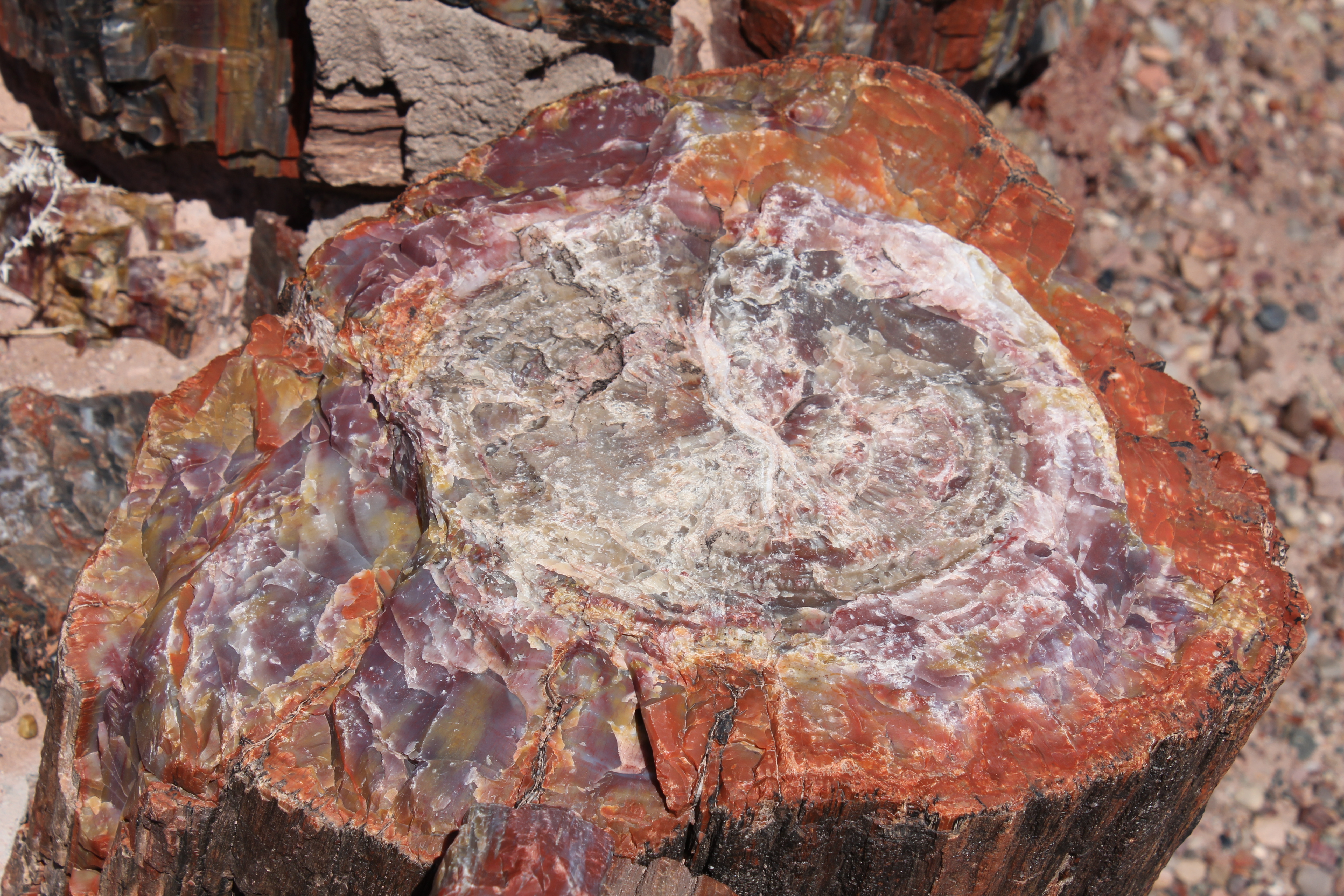
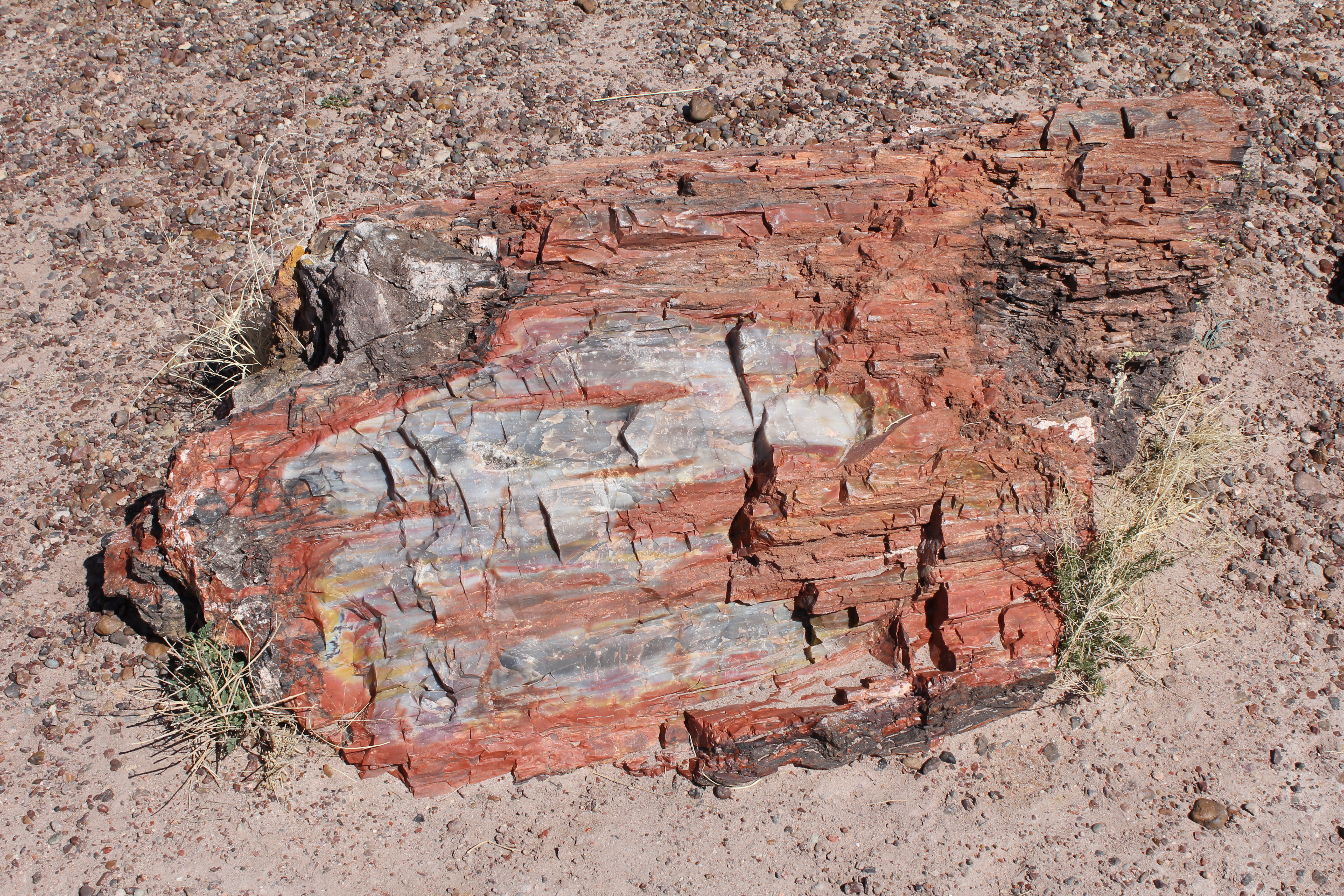
The marvelous colors in this stump are all variations on a theme of quartz, with a variety of "impurities" causing the brilliant hues.
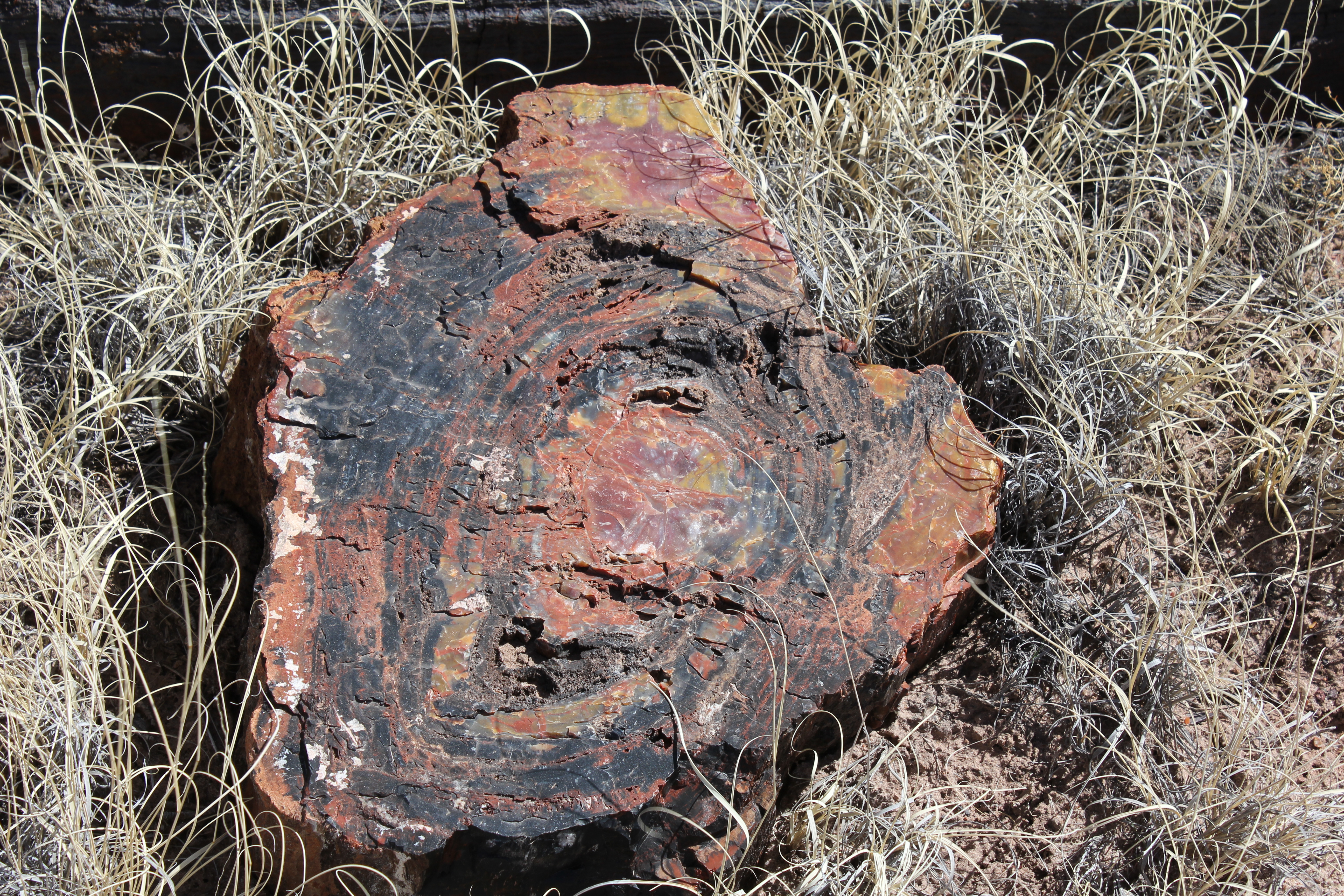
In the high res version of this, you can get a pretty good idea of how old this tree was when the storm that felled it into the Triassic mud happened by counting the rings.
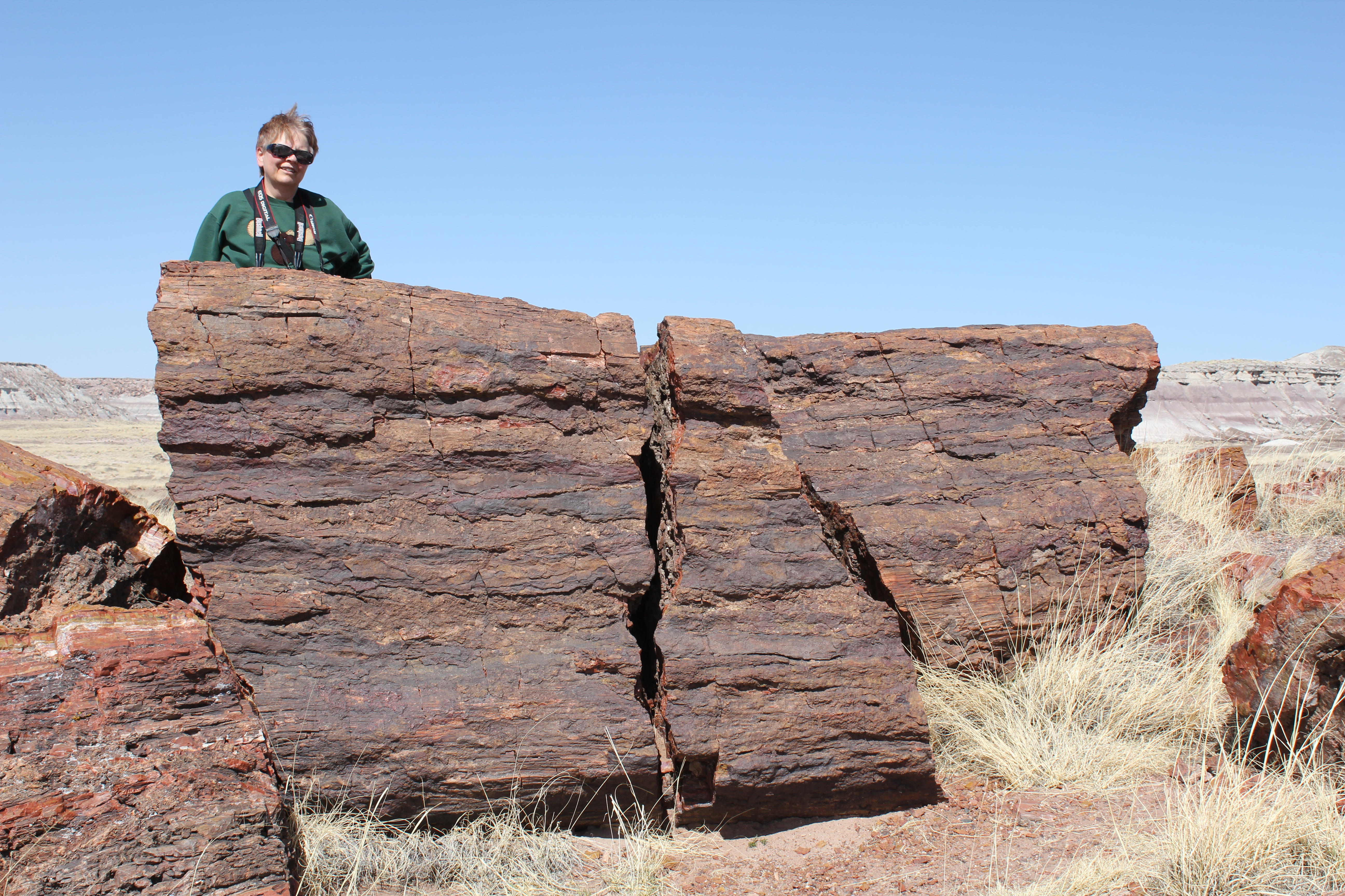
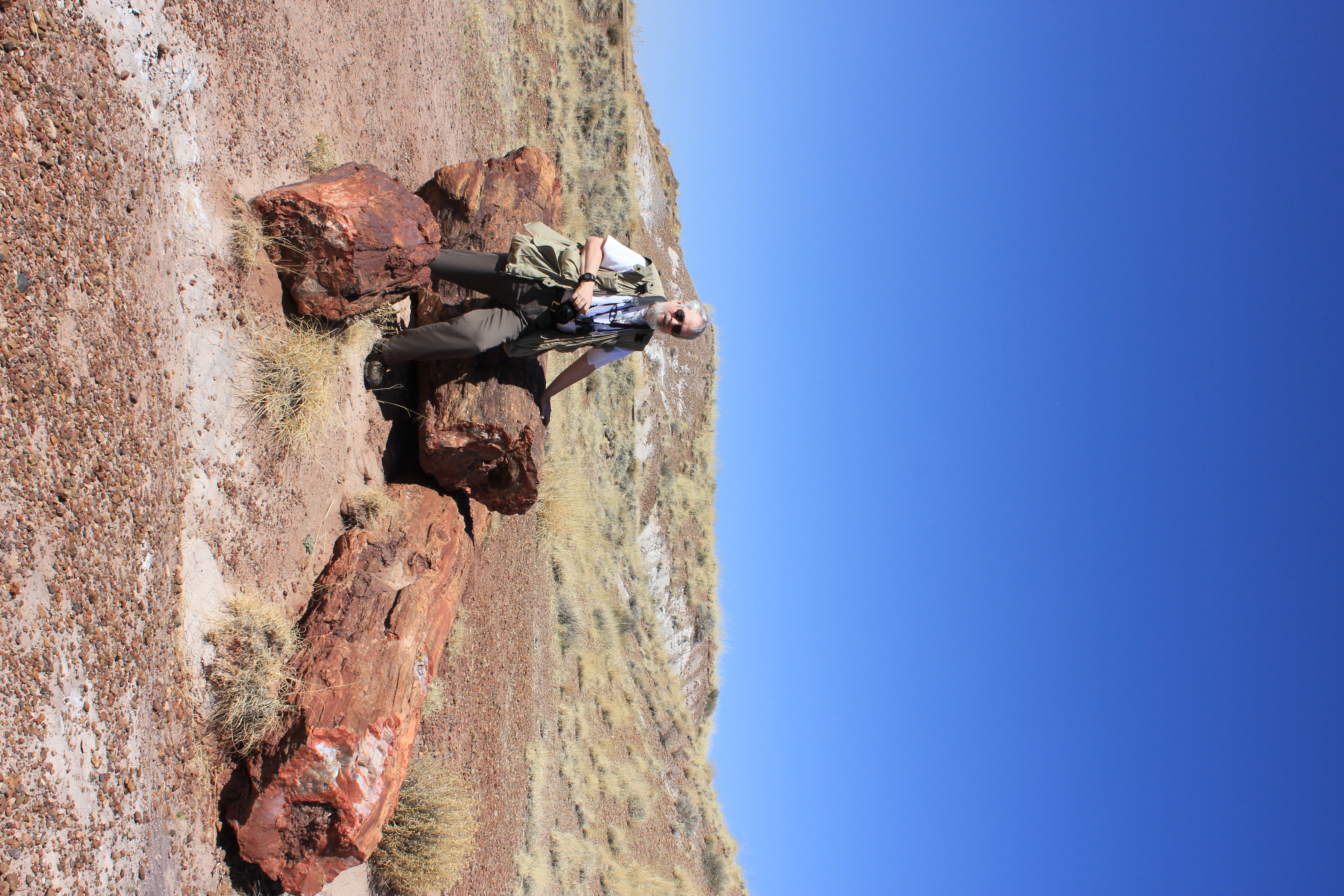
A huge log. Kathie is standing just behind it to give you an idea of how big it is.
The bark has weathered or been otherwise removed from this small log, revealing the multicolored quartz that fills the interior of many of these fossils.
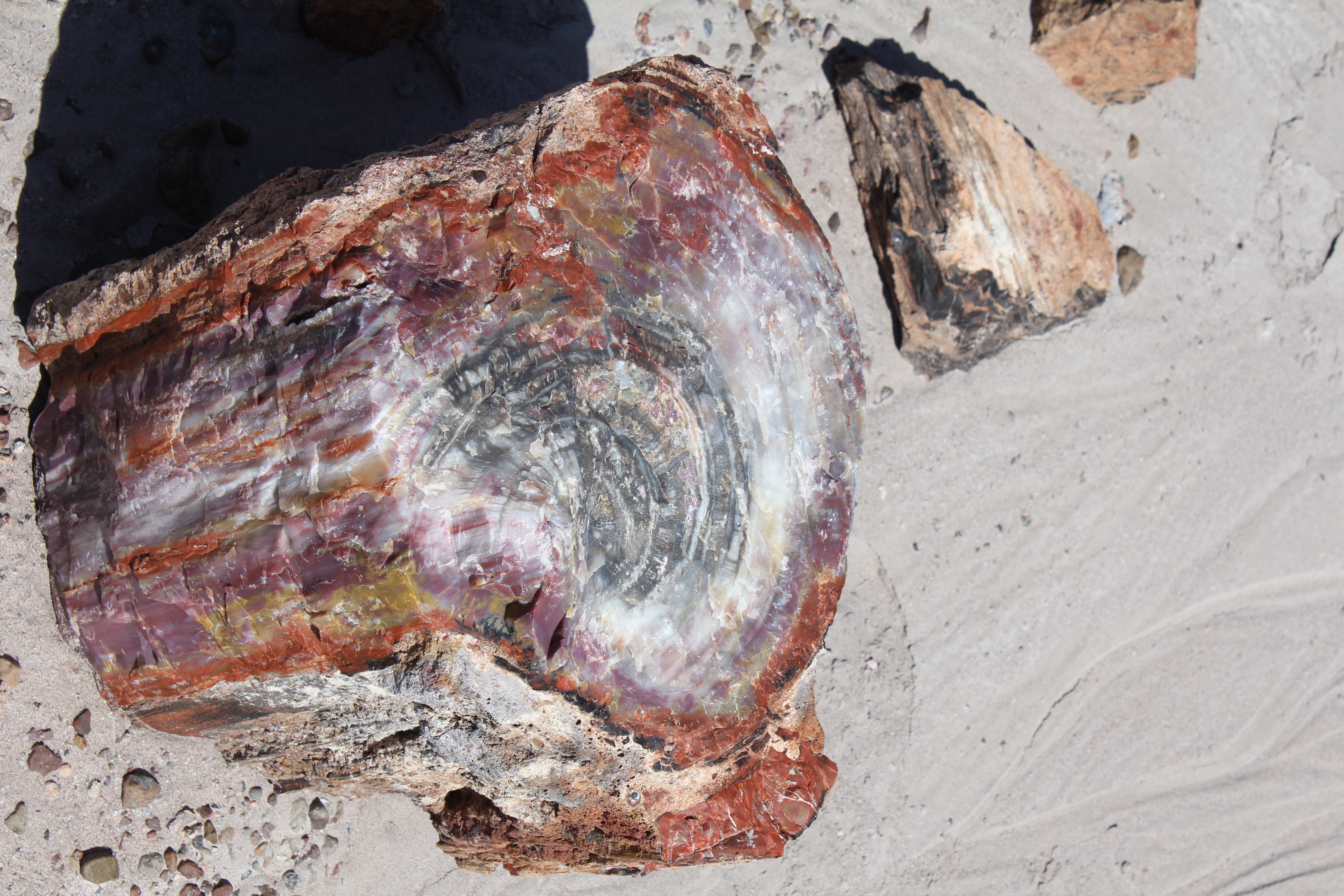
A somewhat larger, multicolored log.
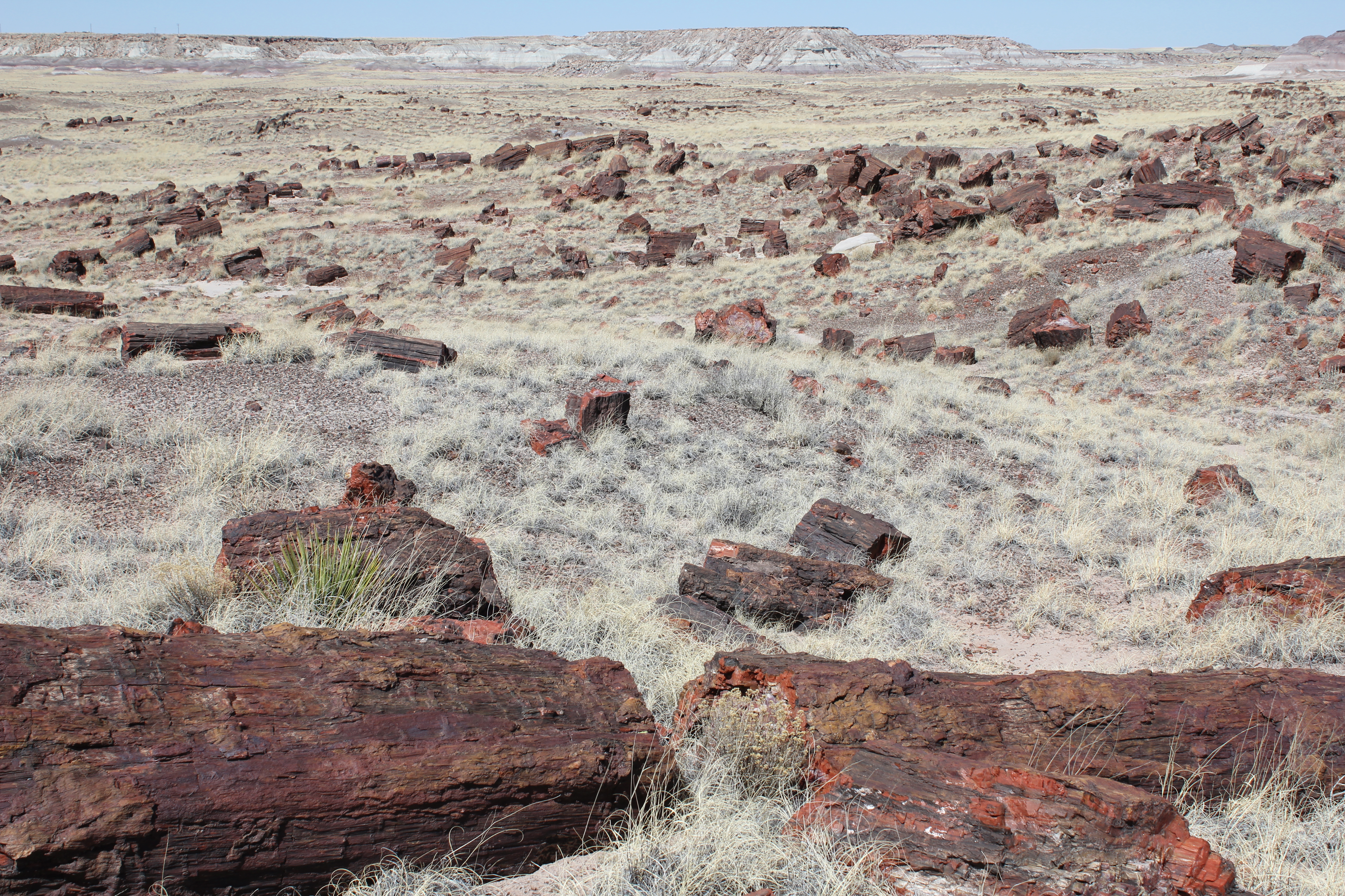
Surrounded by some amazing logs!
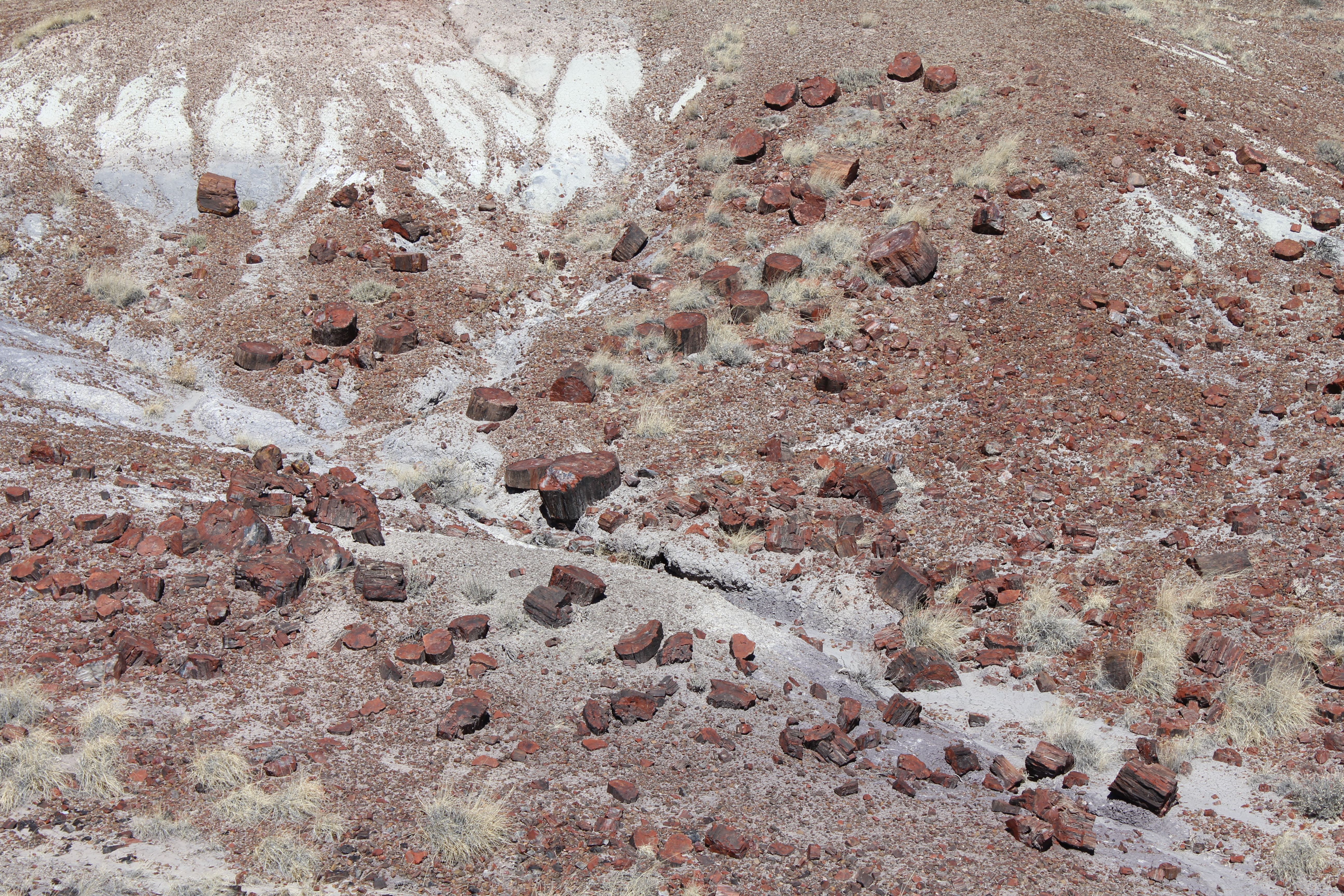
So many logs, so little time!
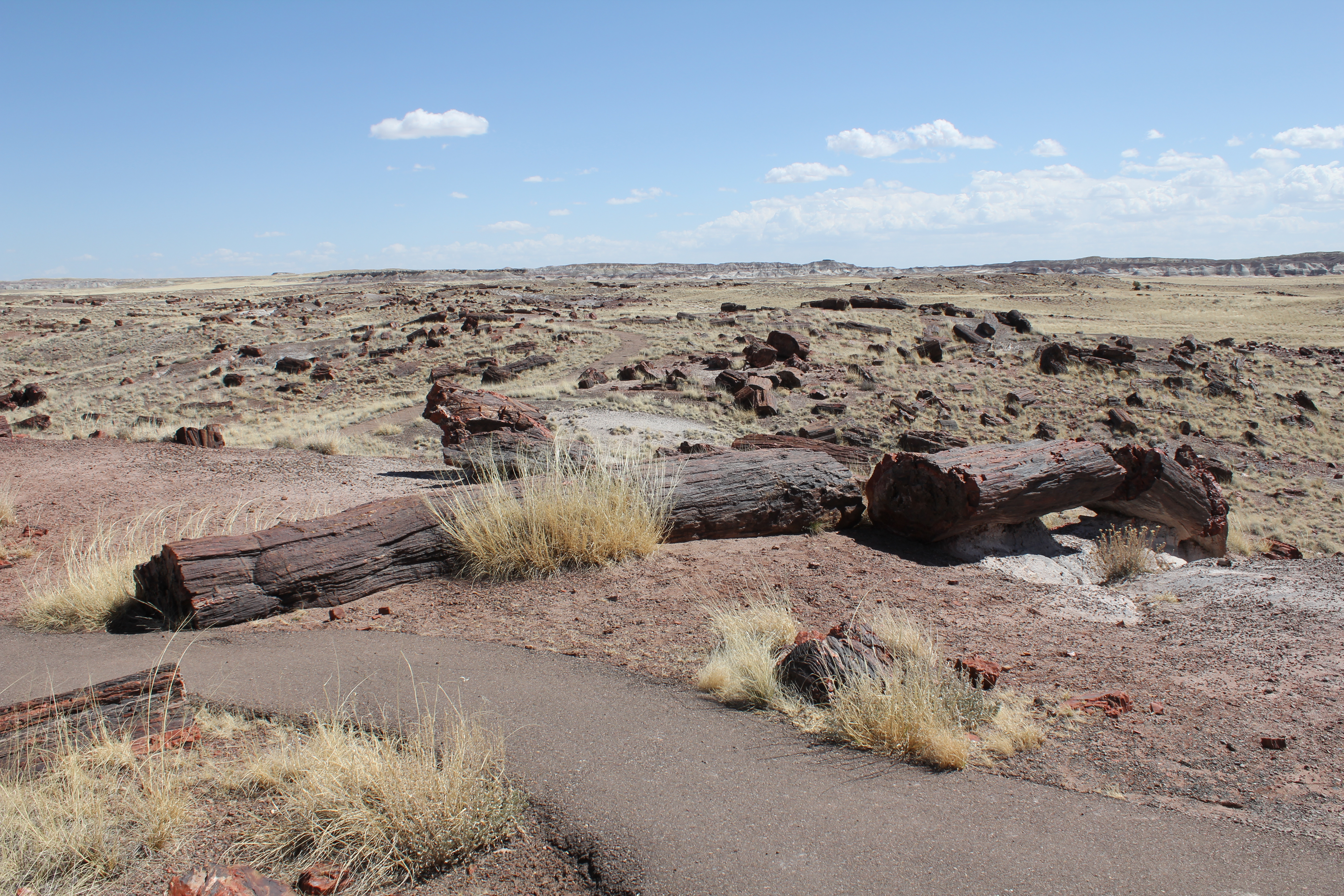
More logs, slowly weathering out.
About a thousand years ago, the Indians built a house here of petrified log pieces. It slowly fell apart, but was reconstructed by the CCC in the 1930s.
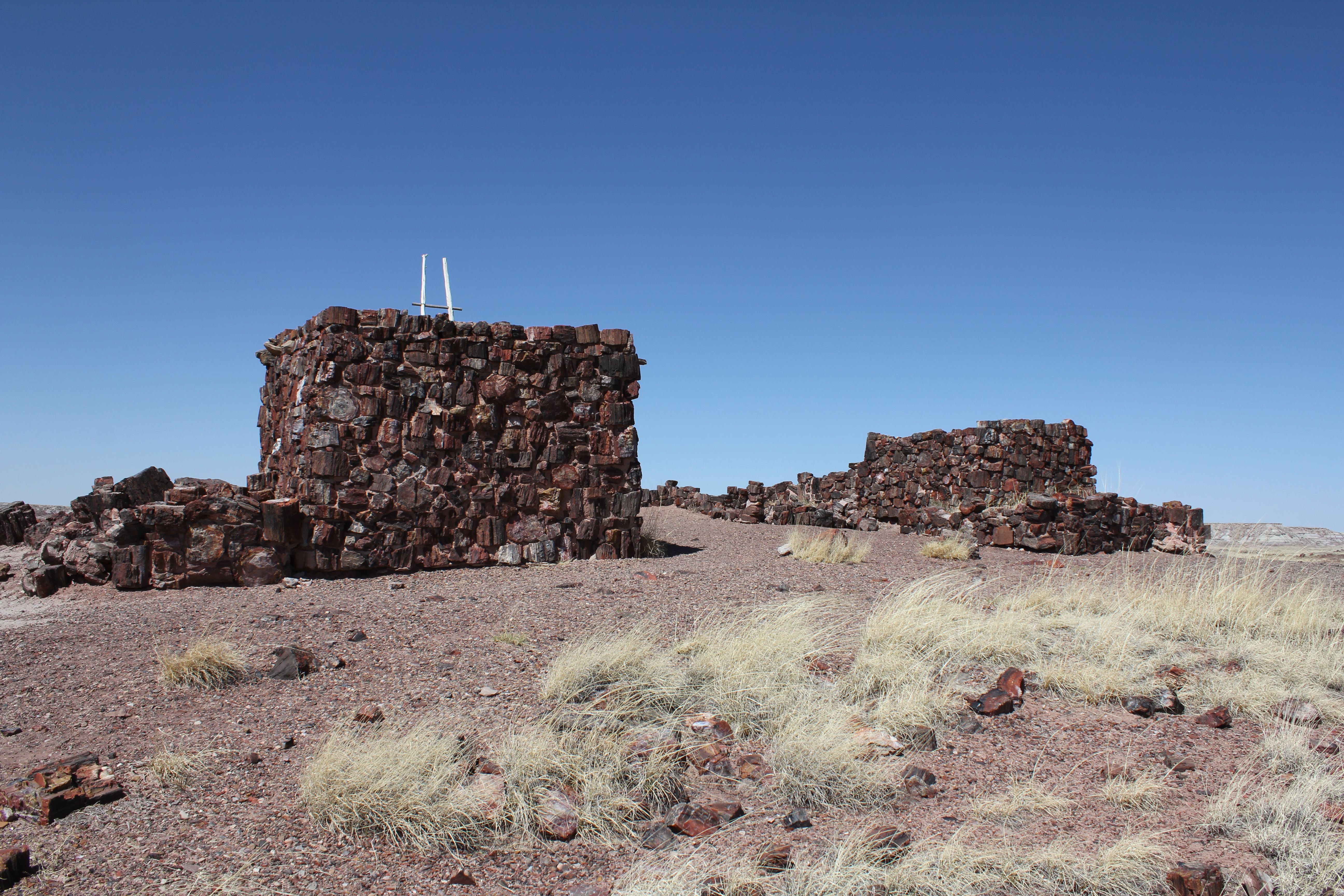
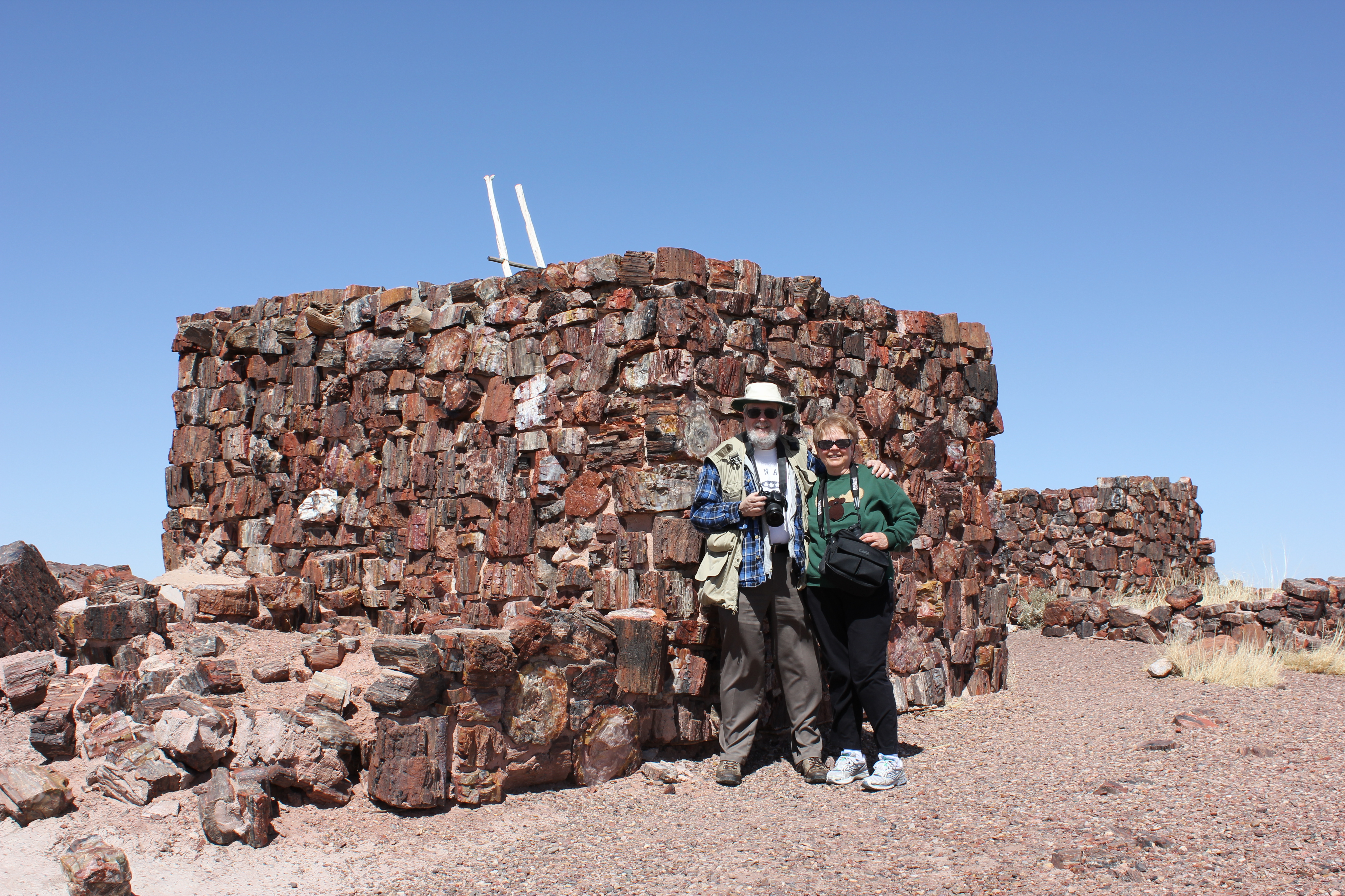
A fellow hiker took our picture, so you can get an idea as to how big the house is.
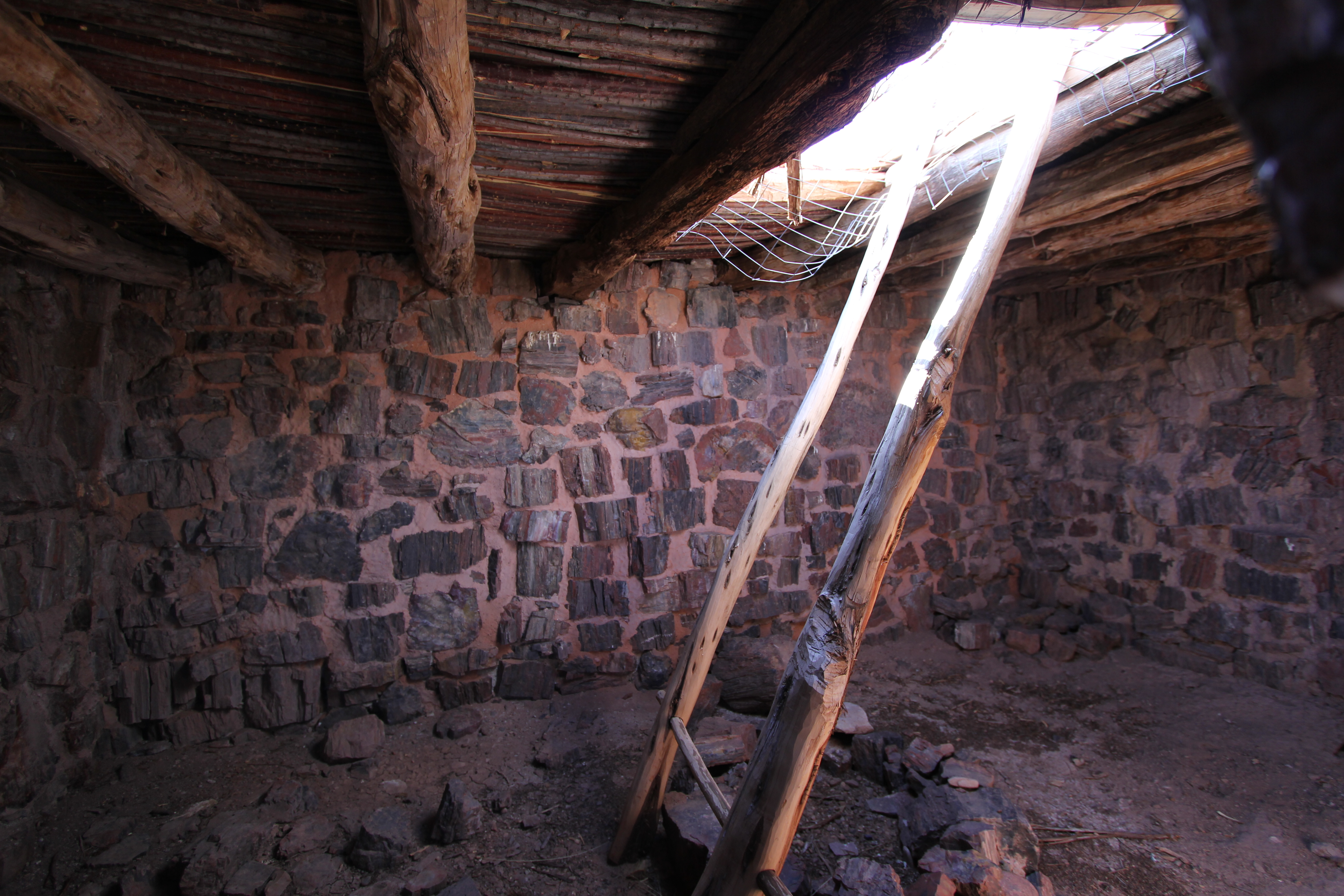
Here's what's inside, a wide angle view.
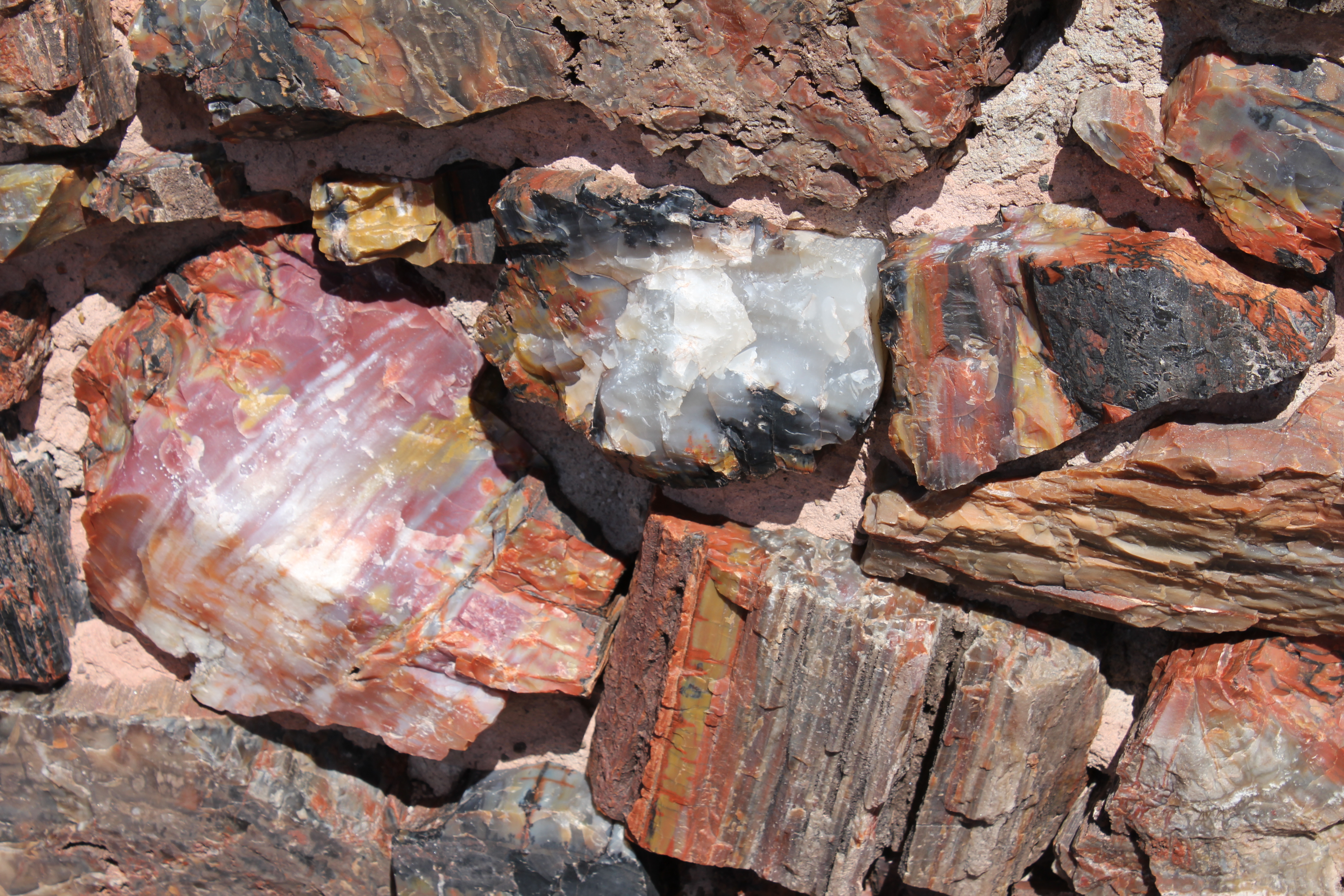
Some of the gem like logs used to create the house.
A view of the wall opposite the wall with the window. There are some lovely rocks here, especially in the high res version.
Some intriguing endgrain, on the edge of the house.
Kathie examines a petrified lumber yard.
A detailed view of some endgrain.
The parks service makes it very hard to steal these treasures, what with the long walk to see them. If you wanted to carry this one out, I guess you'd be hefting about two tons!
Again, the preservation is amazing. Doesn't it just look like a fallen log?
I found the endgrain unexpectedly beautiful.
Redundant, spectacular color. Even better to be right there. Well worth the trip.
More endgrain. You won't see this at your local Home Depot!
There's me, alongside a rocky log for scale.
Every fossil is unique and superb.
Kathie at the end of a very long log.
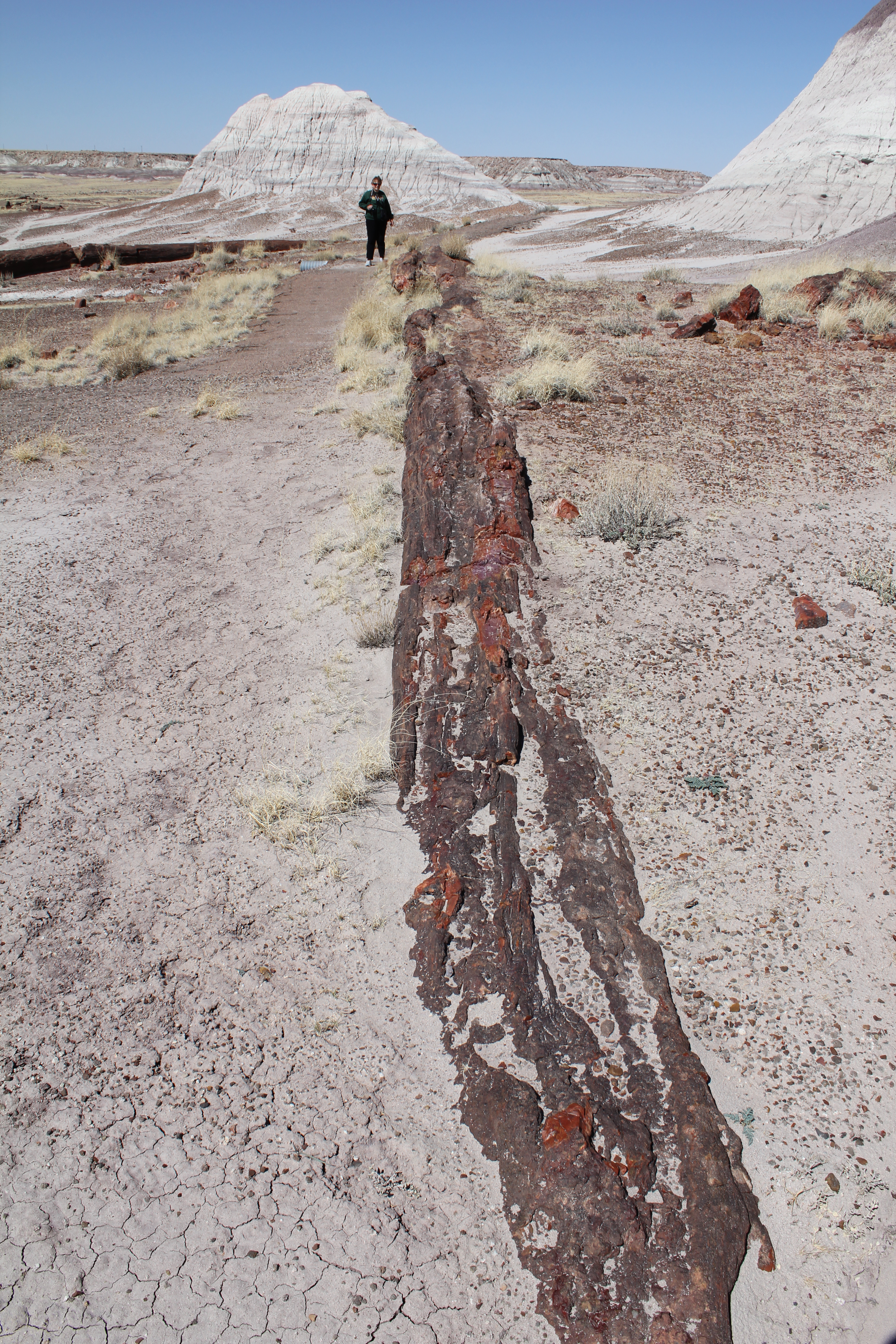
Kathie at the end of the longest log we found.
I was blown away with the beauty of the petrified wood.
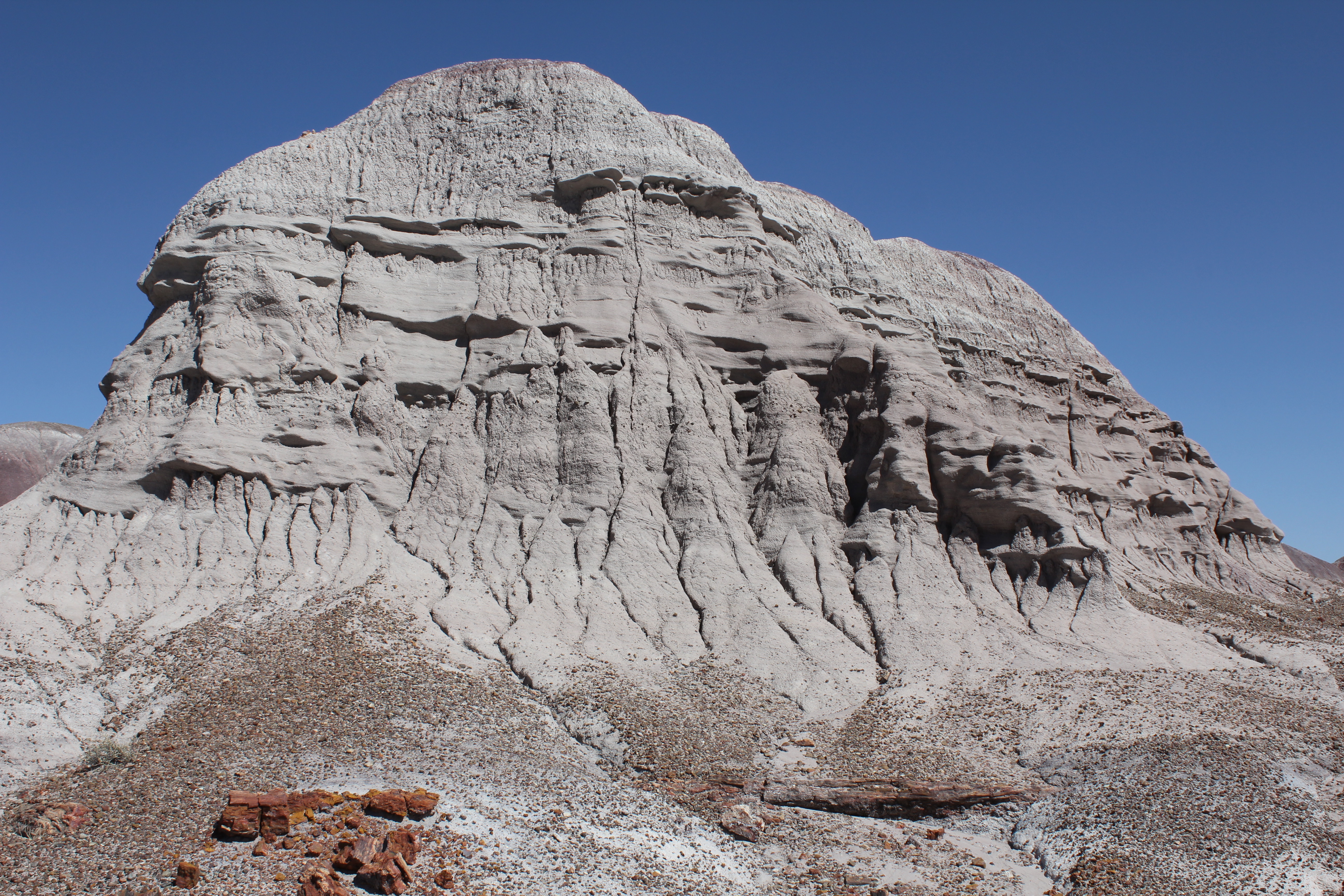
There were wonderful sandstone formations that were overshadowded by the amazing fossils. Here's a desolate, beautiful hill of the stuff.
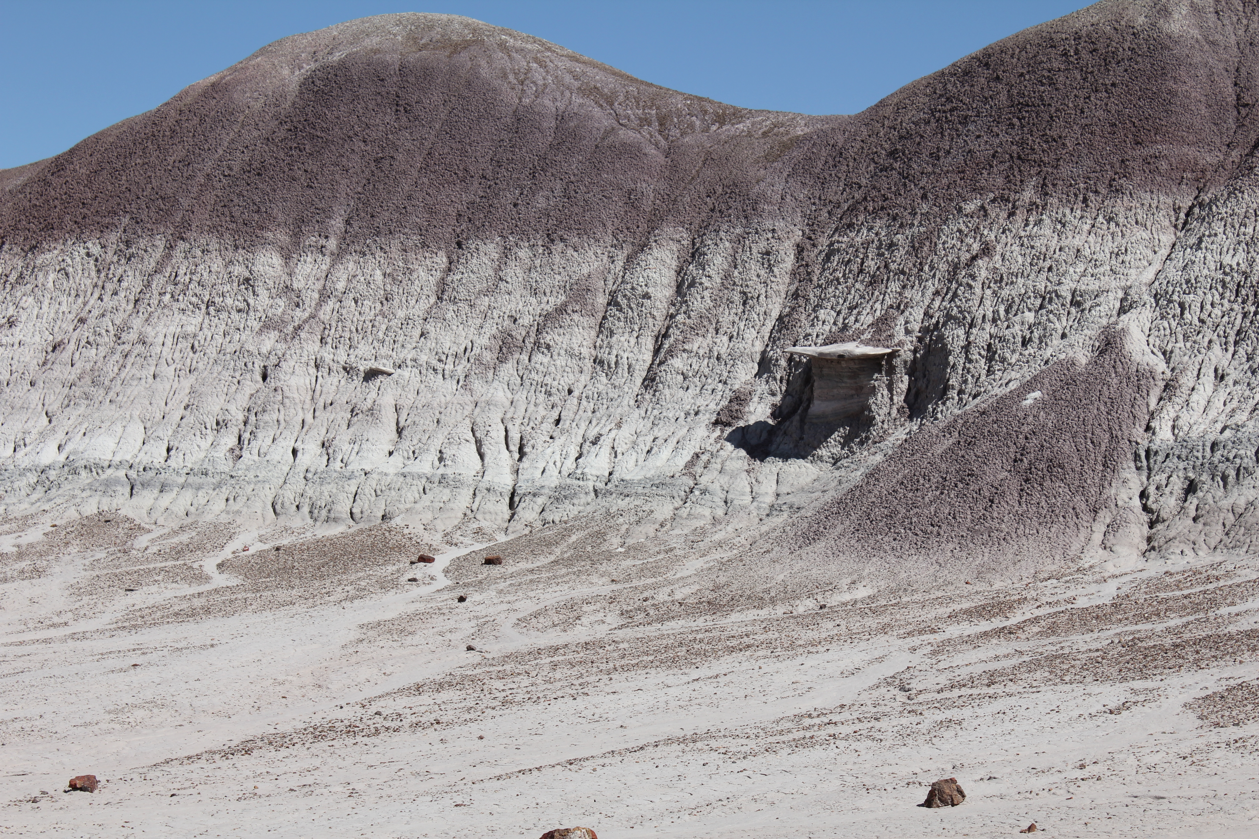
And another. What the ledge is I can't say. Perhaps you can go there and tell me.
After the painted desert and petrified forest, we thought that it couldn't get better than that. Everything else would be an also ran. We were wrong.
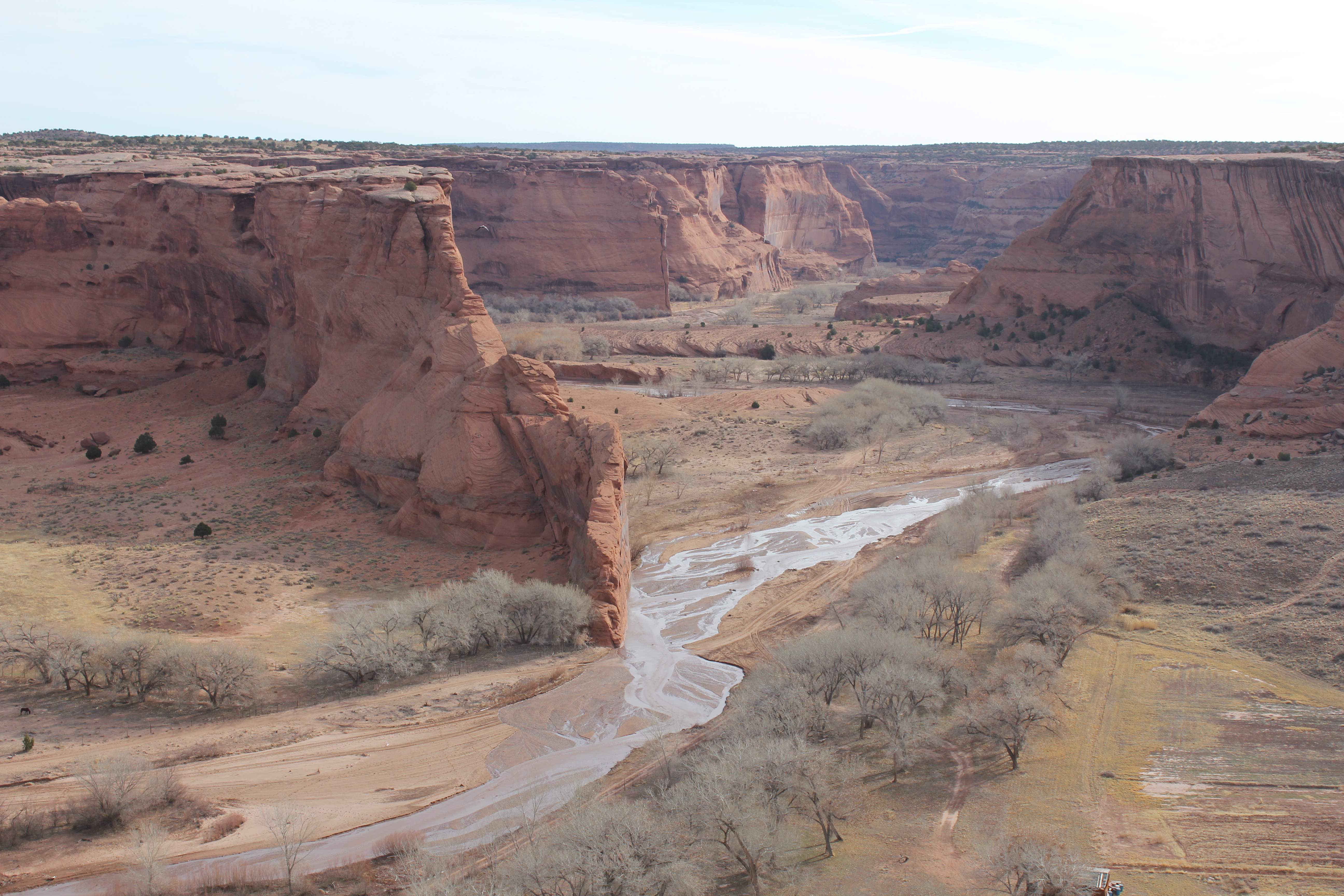
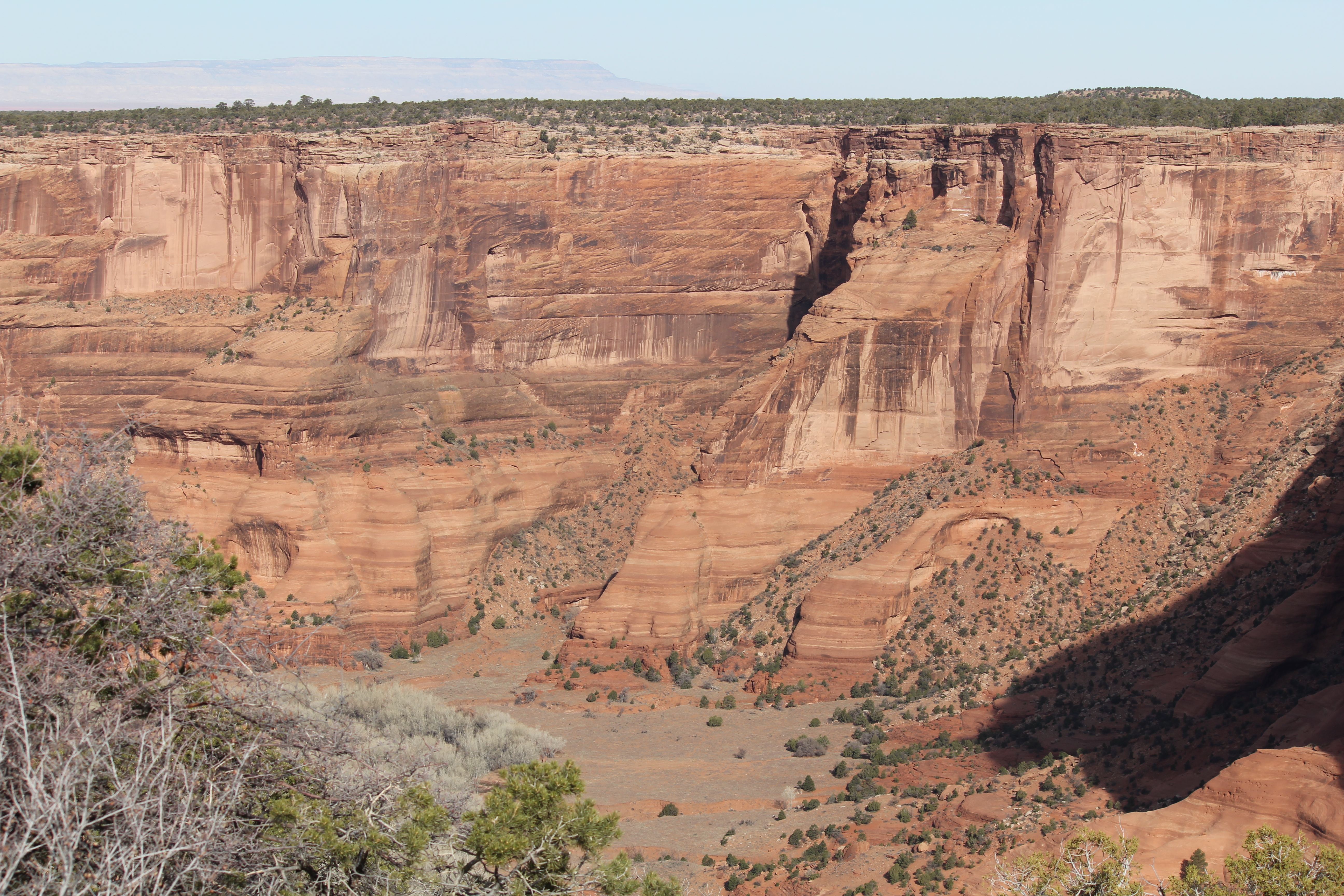
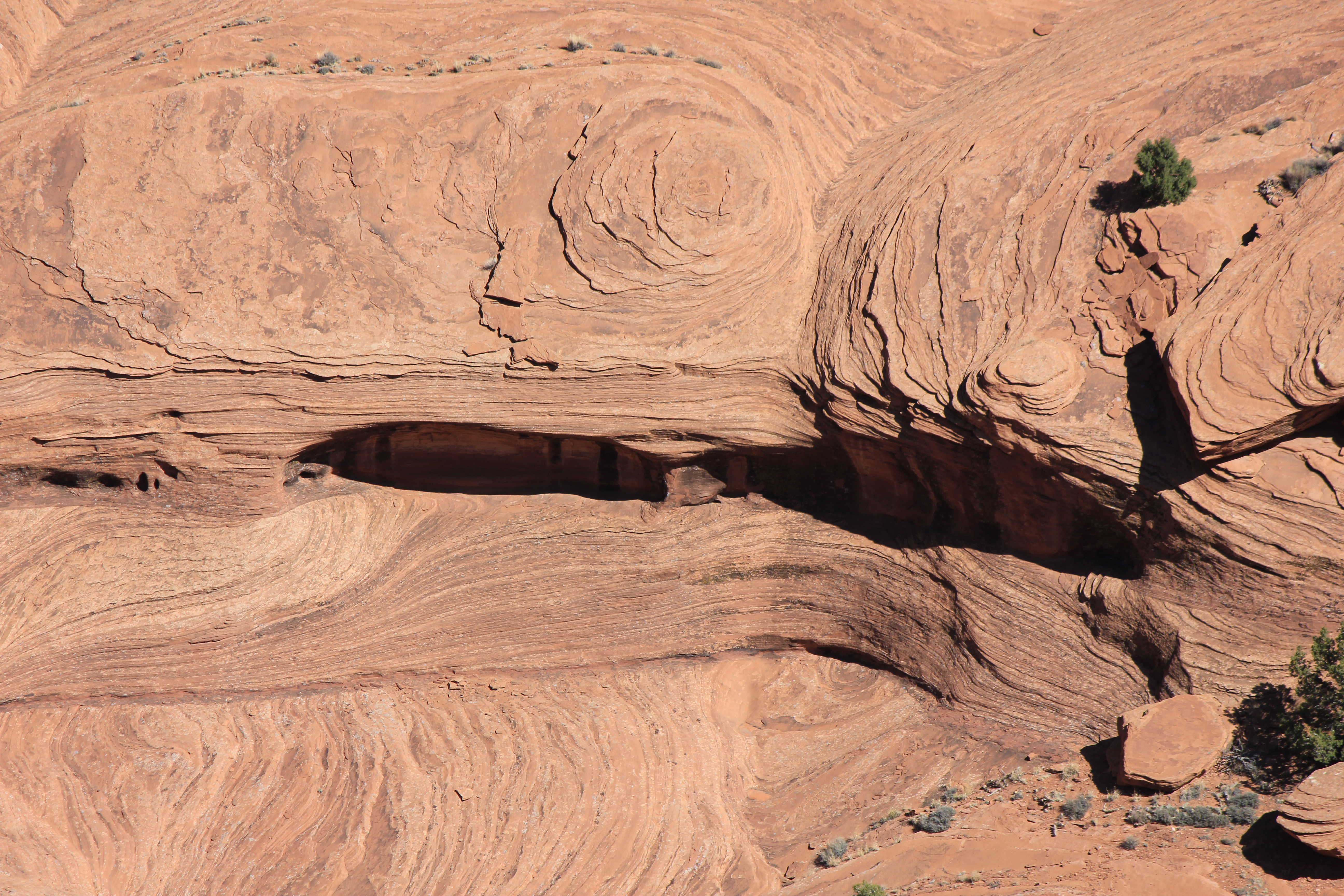
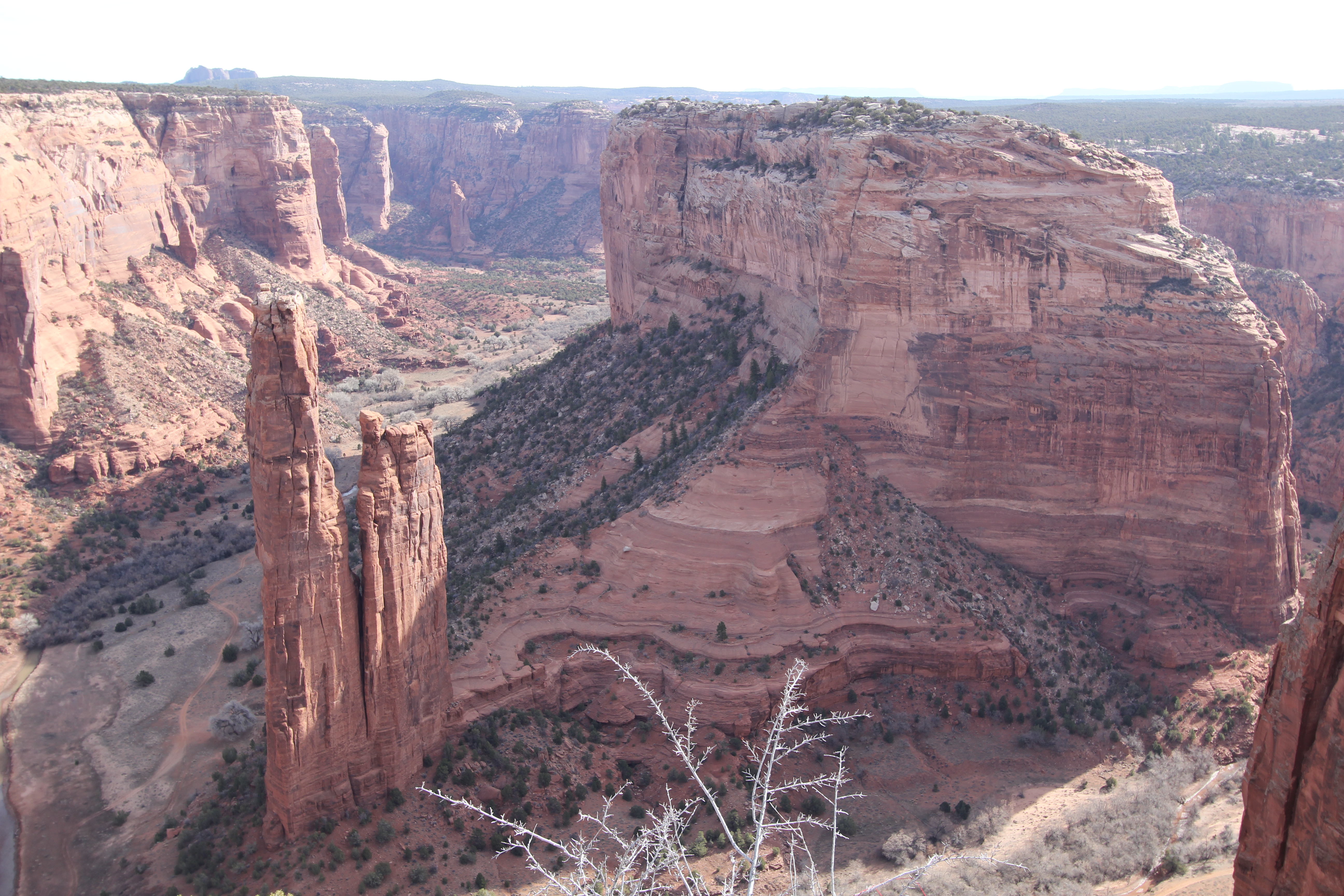
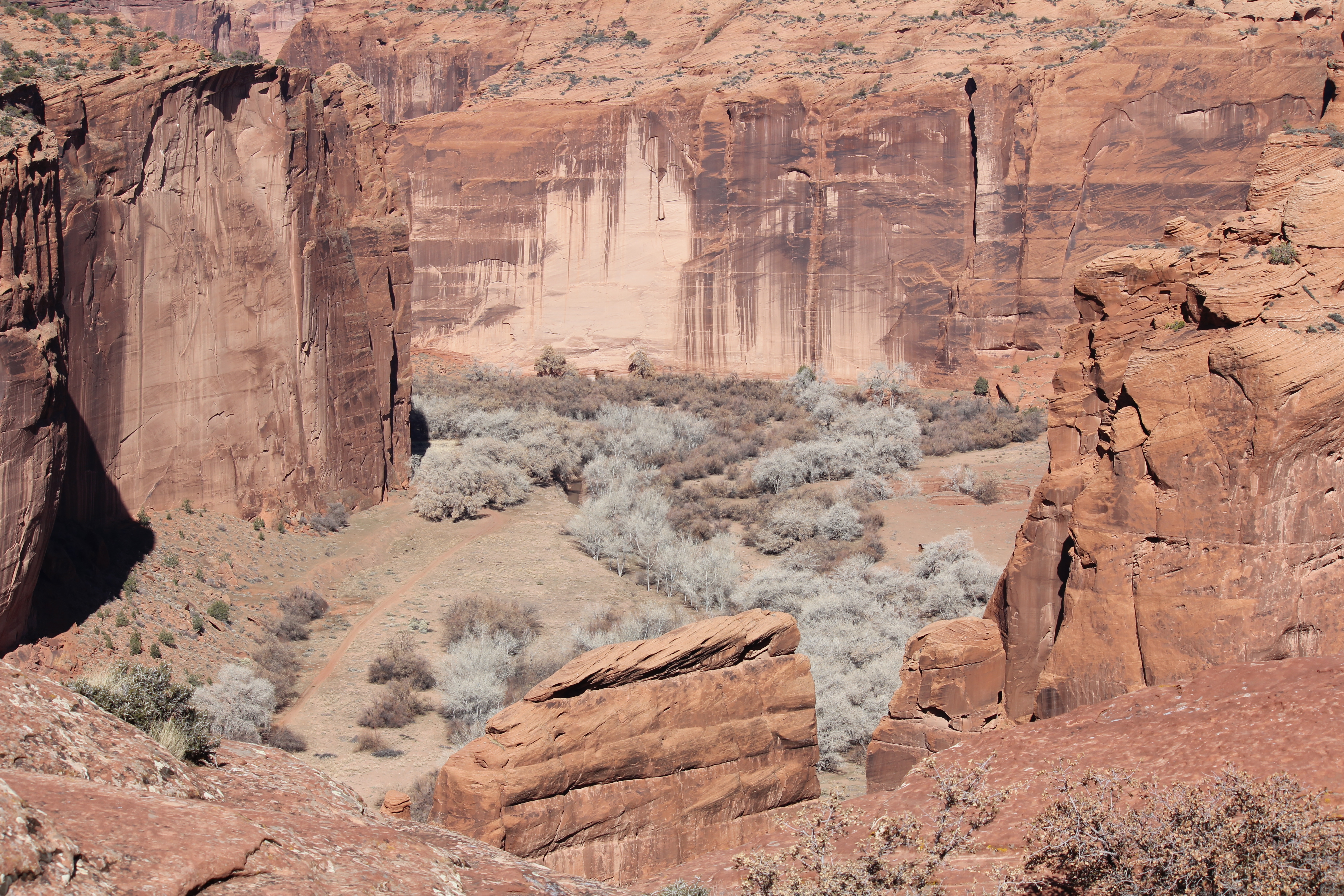
Canyon de Chelly (canyon de shay) was magnificient!! But very different from everything that had gone before.
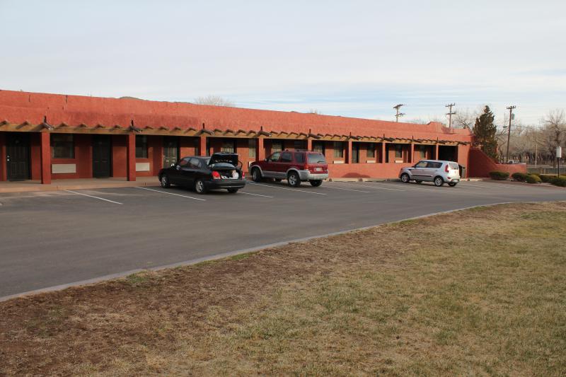
We stayed at this motel. The most expensive of our trip, but located at the base of the canyon. Motel 6 amenities for Hilton prices!
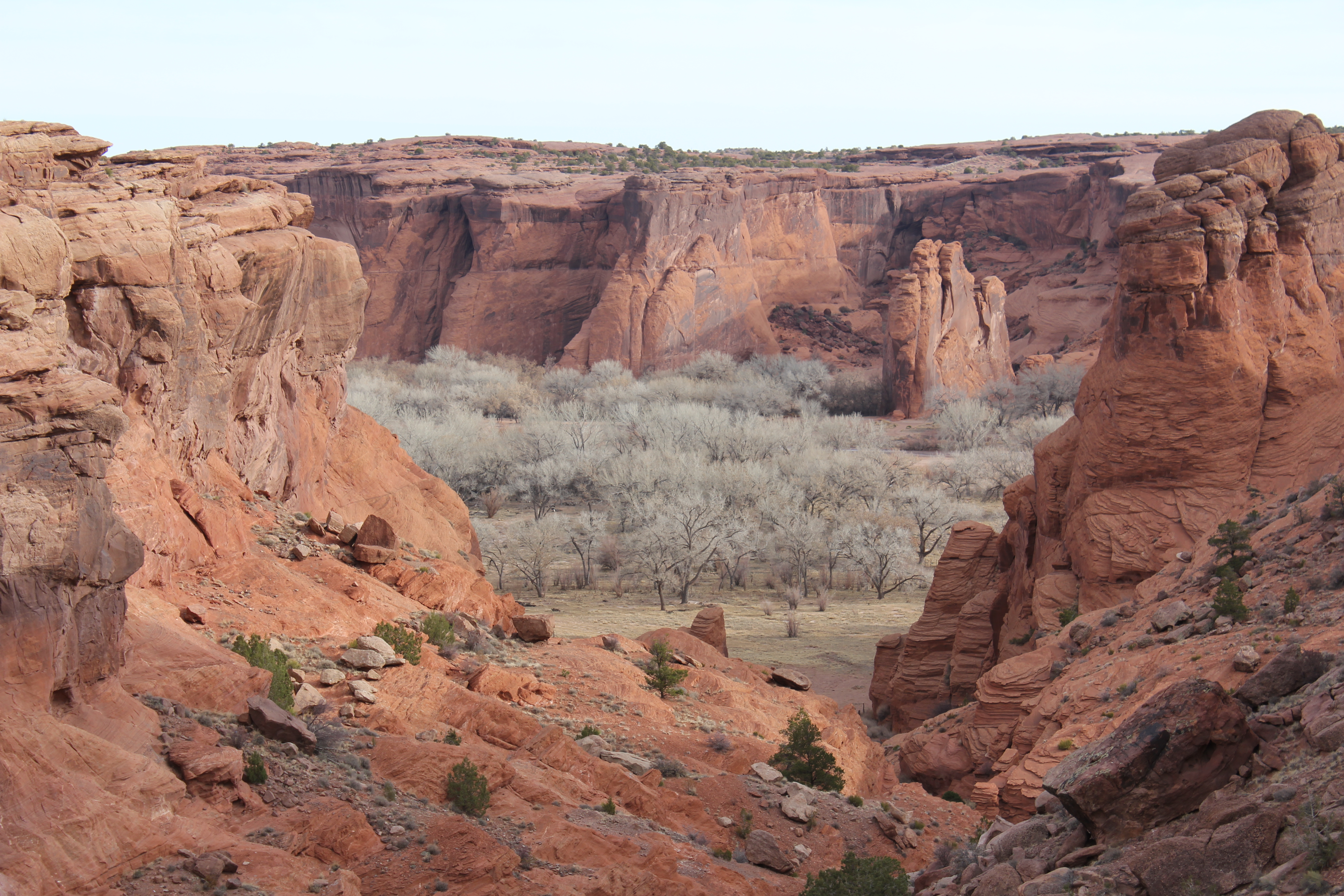
The first view of the Canyon. Wow!
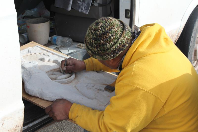
At this pull off, I met a Navaho artist working on a sandstone sculpture. A very erudite guy, he told me the meaning of each symbol in his work and many in his paintings. He was well versed in the geology of the region as well, and told me the origin of some of the Anasazi markings of the rocks in the distance of the latter photo. He was so persusavive that he managed to get me to buy one of his paintings (me! The total skinflint!). All in all a very plesant exchange.
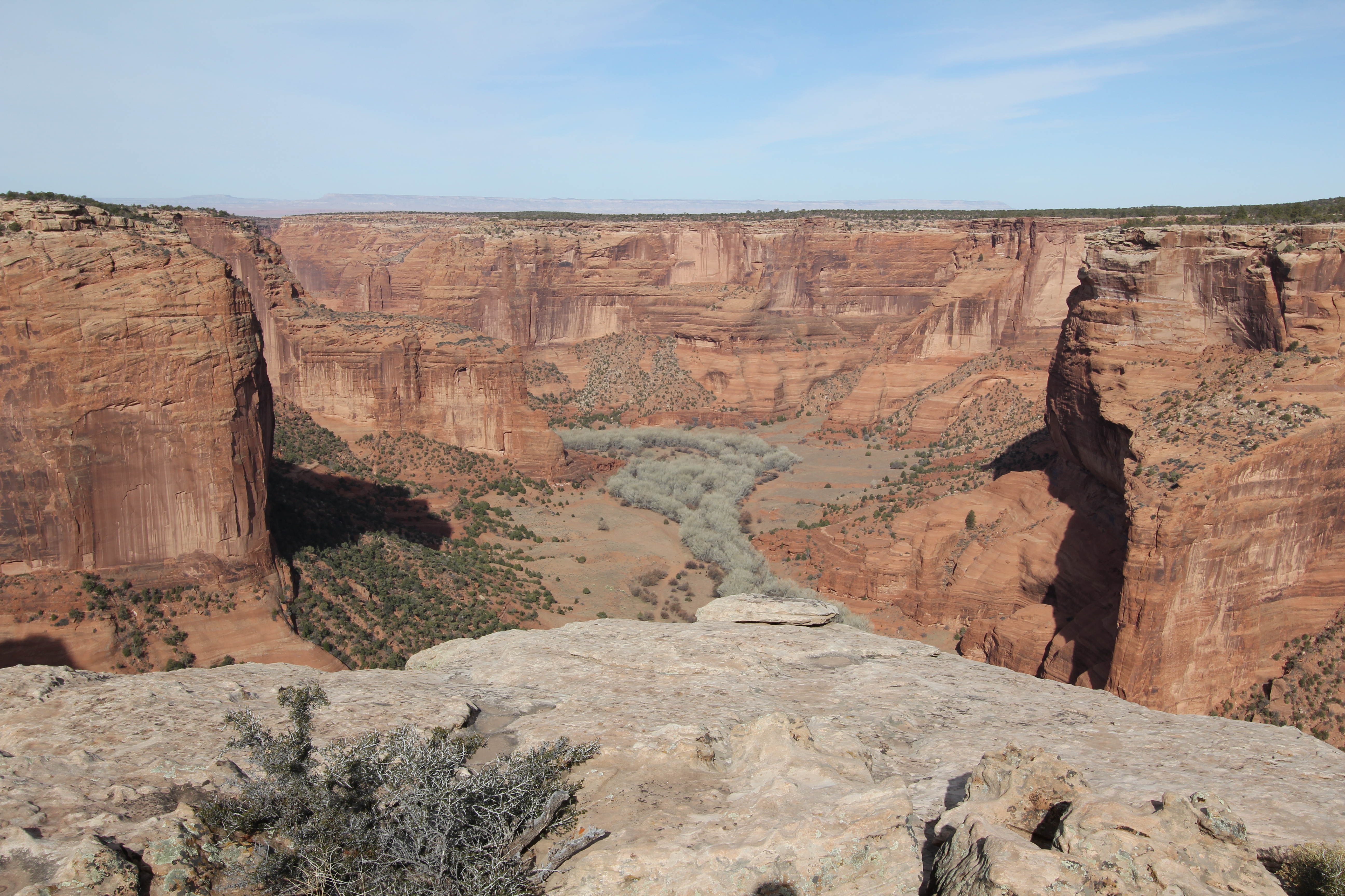
The canyon is not for acrophobes. That's an 800 foot sheer drop.
Here's a wide angle (yes, the full 97° view) from the same pull off. One does get a wee bit nervous that close to the edge.
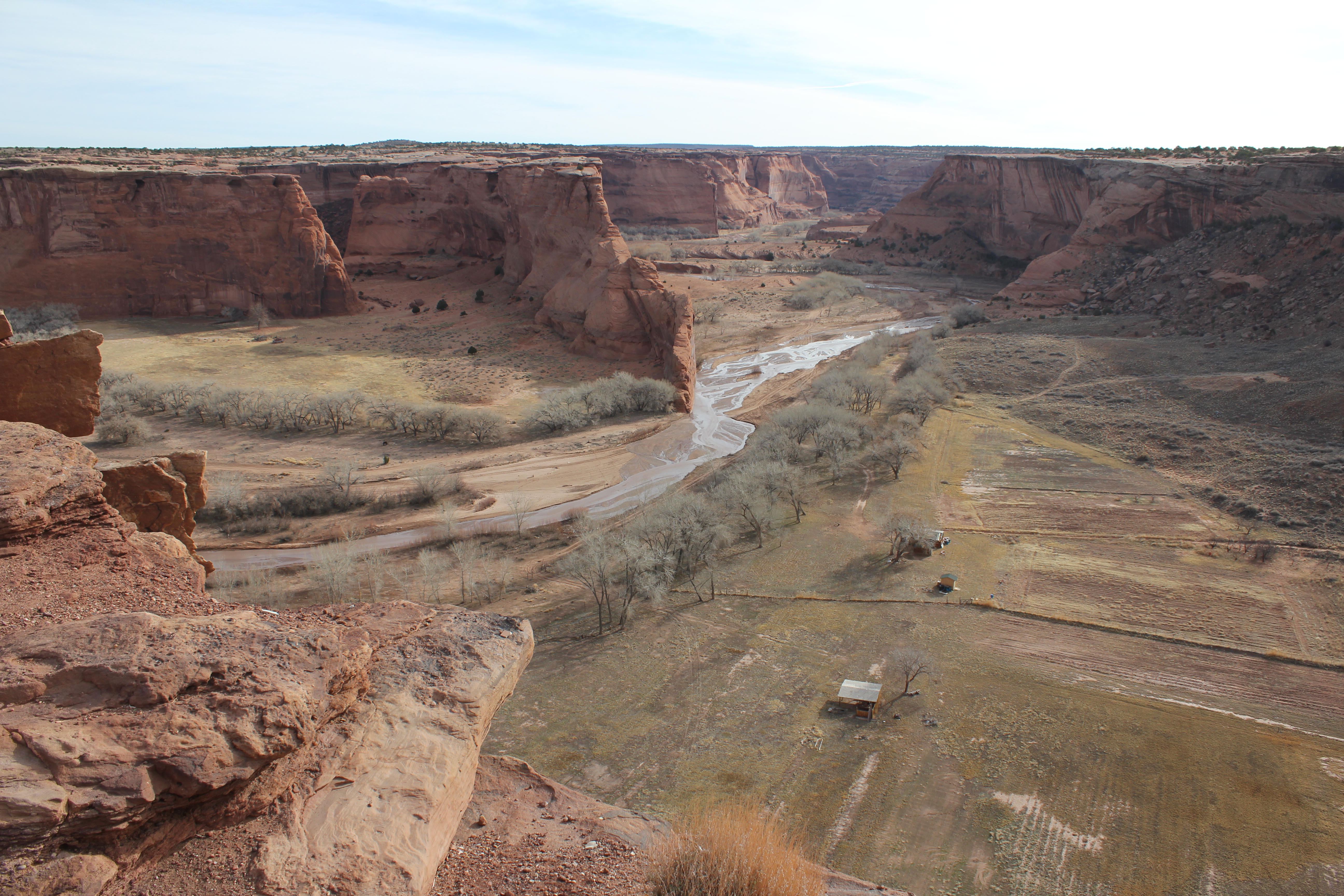
Here's a more "normal" view. The trees below are cottonwoods or Arizona sycamore, depending upon who you talk to.
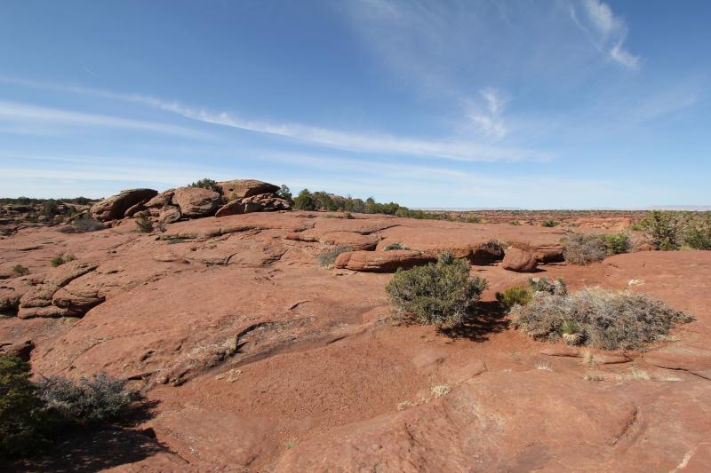
The plateau in which the canyon is cut is very rocky and featureless. I didn't make a high res version of this one.
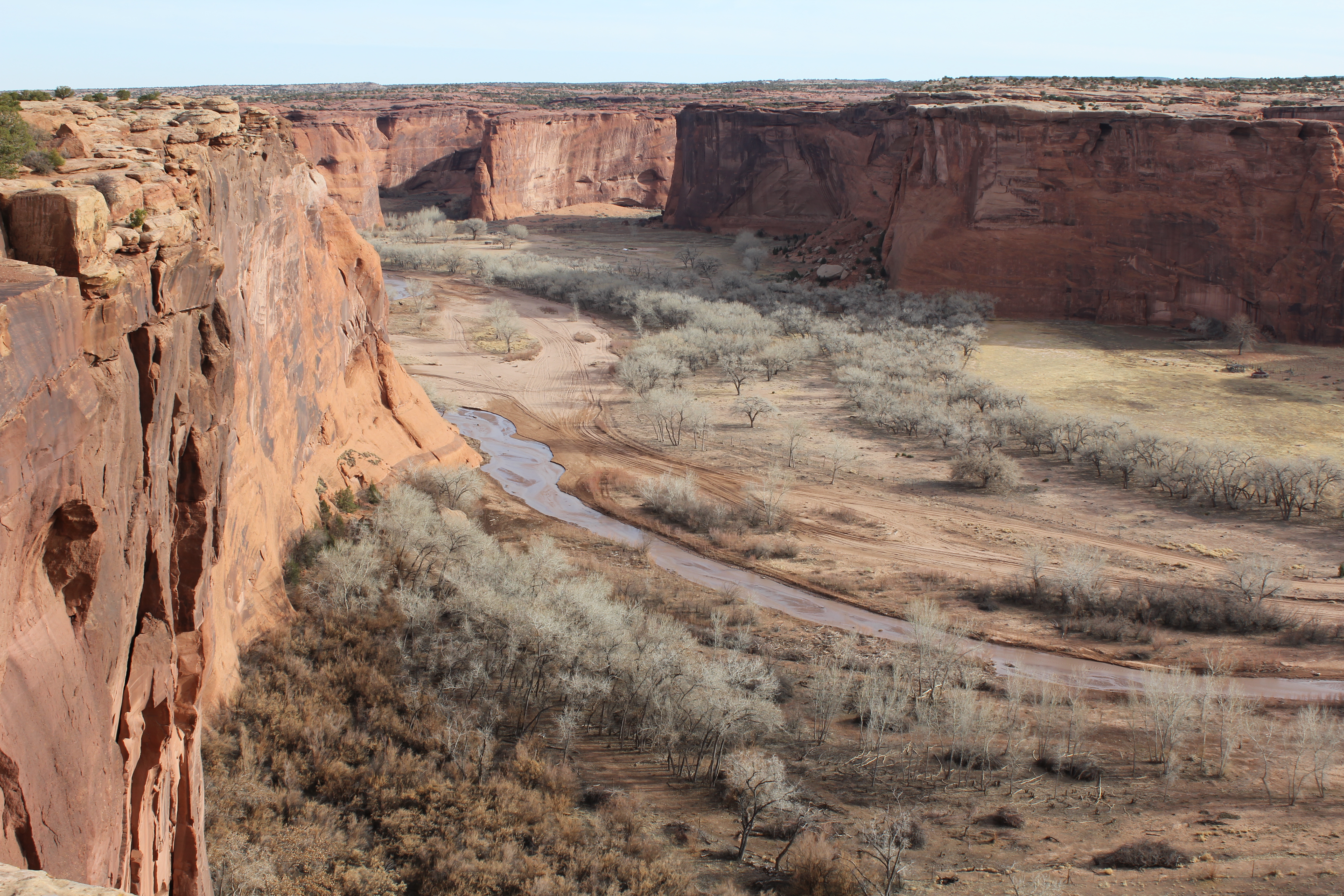
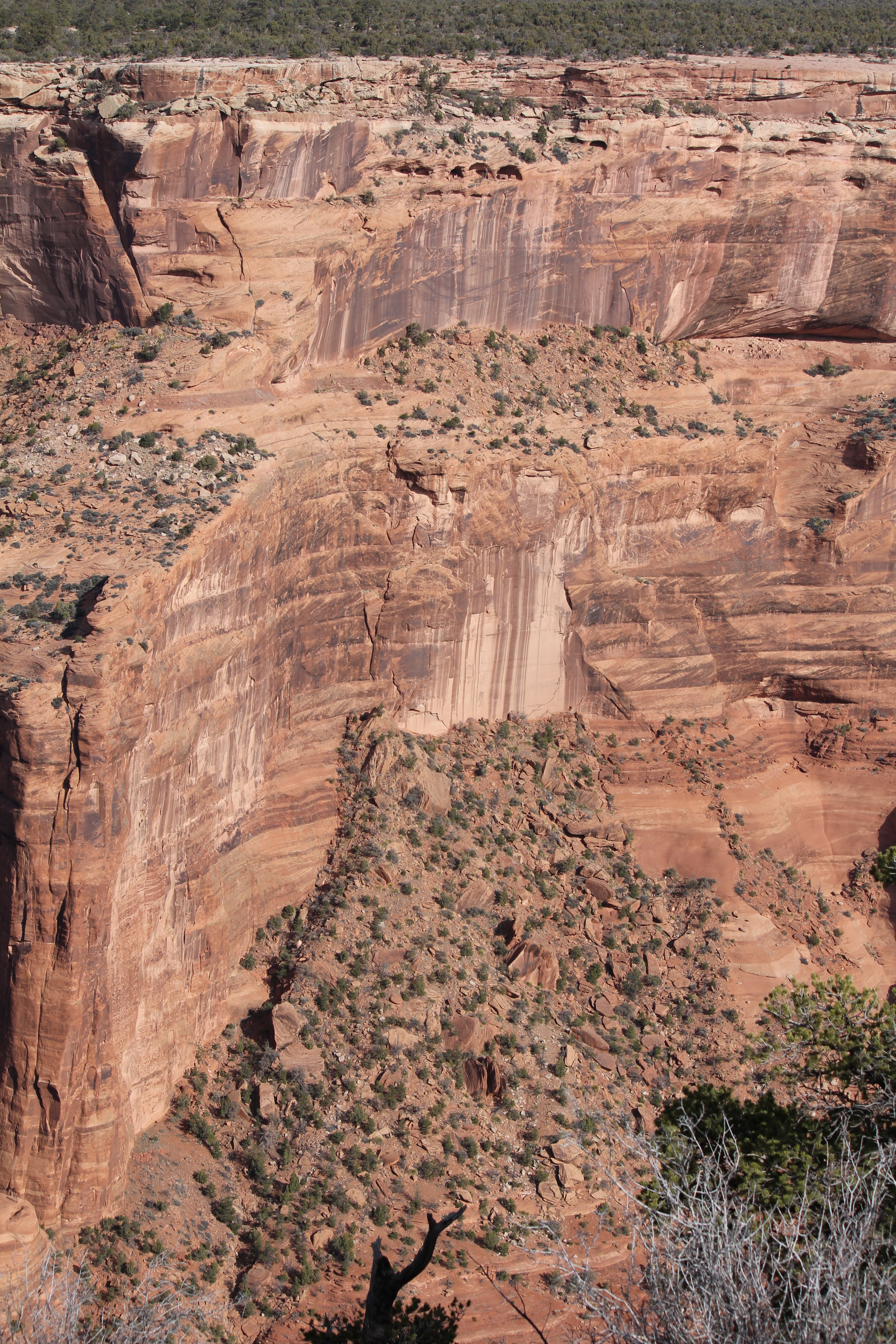
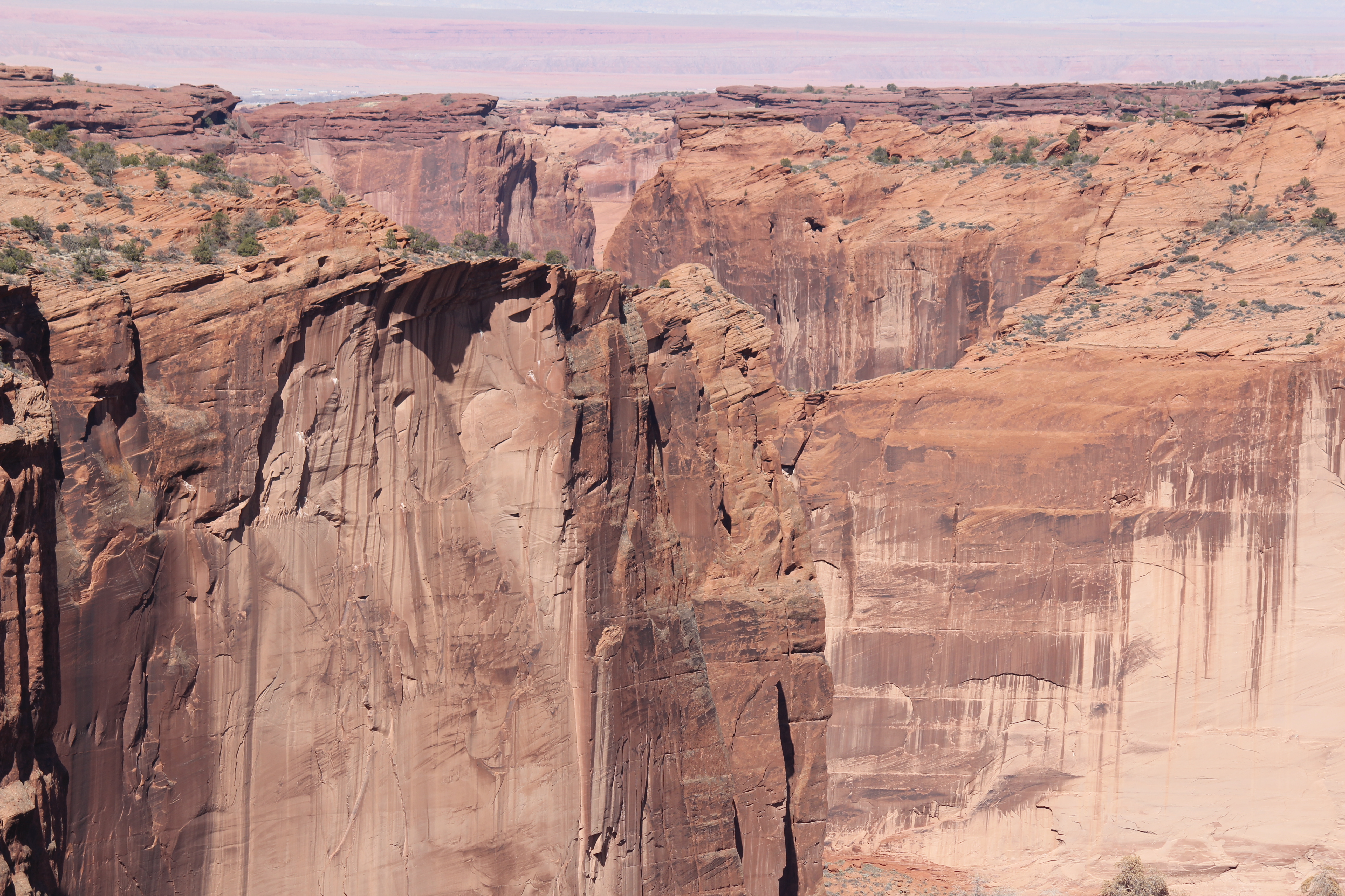
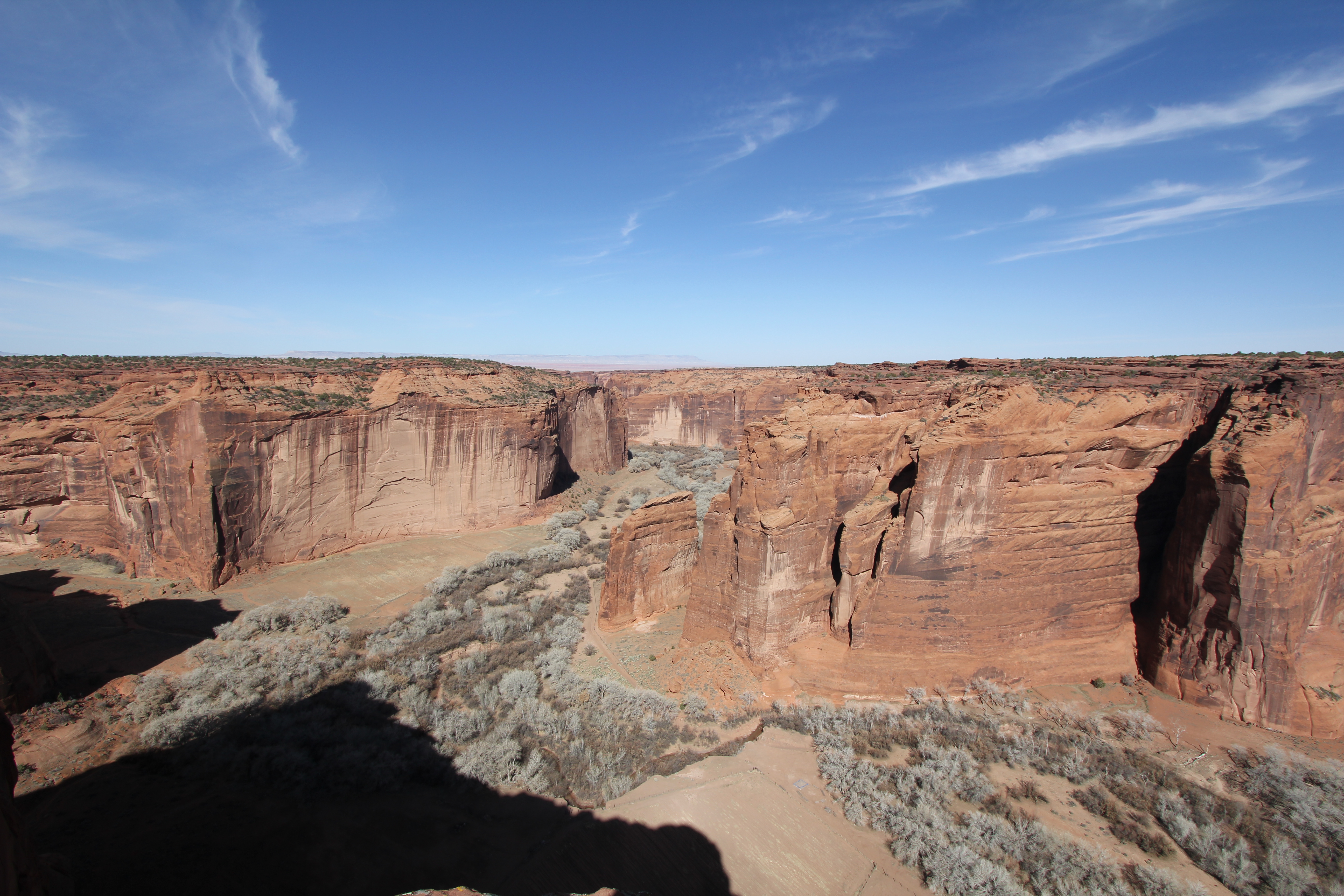
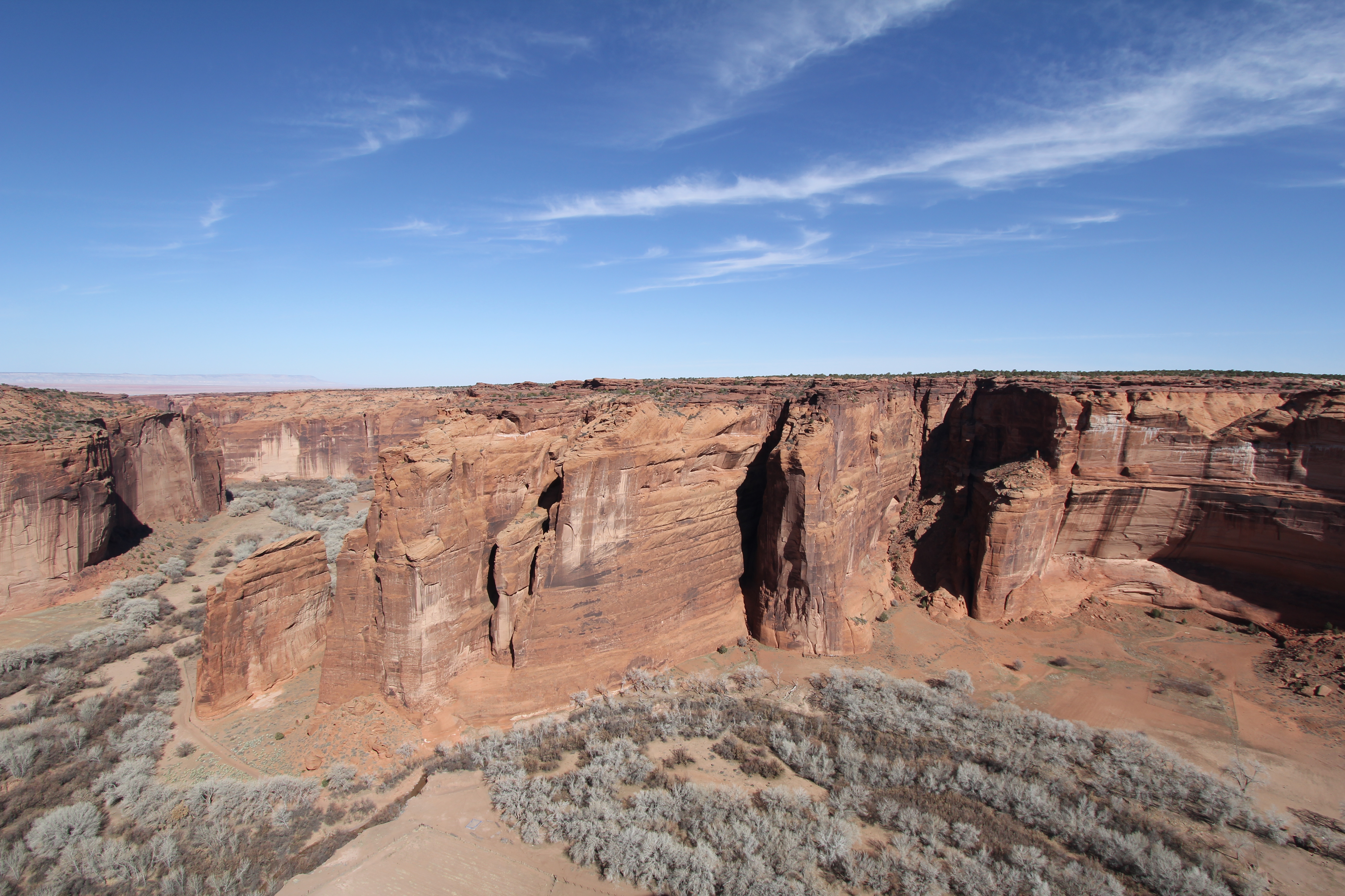
The canyon gives breathtaking vistas, the mostly horizontal sedimentary layers contrasted with the drippings of "desert varnish", the latter actually a very slow growing bacteria based colony. This is a good one to spend a bit of time exploring with the high res version.
While this photo captures some of the grandeur of the scene, it does not do it justice. You have to be there to experience the 3-D effect of the real vista.
Even the 97° cannot encompass the vastness of the view. It does give a fairly good idea of what to expect, however.
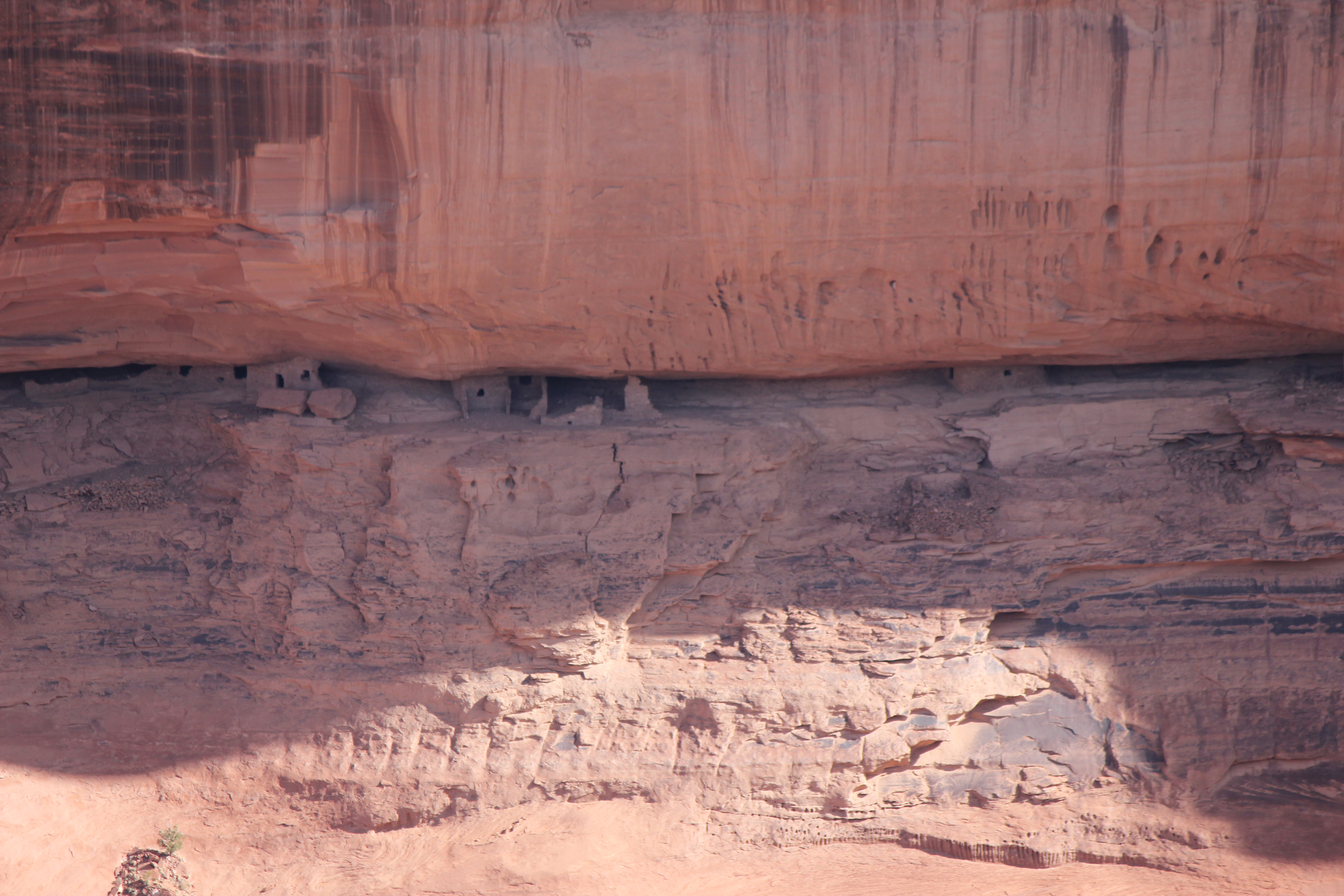
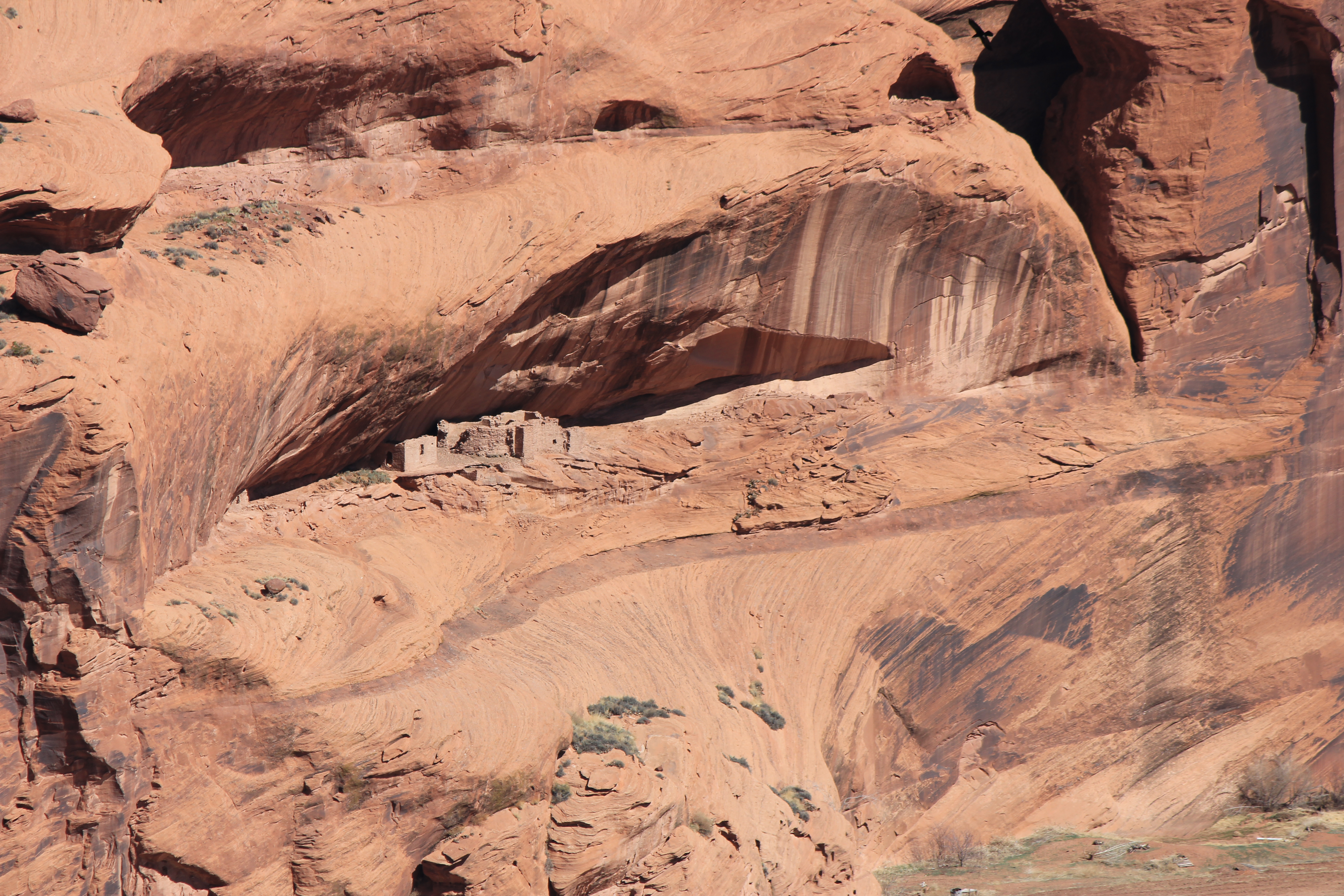
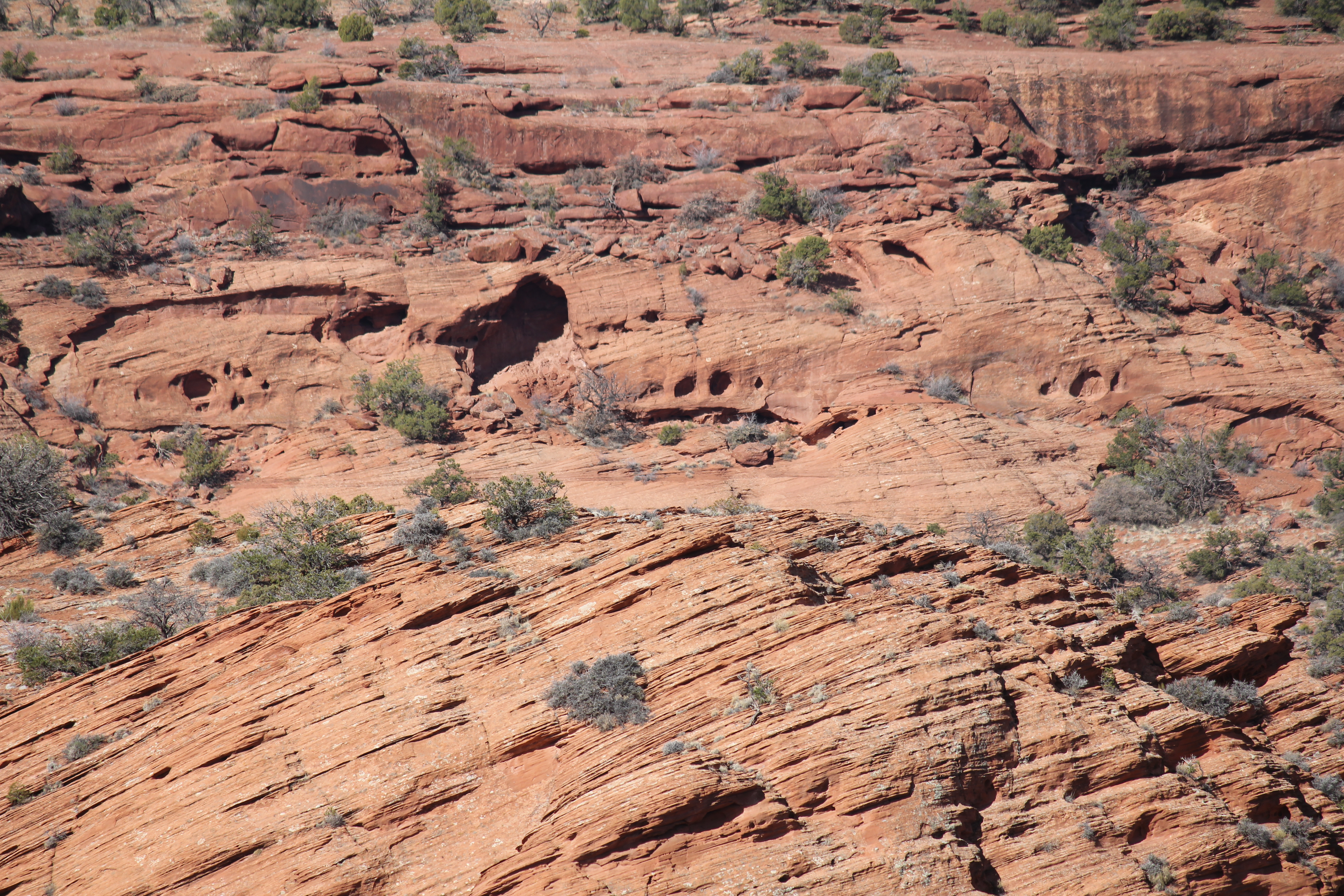
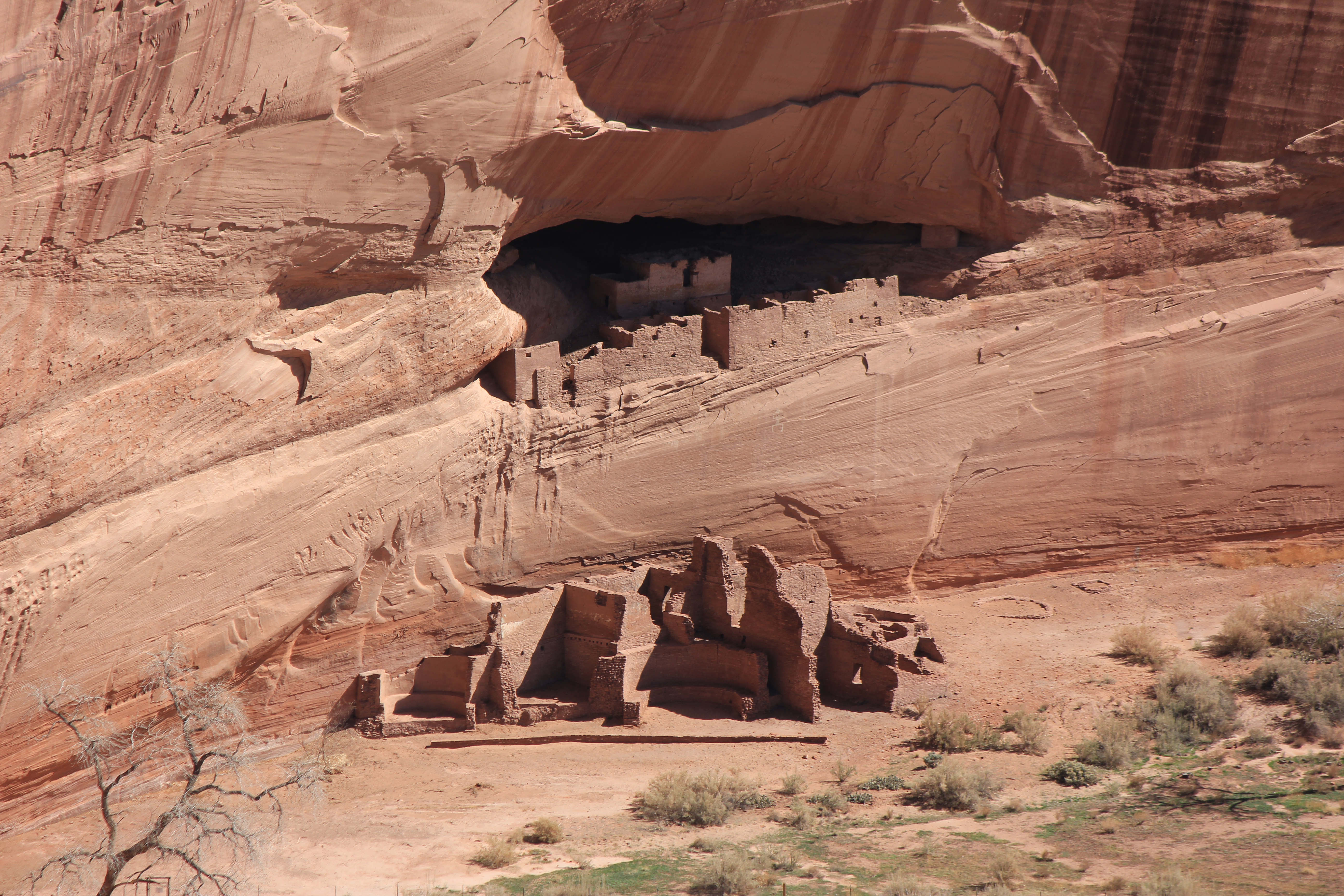
The pubelo people, with their high security requirements, did not mind clambering up to these homes in the sediment gaps.
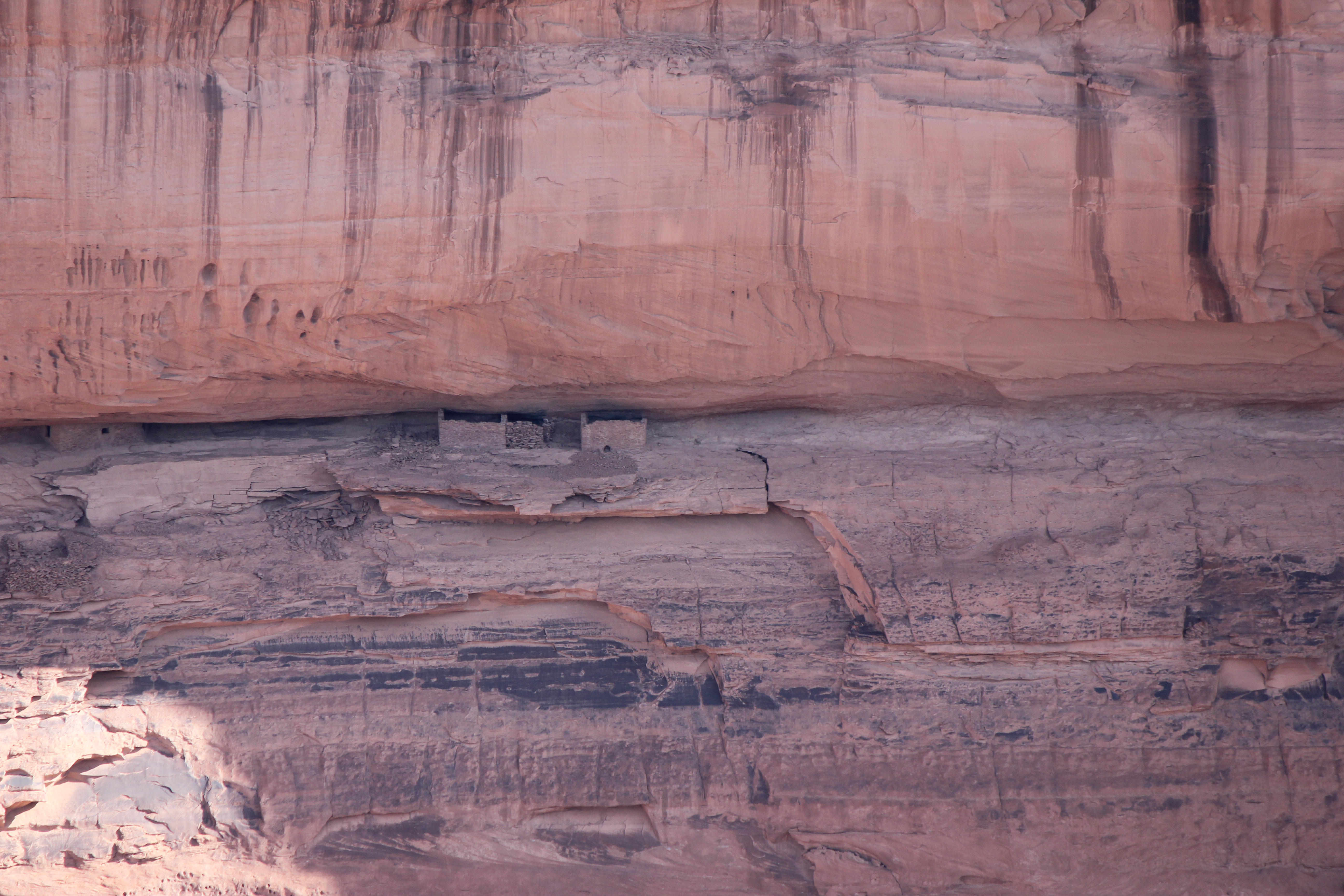
Or these.
The delicately layered sediments were delightful. Note the rooms tucked away in the larger gaps.
More obvious dwellings. This makes modern "gated" communities seem easily accessable!
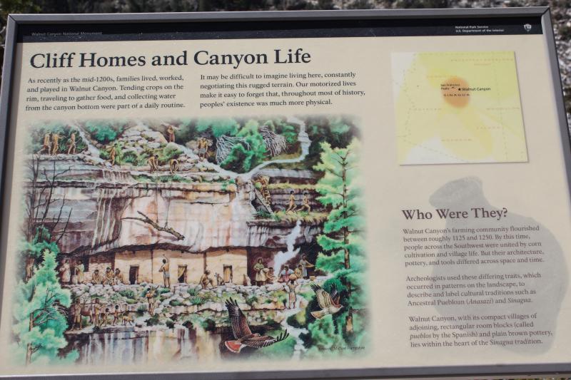
The parks service explains a bit about ancient canyon life.

Here's a telephoto of the floor of the canyon, looking down and about a 65° angle.
Another look down view. Standing at the canyon's rim is much like being in an airplane, flying over the canyon.
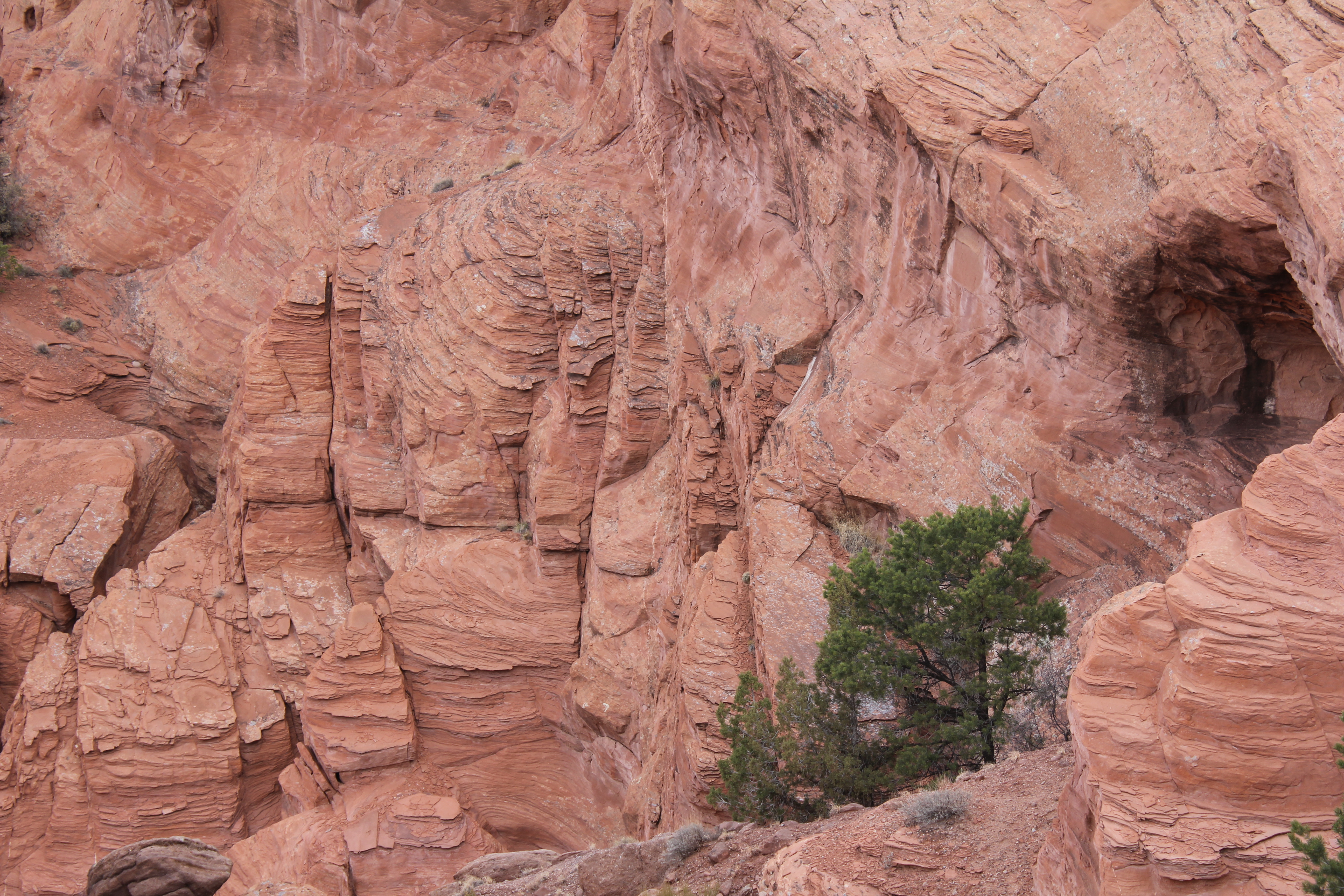
More beautiful sandstone. To this day, I don't know what caused those holes in it.
There are quite a few side canyons that feed into the main canyon. Here are a few of them, although the photo does not do justice to the 3-D effect of being there in person.
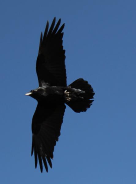
A raven soared by, checking us out.
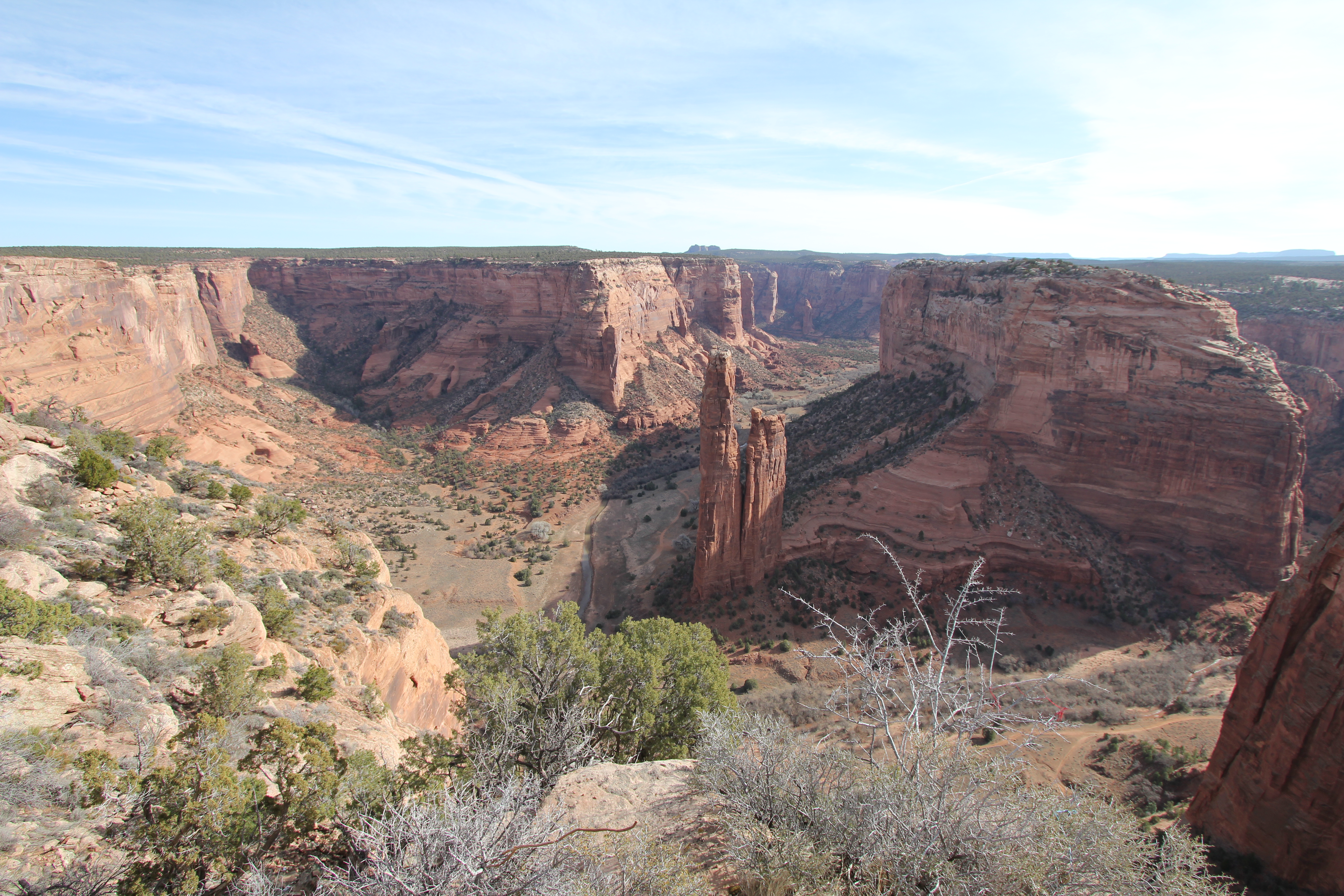
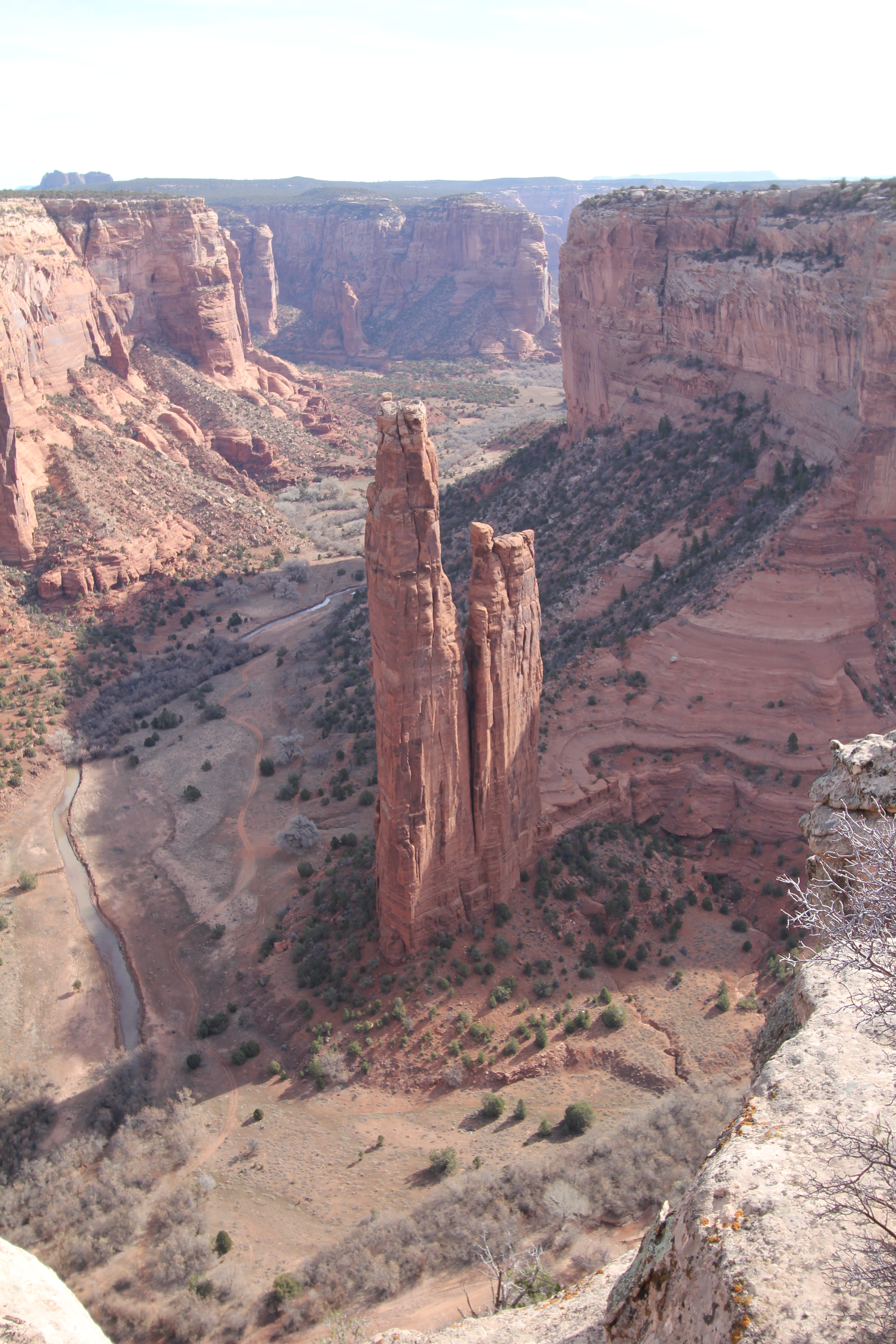
At the end of the canyon is an unexpected and striking pencil like rock, spider rock. Superb. This is the wide angle view.
A more normal view of this seeming unlikely formation. It looks so gossamer! Why hasn't it crumbled long ago? Everything around it did!
This picture, while striking, does not convey the awsome feeling of being there. You're at the edge of the canyon, and the bottom of the picture is close to a 80° drop. In the high res version, at the right hand base of spider rock, if you look carefully, you might see the remains of yet another small dwelling.
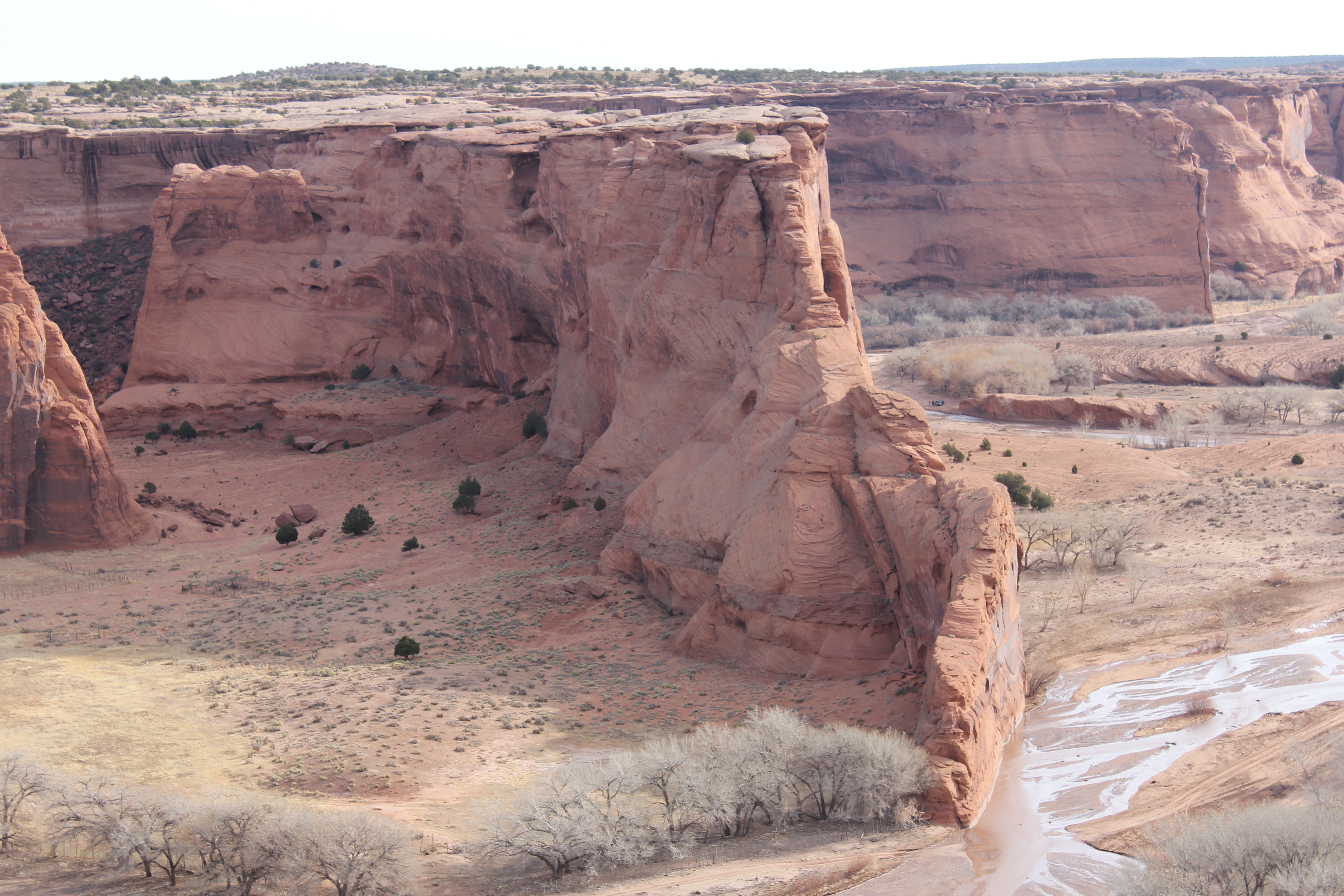
Another glorious vista.
And another. Some slabs of rock are spared the erosion of wind and rain, others become sand. Why? Go figure!
The side canyons long for exploration, but one must hire an Navaho guide to see them.
The "White House" ruin, made famous by Ansel Adam's photos of it earlier last century. This is the only place in the park you're allowed to walk to without the aid of a Navaho guide.
How did this abutment survive, while the others were turned to sand by wind and water?
The canyon abounds with exquisitely detailed vignettes like this one.
We reluctantly left the canyon and headed for Durango. I hoped to see the narrow guage steam train in operation, but did not. The first train left at noon, and the Great Sand Dunes trumped the train.
On Tuesday, March 19, we headed for Alamosa, CO, Kathie driving. The day was overcast, so the views I hope to see from the pass were dull, shrouded in clouds. A second disappointment.
Kathie was driving over the pass. Her first exposure to the roller coaster experience of mountian driving, and she found it a white knuckle experience. Once near Alamosa, things straightened out and Kathie relaxed.
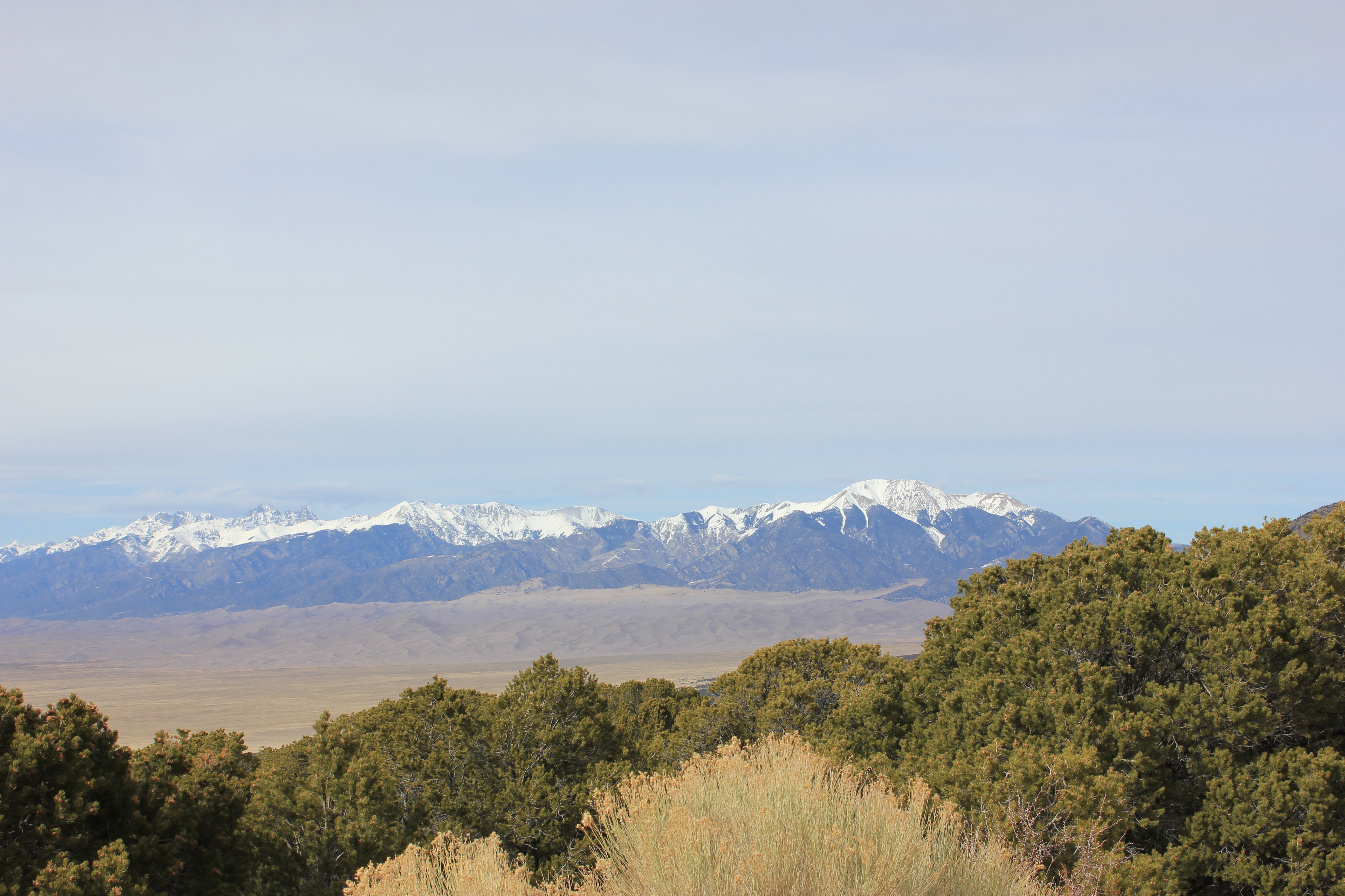
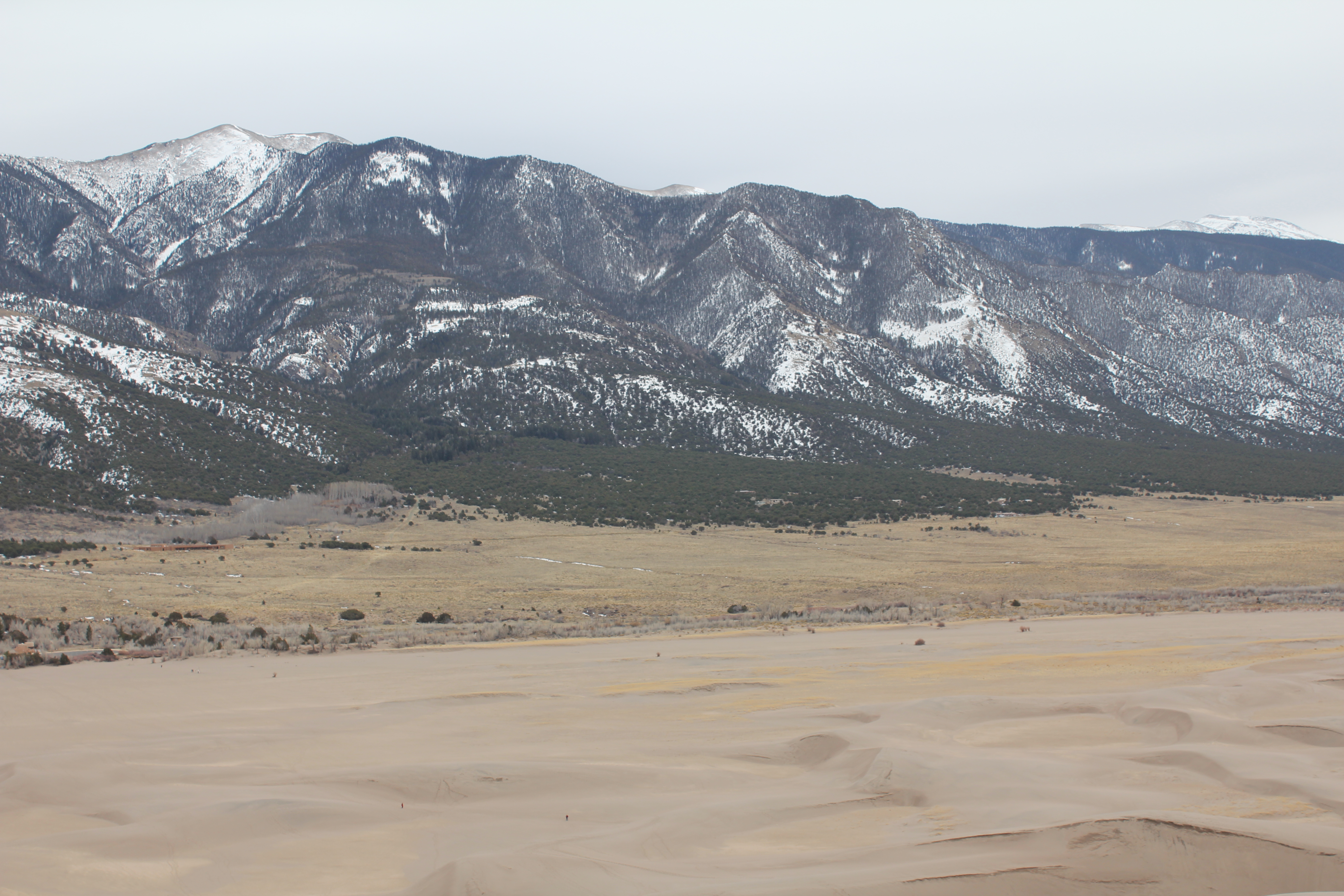
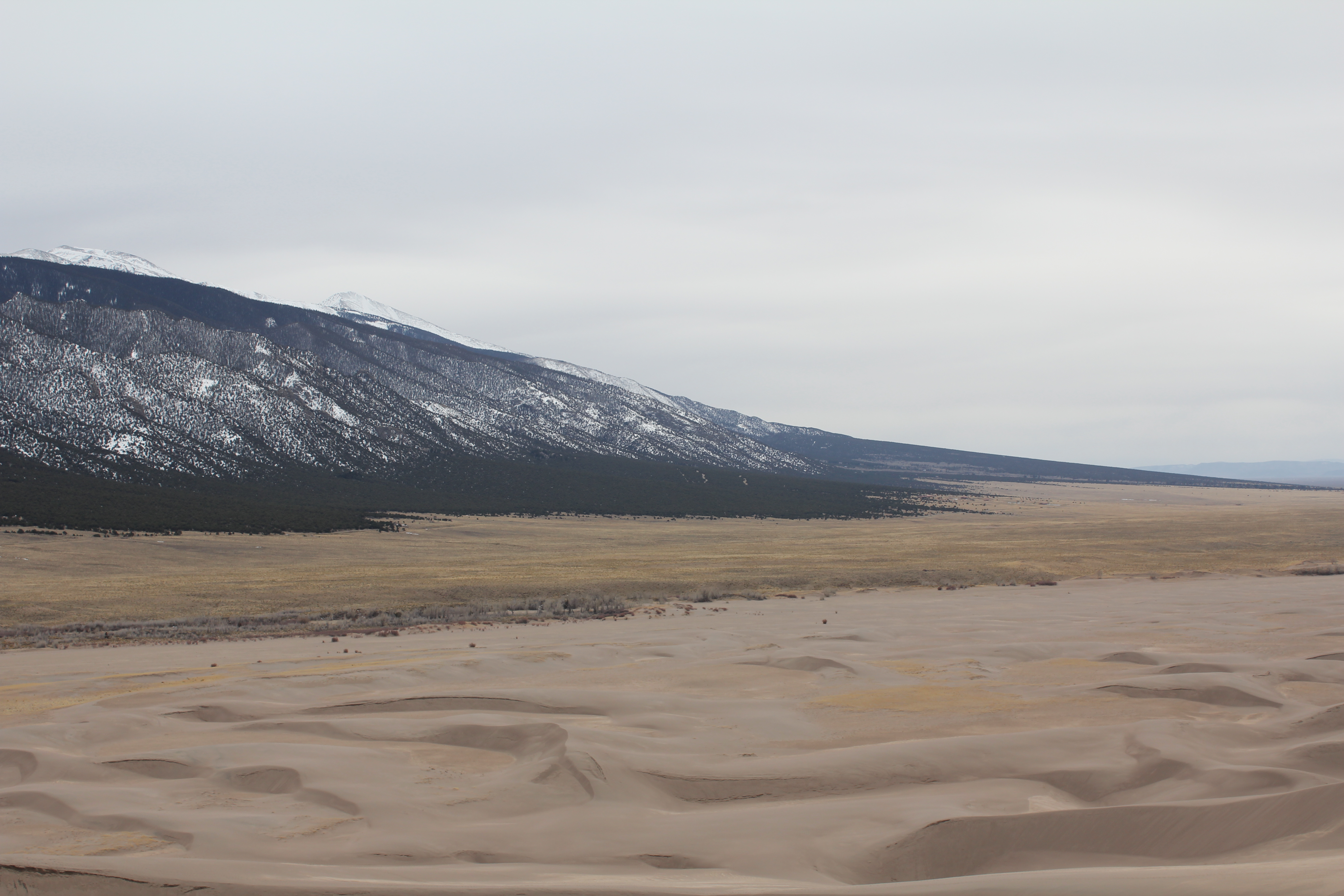
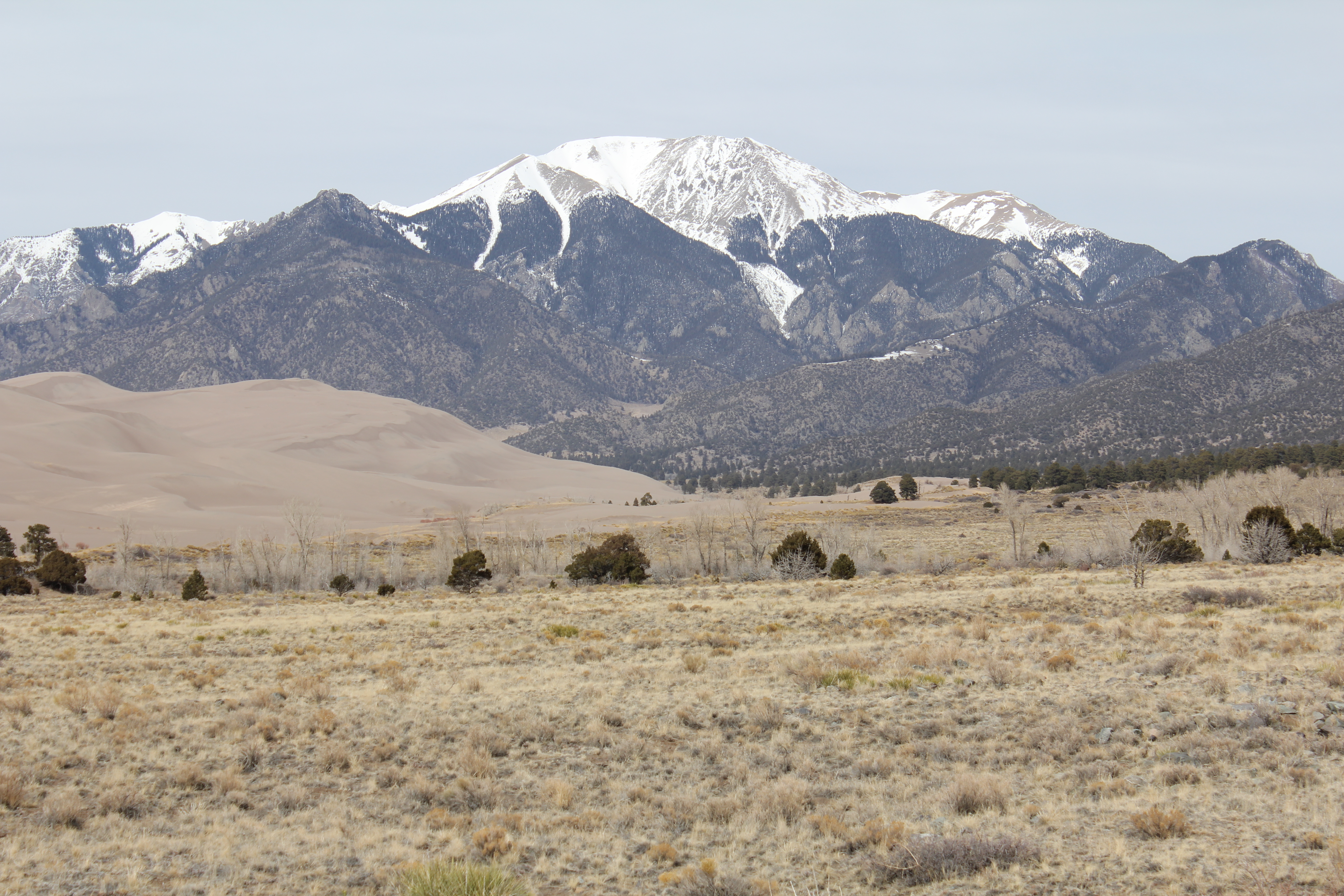
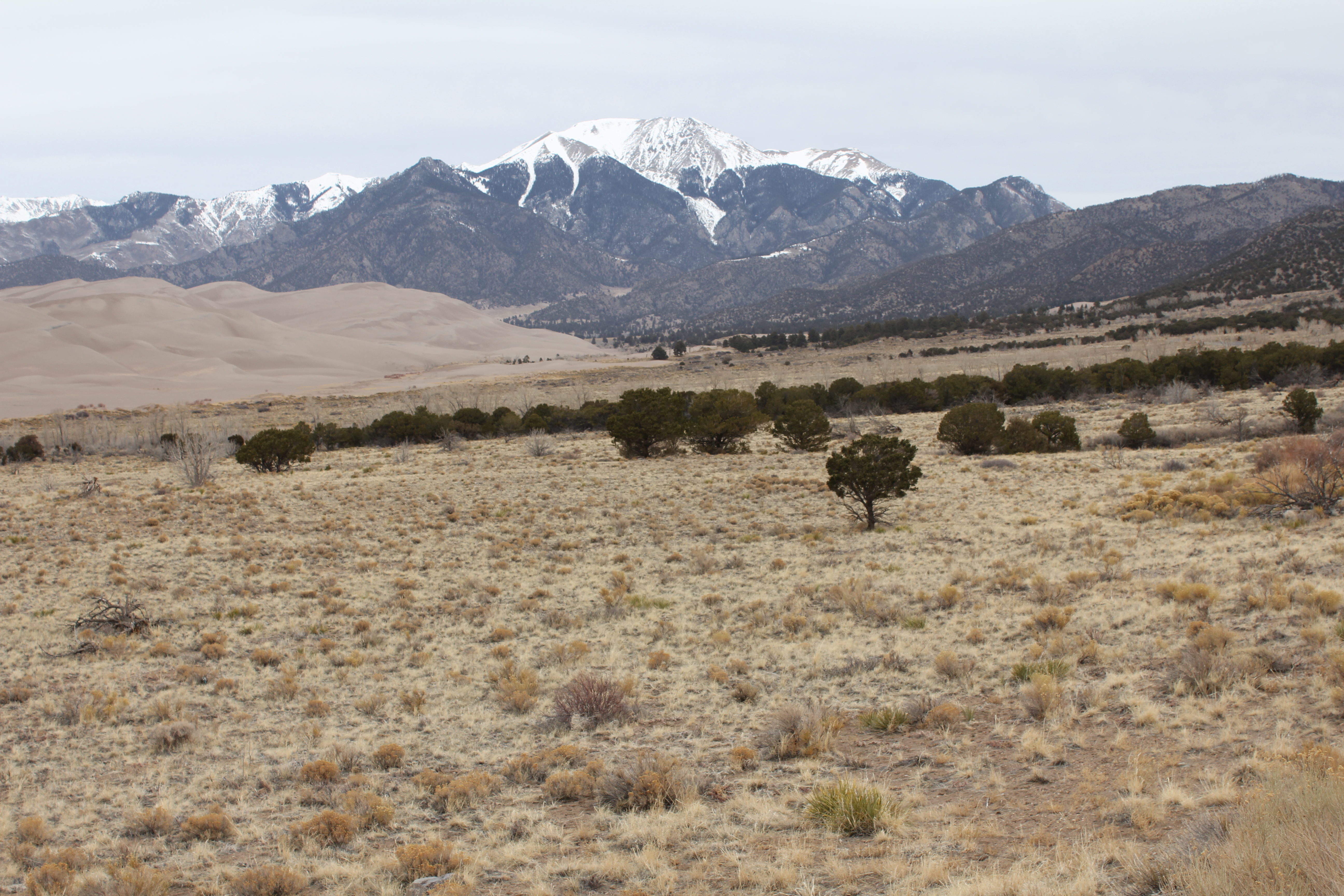
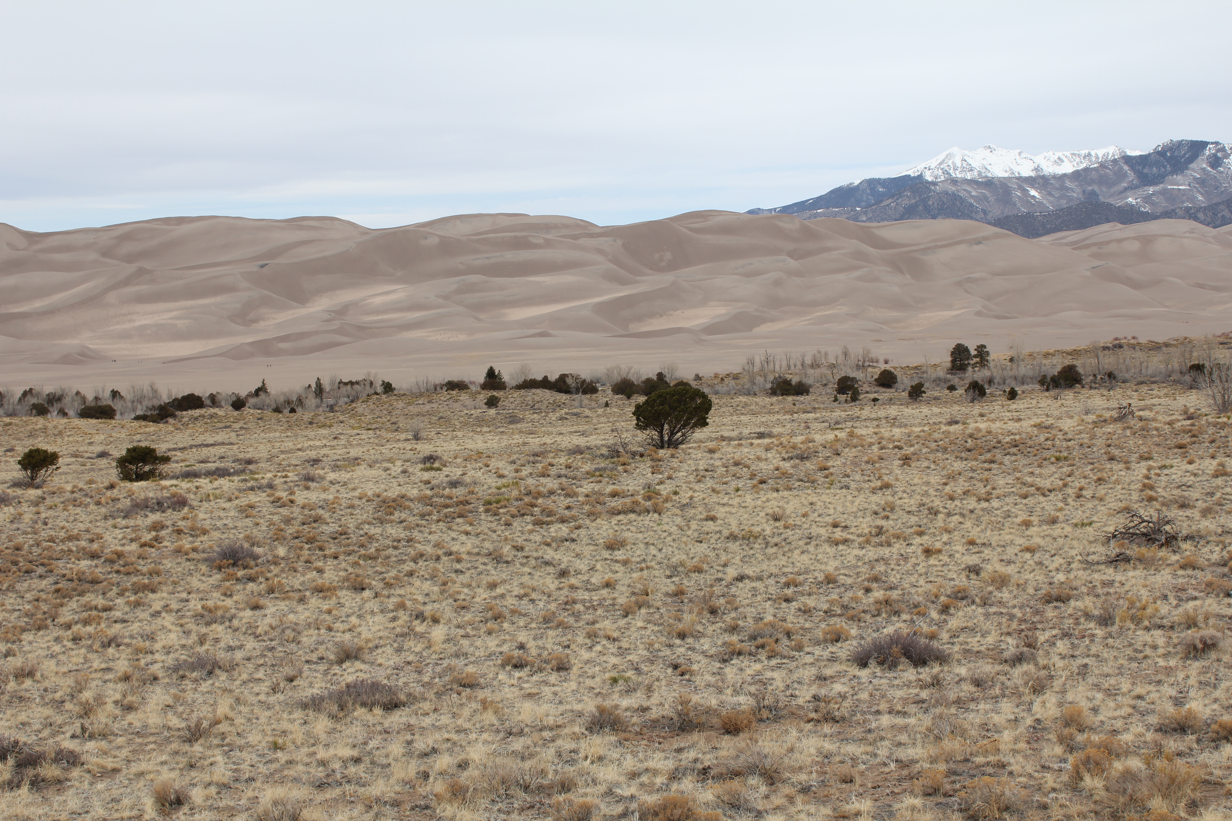
About 15 miles east of Alamosa, on route 160, turn north on Colorado 150 and go another 15 miles or so. You'll come to the highest, most extensive field of sand dunes in North America. This view is actually taken from Zapata falls, about 8 miles from the park's visitor's center.
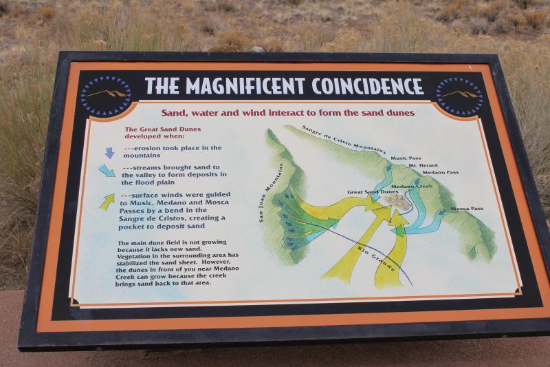
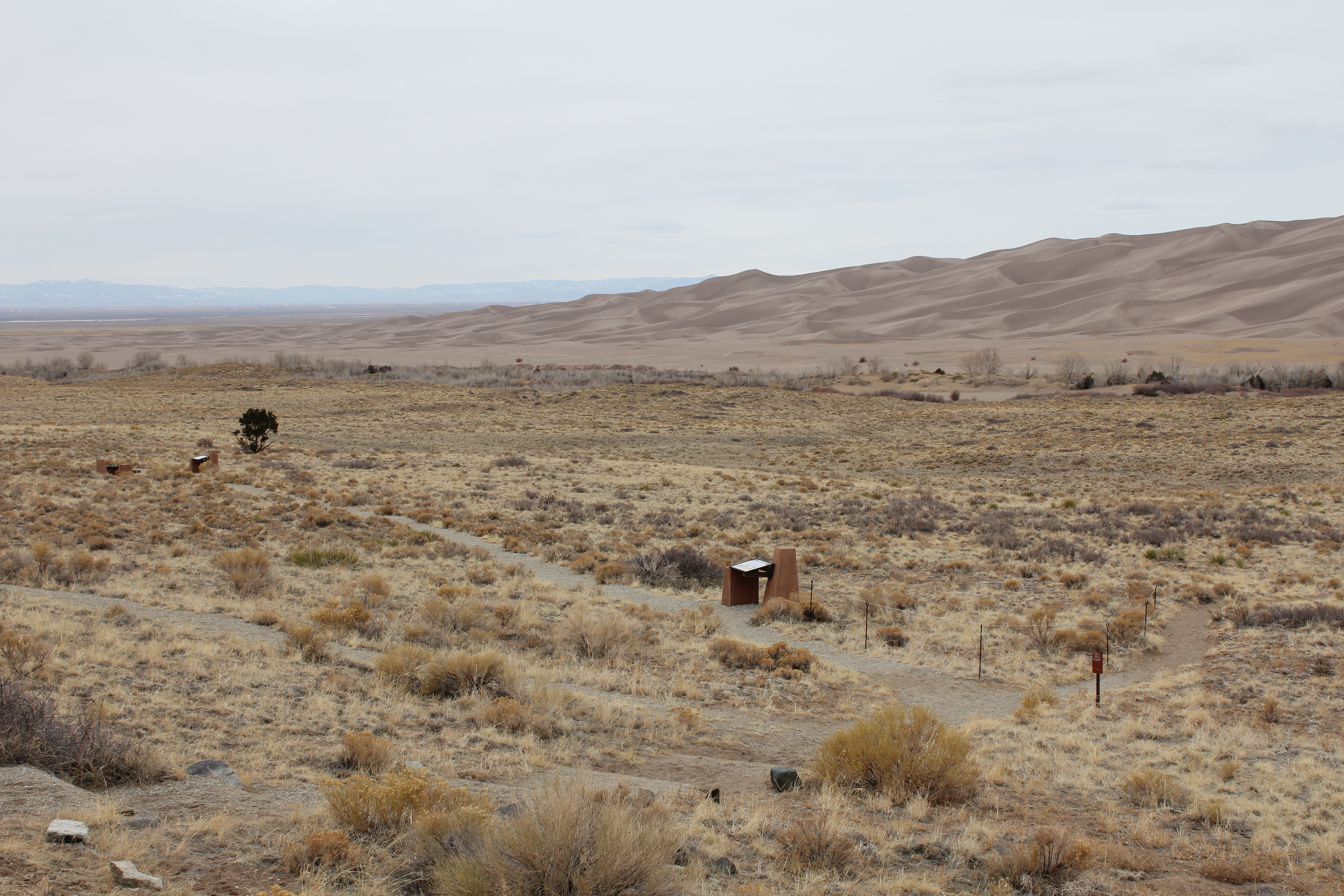
The always helpful park service explains how they came to be. High res not needed here.
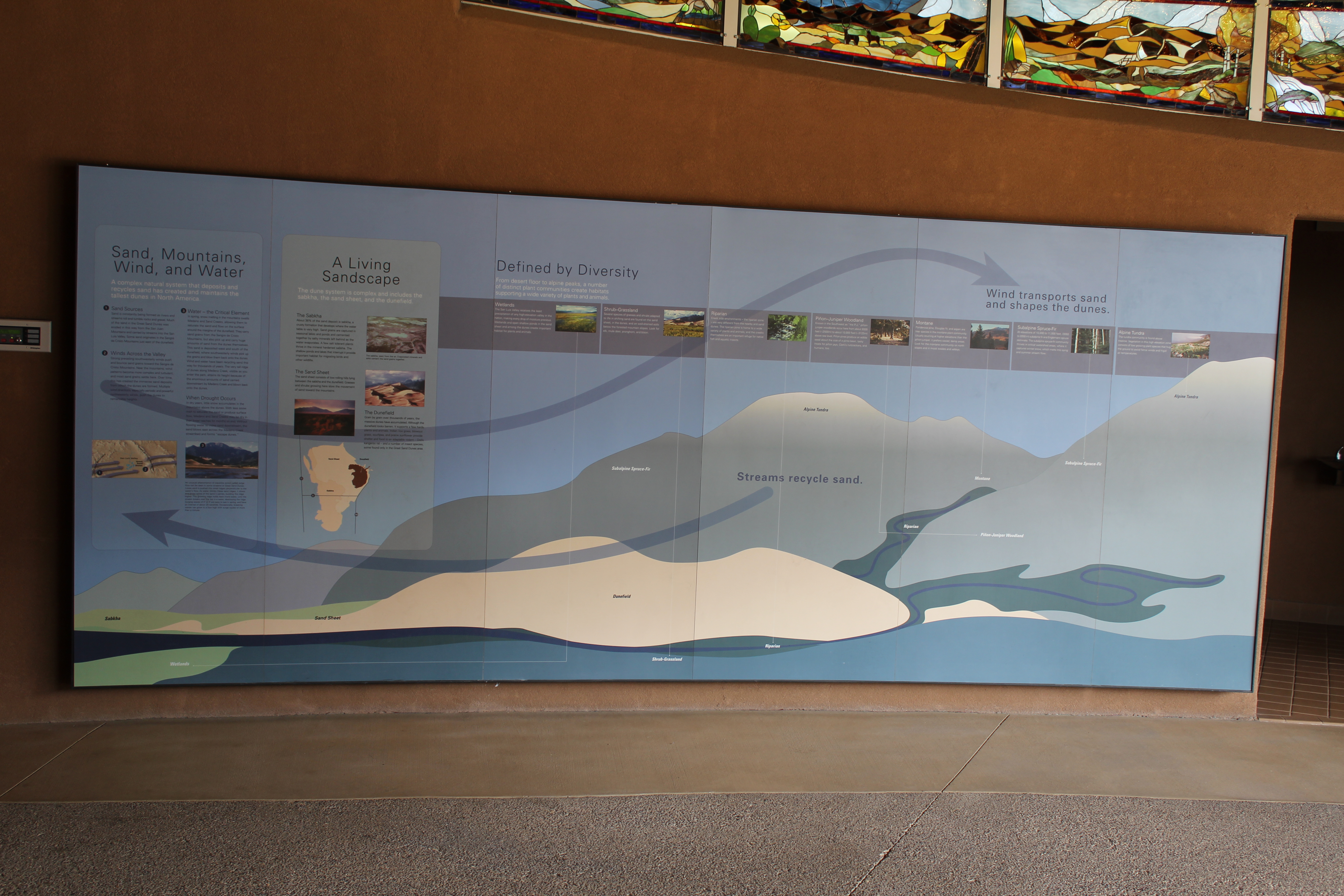
And again, in their visitors center. This one needs the high res version to read it.
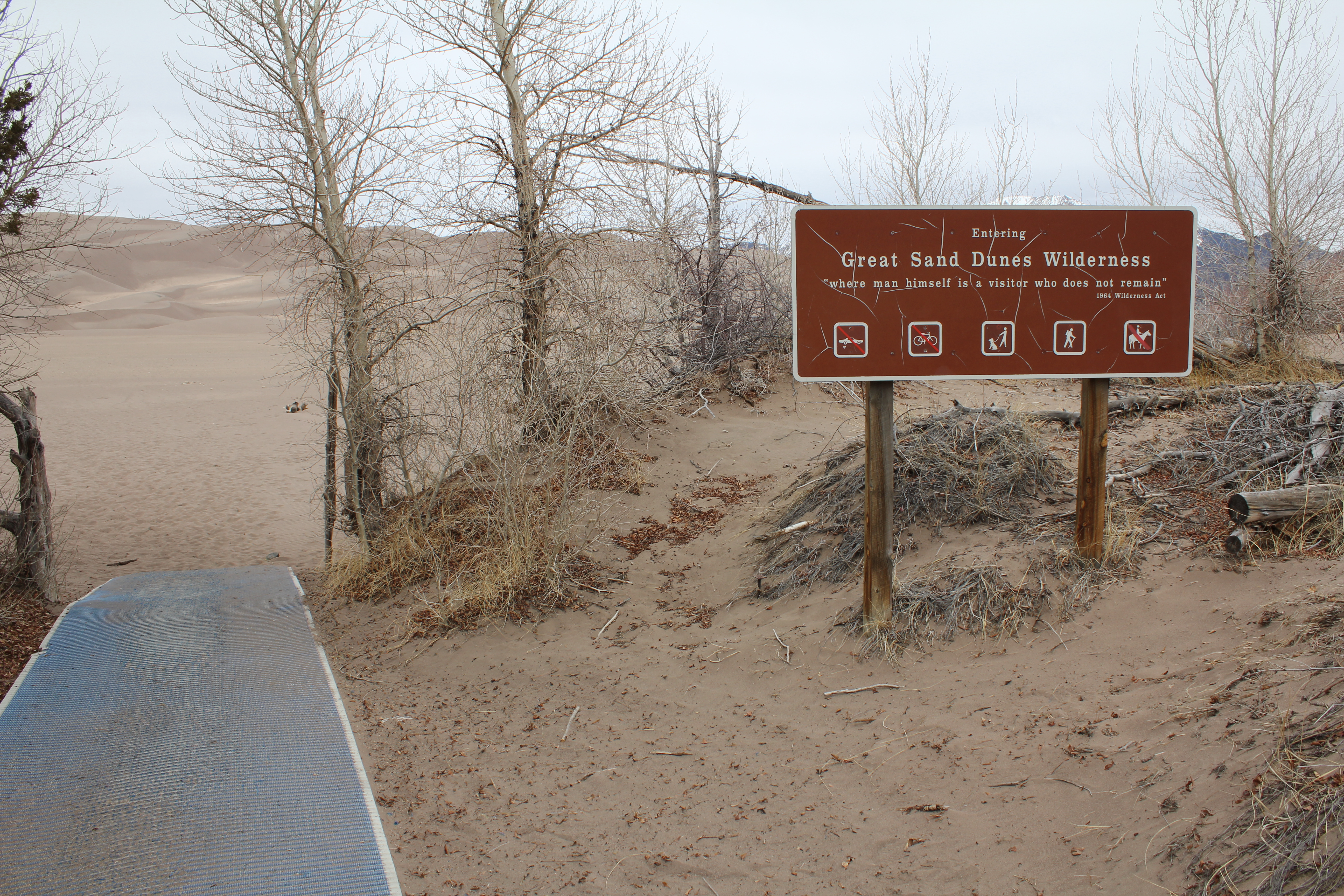
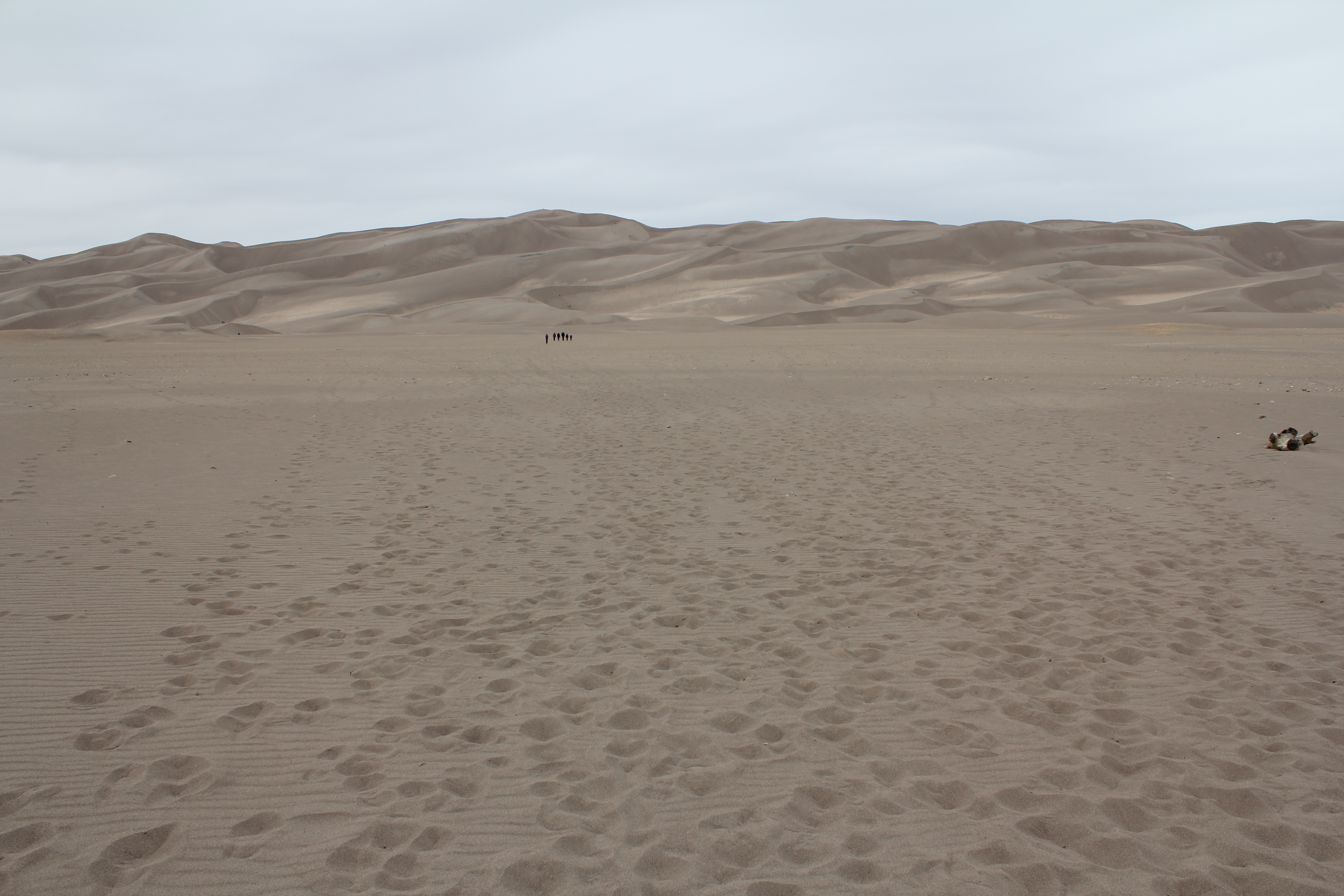
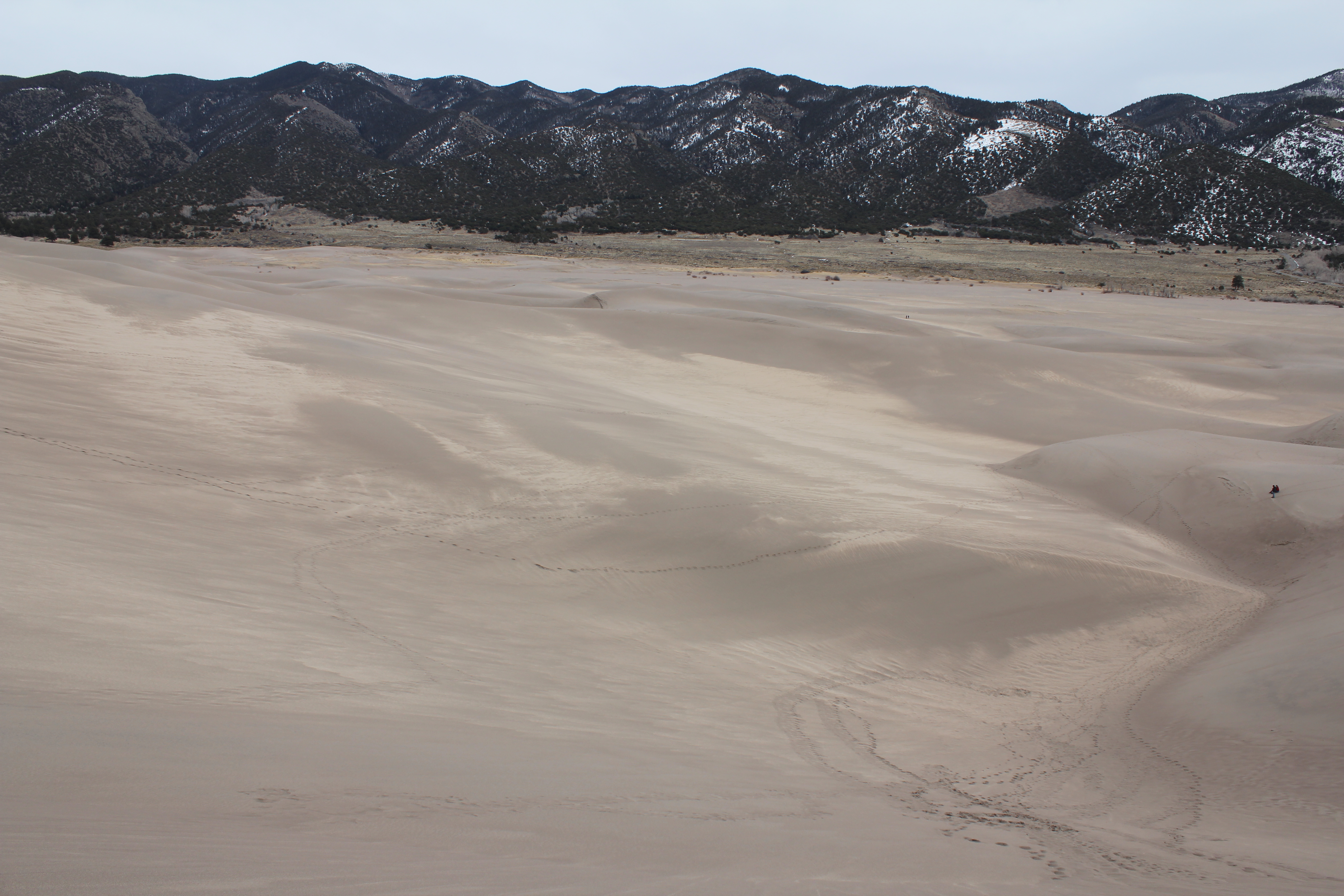
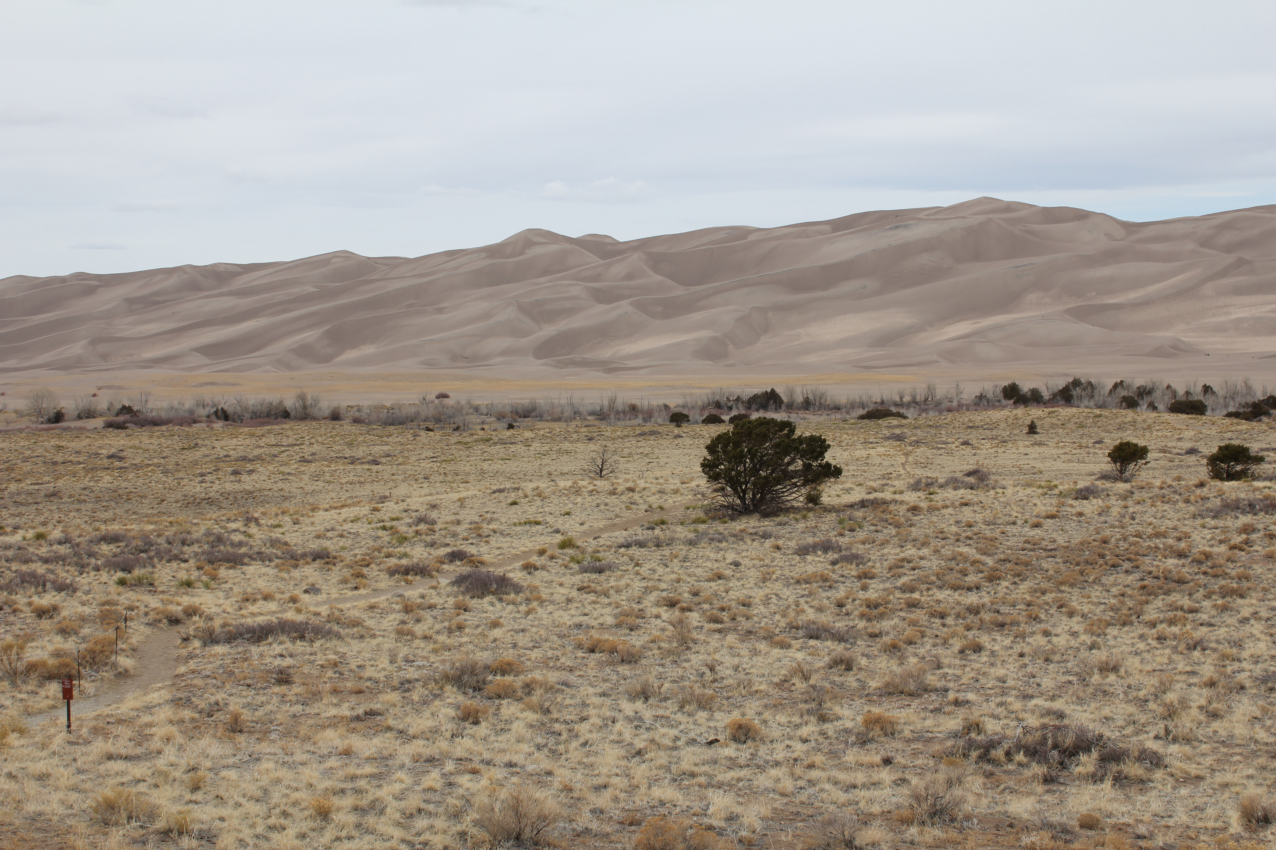
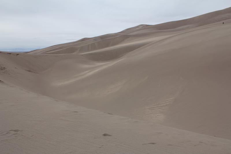
Here's where the marked trail ends, and one begins a trip of several miles to the top of a dune.
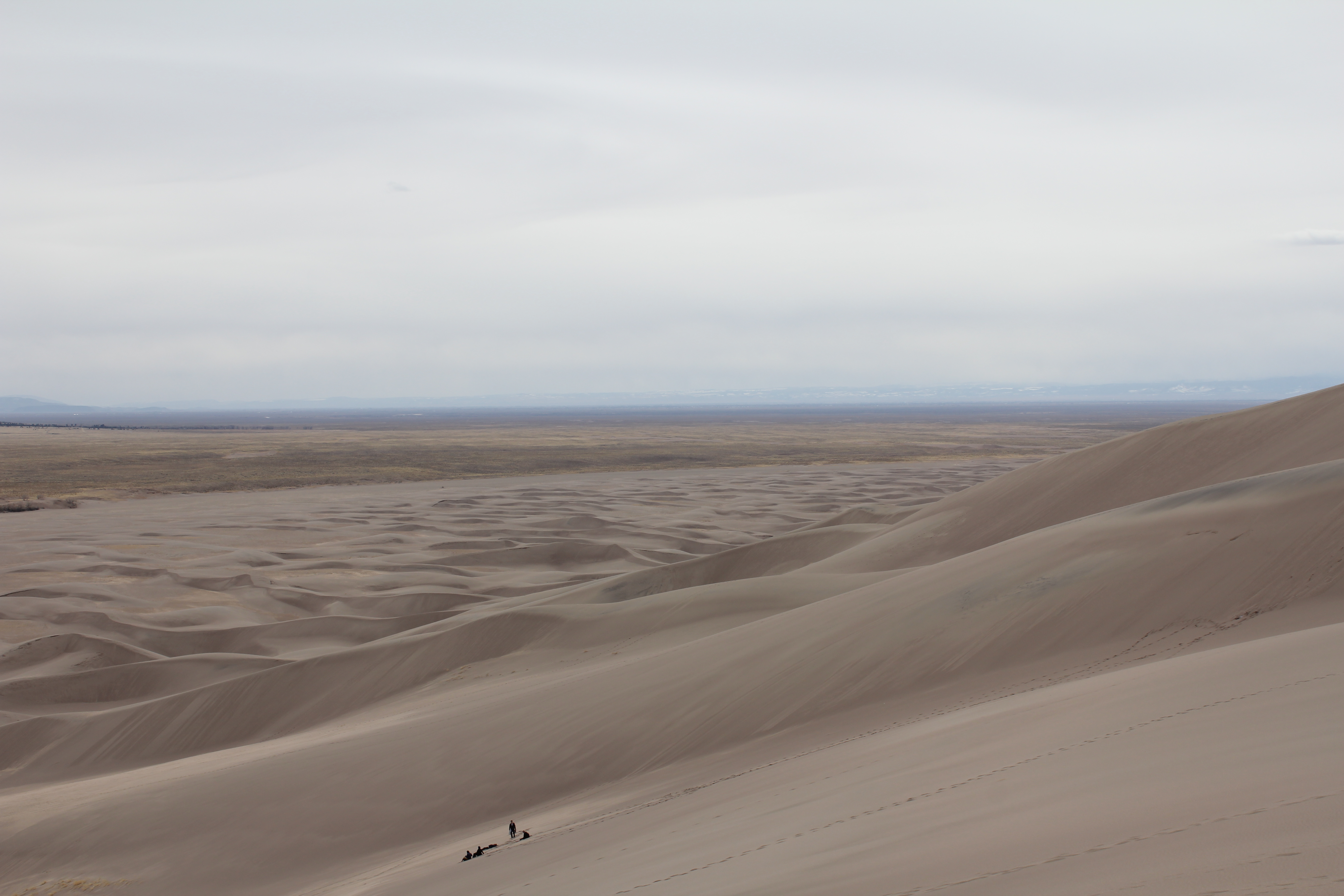
Magnificient desolation. The footprints are wiped out within hours.
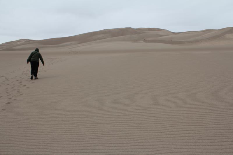
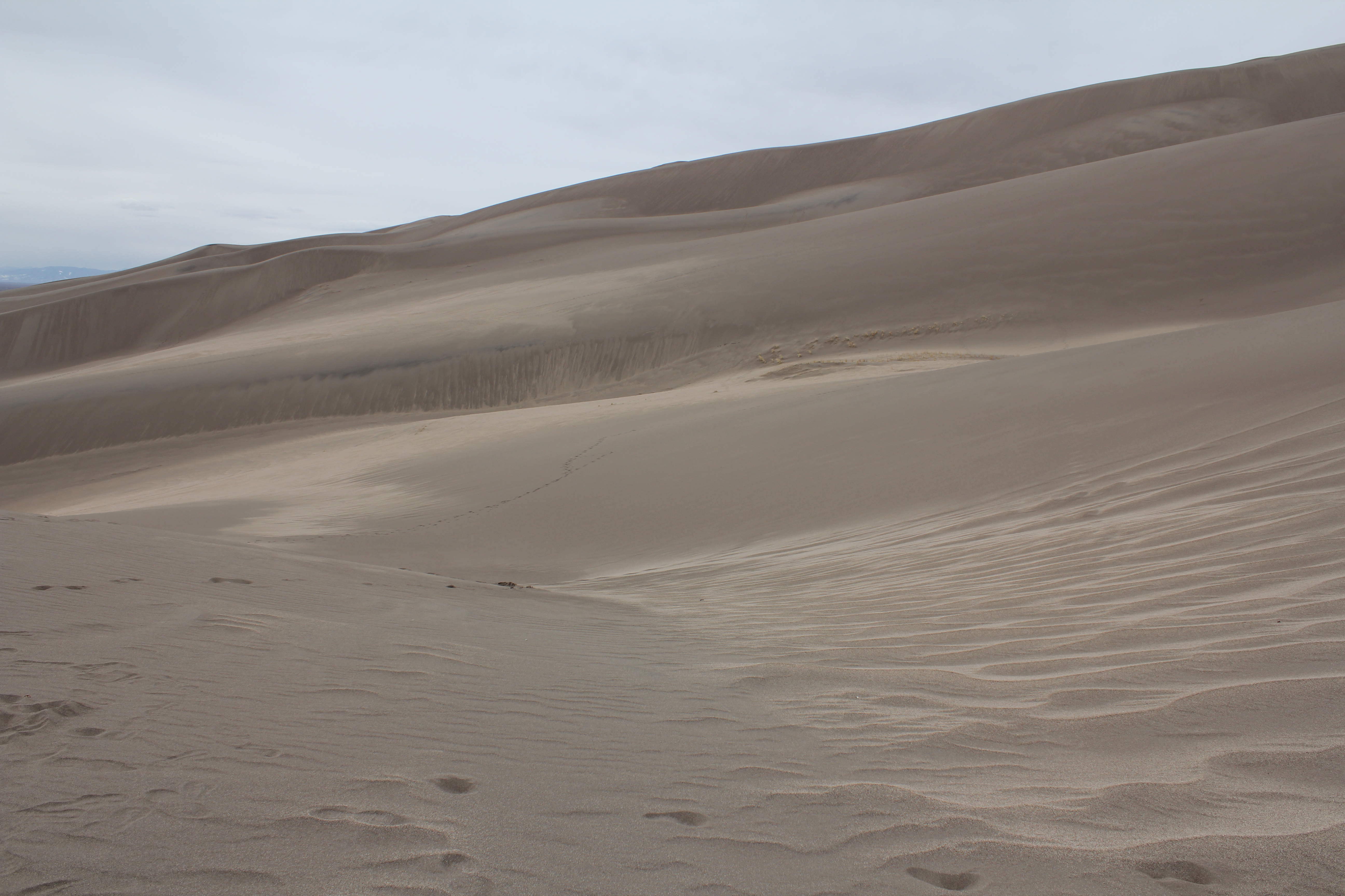
Kathie labors up the dune field.
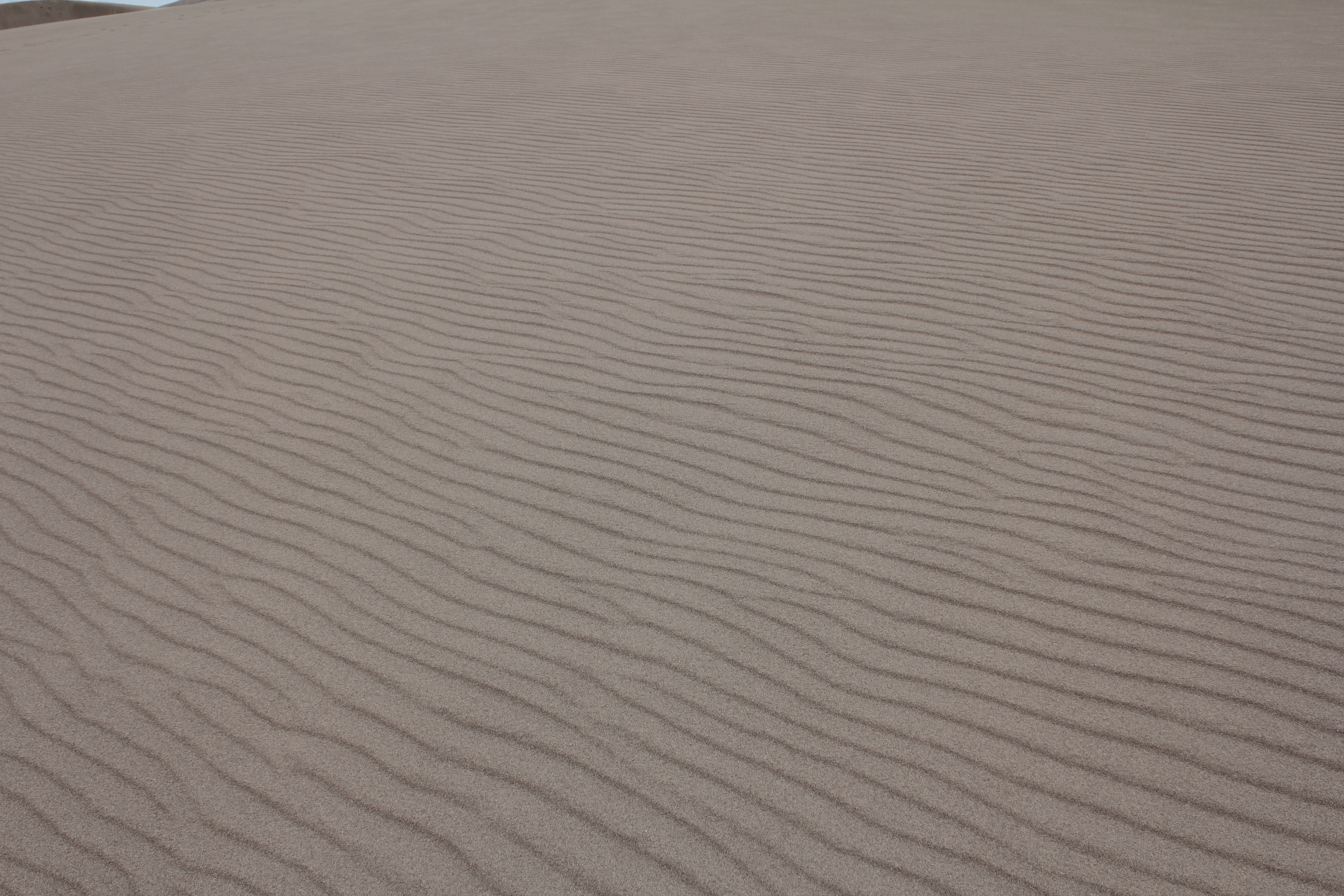
The regular, windswept patterns are lovely. In the high res, you can see the individual sand grains
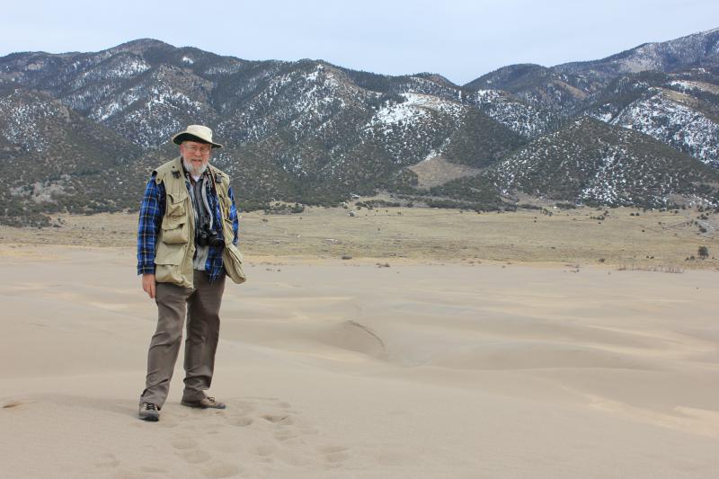
At the top of a dune, about a mile from the trail head. Not the highest dune, but recall that for much of 2012, Kathie was a virtual cripple. This wasn't easy. Remember how much more effort walking on beach sand is? Try doing it uphill. We climbed at least 400 feet!
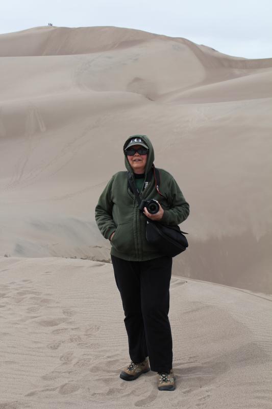
Here I am, same place.
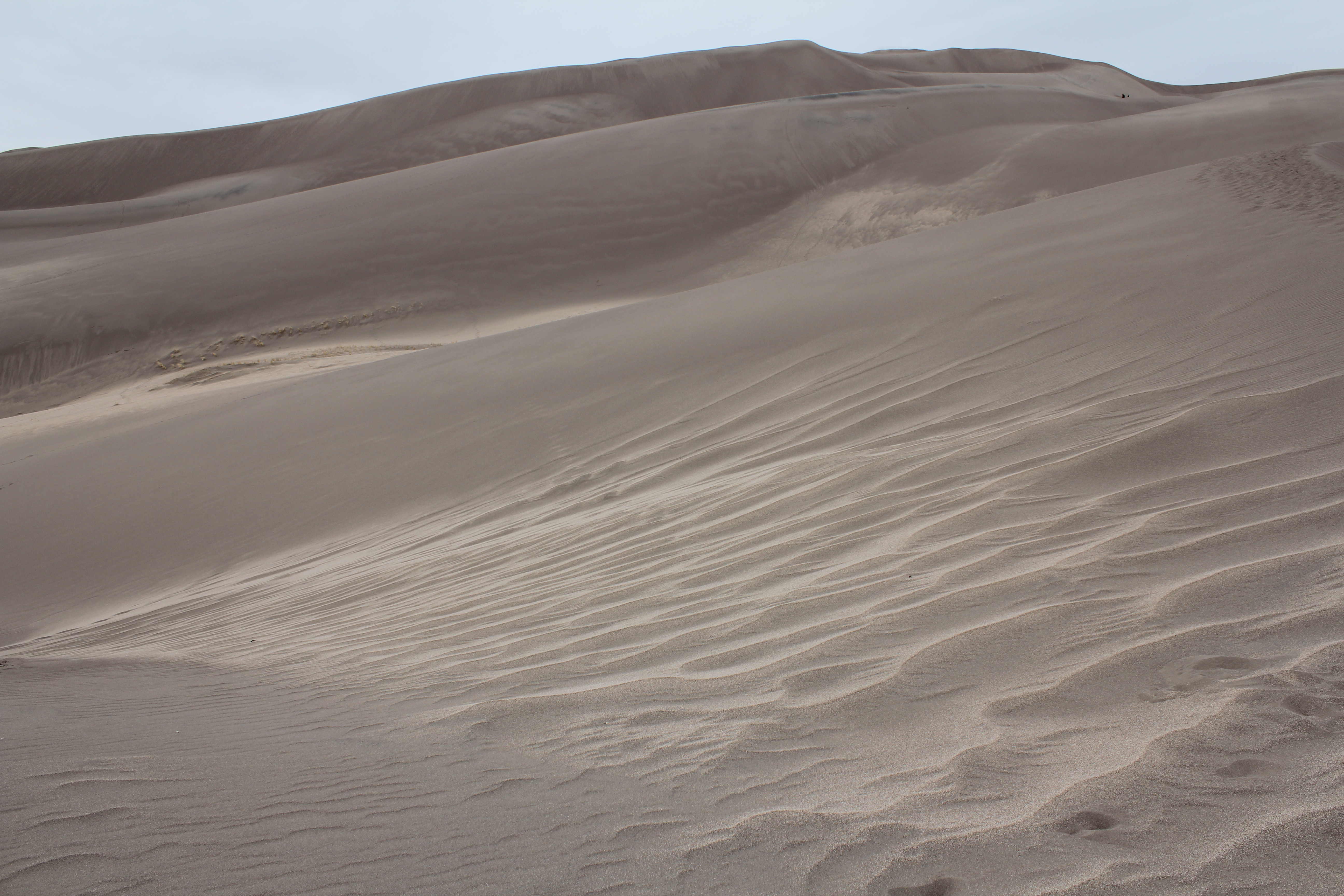
Here's a panaroma of the dunes and mountians that I haven't had time to stich into a real panorama with Gimp yet. There are 7 slightly overlapping views in all. View 1.
View 2.
View 3.
View 4.
View 5.
View 6.
View 7.
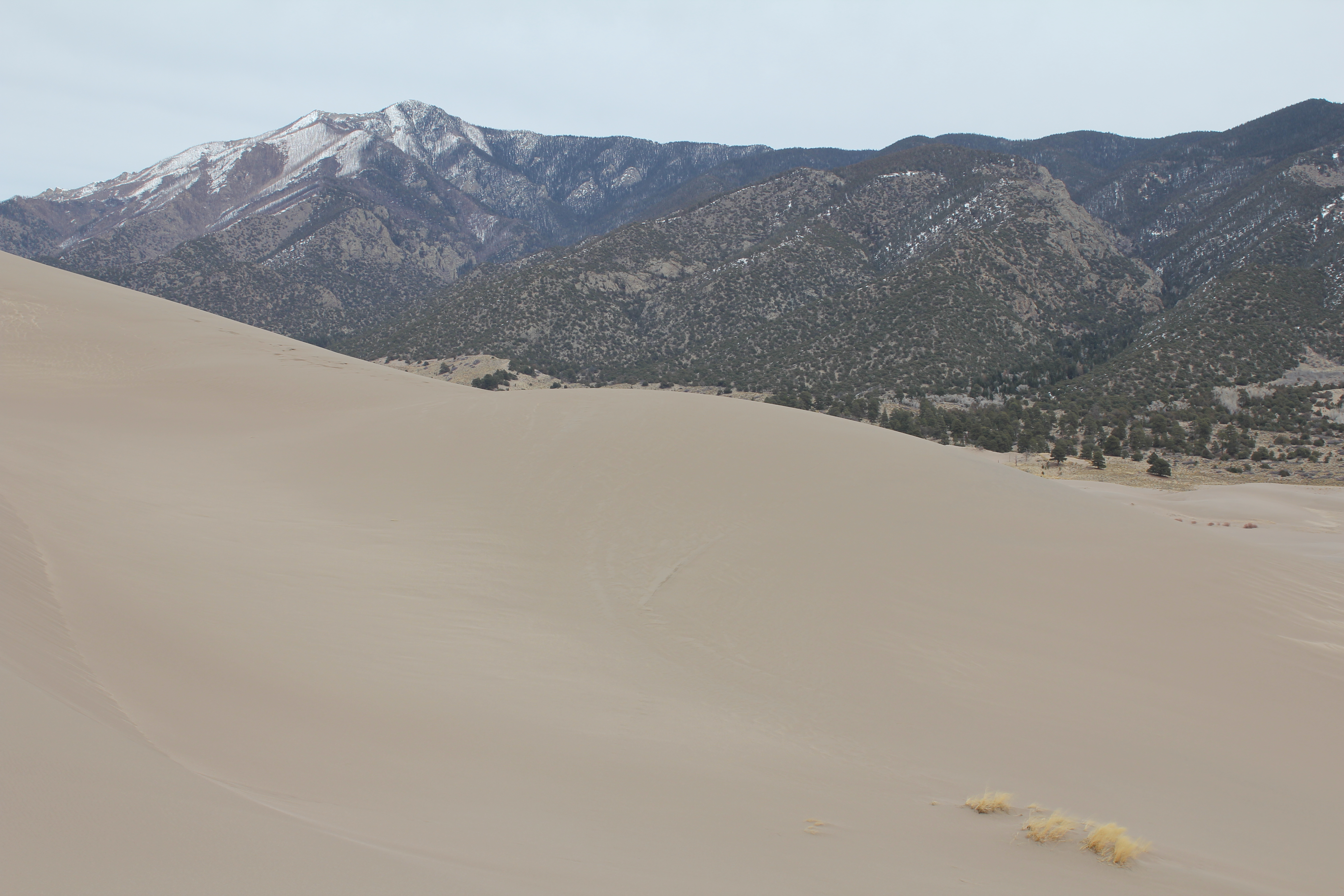
The impressive Sangre de Christo range.
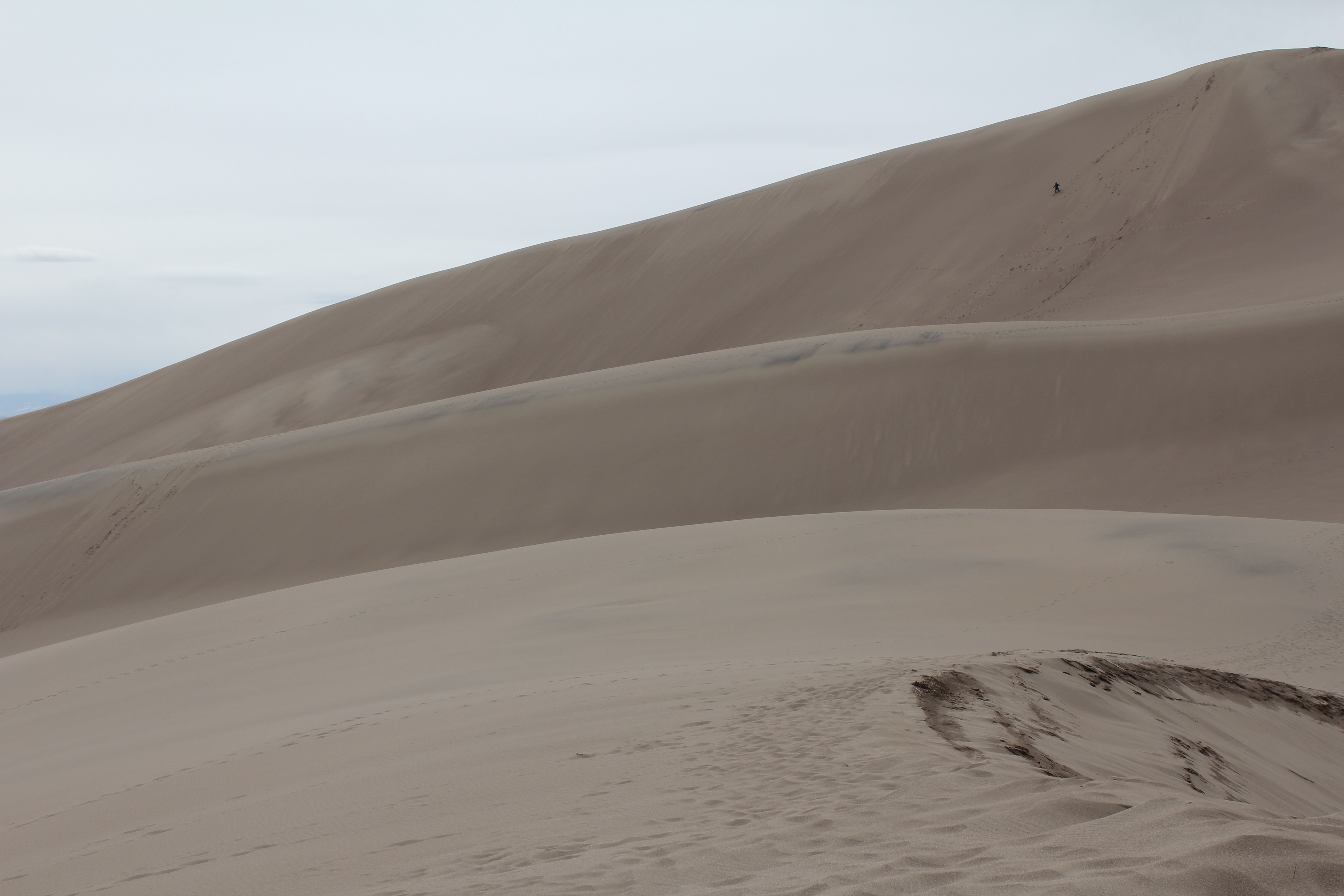
Another view from the top of our dune. Those dots on the dune are people, as will be revealed the high res image.
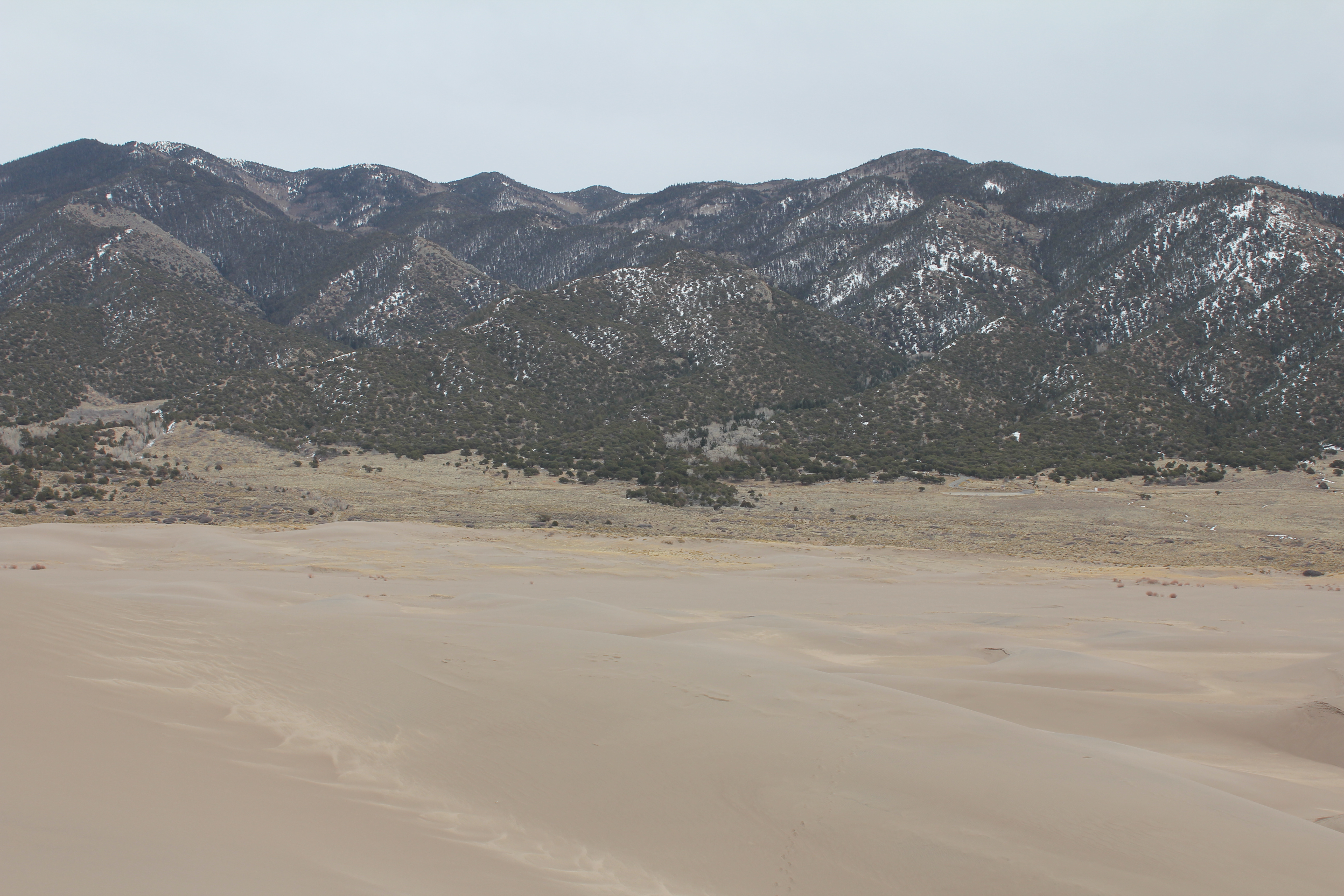
Another view of the dunes.
Yet another. The varied hues in the sand were quite unexpected. I think they are an indication of water content. On one dune we rested on, there was wet sand but a few inches from the surface.
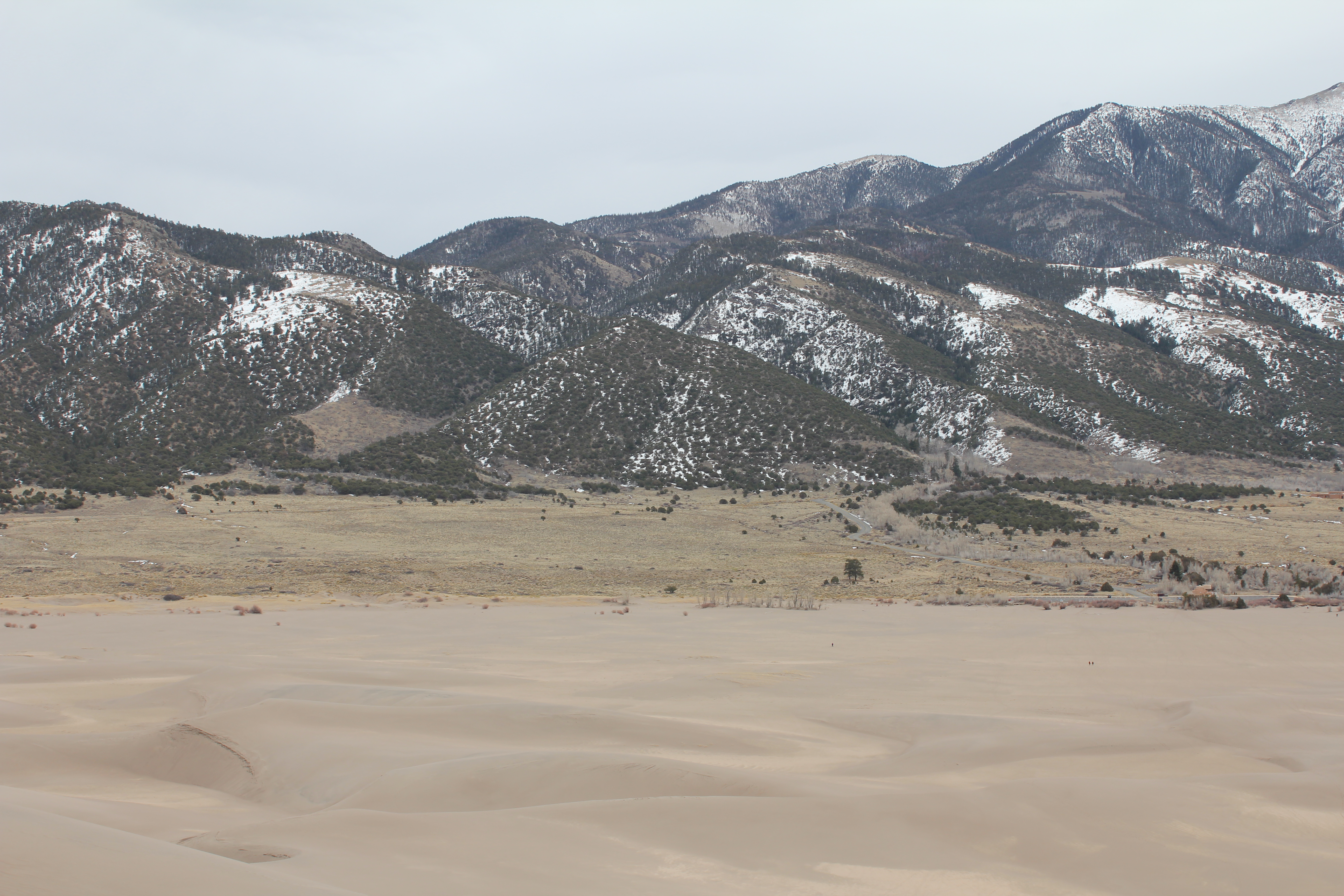
Another panaroma, this time taken from the base of the dunes. View 1.
View 2.
View 3.
View 4.
The camera does not show how steep this valley's side was. One does not walk down this slope. Those that tried found themselves rolling down it, in the soft sand. The kids, especially, loved it.
We next drove from the sand dunes to Zapata falls, about 8 miles from the dunes. As almost always with the parks, to see anything good, one must walk. We hiked up a trail that should be named "twist ankle" trail for the number of nasty rocks and glare ice in it, but kept our ankles intact. The falls are dangerous to some, so the parks service posted a needless sign...
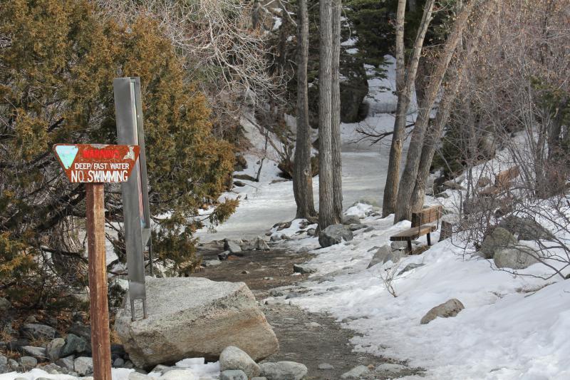
The falls were frozen!
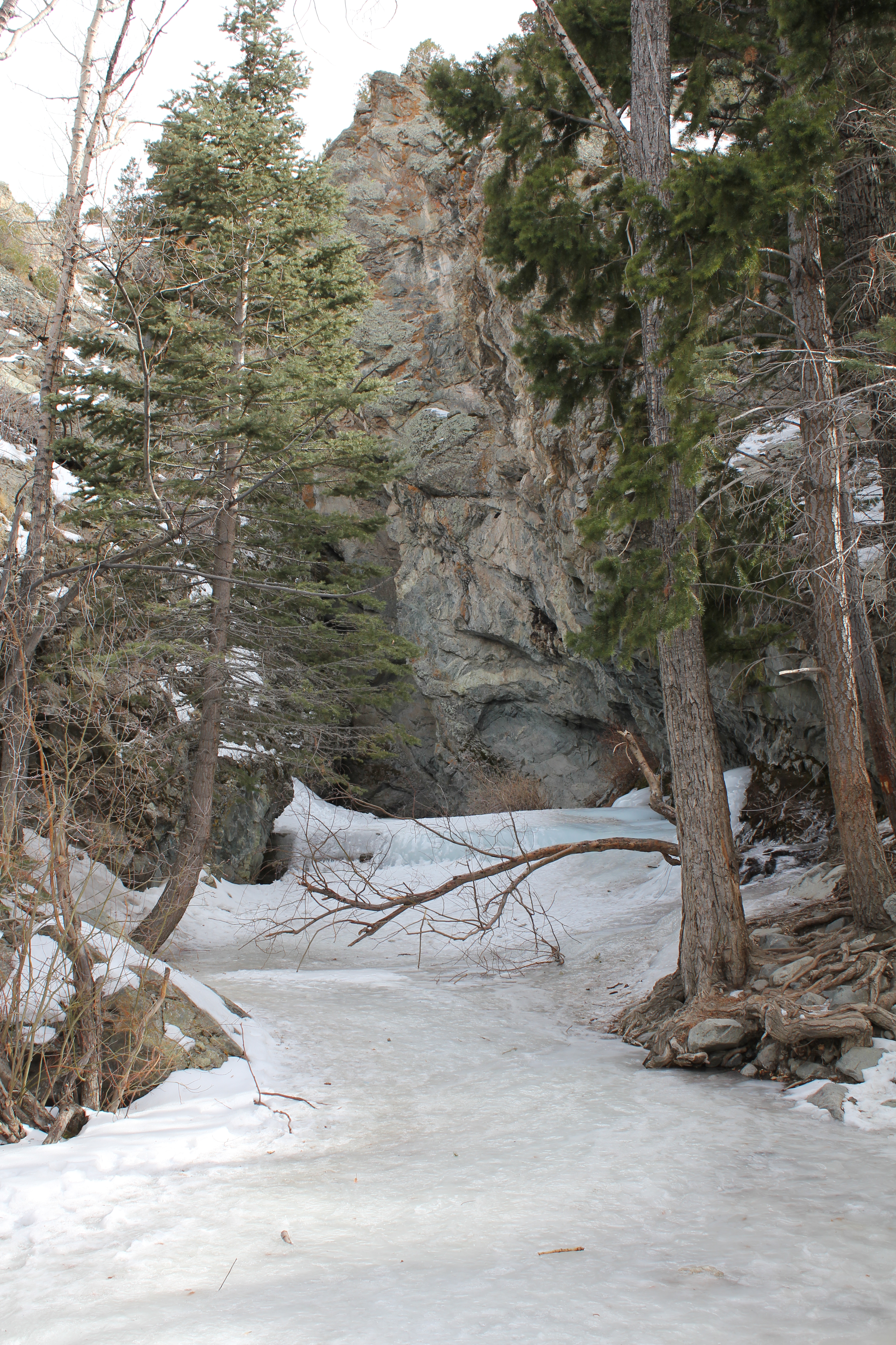
The trees near the falls were beautifully backlit by the sun.
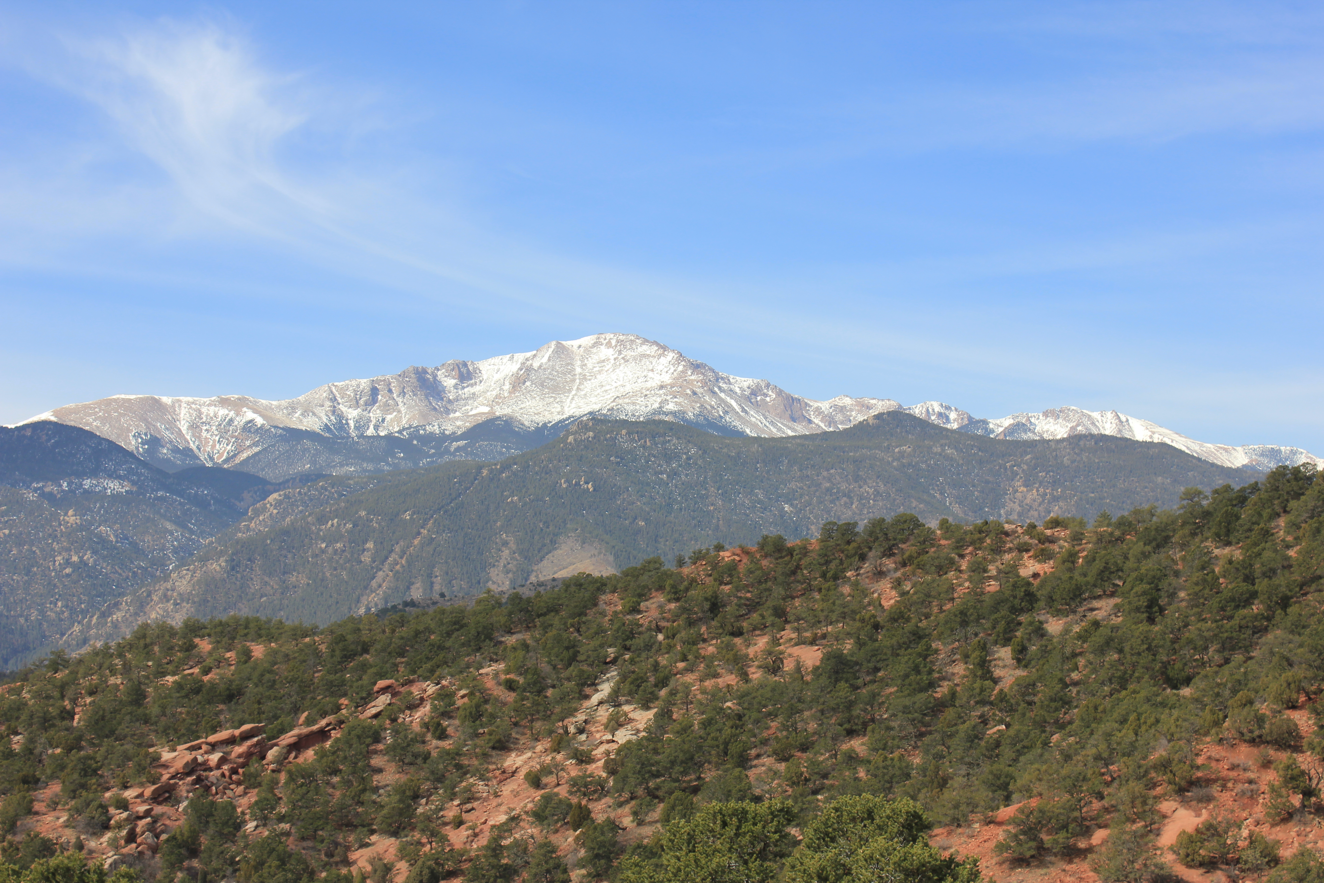
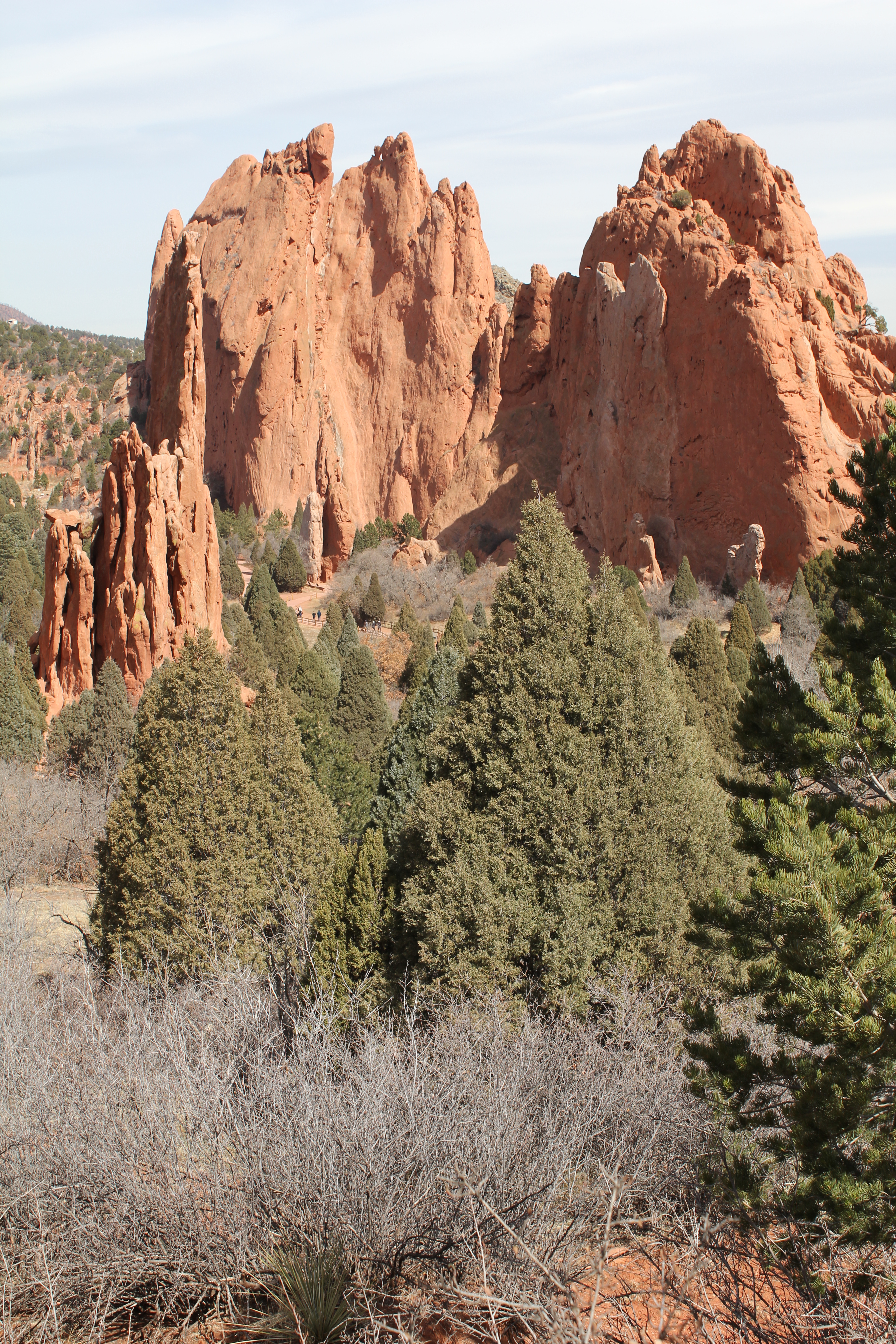
Last stop was the Garden of the Gods, in Colorado Springs. While dwarfing any eastern parks I've seen, it couldn't compare with what had come before.
I've never seen Pikes Peak with less snow in March
The sandstone in the garden was lovely.
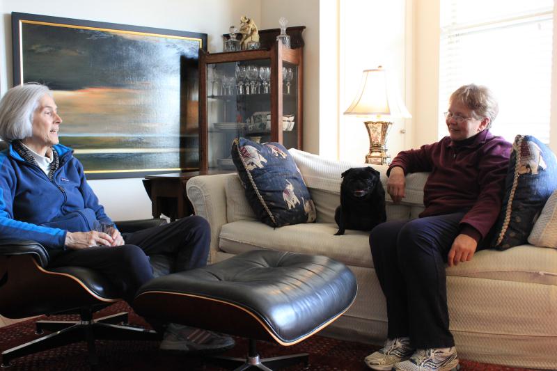
From Colorado Springs, we headed north to Denver, where we visited Robyn Grant, my sister, in her elegant apartment. Here are Robyn, her pug Tatyana, and Kathie.
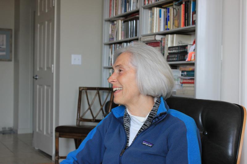
Another shot of Robyn
The last two days were a tedious sprint from Denver to Silver Spring. We were chased by that unwelcome snow storm that swept across the country March 20 to the 23rd.. We did manage to stay ahead of it, and only experienced a dusting of snow in Kansas City.